|
|
|
Metadata
|
|
ID
|
08CEV02
|
|
Also Known As
|
P-2-08-GM
|
|
Abstract
|
United States Geological Survey, Saint Petersburg, Florida,
Center for Coastal and Watershed Studies, Coastal and Marine
Geology Program. Biological and Coring and Geochemical data
of field activity 08CEV02 (P-2-08-GM) in Northern Gulf of
Mexico from 04/19/2008 to 04/22/2008
|
|
Organization
|
United States Geological Survey, Saint Petersburg, Florida, Center for Coastal and Watershed Studies, Coastal and Marine Geology Program
|
|
Project/Theme
|
Holocene Climate and Environmental Variability - Northern Gulf of Mexico
|
|
Activity Type
|
Biological and Coring and Geochemical
|
|
Platform
|
Pelican
|
|
Area of Operation
|
Northern Gulf of Mexico
|
|
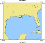
Location map
|
|
|
Bounding Coordinates
|
30.75000
-97.77000 -80.25000
24.20000
|
|
Ports
|
LEAVE Cocodrie, LA
ARRIVE Cocodrie, LA
|
|
Dates
|
04/19/2008 (JD 110) to 04/22/2008 (JD 113)
|
|
Analog Materials
|
No analog holdings.
|
|
Index map

|
|
|
Information Specialist
|
|
|
Purpose
|
|
Calibrate sediment proxies during a sediment trap experiment to reconstruct
|
|
Holocene climate variability in the northern Gulf of Mexico
|
|
|
Information to be Derived
|
|
Faunal, geochemical and isotopic data from sediment trap and sediment core
|
|
samples, geochemical analysis of seawater
|
|
|
Summary
|
|
This project seeks to reconstruct Holocene climate variability in the northern
|
|
Gulf of Mexico by calibrating faunal, isotopic and geochemical proxy records
|
|
from deep-sea sediments using sediment trap material and concurrent
|
|
hydrographic and climatological measurements
|
|
|
Notes
|
|
|
Got Help?
|
For 08CEV02, we would appreciate any information on -- analog materials, chief scientist, contract, crew, days at sea, dive count, equipment used, funding, kms of navigation, national plan, NGDC Info, owner, project number, publications, scanned materials, seismic description, station count, station description, submersible, tabulated info.
|
|