|
|
|
|
Metadata
|
|
ID
|
08LTS01
|
|
Also Known As
|
A-1-08-FL
|
|
Abstract
|
United States Geological Survey, Saint Petersburg, Florida,
Center for Coastal and Watershed Studies, Coastal and Marine
Geology Program. Chief Scientists: Amar Nayegandhi, John
Brock. LIDAR data of field activity 08LTS01 (A-1-08-FL) in
South Hancock County, Pearl River delta, Isles Derniere and
Timbalier Islands from 03/04/2008 to 03/14/2008
|
|
Organization
|
United States Geological Survey, Saint Petersburg, Florida, Center for Coastal and Watershed Studies, Coastal and Marine Geology Program
|
|
Project/Theme
|
EAARL LIDAR survey of Southern Louisiana
|
|
Chief Scientist
|
Amar Nayegandhi
John Brock
|
|
Activity Type
|
LIDAR
|
|
Platform
|
Airplane
|
|
Area of Operation
|
South Hancock County, Pearl River delta, Isles Derniere and Timbalier Islands
|
|
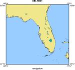
Location map
|
|
|
Bounding Coordinates
|
31.75000
-87.75000 -78.25000
23.75000
|
|
Ports
|
LEAVE Kiln, Mississippi (Stennis Airport)
ARRIVE Kiln, Mississippi (Stennis Airport)
|
|
Dates
|
03/04/2008 (JD 064) to 03/14/2008 (JD 074)
|
|
Analog Materials
|
No analog holdings.
|
|
Index map

|
|
|
Information Specialist
|
|
|
Purpose
|
|
Obtain high-resolution topographic data of wetlands and barrier islands
|
|
|
Information to be Derived
|
|
Sub-aerial topography, geo-referenced digital camera imagery
|
|
|
Notes
|
|
C. Wayne Wright (NASA), Virgil Rabine (Pilot - EG&G), and Richard Mitchell
|
|
(EG&G-NASA)
|
|
|
Got Help?
|
For 08LTS01, we would appreciate any information on -- analog materials, contract, crew, days at sea, dive count, equipment used, funding, kms of navigation, national plan, NGDC Info, owner, project number, publications, scanned materials, seismic description, station count, station description, submersible, summary, tabulated info.
|
|