|
Top of this page
|
|
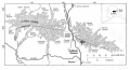
Maps of Gulkana
Glacier, Alaska
Regional Maps
Basin Maps
-
The Tiger Map Server serves maps as static GIF images or as interactive
maps. The user can customize the interactive maps through on-screen dialog boxes to
zoom in, zoom out, turn layers on or off, and place markers and names on the maps. I have
pre-customized the map links below with cities, roads, water bodies, latitude, and
longitude at both state and regional scales. The static maps are larger on screen and show
more detail. Because the maps are generated on-the-fly they can be slow to
retrieve.
State of Alaska
Interactive
map (~ 400x350 pixel map)
Static
map (600x600 pixel GIF; larger, more detailed than interactive map)
Regional map from Glennallen to Fairbanks
Interactive
map (~ 400x350 pixel map)
Static
map (600x700 pixel GIF; larger, more detailed than interactive map)
Connections
For further information: send email here.
Maintainer: Rod March
Last update: Wednesday, January 03, 2007 12:46 PM
URL: http://ak.water.usgs.gov/glaciology/gulkana/maps/index.htm
|