 |
Final Environmental Impact Statement |

September 1975 |

|
Final Environmental Impact Statement |
|
September 1975 |
| ( ) Draft | (x) Final Environmental Statement |
| Responsible Office: U, S. Army Engineer District, Walla Walla, Washington | |
| 1. Name of Action: (x) Administrative | ( ) Legislative |
3. a. Environmental Impacts: Impacts of recreation development are earthwork and related construction and maintenance activities to prepare the project to accommodate an increased visitor use. Such visitor-use involves: accommodating concentrations of people engaged in various recreational pursuits, such as boating and fishing; accumulation of litter; disposal of sewage; vegetation management; and other aspects. Project operation involves seasonal reservoir fluctuation and maintenance and variable downstream water releases. Big game impacts and related elk management activities are also noted.
4. Alternatives: A conceptual alternative would be abandonment of the project and restoration of the flowing stream. An operational alternative would involve the maintenance of optimal conditions for a single purpose rather than operation to accommodate multiple use concepts. Possible single uses are for recreation, fishery enhancement, flood control, and power production.
5. Comments Received:
Department of-Interior Agencies Clearinghouse
13th Coast Guard District
Environmental Protection Agency
Federal Power Commission
Pacific Northwest River Basin Commission
Department of Agriculture, Forest Service
Office of Governor - State of Idaho
Idaho Parks and Recreation Department
Idaho Wildlife Federation
Idaho Fish and Game Department
Clearwater Power Company
Idaho Environmental Council
Orofino Planning Commission
Idaho Department of Health and Welfare
Clearwater Boat and Diving Club
Gerald Jayne
Idaho Department of Water Resources
6. Draft Statement to Council on Environmental Quality: 22 May 1974
DWORSHAK DAM AND RESERVOIR
PREFACE
Table of Contents
1. Project Description
2. Environmental Setting (Pre-Project and Existing
Conditions)
3. The Relationship of the Project to Land Use
Plans
4. Environmental Impacts
5. Adverse Environmental Effects Which Cannot Be Avoided Should the Project Be Implemented
6. Alternatives to the Proposed Action
7. The Relationship Between Local Short-Term Uses of Man's Environment and the Maintenance and Enhancement of Long-Term Productivity
8. Any Irreversible or Irretrievable Commitments of Resources Which Would Be Involved in the Proposed Action Should It Be Implemented
9. Coordination With Other Agencies
| A | Comments and Responses (Pages 9-4 to 9-75) |
| B | Letters (Pages 9-83 to 9-129) |
| C | Archaeology (Article Reprint) |
| D | Operational Recommendations (Idaho Fish and Game) |
| E | Operation Plan Recommendations (Idaho Fish and Game) |
| F | Actual 1974-1975 Operations |
| G | Criteria for Selection of National Recreation Area |
| H | Rules and Regulations Governing Public Use of Water Resource Development Projects |
| I | Plant List |
| J | Wildlife List |
| K | A Brief Chronology of Dworshak Dam |
| L | Newspaper Article and Letter |
| M | 25 August 1972 Letter From Fish and Wildlife Service |
| Acres-foot | A unit of volume one acre in surface and one-foot deep. One acre-foot equals 43,560 cubic feet. |
| Algal | Pertaining to or like algae, a group comprising seaweeds, pond scums, and other related plants. |
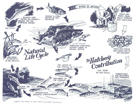
| Anadromous | Fish that hatch from eggs in freshwater streams, migrate to the ocean to grow to adulthood, and then return to their stream of origin to spawn. |
| Avian | Of or pertaining to birds. |
| Base Load | Continuous operation of generation units to meet a constant demand for electricity. |
| Benthic | Of or relating to the bottom of a body of water. |
| Board foot | A volume of wood one foot by one foot by one inch. MBF and MMBF refer to thousand board feet and million board feet, respectively. |
| BOD | Biochemical oxygen demand: the amount of oxygen needed to support the oxygen consuming organisms in a body of water. A high BOD may cause depletion of dissolved oxygen. |
| Biological | Of or relating to living things. |
| COD | Chemical oxygen demand - the amount of oxygen (in mg) required to oxidize the organic matter in one liter of water. |
| Cultural | Aspects of the advancement of human civilization, including traditions, and physical objects relative of the civilization (i.e., manmade objects). |
| Downstream migrants | Young anadromous fish traveling to the sea. Also called juveniles, smolts, or fingerlings. |
| Ecosystem | A system composed of a community of animals, plants, and bacteria; and the physical and chemical environment with which it is interrelated. |
| Embayments | Water bodies along the edges of the canyon extending into tributaries or side drainages. |
| Epilimnion | The water stratum overlying the thermocline of a lake. |
| Fetch | The expanse of open water which can be affected by the wind. |
| Fluctuation | Changes in flow rates and water levels. In this report, the river fluctuations (downstream) are due to daily and weekly changes in power production and turbine discharge rates or to spillway operation. Major reservoir fluctuations are on a seasonal basis due to annual water storage and release. |
| Forebay | The reservoir immediately upstream of a powerhouse, where the intakes of the turbines (penstocks) obtain water to oeprate the generator units. |
| Hypolimnion | The water in a lake below the thermocline. This water is generally stagnant and homogeneous, and resists mixing. |
| Igneous | Relating to rock formed by heat, usually due to volcanic action. |
| Lentic | Slowly flowing (water), for instance, a reservoir. |
| Lignin | An amorphous polymer related to cellulose which binds the cells of a log together. |
| Littoral (Noun) | The shoreline between the high and low watermarks. |
| Littoral (Adjective) | Of or related to the edge of a water body, extending downward to the limit of rooted vegetation. |
| Lotic | Of or pertaining to flowing water. Opposite of lentic. |
| Mammalian | Of or relating to the class of mammals. |
| Mean Sea Level (msl) | The average level of the sea, used for altitude measurements. Sixteen hundred feet msl means 1,600 feet above the average level of the ocean. |
| Metamorphic | (Rock) formed by high pressures and temperatures over a long period of time, such as slate. |
| Mitigation | Abatement, compensation, or offsetting of an effect. Steps taken to make up for adverse impacts. |
| Peaking | The practice of increasing flows through powerhouse turbines during hours of the day and week when power demands are high. The term "power peaking" is also commonly used. |
| Natural | That which is or would be produced or present without human alteration. |
| Naturalistic | Simulating or approaching the results of nature. |
| Penstock | A gate for regulating the flow of water into the outlet system. |
| Releases | Discharges of water through a control structure or powerhouse. Daily release, annual release, and the like, usually refer to averages for the respective periods. |
| Restoration | In reference to a damsite, alleviation of unnecessary intrusion and making the project blend harmoniously with the existing surroundings. |
| Riparian | Of or related to the bank of a watercourse. |
| Salmonid | Fish of the family Salmonidae, which includes salmon, trout, char, and whitefish. |
| Significant wave | The average height of the highest one-third of all the waves on a body of water. Used to get an idea of the "average height of a high wave." |
| Slough | To slip, or cast off a layer or covering. |
| Socio-Economic | Of or relating to the structure of society and its economic activity. |
| Tailwater | The water immediately downstream of a dam or hydro-electric powerhouse. |
| Tainter gate | A curved barrier which pivots on a horizontal axis in order to regulate spillway releases. |
| Tannin | Any of several astringent phenolic soluble materials found in wood. They are hydroxyl derivatives of aromatic hydrocarbons and are leached out when the wood is stored in water. |
| Thermocline | A layer of sharp temeprature drop between a lighter, warmer, more oxygen rich layer of water and a heavier, colder, deoxygenated one. Generally, in the thermocline, the temperature drops at least 1°C for each meter of depth. |
| Turbidity | Thickness or opaqueness of water due to suspended sediment. |
| Note: The words "reservoir," "lake," and "pool" are used interchanagebly in this report in reference to the impoundment created by Dworshak Dam. | |
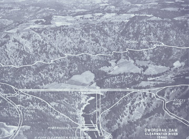
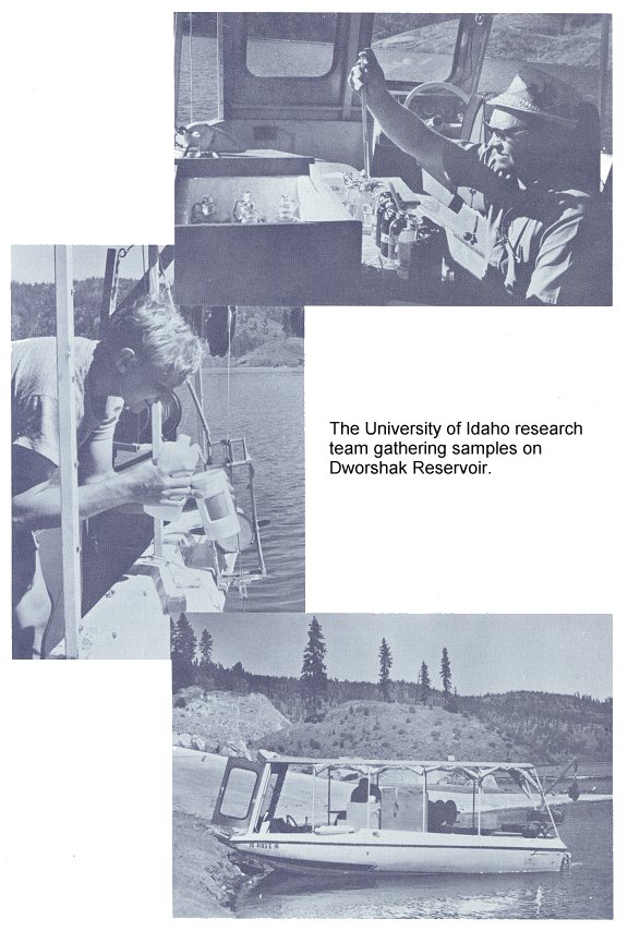
![]()
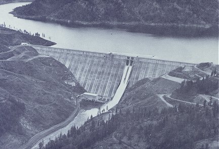
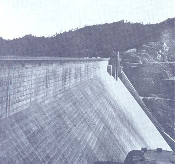
Dworshak Dam
![]()
![]()
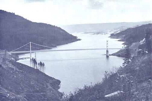
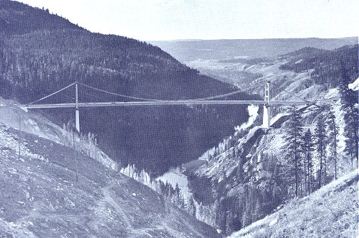
These two photographs of the Dent Bridge indicate the depth of the lake at this particular location.
The bottom photograph was taken before the water started to rise.
![]()
![]()
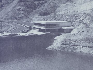
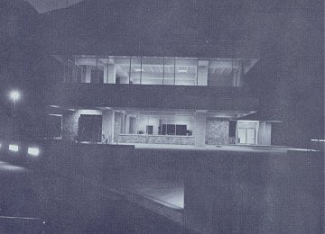
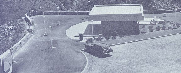
Dworshak Visitor Center
![]()
Pertinent Data
| General | ||
| River mile | 1.9 | |
| Drainage area, square miles | 2,440 | |
| Effective hydraulic height, feet | 632 | |
| Maximum structural height, feet | 717 | |
| Overall length at crest, feet | 3,287 | |
| Streamflow, cfs: | ||
| Minimum of record Mean annual Standard project flood peaks:
Probable maximum flood |
250 5,727 160,000 120,000 100,000 411,000 | |
| Streamflow, acre-feet: | ||
| Minimum annual Mean annual Maximum annual |
2,157,000 4,100,000 6,680,000 | |
| Project design discharges, cfs: | ||
| At pool elevation 1445 At pool elevation 1600:
|
32,290 150,000 40,000 190,000 221,000 | |
| Tailwater elevations: | ||
| Minimum, discharge 1,000 cfs Maximum, at discharge 150,000 cfs |
968 1,003 | |
| First power online | 1 March 1973 | |
| Estimated Cost | ||
| 1 May 1975 | $312,000,000 | |
| Reservoir | ||
| Elevations, feet: | ||
| Maximum Normal operating range |
1605 1600 to 1445 | |
| Storage capacity, acre-feet: | ||
| Gross Usable, flood control and power |
3,453,000 2,000,000 | |
| Length at elevation 1600, miles | 53.6 | |
| Shoreline length, miles | 175 | |
| Surface areas, acres: | ||
| At elevation 1600 At elevation 1445 |
16,417 9,047 | |
| Recreation sites, number: | ||
| Initial Ultimate |
7 19 | |
| Non-Overflows | ||
| Type | Concrete gravity | |
| Crest elevation | 1613 | |
| Deck width, feet | 44 | |
| Concrete volume, cubic yards | 6,45,000 | |
| Upstream slope | Vertical | |
| Downstream slope | Vertical to 1560, 1 on 0.8 below | |
| Elevators, number | 3 | |
| Spillway | ||
| Type | Gate controlled, with stilling basin | |
| Gates: | ||
| Type Size, width by height, feet Number |
Tainter 50 x 56.4 2 | |
| Crest elevation | 1545 | |
| Crane, one, capacity, tons | 50 | |
| Outlet Works | ||
| Water passages: | ||
| Number Type Size, feet |
3 Conduit 12 x 17 | |
| Gates, type and number: | ||
| Tainter Tractor (emergency) |
3 1 | |
| Intake centerline elevation | 1362 | |
| Powerplant | ||
| Initial installation: | ||
| Number of units Nameplate rating, kilowatts:
|
3 90,000 220,000 400,000 | |
| Ultimate installation: | ||
| Number of units Nameplate rating, KVA:
|
6 90,000 220,000 1,060,000 | |
| Powerhouse length, feet | 428 | |
| Turbine type | Francis | |
| Turbine ratings, horsepower: | ||
| Small units Large units |
142,000 346,000 | |
| Generator nameplate ratings, kilovolt amperes: | ||
| Small units Large units |
94,737 231,579 | |
| Synchronous speed, revolutions per minute: | ||
| Small units Large units |
200 128.6 | |
| Distributor centerline elevations: | ||
| Small units Large units |
969 975 | |
| Spacing, feet: | ||
| Small units Large units |
47 65 | |
| Penstock diameters: | ||
| Small units Large units |
12 19 | |
| Penstock intake elevations: | ||
| Small units Large units |
1,420.68 1,412.70 | |
| Gross head, feet | 632.5 | |
| Rated head, feet | 560 | |
| Minimum head, feet | 477.5 | |
| Crane: | ||
| Number Type Capacity, each, tons |
2 Bridge 350 | |
| Relocations | ||
| Roads, miles: | ||
| Highway districts County State |
2.7 24.3 2,2 | |
| Bridges, number | 2 | |
| Fish Hatchery, Steelhead | ||
| Capacity, adult size | 6,000 | |
| Yearly fingerling release, pounds | 480,000 | |
| Dworshak Operational Constraints | ||
|---|---|---|
| Level | Degree of Constraint | Operational Items |
| 1 | Not to be violated except during emergencies | ♦1000 cubic feet per second minimum flow. |
| ♦700,000 acre feet minimum winter flood control storage space. | ||
| ♦Snow-covered area vs. spring flood control. | ||
| 2 | Can be violated with requirements: | ♦Rate of change of release. |
| ♦Schedule of winter flood control evacuation. | ||
| ♦Limitations on fluctuations during fall steelhead season. | ||
| ♦Evacuation below ability to refill to elevation 1570 by 1 July with 95-percent certainty. | ||
| ♦Evacuation below 1570 from 1 June to 1 September. | ||
| ♦Evacuation below 1560 from 1 September to 1 November. | ||
| 3 | Can be violated to meet other system needs at the discretion of the North Pacific Division, Corps of Engineers, Portland, Oregon. | ♦River fluctuation during spring steelhead fishing season. |
| ♦Evacuation below ability to refill to 1600. | ||
| ♦Evacuation below 1600 from June to 1 September. | ||
| ♦River fluctuation during goose nesting. | ||
| ♦Streamflow recession during bass spawning. | ||
 The visitor's viewpoint overlooks the North Fork Clearwater River and Dworshak Dam | |
| Indian Fishing Rock Marker | 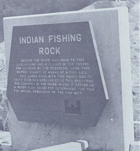 |
| Situated in this same area is an Indian Fishing
Rock that relocated from an inundated section of the river. 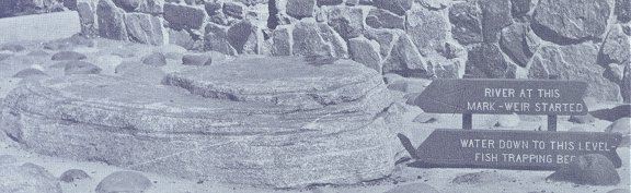 | |
| Summary of Fall
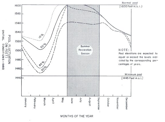
Drawdown Requirements Contained in the Dworshak Reservoir Regulation Model | |||||
|---|---|---|---|---|---|
| Period | Pool Elev. Max/Min |
Release Over Inflow CFS |
Fluctuation Permitted |
Total Space Acre-Feet |
Comment |
| - 1 Sep. | 1600/1570 | ||||
| Sep. - 1 Oct. | 1586/1560 | 4,200 (El. 1600 to 1586) | 250,000 | Release does not have to be uniform. | |
| - 1 Nov. | /1560 | A constraint. Certain procedures of notification and justification will be required prior to violation. | |||
| Oct. - 15 Nov. | /1579 | 1,300 Max. (El. 1586 to 1579) |
± 20 percent of weekly average | 370,000 | Prime steelhead season. Fluctuations are critical. |
| 15 Nov. - 15 Dec. | /1558 | 5,500 (El. 1579 to 1558) | 700,000 | Spill required 25 percent of all years with three units available. | |
| Existing Leases From Others to the Corps of Engineers For Dworshak Project | |
|---|---|
| Organization | Reason |
| Agriculture, Dept of U.S. Forest Service | Access |
| Hutchens, Harold | Stites Radio Repeater Site |
| Northern Pacific RR Co. | Project Office Area |
| Potlatch Forests, Inc. | Snow Gauge Station |
| Existing Outgrants to Others for Use of Dworshak Lands | |
| Organization | Reason |
| Bonneville Power Administration (Two Permits) | Trans Line and Access Road |
| Clearwater Power Co. (Two Permits) | Power Lines |
| Clearwater Power Co. | 115 KV Trans Line |
| Emery, Douglas E. and Mary T. and Olson Ranch Co. | Access Road |
| General Tel Co of the NW | Communication Line |
| Guerney, Edward | Concession Lease (Vending Machines) |
| Idaho, State of | Access Road |
| Nez Perce Tribe of Idaho | Park and Recreation |
| Washington Water Power | 110 KV Trans Line |
| Washington Water Power | Distribution Lines |
| Bureau of Land Management | Timber Access |
| U.S. Forest Service | Cooperative Access |
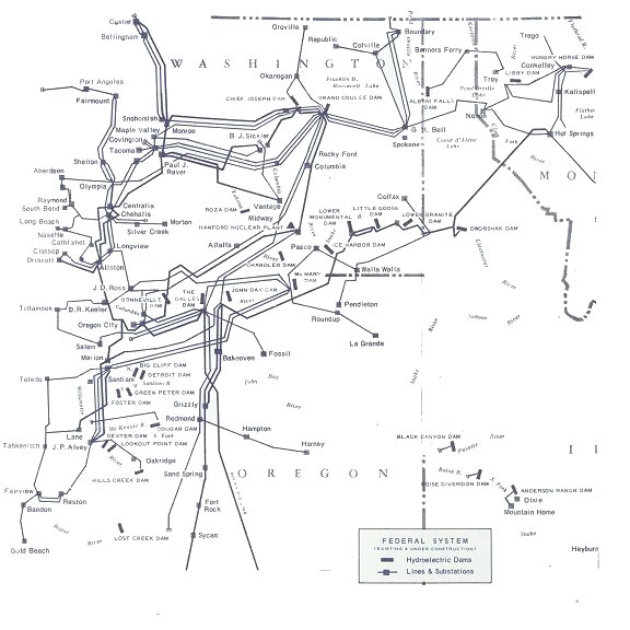
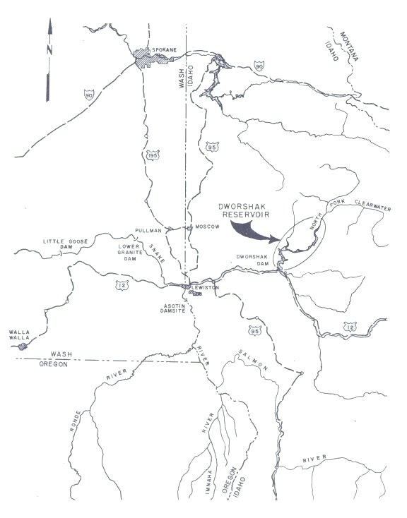
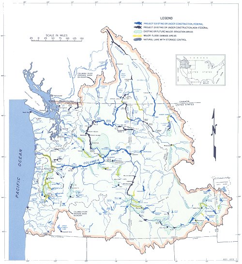
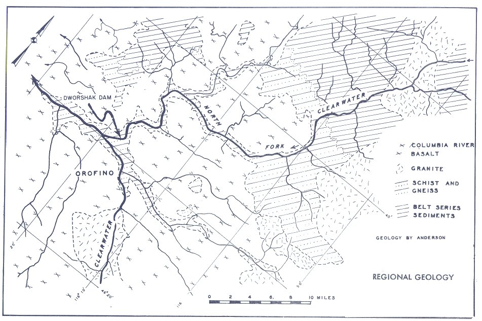
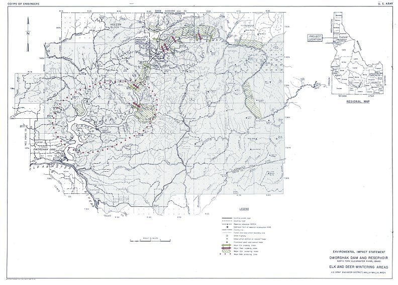
Map adapted from Bonneville Power Administration Material
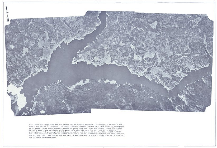
This aerial photograph with overlay shows preimpoundment conditions at the damsite and lower reservoir area.
![]()
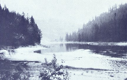
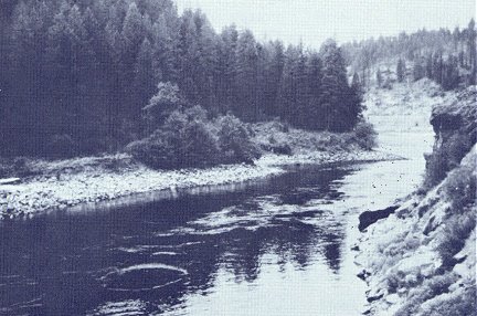
Pre-Project Views of the North Fork Clearwater River
![]()
| Economic Value of Steelhead Trout | |||||
|---|---|---|---|---|---|
| Year | Value/Fish | Fish Caught | Angler Day/Fish |
Fishing Days | Value |
| 1956 | $54.75 | 1,109 | 7.3 | 8,100 | $60,718 |
| 1965 | $71.00 | 7,214 | 3.8 | 27,080 | $512,194 |
| 2000 | $100.00 | 14,428 | 4.3 | 62,284 | $1,442,800 |
| Estimated Harvest | |||
|---|---|---|---|
| Year | Smallmouth Bass |
Rainbow Trout |
Summer Effort |
| 1969 | 7,123 | 117 | 11,556 |
| 1970 | 3,888 | 948 | 10,665 |
| 1971 | 1,957 | 9,626 | 9,249 |
| 1972 | 2,683 | 3,109 | 11,845 |
| 1973 | 1,434 | 8,670 | 13,510 |
| Fish Stocked in
Dworshak Reservoir 1973 | |
|---|---|
| Fish | Number |
| Catchables | 228,000 |
| Fingerlings | 237,000 |
| Fry | 2,086,000 |
| Adult Steelhead | .834 |
| Kokanee | 591,000 |
| Smallmouth Bass | 50,000 |
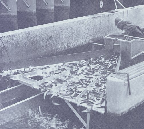
A fishery worker nets trout and places them into a random sampler at Dworshak National Fish hatchery.
The machine selects 20 percent of the fish which will be marked for study.
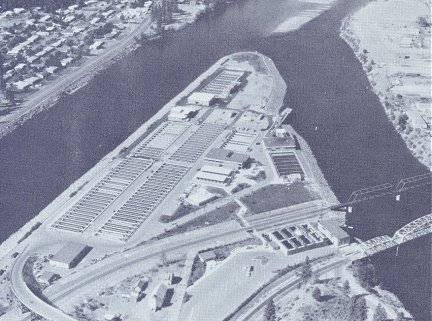
Dworshak National Fish Hatchery
| Number of Steelhead
Counted Over Lewiston Dam (July - June); Estimated Effort, Harvest, and Proportion of Steelhead Harvested During 1969-70, 71-72, and 72-73 Steelhead Fishing Season | |||||
|---|---|---|---|---|---|
| Fish Year | Fishing Season |
Lewiston Dam Fish Count |
Estimated Effort (Hours) |
Estimated Harvest |
Estimated Percent of Run Harvest |
| 1969-70 | Sep. 15 - Apr. 15 | 16,131 | 67,316 | 2,474 | 15.3 |
| 1970-71 | Sep. 15 - Apr. 4 | 14,600 | 56,840 | 2,216 | 15.2 |
| 1971-72 | Sep. 15 - Feb. 29 | 15,273 | 41,309 | 1,615 | 10.6 |
| 1972-73 | Oct. 1 | 19,600* | 81,262 | 4,662 | 23.8 |
| *Estimate based on previous 10-year average of 61.5% passing in fall months. | |||||
Wildlife with the Project
| Cover Type | Acreage |
|---|---|
| Open coniferous timber | 7,202 |
| Dense coniferous timber | 6,100 |
| Brush | 1,190 |
| Grass | 510 |
| Agricultural crops | 170 |
| Water and wasteland | 1,798 |
| Total | 16,417 |
Wildlife Compensation
Reptiles and Amphibians
Reptiles
Amphibians

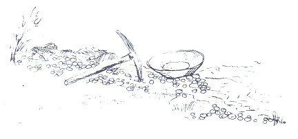
Gold
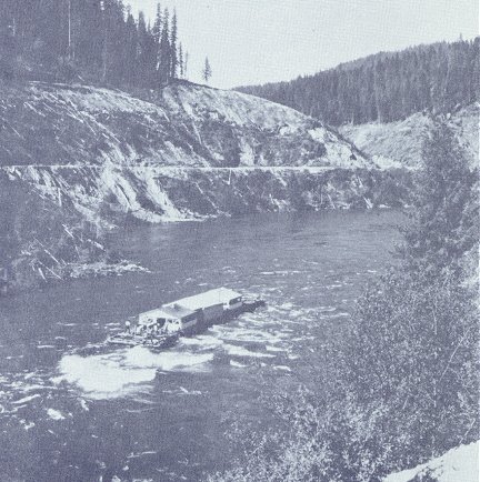
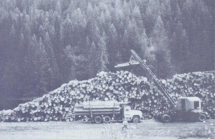
A former event--logs being placed on the river bank in anticipation of the log drive
to come with high spring flows on the North Fork.
Logging operations removed large quantities of
lumber from the river basin in this manner in years past.
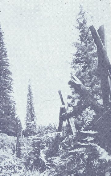
Past human activity in the reservoir area left its unique mark on the land, such as this split rail fence.