Surface Management Maps (see sample)
- Scale: 1:100,000 (1 centimeter = 1 kilometer)
- Price: $4.00 each through BLM
- Use our Map Order Form or call our Information Center at 303-239-3600 (Mon-Fri, 9-4 MST)
- Also available at many local map stores and through USGS at 1-888-ASK-USGS
- You may also order the maps online from the Public Lands Information Center for $7.00
Surface Management Maps are detailed resource management maps measuring 42" x 30." Fifty-six are needed to cover the state in its entirety. Each Surface Management Map contains Federal and State ownership information as well as geographic, topographic and roadway information. Township, Range and Section information is also clearly marked. A variation, the Surface and Mineral Management Map, depicts the location and nature of federally owned mineral rights in addition to surface management information. Maps are updated regularly to accommodate changes in surface ownership. Revisions are reviewed by staff at State and Field Offices to ensure accuracy.
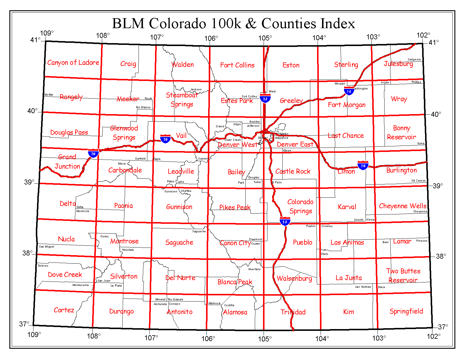
Refer to our Map Index , County Index or Game Management Index to determine which Surface Management Map corresponds with your particular area of interest. For additional information, contact the Colorado State Office Information Center at 303-239-3600, or the Field Office where your area of interest is located.
State Map (see Sample)
- Scale: 1:500,000 (1 centimeter = 5 kilometers)
- Price: $4.00 each through BLM (volume discounts are available for orders over 49 BLM maps)
- Use our Map Order Form or call our Information Center at 303-239-3600 (Mon-Fri, 9-4 MST)
- Also available at many local map stores and through USGS at 1-888-ASK-USGS
State Maps are 52"x 44" resource management maps of the entire State of Colorado containing Federal and State ownership information overlaid with Township and Range information. At this scale, maps contain only basic geographic, topographic, and roadway information.
Other Useful Maps
USGS Topographic Maps show topographic information, streams, roads, lakes and other physical features at a scale of 1:24,000. Surface management status is not shown, but they serve as an ideal supplement to Surface Management Maps. They are available through USGS at 1-888-ASK-USGS.
US Forest Service Maps show roads, trails, streams, lakes, recreation sites, land ownership, and major points of interests within each National Forest. Maps of the Rocky Mountain Region are available through the USFS at 303-275-5350.


 Programs