![]()

![]()
Hot Creek Gorge thermal area, managed by U.S. Forest Service, is a popular recreational area. The largest springs discharge subaqueously into the stream.
 |
Hot Creek Gorge from the parking lot at the top of the canyon. Photo taken June 3, 2002 by M. Sneed, USGS. |
 |
A closer view of Hot Creek Gorge from the parking lot at the top of the canyon. Photo taken June 3, 2002 by M. Sneed, USGS. |
 |
Bright blue pools in Hot Creek Gorge. The blue color is caused by reflection of the blue sky on the white clay bottom, similar to a swimming pool. Photo taken June 3, 2002 by M. Sneed, USGS. |
 |
The subaqueously discharging springs can be identified by areas of upwelling (near center of photo). Photo was taken December 3, 1999 by C. Farrar, USGS. |
 |
Subaqueous springs in Hot Creek Gorge can be detected by the upwelling at the water surface. Photo taken December 3, 1999 by C. Farrar, USGS. |
 |
Gas bubbles indicate degassing at Hot Creek Gorge. Photo taken June 3, 2002 by M. Sneed, USGS. |
 |
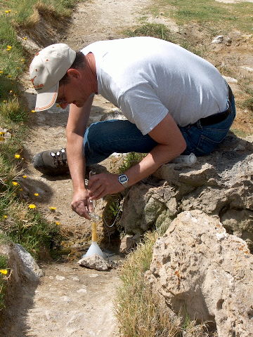
Bill Evans, USGS, preparing equipment for gas sampling at Hot Creek Gorge. Photo taken June 3, 2002 by M. Sneed, USGS. |
 |
Bill Evans, USGS, taking a gas sample at Hot Creek Gorge. Photo taken June 3, 2002 by M. Sneed, USGS. |
 |
Mike Sorey, USGS (retired), and Bill Evans, USGS, taking a temperature measurement at Hot Creek Gorge. Photo taken June 3, 2002 by M. Sneed, USGS. |
 |
Bill Evans, USGS, demonstrating an egg cooking in Hot Creek Gorge; he was being filmed by group who were producing a childen's documentary. Photo taken June 3, 2002 by M. Sneed, USGS. |
![]()
![]()