  |
||
|
|
Marco Polo Takes A TripIntroductionDuring the Middle Ages, most people in Europe spent their entire lives in the village where they were born. But in the 13th century, a young Italian named Marco Polo traveled all the way to China! He spent 17 years as a member of the court of Mongol emperor Kublai Khan. After he returned to Italy, he recorded his experiences in a book, sparking a surge in interest in the Far East among Europeans that led to a great age of exploration. In this lesson, students will learn about the remarkable travels of Marco Polo. They will consult maps to locate Venice and follow the routes Marco took to Beijing and back. They will learn about the challenges of traveling along the Silk Road, discover some interesting facts about China under Mongol rule, and find out how Marco came to produce his famous book. Then they will work in groups to create a large mural/timeline of the life and adventures of this famous traveler. Guiding Question:Who was Marco Polo? Why did he travel to China? What was it like to travel along the Silk Road? What was China like in the 13th century? How did Marco Polo get back home? Why did he write a book, and why is this book important? Learning ObjectivesAfter completing this lesson, students will be able to:
Special Materials for Mural/Timeline
Preparing to Teach this Lesson
Read through the lesson plan and become familiar with materials and websites listed. Bookmark the sites you plan to use. Ideally, computer-generated images from the various websites in this lesson should be projected on a screen visible to all members of the class. Students can also work in small groups sharing a number of computers. Or you can download and reproduce all materials for use by students at their desks. Background information about Marco Polo and the Silk Road can be found at the following sites:
Tape or tack the butcher paper for the mural/timeline to a long bulletin board (or a wall) at a level sufficiently low for all students to write and draw on it. Divide the paper into seven sections. Leaving the first section on the left blank, number the others from one to six, moving left to right. If possible, obtain from your school library the following books by Fiona MacDonald: Marco Polo: A Journey through China and The World in the Time of Marco Polo. It would be very helpful to have on hand and visible to students a globe, a world map, and, ideally, a large map of Asia. Suggested ActivitiesActivity 3—From Venice to Kashgar Activity 4—Crossing the Deserts Activity 5—Adventures in China Activity 8—Making a Mural/Timeline Ask the students to think about a trip they have taken with their families—it can be something as ambitious as a visit to Disney World or as simple as a trip to the local zoo. Even a short trip can be an adventure, a chance to learn something new. Make a list of these trips on the board, leaving space to add a few descriptive phrases. Ask how they prepared for the trip. What did they take along? (Special articles of clothing? Favorite books or games? Snacks?) Write these on the board next to the trip descriptions. Often things turn out differently than one might expect. Ask if anything unusual or unexpected happened on their trips. (Did anything surprise them? Did they learn anything new?) Note these down on the board. Finally, ask what was the first thing they told their friends about their trip. Write these on the board. Tell the students that they will be learning about a young man named Marco Polo, who took a very long trip with his father and uncle, visiting places he had never even heard about. Begin this activity by saying that Marco Polo lived during the Middle Ages. Most people associate the Middle Ages with castles and knights. However, the majority of Europeans who lived at that time were simple farmers, who lived in small villages. But Marco Polo didn't live in a castle or on a farm. He lived in a city—Venice.
Locate Venice on the map following these steps:
Marco's father was a merchant, who often traveled far from home to obtain luxury products that were not available in Venice. When Marco was just five, his father and his uncle left home on such a trip. They would be gone for 12 years. During this time, Marco lived alone with his mother. He went to school and discovered that he had a knack for languages. He also spent time around the docks, where he heard many tales about distant ports. Ask the students to imagine what it might have been like to grow up in a trading port like Venice. What sorts of dreams might Marco have had about his future? If you have MacDonald's The World in the Time of Marco Polo available, read a few selected passages, sharing the illustrations as you proceed. Other passages can be shared in later activities. Assessment:Complete this activity by having students fill out the chart available in pdf format. Older students can work in pairs to write in the answers. Younger students can brainstorm as a group, suggesting answers, which you can write on the board.When Marco's father and uncle finally returned home, they had many stories to tell. They had traveled all the way to eastern China!
Marco's mother had recently died, so when his father and uncle began planning a return trip to China, they invited Marco to go along. (He was now 17.) He was, of course, very excited about this opportunity. But he was also a little nervous about the stories his father and uncle told about their journey across vast, windy plains, through sizzling deserts, and over high snow-capped mountains. Have the students put themselves in Marco Polo's shoes and think about setting off on a trip through rugged environments he knows little about—except that it can be very hot or very cold. What sorts of things should he pack for his trip? (Remind them that he will have to carry everything on his back!) What excites him most about taking a trip? Exploring the unknown? Spending time with "Dad" (and Uncle)? Getting away from Venice? What aspects of the upcoming journey worry him? If you are working with younger students, note down their ideas on the board. Older students can write a page in Marco's daily journal, reflecting what his thoughts might have been about his upcoming trip. Activity 3—From Venice to Kashgar The journey to China took over three years. Remind the
students that during the Middle Ages there were no planes, trains, or cars, and
that the roads were poor.
To reach Kashgar the Polos had to cross the towering Pamir Mountains, whose peaks are so tall they are known as the “Roof of the World.” Call upon students to describe what they see. What skills would a traveler need to survive a trek through mountains like these? You might wish to initiate a short discussion by asking the students how they would feel after taking a long hike, running a hard race, or spending a long day at a ski area. What would they want most to do? Take a nap? Drink some water? Sit by the fire? Imagine how the Polos must have rejoiced when they finally made it over the Pamirs and reached the bustling trading city of Kashgar, famous for its cool water, warm climate, and fresh melons! Assessment:Complete this activity by having the students, working in pairs, fill out the chart available in pdf format. Younger students should do this together as a group activity under your guidance.Activity 4—Crossing the Deserts From Kashgar, the Polos had to cross two deserts - the
Taklamakan and the Gobi.
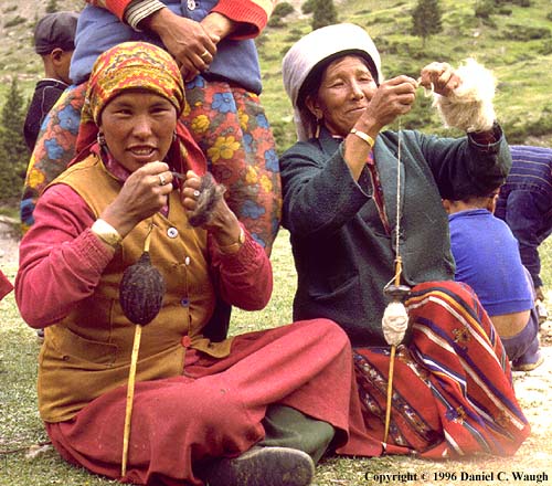
Activity 5—Adventures in China The Polos finally arrived in China and traveled on to Shangdu, the summer capital of the great emperor of China, Kublai Khan. (Shangdu was not far from modern Beijing.) Introduce the students to Kublai Khan by viewing the Painting of Emperor Khublai Khan available through Asia Source. Kublai was so impressed with Marco's intelligence, poise, and his skill with languages that he made him an official of his court. He sent him on missions throughout China and outlying regions, instructing him to observe carefully and to come back to relate what he had seen. Below are some of Marco's observations, which he later described in his book. Share these with your students.
Assessment:Conclude this activity by having the students identify a picture of Kublai Khan and describe some of the marvels of 13th century China during the emperor's reign. Which of these marvels or inventions and practices were later used in the modern Western world? If you are working with younger students, create a large Venn Diagram on the board and brainstorm with the class to determine which items from the ancient society of Kublai Khan's China are still used in Western society today. After 17 years in China, Marco and his father and uncle were anxious to return to Italy. So when arrangements were being made to send a Mongol princess by the sea route to Persia, where she would marry a prince, they offered to accompany her. Kublai reluctantly gave his permission.
The sea journey took 2 years, during which 600 passengers and crew died. Marco doesn't tell us much about the circumstances, so we can only imagine what they must have been. (Were there storms at sea? Did the travelers become ill? Was there fighting with local natives? We'll never know for sure.) When the Polos finally arrived in Persia, they learned that the prince had died, so the princess married his son. They also learned of the death of Kublai Khan, who had lived to be 80. They traveled across Persia to the Black Sea, then by boat to Constantinople, then Venice.
Assessment:Have the students fill out the chart available in pdf format. As in earlier activities, younger students should work as a group, brainstorming under your guidance to answer the questions in the chart. Three years after Marco had returned home, he was involved in a war between his city, Venice, and its trading rival, Genoa. He was captured and taken prisoner. While he was locked up, he became friendly with a fellow prisoner, Rusticello (pronounced Rustichello) of Pisa, who was a writer of romance novels. Marco told the writer all about his adventures in Central Asia, China, India, and the other places he visited. Rusticello wrote down his words, and this led to the creation of Marco's book. The book became a bestseller! However, most Europeans considered it science fiction, not fact. They couldn't believe that the places described could actually exist. They even called Marco Il Milione—because they believed he told a million lies! And yet, as Marco lay dying (he lived to be an old man, see Marco Polo), he insisted that he had only told part of what he had seen. Incredible though his tales seemed, they did inspire a number of people to travel East to find out about this exotic land for themselves. So in this way, Marco Polo launched a whole new age of exploration. Review the major phases of Marco's travels - his trip from Venice to Acre and the Persian Gulf, his trek along the Silk Road, his adventures in China, and his voyage home. Remind the students that the Polos were the first Europeans to go all the way to Beijing, China. To most of their friends and neighbors, that must have seemed like the end of the world. Instruct older students to make a list of those aspects of Marco's travels that might have struck the Europeans as the most far-fetched. Younger students might draw pictures of what they consider the most unusual parts of Marco's story. Afterwards, have the students share their opinions. Would they have believed Marco's stories if they had lived in Europe during his times? Activity 8—Making a Mural/Timeline Tell the students that they will be working together to create a colorful mural/timeline of the life of Marco Polo. Divide the class into six groups. Assign to each group one of the following topics, which relate to the stages of Marco Polo's life and travels in Activities 1 through 6:
The students should meet together in their groups to review the period in Marco's life and/or travels they have been asked to illustrate. Have them refer to the charts they filled out in the previous activities, as well as any pictures they might have drawn. You might wish to distribute copies of maps or photographs you have downloaded from websites visited during this project. Each group should decide how to illustrate their part of the mural, including physical features of the environment, local inhabitants, and, of course, a picture of Marco Polo "in action." After the review session, instruct groups of students to begin work on their section of the mural (which you numbered in preparing the lesson). After writing a descriptive title at the top of the section (such as "Growing up in Venice"), each group will begin illustrating, using markers and other materials available. If you are working with younger students, you should write the topics on the butcher paper and let the students concentrate on their drawings. It is not necessary to add dates, but make certain that the students understand that the passage of time proceeds from left to right, like the words in a book. When the illustrations are completed, choose a student (one with very good handwriting) to write the title ("The Life of Marco Polo" or something similar) at the beginning of the mural. Assemble the class in front of the mural/timeline. Have each group "present" their section to the rest of the class. Invite other classes or parents to come to your room for a student led "virtual tour" (using the mural/timeline) of the life of Marco Polo. Perhaps one student (or several, taking turns) can play the role of Marco and tell his story, referring to the mural as he proceeds. Other members of the class might point out the routes he took to China and back on the large world map. After the presentation, encourage members of the audience to ask specific questions of the students, so that they can each demonstrate how much they've learned about the life and travels of Marco Polo. Assessment:Ask students to:
Selected EDSITEment Websites
Ask Asia [http://www.askasia.org/ ]
National Geographic Xpeditions
Standards Alignment View your state’s standards |
||||||||||||||||||||||||||||||||||||||||||||||||||||||||||||||||||

  |
||
| EDSITEment contains a variety of links to other websites and references to resources available through government, nonprofit, and commercial entities. These links and references are provided solely for informational purposes and the convenience of the user. Their inclusion does not constitute an endorsement. For more information, please click the Disclaimer icon. | ||
| Disclaimer | Conditions of Use | Privacy Policy Search
| Site
Map | Contact
Us | ||