
 Feeds & Data
ShakeMaps
ShakeMap is a product of the U.S. Geological Survey Earthquake Hazards Program in conjunction with regional seismic network operators. ShakeMap sites provide near-real-time maps of ground motion and shaking intensity following significant earthquakes. These maps are used by federal, state, and local organizations, both public and private, for post-earthquake response and recovery, public and scientific information, as well as for preparedness exercises and disaster planning.
Networks producing ShakeMaps
Click a network name to view a list of events, or on an image to view the event
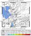
S California

10368325N California

51214595Pacific NW

0811260731Nevada

2009005_270825Utah
1000001272Hawaii

00031867Alaska

85219Global

2009blaj
Last 10 ShakeMaps from any Network
A list of all ShakeMaps is available in the ShakeMap Archive
| Mag | Name/Epicenter | Date | Time | Lat | Lon | Network | Event ID |
|---|---|---|---|---|---|---|---|
| 3.6 | 70.5 miles S of HENDERSON-NV | Jan 05 2009 | 11:02:20 UTC | 35.025 | -114.855 | Nevada | 2009005_270825 |
| 5.5 | GULF OF CALIFORNIA | Jan 05 2009 | 10:59:30 UTC | 23.821 | -108.714 | Global | 2009blaj |
| 5.7 | HINDU KUSH REGION, AFGHANISTAN | Jan 04 2009 | 23:12:59 UTC | 36.516 | 70.865 | Global | 2009bkcf |
| 4.2 | 3.5 km (2.2 mi) ESE of The Geysers, CA | Jan 04 2009 | 17:27:10 UTC | 38.783 | -122.771 | N California | 51214595 |
| 4.3 | 49.6 miles NE of WELLS-NV | Jan 04 2009 | 15:29:20 UTC | 41.693 | -114.405 | Nevada | 2009004_270790 |
| 5.9 | NEAR THE NORTH COAST OF PAPUA, INDONESIA | Jan 04 2009 | 07:14:00 UTC | -0.371 | 132.777 | Global | 2009bkaz |
| 7.4 | NEAR THE NORTH COAST OF PAPUA, INDONESIA | Jan 03 2009 | 22:33:42 UTC | -0.713 | 133.336 | Global | 2009bjca |
| 5.6 | NEAR THE NORTH COAST OF PAPUA, INDONESIA | Jan 03 2009 | 21:49:32 UTC | -0.363 | 132.834 | Global | 2009bjb8 |
| 5.9 | HINDU KUSH REGION, AFGHANISTAN | Jan 03 2009 | 20:23:22 UTC | 36.402 | 70.754 | Global | 2009bjbs |
| 7.6 | NEAR THE NORTH COAST OF PAPUA, INDONESIA | Jan 03 2009 | 19:43:54 UTC | -0.510 | 132.783 | Global | 2009bjbn |
