3RiversHUG-CUP Students
Begin a New Chapter in HAZUS History
The State of Pennsylvania - In March 2006, the 3Rivers HAZUS User Group (3RiversHUG) made history—by voting to initiate a student chapter of the HAZUS user group at the California University of Pennsylvania. Interested students from the Department of Earth Science, particularly undergraduates majoring in Geography, with a concentration in Geographic Information Science and emergency management, eagerly accepted the invitation and established the first-ever student chapter of a HAZUS User Group.
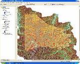
One early example of a successful group project was completed during the spring semester of 2006, as part of Dr. Tom Mueller’s Advanced GIS course. One of the groups worked with Washington County 911 Coordinator, Chris Barton, a member of 3RiversHUG, to update the school’s database for Washington County, Penn.
In addition to these other activities, students also determined that the location data was inaccurate, and Global Positioning Systems (GPS) units were then used to create more accurate location data for the school’s database and other databases through internships conducted during the following semester.
During the summer of 2006, another student was given the opportunity to intern at the Washington County Department of Public Safety in order to assist with a Hazardous Materials Commodity Flow Study. This report detailed the moving of hazardous materials via the county’s many modes of transportation.
During this internship, a database was developed that displayed all of the SARA reporting facilities within the county linked to a database indicating all the contact and response information about those facilities. The intern also compiled a searchable fire-resources database that showed the locations of all fire-service assets within the county.
The relationships developed through the 3RiversHUG are proving productive for linking local organizations that need assistance with qualified students seeking practical experience. The resulting projects, service-learning activities, and internships are providing real advances—especially in the areas of GPS data creation, GIS analysis, and database-updating and management—that will help create better flood-model results from Level 2 HAZUS runs. These improvements will extend to subjects beyond flooding, including emergency preparedness, mitigation decision-making, and general planning.
State-wide,
Pennsylvania
Quick Facts
Sector:
Public
Cost:
Amount Not Available
Primary Activity/Project:
HAZUS-MH
Primary Funding:
Academic