|
|
 |
Hurricane Ivan
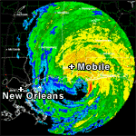
 Hurricane Ivan. Image courtesy of the National Weather Service. [larger version] Hurricane Ivan. Image courtesy of the National Weather Service. [larger version] |
Category-3 Hurricane Ivan came ashore near Gulf Shores, Alabama, on September 16, 2004. The U.S. Geological Survey (USGS), NASA, U.S. Army Corps of Engineers (USACE), and University of New Orleans (UNO) are cooperating in a research project investigating coastal change that occurred during Hurricane Ivan.
After landfall, aerial video, still photography, and airborne laser mapping data were acquired from the impacted areas and compared with earlier data. The comparisons show the nature, magnitude, and spatial variability of coastal changes such as beach erosion and overwash deposition. These data will be used to develop and test predictive models of coastal impacts from severe storms. The data are being made available to local, state and federal agencies for purposes of disaster recovery and erosion mitigation.
|