


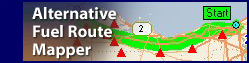

U.S. Views of Alternative Fueling Stations

This page provides several options for viewing alternative fueling stations throughout the United States. The stations displayed by this tool have been independently verified by the Alternative Fuels and Advanced Vehicles Data Center (AFDC).
U.S. Maps by Fuel Type
The following links go to station location pages within the Fuels section of this Web site. The maps on these pages display concentrations of fueling stations in each state and allows you to get station location details for each state.
Interactive U.S. Map for All Fuels
This interactive map provides an overview of fueling station locations in the United States. It allows users to select any combination of fuel types by clicking the "Visible" box next to the fuel type. Zoom in by clicking and dragging on the map. Make sure to click the "Refresh Map" button after changing the selections in the Layers box. When you have the map you want, you can bring up a printable view by clicking on the printer icon in the left toolbar.
If you are using a specialized screen reader and having difficulty understanding the page content, contact the AFDC Webmaster who can assist you with a verbal or written description.
![]()