|
|
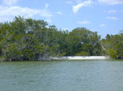
projects > modeling hydrologic flow and vegetation response across the tamiami trail and coastal watershed of ten thousand islands nwr
Modeling Hydrologic Flow and Vegetation Response across the Tamiami Trail and Coastal Watershed of Ten Thousand Islands NWR
There is a critical need for current hydrologic and vegetation data to understand current processes and relations
controlling hydroperiod, salinity, and plant succession under pre-project conditions and climate in order to build models and to predict how increasing freshwater flow and sea-level rise will impact future habitat quality and distribution. This study will establish a stratified network of gaging stations to monitor continuous water levels and salinity conditions associated with vegetation type and growth response and to produce a hydrodynamic model to predict changes in hydroperiod and salinity under different rates of freshwater inflow, pre- and
post-project. Gaging stations will be surveyed to vertical datum to create a digital elevation model of both land and water surface that can be used to calibrate hydroperiod and salinity relations that control vegetation growth and succession. Model applications will be extended to predict vegetation migration and succession under changing freshwater delivery regimes and changing sea-level under projected climate change. Refuge personnel will benefit from the repository of observational data and interactive models for adaptive management
purposes. This research will record the rate and stage of water flow under varying climatic conditions (e.g., wet and dry season) across the coastal margin of TTINWR prior to and following implementation of hydrologic restoration outlined for the Picayune Strand Restoration Project (and Southern
Golden Gate Estates Hydrologic Restoration). Overall project tasks and objectives include: gaging
hydrologic conditions, surveying ground and water elevations, correlating hydroperiod and plant associations, monitoring intra-annual growth response to climate and hydrology, and modeling hydrologic coupling and vegetative
succession. Work PlansProject SummariesMetadata
PublicationsAbstracts |
U.S. Department of the Interior, U.S. Geological Survey
This page is: http://sofia.er.usgs.gov/projects/index.php?project_url=hydro_flow_TT
Comments and suggestions? Contact: Heather Henkel - Webmaster
Last updated: 24 September 2008 @ 01:45 PM (BJM)