|
|
projects > evaluation of methods to determine groundwater seepage beneath levee 30, miami-dade county, florida
Evaluation of Methods to Determine Groundwater Seepage Beneath Levee 30, Miami-Dade County, Florida
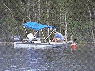
The amount of water seeping under the protective levee system between Water Conservation Area 3B (WCA3B) and the Pennsuco wetlands to the east is poorly estimated. The objective of this project is to evaluate methods of determining seepage from WCA3B near Levee 30 and ground-water seepage beneath Levee 30. Plans to restore historical hydrologic conditions in the northeast section of ENP include the raising of water levels in ENP and WCA 3B, which overlie the Biscayne aquifer, an extremely permeable aquifer. The increase in water levels is likely to cause an increase in seepage losses to the east under Levee 30. Groundwater level and surface-water stage data, canal discharges, and vertical seepage data have been collected and evaluated with respect to vertical seepage from the Everglades and horizontal flow in the Biscayne aquifer. A ground-water flow model has been developed to quantify ground-water seepage beneath the protective levee. The groundwater flow model developed through this project is needed to estimate the effects of changing water levels in Water Conservation Area 3B (WCA 3B). The results of the study will be used by the South Florida Water Management District as part of the Lake Belt study in Miami-Dade County. The final report, "Methods to Quantify Seepage Beneath Levee 30, Miami-Dade County, Florida" will document the results of the data collection and modeling efforts. ProposalsProject SummariesData
Metadata
PublicationsAbstracts
Fact SheetsPosters
Water Resources Investigations Reports
Photos |
U.S. Department of the Interior, U.S. Geological Survey
This page is: http://sofia.usgs.gov/projects/index.php?project_url=levee_30
Comments and suggestions? Contact: Heather Henkel - Webmaster
Last updated: 24 September 2008 @ 01:45 PM (BJM)