
Forest Inventory and Analysis National Program
| Regulations.gov | |
| Employee Search | |
| Information Center | |
| National Offices and Programs | |
| Phone Directory | |
| Evaluate Our Service We welcome your comments on our service and your suggestions for improvement. |
Forest Inventory &
Analysis (703) 605-4177 |
|
|
|
Program Features
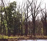
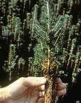
Forest Health Indicators
The forest monitoring
component is the best-known component of the
FIA program. This component consists of a
three stage systematic sample of sites across
all forested lands of the US. Phase 1 consists
of remote sensing for stratification, to identify
where the forested land is. Phase 2 consists
of one field sample site for every 6,000 acres
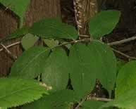
of forest, where field crews collect data
on forest type, site attributes, tree species,
tree size, and overall tree condition. Phase
3 consists of a subset of Phase 2 sample plots
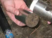
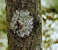
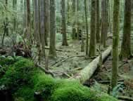
which are measured for a broader suite of
forest health attributes including tree crown
conditions, lichen community composition,
understory vegetation, down woody debris,
and soil attributes. Soil samples are sent
to a laboratory for chemical analysis. Finally,
an associated sample scheme exists to detect
cases of ozone damage occurring to adjacent
forest vegetation.
Collectively, the forest monitoring component
of FIA provides a nationwide systematic sample
of a wide array of measurements on forested
ecosystems, which are used by a diverse set
of customers for many purposes. For example,
FIA data have been used to map habitat for
endangered animal species, to identify areas
of forest decline, and to track the effect
of global change reflected in changing species
distributions.
In additional to producing a variety of reports
and analyses at the state and regional level,
information from the FIA forest monitoring
program is publicly available through our
online FIA
database. To learn more about the Forest Health Indicators click on indicator pictures below or links above.
|


USDA Forest Service
Last Modified:
January 31, 2005