|
| |
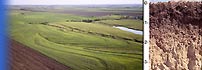
Inherent Land Quality Map

- Key Words: land quality, land quality map
- About the Map: The Inherent Land Quality map is based on a reclassification of the global soil climate map and global soil map.
- Possible Uses of the Map: Useful for teachers and students who are interested in the global distribution of inherent land quality. Global modelers may be able to use the data for small scale analysis.
Data
- Source: Soil map and soil climate map, USDA-NRCS, Soil Survey Division, World Soil Resources, Washington D.C.
- Data Aggregation and Reliability: The Inherent Land Quality map data is rasterized on a 2 minute grid cell.
- Data Definitions: Nine classes are defined based on soil climate and soil classification. Legend is structured as a matrix using soil performance and soil resilience.
- Data Disclaimer: Country boundaries are not authoritative.
- Database Manager: Paul Reich, Geographer, World Soil Resources. Email: paul.reich@usda.gov
Map Production Information
- Map Identification: landqual.jpg
- Production Date: 1998
- Geographic Coverage: Global
- Projection: Geographic
- Minimum Scale: 1:5,000,000
This page last updated on September 8, 2003.
< Back to Map Index
| |
|