|
|
|
Metadata
|
|
ID
|
92005
|
|
Also Known As
|
92005
ARMN92-1
M-1-92-MY
|
|
Abstract
|
United States Geological Survey, Woods Hole, Massachusetts.
Chief Scientist: Ron Circe. Data (navigation) of field
activity 92005 (M-1-92-MY) in Massachusetts Bay from
05/06/1992 to 05/14/1992
|
|
Organization
|
United States Geological Survey, Woods Hole, Massachusetts
|
|
Project/Theme
|
Massachusetts Bay Experiment
|
|
Chief Scientist
|
Ron Circe
|
|
Platform
|
Argo Maine
|
|
Area of Operation
|
Massachusetts Bay
|
|
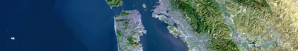
Location map
|

|
|
Bounding Coordinates
|
42.70000
-70.90000 -70.10000
42.00000
|
|
Dates
|
05/06/1992 (JD 127) to 05/14/1992 (JD 135)
|
|
Analog Materials
|
No analog holdings.
|
|
Index map

|
|
|
Crew
|
|
Ron Circe
|
Chief Scientist, USGS Eastern Region
|
|
Dave Nichols
|
Unspecified, USGS Woods Hole
|
|
Nancy Soderberg
|
Unspecified, USGS Woods Hole
|
|
Rick Rendigs
|
Unspecified, USGS Woods Hole
|
|
Barbara Seekins
|
Unspecified, USGS Woods Hole
|
|
Dann Blackwood
|
Unspecified, USGS Woods Hole
|
|
Carol Parmenter
|
Unspecified, USGS Woods Hole
|
|
Chris Schneider
|
Unspecified, USGS Woods Hole
|
|
Nicole Moser
|
Unspecified, USGS Eastern Region
|
|
Don Bradford
|
Captain, Maine Maritime Academy
|
|
|
Equipment Used
|
|
|
Purpose
|
|
Side scan sonar, boomer, sample
|
|
|
Got Help?
|
For 92005, we would appreciate any information on -- activity type, analog materials, contract, days at sea, dive count, funding, information specialist, information to be derived, kms of navigation, national plan, NGDC Info, notes, owner, ports, project number, publications, scanned materials, seismic description, station count, station description, submersible, summary, tabulated info.
|
|