|
|
|
Metadata
|
|
ID
|
K-3-75-AR
|
|
Also Known As
|
ARCS-75-KE
|
|
Abstract
|
Chief Scientist: Erk Reimnitz. Geological and Geophysical
data (7khz, 12khz, sidescansonar, uniboom, 200khz,
200khz7khz, underwatertelevision, Beckmanstc, Aanderaa,
transmissometer, airgun) of field activity K-3-75-AR in
Chukchi-Beaufort Sea area, Alaska from 08/31/1975 to
09/23/1975
|
|
Chief Scientist
|
Erk Reimnitz
|
|
Activity Type
|
Geological and Geophysical
|
|
Platform
|
Karluk
|
|
Area of Operation
|
Chukchi-Beaufort Sea area, Alaska
|
|
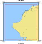
Location map
|
|
|
Bounding Coordinates
|
71.00000
-169.00000 -158.00000
66.75000
|
|
Ports
|
leave Barrow, AK
arrive ?
|
|
Dates
|
08/31/1975 (JD 243) to 09/23/1975 (JD 266)
|
|
Analog Materials
|
list
|
|
Index map

|
|
|
Crew
|
|
Bill Clique
|
Unspecified Investigator, USGS Western Region
|
|
Erk Reimnitz
|
Chief Scientist, USGS Western Region
|
|
Harry Hill
|
Electronics Technician, USGS Western Region
|
|
Larry Toimil
|
Geologist, USGS Western Region
|
|
|
Equipment Used
|
|
7khz
|
|
12khz
|
|
sidescansonar
|
|
uniboom
|
|
200khz
|
|
200khz7khz
|
|
underwatertelevision
|
|
Beckmanstc
|
|
Aanderaa
|
|
transmissometer
|
|
airgun
|
|
|
Publications
|
|
|
Got Help?
|
For K-3-75-AR, we would appreciate any information on -- contract, days at sea, dive count, funding, information specialist, information to be derived, kms of navigation, national plan, NGDC Info, notes, organization, owner, project, project number, purpose, scanned materials, seismic description, station count, station description, submersible, summary, tabulated info.
|
|