|
|
|
Metadata
|
|
ID
|
A-1-05-OA
|
|
Abstract
|
United States Geological Survey, Pacific Science Center.
Chief Scientist: Curt Storlazzi, USGS Pacific Science Center.
Deployment data (navigation) of field activity A-1-05-OA in
Pearl Harbor, Honolulu, Oahu, Hawaii from 03/31/2005 to
04/04/2005
|
|
Organization
|
United States Geological Survey, Pacific Science Center
|
|
Chief Scientist
|
Curt Storlazzi
|
|
Activity Type
|
Deployment
|
|
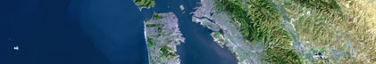
Area of Operation
|
Pearl Harbor, Honolulu, Oahu, Hawaii
|
|
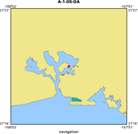
Location map
|

|
|
Bounding Coordinates
|
21.36468
-157.95076 -157.95055
21.36421
|
|
Dates
|
03/31/2005 (JD 090) to 04/04/2005 (JD 094)
|
|
Analog Materials
|
No analog holdings.
|
|
Index map
|
|
|
Information Specialist
|
|
Joshua Logan USGS Menlo Park
|
|
|
Crew
|
|
Curt Storlazzi
|
Chief Scientist USGS Pacific Science Center
|
|
Matt Russell
|
NPS Submerged Resources Division
|
|
Tom Reiss
|
Dive Safety Officer USGS Menlo Park
|
|
Josh Logan
|
Diver USGS Pacific Science Center
|
|
|
Equipment Used
|
|
|
Purpose
|
|
Determine circulation patterns around the USS Arizona
|
|
|
Information to be Derived
|
|
Circulation around the hull
|
|
|
Notes
|
|
Cooperative with National Park Service Submerged Resources Center.
|
|
Equipment used: SCUBA deployment, Acoustic Doppler Current Profiler (ADCP)
|
|
|
Got Help?
|
For A-1-05-OA, we would appreciate any information on -- analog materials, contract, days at sea, dive count, funding, kms of navigation, national plan, NGDC Info, owner, platform, ports, project, project number, publications, scanned materials, seismic description, station count, station description, submersible, summary, tabulated info.
|
|