| Planning | |
| Scenario Planning | |
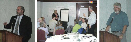
SummaryThe following report summarizes a Peer Workshop on tools and effective practices for scenario planning. The Federal Highway Administration (FHWA) coordinated and led the daylong workshop in Traverse City, Michigan. Presenters from the FHWA provided participants with an overview of the scenario planning process and described available resources and tools to assist with scenario planning analysis. A local presenter from the Traverse City Transportation and Land Use Study (TC-TALUS) discussed population, quality of life, and development trends in the Traverse City region. Peer presenters from the San Luis Obispo Council of Governments (California) and Michigan's Grand Valley Metropolitan Council presented information on their regions' scenario planning efforts, including using real-time feedback to engage stakeholders and both high and low-tech methods for scenario planning. Lively debated ensued in the breakout sessions and discussion periods, focused primarily on stakeholder engagement and incorporating scenario planning into upcoming planning studies in the Traverse City Region.
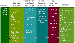
I. IntroductionJody McCullough of the FHWA Office of Planning began the workshop by presenting an overview of scenario planning and the FHWA's role in supporting its use. Scenario planning represents an integrated approach to decision making. It is not a prediction for the future, but rather a tool to help communities recognize uncertainty and make good decisions across a range of possible futures. The process begins with an assessment of the community's values, existing quality of life issues, and trends. Next, visualization tools, usually Geographic Information Systems (GIS)-based, are used to help participants picture a future based on existing conditions and possible future changes in transportation, housing, and other areas. Last, planners need to build relationships, credibility, and trust with stakeholders and the public. An effective way to build trust is to listen to the public and show them that their input is being acted upon. Queensland, Australia, developed the following step-by-step process for scenario planning: Step 1: Identify Quality of Life Issues One benefit of scenario planning is being able to analyze complex issues through a strong analytical framework and process, good data, and system oriented tools. Scenario planning also facilitates consensus building by creating the capacity for communities to participate actively, improving communication and understanding among stakeholders, and making the decision-making framework more transparent. FHWA supports scenario planning in the transportation planning process. As part of this support, FHWA encourages the use of Metropolitan Planning (PL) and other transportation funds to implement scenario planning, provides feedback on efforts being planned or implemented, shares and provides information on scenario planning efforts nationwide, identifies resources and tools for use in scenario planning, and facilitates peer workshops. More resources, including case studies, techniques, and tools can be found on the Scenario Planning web site, www.fhwa.dot.gov/planning/scenplan/.II. Local Trends and Planning EffortsA. Overview of Local TrendsMatt Skeels, Traverse City Transportation and Land Use Study (TC TALUS) The peer presenters provided the group with two different approaches for conducting and implementing scenario planning. The presenter from the San Luis Obispo Council of Governments (SLOCOG) discussed how his region had used technology and real-time results to engage stakeholders. The presenter from the Grand Valley Metro Council discussed how his region's scenario planning effort began with "low-tech" methods, as well as how the region is working to integrate scenario planning into the transportation and land use planning process. III. Peer Practices and ObservationsA. Community 2050 UpdateSteve Devencenzi, San Luis Obispo Council of Governments , San Luis Obispo, California OverviewThe San Luis Obispo Council of Governments serves San Luis Obispo County in central California. Like Traverse City, San Luis Obispo has recently experienced an influx of retirees, while tourism's role in the economy has increased - unlike agriculture's role, which has decreased. SLOCOG received a Blueprint grant from the state in fiscal year 2005-06 to undertake a scenario planning process. This process, called the Community 2050 Update, centered on having the community envision the region's future. SLOCOG started with its municipalities' 20-year plans, and then asked how people wanted the region to develop from there over the next couple of decades. SLOCOG is currently between Phases II and IVA in Figure 3. Based on the preferred 2050 vision, some changes may need to be made to the 20-year plans. SLOCOG endeavors to align each agency in the region with a shared, public vision through the scenario planning process. To succeed in this process, SLOCOG divided the county into four parts based on each part's own distinct markets (for example, jobs and housing) and characteristics; this allowed smaller areas within the county to be heard. The four parts were the North Coast, Central Area, North County, and South County. 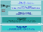 (click image to enlarge) Figure 1: The phases of SLOCOG's scenario planning process SLOCOG set up stakeholder involvement committees with locally elected officials and other interested parties in each of the four parts of the county to solicit their input and to get their buy-in early on. SLOCOG ensures that they have locally elected officials on board as early as possible to engender a feeling of ownership of the process. They also stress that a regional vision is being created that the communities can choose to implement in their plans, or not. SLOCOG held a series of workshops in each of the areas in the county as part of their 2050 visioning process. The general public was invited, and elected officials and planning commissioners also attended. At the workshops, members of the community and stakeholders got together to review existing maps and brainstorm ideas for new development. The main purpose of the workshops was to build awareness and consensus. SLOCOG created "Development Type" menus in their model, described more below, that enabled participants to create alternative scenarios (Development Type indicators are listed in Box 1). The scenarios are compared on the fly to assist in developing new ideas. Interactive polling was used to ask participants what summary concepts and scenarios they most preferred. Existing land use served as a baseline scenario to compare proposed land use changes and to evaluate development impacts.
In working with stakeholders and the public, SLOCOG found real-time analysis of the scenarios to be an important tool in demonstrating how infrastructure decisions shape the community. Having real-time results also helped SLOCOG build trust and bolster public buy-in, as the process was open and transparent to the participants. At the public workshops, participants were first seated at tables within a meeting room, then given chips to place on a map of the county in areas where they thought population and jobs should be located between the years 2030-2050. Participants were given the choice of several chip sets, from low-density (business as usual) growth up to high-density growth. As participants sketched out future land use scenarios, forecasters at each table entered information into a computer. Through a program called iPLACES, which was connected to the region's traffic model, the computer yielded immediate feedback to emphasize the relationship between land use choices and traffic conditions. Figure 3 shows how SLOCOG used technology to inform workshop participants of the transportation impacts of their development choices. Generating feedback took only 15 minutes. When people saw the impact of continuing low-density growth on their community and the surrounding environment, many participants traded their lower-density chips in for higher density chip sets, and new information was entered into iPLACES. Technical assistance for the project was provided by nearby California Polytechnic University. Working with the local university enables SLOCOG and local units of government to take advantage of a broad knowledge base and a pool of student labor. California Polytechnic University houses GIS data and makes it available for use by all.  (click image to enlarge) Figure 2: Real-Time Modeling of Transportation Impacts The program SLOCOG used to translate the participants choices into regional impacts - iPLACES - is a parcel-level web-based scenario planning tool that is the successor of PLACE3S. PLACE3S is a desktop scenario planning tool that has been used by the Sacramento, San Francisco, and San Diego regions. In the next phase, SLOCOG will begin using UPlan, a tool developed by the University of California at Davis in partnership with CalTrans. UPlan models where land use changes will occur in response to the transportation infrastructure. Lessons LearnedMr. Devencenzi noted that the biggest problem facing city planners is a lack of consensus. Scenario planning helps groups reach consensus quickly. SLOCOG believes their workshops were particularly successful since the community was continuously engaged with real-time results. Fast, high-tech results made the workshops more enjoyable and impressive. During the process, many participants were surprised to learn that location matters: forecast traffic conditions varied from table to table even though the same number of households and jobs were added at each. Overall, the process served to strengthen SLOCOG's credentials in future public dialogue on land use issues. Challenges SLOCOG faced include performing complex tasks quickly in front of a large audience. Doing this is necessary for real-time results, but is inherently risky. SLOCOG found that it was a good idea to have backups ready for everything. Another lesson learned was that when the public uses the same tools that planners use, they understand planning much better. Participants learned a lot from the results of their first scenario. Giving them time to develop a second scenario reinforces the lessons they learned. SLOCOG found that it was important to agree on goals, to develop principles of agreement, and to measure development based on these principles throughout the process. B. Metropolitan Development BlueprintJay Hoekstra, Grand Valley Metropolitan Council (GVMC) www.gvmc.org/, Grand Valley, Michigan. The GVMC is composed of local governments in the Grand Rapids, Michigan area. The Metropolitan Development Blueprint project had as its goal producing a functional regional development framework for the entire region. In 2002, GVMC began a scenario planning process to further the work of the Blueprint project. Due to the number of local governments in the area, GVMC created subregions of neighboring townships where people live, work, and know each other. A series of three meetings was held for each of the subregions. Each unit of government sent three participants, a member of the planning staff, a planning commission member, and an elected official. Before beginning the meeting series, GVMC did extensive GIS work and data analysis. They compared growth projections, what was allowed in the zoning, and what was suggested by the plans. They found that the region as a whole was zoned for more than 200% of the forecast population. Units of government were not consulting with each other: each subregion had planned and zoned for far more than the projected population. GVMC also analyzed how much land would be consumed by accommodating the projected population in various development types. At the meetings, participants where asked to consider the projected population growth and answer the questions, "where will they live, in what kind of dwellings, and how will those dwellings be arranged"? Participants used styrofoam blocks which represented various development types to arrange the housing choices on base maps. To start with, participants were hesitant to make choices, particularly in other communities. They believed that growth would happen regardless of their input and that they were not empowered to control it. To overcome this, GVMC asked them to first develop a scenario that they thought would happen, and then to develop a scenario that they would like to see happen. In all cases, the first scenario consumed significantly more land, but accommodated fewer people than the second scenario. Participants showed a preference for clustered and traditional neighborhood development (TND). In the second meeting, participants could set priorities for growth areas and vote on how much population they wanted to accommodate in their subregion, and how much in the other subregions. All subregions voted fairly consistently. This was an important outcome, as it demonstrated consensus on where growth should and should not occur (See Figure 5 below). To realize this goal, significant infill work will have to be done in the urban metro area. Implementation ActivitiesTo advance the goals set out in the scenario planning process, GVMC sponsored two major projects: an economic analysis of the market for TND and a form-based code. The community was reluctant to create TND, as the market demand was unknown. A consultant was hired to study the question. The primary conclusion was that the existing supply of single-family housing is adequate and TND in the study areas could satisfy a majority of the housing growth projected within the region over the next 30 years. The second major project was the development of a form-based code for streets and buildings. Local experts were surveyed to determine the region's "best places". These places were then analyzed and their common characteristics were used to create new standards for development. The code's increment of planning and zoning is the neighborhood; neighborhoods can be clustered to create nodes. Next steps include working with customized INDEX PlanBuilder software tools to expand the use of scenario planning in the Grand Rapids area. PlanBuilder will be available to all the member agencies for uses ranging from neighborhood planning and evaluation of development proposals up to regional planning. C. Modeling Tools: Update on LEAMMatt Skeels, TC-TALUS In 2005, TC-TALUS used grant funding to create a rudimentary scenario planning exercise. Travel demand models traditionally ignore land use and socio-economic changes. The Landuse Evolution and Impact Assessment Model (LEAM) incorporates these factors to gain a more regional perspective on growth. Compared to the traditional traffic modeling approach, the LEAM model predicted a different growth distribution pattern. LEAM allows the user to input proximity to various drivers; Traverse City used transportation, development, and projections, as there was not the funding to produce the additional levels of detailed data. Users can compare base assumptions to zoned and unzoned scenarios and transportation and land use models can be used to improve each other. Reports are available at www.leamgroup.com/Projects/projects/index.htm. D. Traffic ModelingKaren Faussett, Michigan Department of Transportation (MDOT). Ms. Faussett introduced the basics of the transportation demand modeling process. Models are used in long-range planning, in air quality analysis, and to help make policy and project decisions. In Michigan, MDOT maintains the statewide model, the small urban area models, and models for other areas that are not MPOs including the TC-TALUS area. Transportation Management Areas maintain their own models with oversight from MDOT. The two main components of models are the network and the travel analysis zones (TAZs). The TAZs contain data on households and employment. Household information (number of households, income and auto ownership) is generally obtained from the Census. The employment data is more difficult to obtain and often comes from state unemployment records or a privately developed database. The land use (household and employment) data drives the model; realistic land use assumptions are critical. The models forecast future travel based on these land use assumptions. Traffic volumes are the main output, but other outputs include vehicle miles traveled (VMT), vehicle-hours, and delay. The models can be utilized to evaluate the transportation impacts of alternative land use scenarios. Models are an evolving tool and are getting more sophisticated. Resources for understanding and improving transportation models include the FHWA's Travel Model Improvement Program (TMIP) and Edward Beimborn and Rob Kennedy's Inside the Black Box: Making Transportation Models Work for Livable Communities 1. E. Picture Michigan TomorrowChuck McKeown, Michigan State University, www.landpolicy.msu.edu; www.pmt.msu.edu The Michigan State University (MSU) Land Policy Program conducts land use research and provides technical assistance to Michigan communities. Land use modeling takes into account demographics, regulatory factors, transportation, and existing land use and infrastructure. The process is data-intensive and evolving. Picture Michigan Tomorrow, a new initiative, has the mission of building the next generation of highly-defensible, scalable land use models for Michigan. The program has assembled a large dataset already, although there the data needs continue to be great. The dataset will ultimately be available online. In the interim, Peer Workshop participants are welcome to contact Mr. McKeown.
Figure 3: Picture Michigan Tomorrow Process The Kellogg Foundation commissioned the Michigan Land Resource study, which used a neural network model to create map of land use projections for econometric analysis. According to Mr. McKeown, the model is "anecdotal at best" due to its broad scope and data deficiencies. Projected impacts include a loss of 25% of fruit growing land over the next 40 years and 17% of farmland overall. The results spurred the creation of the Michigan Land Use Leadership Council. MDOT asked MSU to model the land use impacts of transportation major changes in the Grand Rapids corridor, including land use and property value implications. MSU projected the bid-rent curve for residential development and agricultural development by travel times to employment centers. Picture Michigan Tomorrow identified critical problems with Michigan data, including a need for up-to-date, accurate aerial imagery. They brokered the Michigan Aerial Imagery Partnership (MAIP): a new flyover of the entire state at one-meter resolution. The images will be downloadable off of the website. Department of Homeland Security funding has been received to translate imagery into land use and land cover data and maps. C. Scenario Planning ToolsJim Thorne, Metropolitan Planning Specialist, FHWA Resource Center; Chicago, IL Mr. Thorne presented a range of scenario planning tools and resources.. He recommended that participants begin by figuring out their goals and then selecting the tools to realize them. Technology has come a long way, but there are low-tech tools, such as stickers, pen and paper, and cardboard, that can be very effective. Different tools can be used at different levels of analysis. FHWA cannot recommend one software package over another; the choice of software will depend on the user's goals. Many websites have resources to help identify the appropriate tools for various planning process. A variety of technology tools can help communities consider scenarios and make better decisions. These tools can be divided into the following categories:
IV. Question and Answer PeriodIssues discussed during the question and answer period mainly revolved around the upcoming planning study for the Grand Traverse region, and the role of scenario planning and public participation in it. The group discussed setting up a subcommittee on scenario planning to advance its use in the region, but no consensus was achieved. Two other active topics of discussion were current trends in the area, including demographic shifts, and encouraging public participation. Demographic shifts include an influx of retirees and seasonal residents and shifts away from Traverse City proper to the surrounding areas. Local agriculture, centered around the cherry industry, is seen to be changing as well. V. For More Information
VI. AttachmentsA. AgendaScenario Planning Peer Workshop
B. List of Presenters
1 Inside the Black Box: Making Transportation Models Work for Livable Communities To provide Feedback, Suggestions or Comments for this page, contact Jody McCullough (jody.mccullough@dot.gov). |
|||||||||||||||||||||||||||||||||||||||||||||||||||||||||||||||||||||||||