 |
|
|
||||
| Earth Resources Observation and Science (EROS) |
Multispectral Scanner (MSS)
|
Contents: |
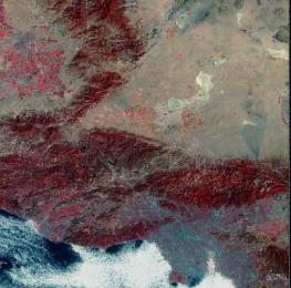
MSS image from Landsat |
|
back to Satellite Product List Product DescriptionThe Landsat Multispectral Scanner (MSS) was a sensor onboard Landsats 1 through 5 and acquired images of the Earth nearly continuously from July 1972 to October 1992, with an 18-day repeat cycle for Landsats 1 through 3 and a 16-day repeat cycle for Landsats 4 and 5. Landsat MSS image data consist of four spectral bands (band designations), although the specific band designations changed between Landsats 1-3 and Landsats 4-5. The resolution for all bands of 79 m, and approximate scene size is 170 km north-south by 185 km east-west (106 mi by 115 miles). Most Landsat MSS data are available as digital products, but for some MSS scenes, data are only available as high resolution scans of film separates, one for each band. Scanned digital products are distributed as individual GeoTIFF files for each band.
For all levels of digital correction, the following processing parameters are customer-defined:
*Other options may be available upon request. Additional InformationPrices (Digital Source)
Prices (Film Source)Pricing and information apply only to MSS data created by scanning film separates. Digital File SizesHigh resolution Scanned:
Actual image size will generally be larger than the sizes listed above because reference data on the film are scanned along with the image, and a USGS logo is added. Scanning at 21 microns is equivalent to 1200 dpi, 14 microns is equivalent to 1800 dpi, and 7 microns is equivalent to 3600 dpi. High Resolution Scanned: $30.00 per frame
Maximum stacking limits (the number of frames that can fit on a particular CD or DVD media).
Bulk DiscountA bulk discount of 20 percent off the standard product price will be applied to orders containing 25 or more single Landsat scenes (any combination of MSS, Thematic Mapper, and Enhanced Thematic Mapper Plus (ETM+) Scan Line Corrector (SLC)-on digital products are allowed). No discounts are available for film products, Landsat 7 ETM+ SLC-off, or ETM+ Gap-filled products. Search & OrderAll Landsat MSS scenes from both digital and film sources in the USGS archive can be searched by geographic location using Earth Explorer or the USGS Global Visualization Viewer (GloVis). Only scenes with browse capability can be searched and ordered on GloVis. Landsat MSS data from satellites 1 through 3 are referenced to the Landsat Worldwide Reference System of paths and rows - WRS-1; Landsat MSS data from satellites 4 and 5 are referenced to WRS-2. There are several commercial firms that can provide printed images from USGS digital data. Image PreviewsLandsat MSS images should always be previewed prior to purchase. Browse images of available scenes may be viewed by searching on Earth Explorer or GloVis. Each Landsat MSS browse image is a resampled JPEG of the actual image data. The browse image will be displayed as a 4,2,1 (RGB) composite. Sample DataLandsat MSS product samples are available for download at the Landsat Sample Products Web page. | |||||||||||||||||||||||||||||||||||||||||||||||||||||||||||||||||||||||||
| Accessibility FOIA Privacy Policies and Notices | |
 |
|