You are here: Home » Research & Monitoring » Seismic Hazard Mapping » Memphis, 1996 Disaggregation

Memphis, 1996 Disaggregation

Before you look a the information available on the maps mentioned below, you should read the Explanation of deaggregated seismic hazard.

To obtain the four hazard matrices and the related hazard maps, go to the CEUS map or WUS map and click on the city (red dot). The entries are per cent contribution to hazard. They will sum to 100 per cent for each matrix.

Western U.S. Cities Map Central/Easter U.S. Cities Map

Hazard Matrices

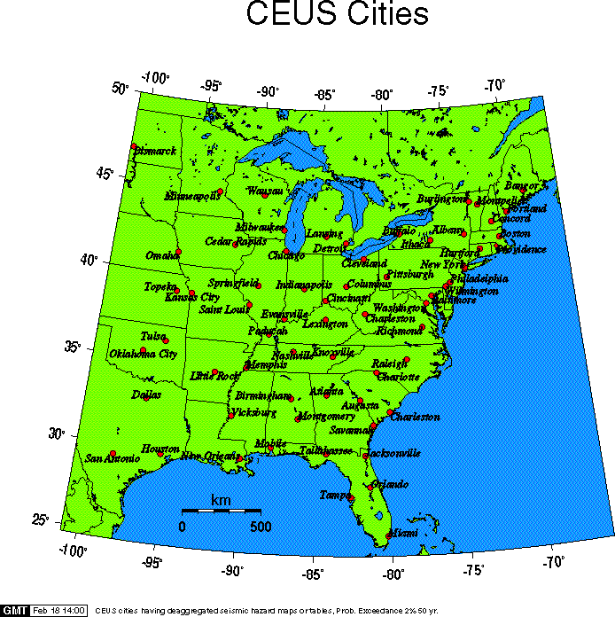
The distance scale on the following two maps is accurate in the east-west direction,
but there is foreshortning in the north-south direction.

Disaggregated Seismic Hazard for 1 second Spectral Acceleration GIF, PDF, PS,
Disaggregated Seismic Hazard for 0.2 second Spectral Acceleration GIF, PDF, PS,


City List Aberdeen Albany Albuquerque
Amarillo Atlanta Augusta Bakersfield
Baltimore Bangor Bellingham Billings
Birmingham Bismarck Boise Boston
Buffalo Burlington Carson City Cedar Rapids
Charleston Sc Charleston Wv Charlotte Cheyenne
Chicago Cincinnati Cleveland Columbus
Concord Dallas Deadwood Denver
Detroit Durango Elko Elpaso
Eugene Eureka Evansville Flagstaff
Fresno Hartford Helena Houston
Indianapolis Ithaca Jackson Jacksonville
Kansas City Knoxville Lansing Las Vegas
Lexington Libby Littlerock Losangeles
Medford Memphis Menlo Park Miami
Milwaukee Minneapolis Missoula Moab
Mobile Monterey Montgomery Montpelier
Nashville New Orleans New York City Oakland
Ogden Ok City Olympia Omaha
Orlando Paducah Palmsprings Philadelphia
Phoenix Pittsburgh Pocatello Portlandme
Portlandor Providence Pueblo Raleigh
Redding Reno Richmond Sacramento
Saintgeorge Saintlouis Salem Salinas
Salt Lake City San Antonio San Diego San Francisco
San Jose San Luisobispo Santabarbara Savannah
Seattle Spokane Springfield Tallahassee
Tampa Taos Topeka Tucson
Tulsa Twinfalls Umatilla Vicksburg
Wallawalla Washington D.C. Wausau Wilmington
Yuma