|
|
 |

Priority Ecosystems Science
Introduction
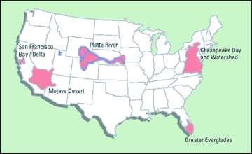
The mission of Priority Ecosystem Science, PES is to provide science in support of adaptive management of ecosystems that have near-term societal concern and significant long-term societal value. Studies are designed to serve local ecosystem management needs and to provide knowledge and approaches transferable to similar ecosystems across the Nation. PES efforts focus in areas where new integrated science approaches can be developed to address the needs of a diverse group of decision-makers and to meet Department of the Interior's responsibilities to manage the Nation's lands. Activities require collaboration and integration of expertise from the four USGS disciplines, Biology, Geology, Geography, and Water to achieve a system-scale understanding of the natural and anthropogenic factors affecting ecosystems and to better understand the interactive nature of resources and the environment. On a larger scale, PES efforts contribute to a broader capability needed to understand and assess the health of the Nation's ecosystems. Current PES study units include the Greater Everglades, San Francisco Bay, Chesapeake Bay, the Mojave Desert, and the Platte River. More information on each study unit can be found below.
|
|
Greater Everglades
In the last 100 years, requirements for water supply and flood protection for urban areas and agriculture in South Florida have resulted in the construction of an extensive canal system to prompt drainage of water into the Atlantic Ocean rather than allowing seasonal seepage through the Everglades and Florida Bay. Water diversions and excessive nutrients and contaminants within the Everglades have decimated bird populations and driven the Florida panther to the brink of extinction. In Florida Bay, declines in seagrasses have resulted in decreasing water clarity, degradation of the food web, and resultant declines in fish populations. In support of restoration, federal, state, and local agencies have established a $7.8 billion ecosystem restoration program for the Everglades, known as the Comprehensive Everglades Restoration Plan and Congress has established the South Florida Ecosystem Restoration Task Force to coordinate efforts and exchange information for the restoration, preservation, and protection of the South Florida ecosystem. In support of providing sound, relevant, and timely science information, PES conducts scientific investigations in south Florida to improve society's understanding of the environment and assist in the sustainable use, protection, and restoration of the Everglades and other ecosystems within the region.
San Francisco Bay
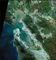
The vast San Francisco Bay and Delta region of California is located at the confluence of the Sacramento and San Joaquin Rivers. It is often referred to as the San Francisco Bay estuary. Since the discovery of gold in the Sierra Nevada foothills in 1848, this region has undergone rapid, large-scale, and permanent changes driven by population migration attracted to the region's natural setting and economic opportunities. The consequent land use changes, particularly urbanization, have resulted in the loss of wetlands, alteration of freshwater inflows, contamination of water, sediments and biota, and declines of fish and wildlife species. The USGS has maintained a broad program of multi-disciplinary research studies, both fundamental and applied, in the San Francisco Bay estuary and its watershed. The studies help us understand the extent and impact of these changes, and also help decisionmakers use science to help mitigate adverse effects. PES studies often are conducted in cooperation with other Federal, State, and local agencies, and have been designed to increase our understanding of important issues including waste disposal, water flow management, harbor/channel dredging, wetland restoration, food web processes, exotic species impacts, natural hazards mitigation, and maintaining quality of life.
Chesapeake Bay
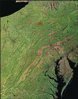
The Chesapeake Bay, the Nation's largest estuary, has been degraded due to water quality problems, loss of habitat, and over harvesting of living resources. Additionally, the Bay was listed under the Clean Water Act as an “impaired water body” due to excess nutrients and sediments and must improve water-quality conditions by 2010. In response to the problems facing the Bay, the Chesapeake Bay Program (CBP), which is a multiagency partnership, completed Chesapeake 2000, a new agreement that revises and establishes new restoration goals for the next 10 years in the Bay and its watershed. The USGS, one of the original CBP Federal partners, has the critical role to provide unbiased scientific information that is utilized to formulate, implement, and assess the effectiveness of restoration goals. PES is contributing to these needs by improving watershed and land-use data to understand changes in water quality and living resources; understanding the impact of sediment on water clarity and biota; enhancing the prediction and monitoring of nutrient delivery to the Bay; and assessing the factors affecting the health of fish and water birds.
Mojave Desert
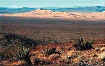
The Mojave Desert Ecosystem is a landscape of contrasts and challenges spread over southern Nevada, western Arizona, southwestern Utah, and a quarter of California. Encompassing six military bases, four national parks, and considerable Bureau of Land Management and other Federal lands, the Mojave Desert is home to a rapidly growing population of well over a million people. The desert is also home to active and abandoned mines, off-road recreation areas, and waste disposal sites. The most remote area of the desert lies within three miles of a road. Estimating the effects of continued population growth and increased resource use in the region is difficult given the limited knowledge of biological diversity, mineral wealth, and surface- and ground water hydrology. The desert is dynamically linked to global climate that modulates seasonal and annual weather patterns, which influence floods, droughts, wildfires, and water availability. PES activities provide a critical information base to enable citizens, local and state governments, tribes, Department of the Interior Bureaus, and other Federal agencies to make informed decisions concerning land and water management, environmental protection, and ecological preservation.
Platte River
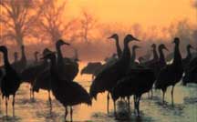
The central Platte River Valley in Nebraska is an internationally significant staging area for migratory water birds of the Central Flyway and is best known for the one-half million sandhill cranes and the several million other waterfowl that migrate annually through the valley. The riparian habitats and other wetlands and prairies within the watershed provide migratory and breeding habitat for numerous species of birds. Nine endangered species use the central Platte River Valley for habitat, including the whooping crane, piping plover, and least tern. Changes in water and land use have transformed the river channel and altered adjacent wet meadows. With changes in the hydrology of the river and the structure of riparian habitats, the sustainability of migratory and resident birds and other biota have been brought into question. Of central concern is how the ecosystem has adjusted to changes in stream flow. Through PES, the USGS is developing successful strategies to sustain or rehabilitate the riparian ecosystem of the central Platte River, which requires an understanding of the linkages between hydrology, river morphology, biological communities, and ecosystem processes.
Contact Information
Martha N. Garcia
National Coordinator
U.S. Geological Survey
906 National Center
Reston, Virginia 20192
(703) 648-6960
(703) 648 6937 fax
mgarcia@usgs.gov
|
|
The information for this page is from an information sheet produced in November 2004. It is also available in PDF format (572 KB). You will need the free Adobe Acrobat Reader in order to view this file.

Want to learn more about this program? View the U.S. Geological Survey's
Integrated Science Video
(Produced by the USGS/NMD EROS Data Center in 2000)
Available in three formats (runtime 9:19):
| MPEG (148 MB) | Quicktime (118 MB) | AVI (304 MB) |
You can also view just the section on south Florida (runtime: 33 secs.):
| MPEG (9 MB) | Quicktime (7 MB) |
(Thanks to Don Becker for making this video available for the PBS website!) |
|

