 |
 |
 |
 |
|||
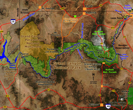
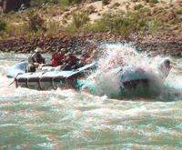
| Colorado River Raft Tour Take a virtual raft trip down the Colorado River in the Grand Canyon. Click here for a thumbnail gallery. |
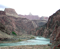
Phantom Ranch Tour Hike into the Grand Canyon to Phantom Ranch along the Kaibab and Bright Angel Trails. Click here for a thumbnail gallery. |
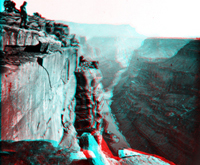
South Rim Tour Tour the South Rim from the Little Colorado River Gorge to the Canyon Village area. Click here for a thumbnail gallery. |
Historic Tour See imagery from John Wesley Powell's Second Expedition (1871-1872). Click here for a thumbnail gallery. |
|
|
 |
Click here to see the same images in 3D photography (you will need red-and-cyan glasses to get the stereographic effects). |
|
|
|
Click here to learn more about Grand Canyon National Park (National Park Service website: http://www.nps.gov/grca). Click here to see historic 3D photography taken by the John Wesley Powell Survey of 1871-72. Click here to learn more about sedimentary rock formations exposed in the Grand Canyon. Geologic maps of the Grand Canyon include: Billingsley, George H., 2000, Geologic Map of the Grand Canyon 30' by 60' Quadrangle, Coconino and Mohave Counties, Northwestern Arizona: U.S. Geological Survey Geologic Investigation Series I-2688, Available on-line at: http://pubs.usgs.gov/imap/i-2688/, Billingsley, George H. and Wellmeyer, Jessica L., 2004, Geologic Map of the Mount Trumbull 30' x 60' Quadrangle, Mohave and Coconin Counties, Northwestern Arizona: U.S. Geological Survey Geologic Investigation Series I-2766, Available on-line at: http://pubs.usgs.gov/imap/i-2766/, |
Click here to see more 3-D geology tours of National Parks.
This website was prepared by Phil Stoffer
USGS Western Earth Surface Processes
Team, Menlo Park, California.
U.S.
Department of the Interior - U.S.
Geological Survey - Geology
Discipline |