|
! Converted to time format with year at start.
|
|
!
|
|
DATA COLLECTION OVERVIEW (use NGDC GEODAS CD to retrieve data)
|
|
|
|
MCG Data Collection ID --- V272NA
|
|
Institution Data Collection ID --- V3002
|
|
NGDC ID --- 01030161
|
|
Funding --- (SEE ADD DOC / 19)
|
|
Project, Cruise & Leg --- CRUISE V30, LEG 02
|
|
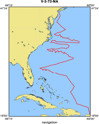
Study region --- +41.00000,+18.00000, -79.00000, -66.00000
|
|
Chief Scientist(s) --- OLAV ELDHOLM
|
|
Name of vessel --- VEMA (surface ship)
|
|
Date field data collection started --- 12/08/72 NEW YORK, USA
|
|
Date field data collection ended --- 12/30/72 SAN JUAN, PUERTO RICO
|
|
Parameters surveyed ---
|
|
Bathymetry: surveyed, contained in data file
|
|
Magnetics: surveyed, contained in data file
|
|
Gravity: surveyed, contained in data file
|
|
High-resolution seismics: surveyed, but not contained in data file
|
|
Deep penetration seismics: surveyed, but not contained in data file
|
|
Format --- (I1,A8,F5.2,4I2,F5.3,F8.5,F9.5,I1,F6.4,F6.1,I2,i1,3F6.1,I1,F5.1,F6.0,F7.1,F6.1,F5.1,A8,4I1)
|
|
Date of data input to NGDC --- 07/03/89
|
|
Contributing institution --- LAMONT-DOHERTY GEOLOGICAL OBSERVATORY
|
|
Country --- USA
|
|
|
|
Navigation instrumentation --- SATELLITE/ SEXTANT
|
|
Position determination method --- SATELLITE/ DEAD RECKONING
|
|
|
|
Bathymetry instrumentation --- (SEE ADD DOC / 18)
|
|
Additional forms of bathymetric data --- ANALOG RECORDS
|
|
General rate of bathymetry in file --- 6.0 minutes
|
|
General collection rate of bathymetry --- ONE SECOND
|
|
Assumed sound velocity --- 1463.0 m/sec
|
|
Bathymetric datum code --- No correction applied (sea level)
|
|
Bathmetry interpolation scheme --- NONE
|
|
|
|
Magnetics instrumentation --- L-DGO MFG PROTON-PRECESSION
|
|
Additional forms of magnetics data --- ANALOG RECORDS
|
|
General rate of magnetics in file --- 6.0 minutes
|
|
General collection rate of magnetics --- 6 seconds
|
|
Magnetic sensor tow distance --- (unspecified)
|
|
Magnetic sensor depth --- (unspecified)
|
|
Two sensor horizontal separation --- (unspecified)
|
|
Residual magnetics reference field --- IGRF-65
|
|
Method of applying residual field --- LINEAR INTERPOLATION BETWEEN TWO PTS
|
|
|
|
Gravity instrumentation --- GRAF-ASKANIA GSS2-12
|
|
Additional forms of gravity data --- ANALOG RECORDS
|
|
General rate of gravity in file --- 10.0 minutes
|
|
General collection rate of gravity --- (unspecified)
|
|
Theoretical gravity formula --- International 1930
|
|
Reference system --- Potsdam system
|
|
Corrections applied --- (unspecified)
|
|
Starting land tie --- (unspecified)
|
|
Ending land tie --- (unspecified)
|
|
|
|
Seismic instrumentation --- L-DGO 25CU-IW-AIRGUN,EEL,DRUM RECORDER
|
|
Formats of seismic data --- TWO,2-CHANNEL SHEET RECORDS
|
|
|
|
Notes ---
|
|
06 -3.5 AND 12 KHZ, WIDE BEAM (60 DEG), 1 SECOND SWEEP
|