Link to USGS home page
USGS Home
Contact USGS
Search USGS
Coastal & Marine Geology InfoBank

USGS CMG G-19-71-BS Metadata

Skip navigational links
Search InfoBank
Home tab FACS tab Activities tab Atlas tab Geology School tab More tab More tab Activities tabs
   
Activities: by ID   by Platform   by Year   by Region   by Participant   by Organization   by Project/Theme   with Incomplete IDs   Disclaimer  
Activity First Letter: A   B   C   D   E   F   G   H   I   J   K   L   M   N   O   P   Q   R   S   T   U   V   W   X   Y   Z   0   1   2   3   4   5   6   7   8   9  
Virtual Globes: Atlas  (GE)    Samples  (GE)    Illuminate Oceans  (GE)    Earthquakes  (GE)    Get GE    InfoBank examples    State Waters
G-19-71-BS links...
Metadata & Data: Bathymetry   Magnetics   Metadata   Navigation   Samples   bath (GE GM)   mag (GE GM)   nav (GE GM)   samp (GE GM)   times (GE GM)  
Formal Metadata: Frequently-Anticipated Questions   Outline   Parseable Text   XML  
   
   
Metadata
ID G-19-71-BS
Also Known As 15050017
DSDP19GC
G1971NP
Abstract United States Geological Survey, Menlo Park, California,Scripps Institution of Oceanography. Chief Scientists: Joe Creager, Dave Scholl. Geophysical data (bathymetry, magnetics) of field activity G-19-71-BS in Bering Sea, Alaska from 07/22/1971 to 09/09/1971
Organization United States Geological Survey, Menlo Park, California
Scripps Institution of Oceanography
Project/Theme Deep Sea Drilling Project
Chief Scientist Joe Creager
Dave Scholl
Activity Type Geophysical
Platform Glomar Challenger
Area of Operation
Bering Sea, Alaska
Location map G-19-71-BS location map of where navigation equipment operated
Bounding Coordinates 57.23030
147.87930    -152.33640
44.05070
Ports leave Kodiak, Alaska
arrive Yokohama, Japan
Dates 07/22/1971 (JD 203) to 09/09/1971 (JD 252)
Analog Materials list
Index map

G-19-71-BS map of where navigation equipment operated

Crew
Joe Creager Chief Scientist
Dave Scholl Chief Scientist, USGS Western Region
Equipment Used
bathymetry
magnetics
Notes
was also known as G1971NP
NGDC Overview
! Converted to time format with year at start.
!
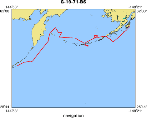
DATA COLLECTION OVERVIEW (use NGDC GEODAS CD to retrieve data)
MCG Data Collection ID --- G1971BS
Institution Data Collection ID --- DSDP19GC
NGDC ID --- 15050017
Funding --- (unspecified)
Project, Cruise & Leg --- DEEPSEA DRILL.LG 19
Study region --- +58.00000,+44.00000,+147.00000,-152.00000
Chief Scientist(s) --- CREAGER J.S.,SCHOLL D.W.
Name of vessel --- D/V GLOMAR CHALLENGER (surface ship)
Date field data collection started --- 07/22/71 KODIAK,ALASKA
Date field data collection ended --- 09/09/71 YOKOHAMA,JAPAN
Parameters surveyed ---
Bathymetry: surveyed, contained in data file
Magnetics: surveyed, contained in data file
Gravity: not surveyed
High-resolution seismics: not surveyed
Deep penetration seismics: surveyed, but not contained in data file
Format --- (I1,A8,F5.2,4I2,F5.3,F8.5,F9.5,I1,F6.4,F6.1,I2,i1,3F6.1,I1,F5.1,F6.0,F7.1,F6.1,F5.1,A8,4I1)
Date of data input to NGDC --- 11/22/79
Contributing institution --- SCRIPPS INSTITUTION OF OCEANOGRAPHY
Country --- USA
Navigation instrumentation --- SATNAV,MANUAL ENTRY GYRO AND SPD CHANGES
Position determination method --- LINEAR INTERP.BETWEEN ADJACENT FIXES
Bathymetry instrumentation --- 12KHZ/GIFFT RECORDER/WIDE(60DEG)BEAM
Additional forms of bathymetric data --- ANAL.RECORDS,CARDS,35MMFILM
General rate of bathymetry in file --- 5.0 minutes
General collection rate of bathymetry --- 1SECONDSWEEP
Assumed sound velocity --- 1463.0 m/sec
Bathymetric datum code --- No correction applied (sea level)
Bathmetry interpolation scheme --- 5 MINUTE INTERVAL
Magnetics instrumentation --- VARIAN MFD PROTON PRECESSION MOD 4970
Additional forms of magnetics data --- ANAL.RECORDS,CARDS,35MMFILM
General rate of magnetics in file --- 5.0 minutes
General collection rate of magnetics --- 6 seconds
Magnetic sensor tow distance --- (unspecified)
Magnetic sensor depth --- (unspecified)
Two sensor horizontal separation --- (unspecified)
Residual magnetics reference field --- IGRF-65
Method of applying residual field --- LIN.INTERP.AT 30DEG C/C OR 500MI ALONG TRACK
Seismic instrumentation --- 20TO300CU.IN.AIRGUN,10-300HZ,EDO PSR REC
Formats of seismic data --- ANAL.RECORDS,35MM MICROFILM
Notes ---
*TIME*NAV AND RECORDS ORIGINALLY IN LOCAL TZ. DIGITIZED DATA CONVERTED TO GMT.
Publications
Core Data from the Deep Sea Drilling Project, Leg 19:
http://www.ngdc.noaa.gov/mgg/geology/dsdp/data/19/leg19.htm
Got Help? For G-19-71-BS, we would appreciate any information on -- contract, days at sea, dive count, funding, information specialist, information to be derived, kms of navigation, national plan, owner, project number, purpose, scanned materials, seismic description, station count, station description, submersible, summary, tabulated info.


Skip footer navigational links


InfoBank   Menlo Park & Santa Cruz Centers   St. Petersburg Center   Woods Hole Center   Coastal and Marine Geology Program   Geologic Information   Ask-A-Geologist   USGS Disclaimer  

FirstGov button   Take Pride in America button