|
|
|
Metadata
|
|
ID
|
W-3-82-NC
|
|
Also Known As
|
CODE_2-3_LEG_10
W-10-82-NC
|
|
Abstract
|
Chief Scientist: Dave Cacchione. Recovery data (12khz,
3dot5khz, CTDmeter, Geoprobe, rangerange, LoranC, boxcore) of
field activity W-3-82-NC in Northern California from
07/28/1982 to 07/31/1982
|
|
Chief Scientist
|
Dave Cacchione
|
|
Activity Type
|
Recovery
|
|
Platform
|
Wecoma
|
|
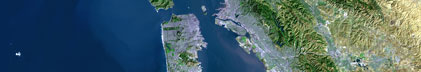
Area of Operation
|
Northern California
|
|
Location map
|

|
|
Bounding Coordinates
|
39.00000
-124.00000 -122.50000
38.00000
|
|
Ports
|
leave Yerba Buena Island, CA
arrive Yerba Buena Island, CA
|
|
Dates
|
07/28/1982 (JD 209) to 07/31/1982 (JD 212)
|
|
Analog Materials
|
list
|
|
Index map

|
|
|
Crew
|
|
Dave Cacchione
|
Chief Scientist, USGS Western Region
|
|
Dave Drake
|
Geologist, USGS Western Region
|
|
George Tate
|
Mechanical Technician, USGS Western Region
|
|
Jack Swenson
|
Electronics Technician, USGS Western Region
|
|
Joanne Thede Ferreira
|
Watchstander, USGS Western Region
|
|
Mara Schiltz
|
Dafe Curator, USGS Western Region
|
|
Pat O'Malley
|
Mechanical Technician, WHOI
|
|
Scott Briggs
|
Geologist
|
|
Ted Clarke
|
Watchstander
|
|
|
Equipment Used
|
|
12khz
|
|
3dot5khz
|
|
CTDmeter
|
|
Geoprobe
|
|
rangerange
|
|
LoranC
|
|
boxcore
|
|
|
Publications
|
|
Reid, J.A., Reid, J.M., Jenkins, C.J., Zimmermann, M., Williams, S.J., and
|
|
Field, M.E., 2006, usSEABED: Pacific Coast (California, Oregon, Washington)
|
|
offshore surficial-sediment data release, U.S. Geological Survey Data Series
|
|
182, version 1.0. Online at:
|
|
|
http://pubs.usgs.gov/ds/2006/182/
|
|
|
Got Help?
|
For W-3-82-NC, we would appreciate any information on -- contract, days at sea, dive count, funding, information specialist, information to be derived, kms of navigation, national plan, NGDC Info, notes, organization, owner, project, project number, purpose, scanned materials, seismic description, station count, station description, submersible, summary, tabulated info.
|
|