|
|
|
|
Metadata
|
|
ID
|
93ERM01
|
|
Also Known As
|
C-1-93-FL
93ERM01
|
|
Abstract
|
United States Geological Survey, St. Petersburg, Florida,
Biological Resources Division,United States Geological
Survey, St. Petersburg, Florida, Coastal and Marine Geology
Program. Chief Scientist: Gene Shinn. Coring and Well
Installation data (drillcore) of field activity 93ERM01
(C-1-93-FL) in Florida Bay from 08/21/1993 to 08/27/1993
|
|
Organization
|
United States Geological Survey, St. Petersburg, Florida, Biological Resources Division
United States Geological Survey, St. Petersburg, Florida, Coastal and Marine Geology Program
|
|
Project/Theme
|
Ecosystem Restoration and Management
|
|
Chief Scientist
|
Gene Shinn
|
|
Activity Type
|
Coring and Well Installation
|
|
Platform
|
Captains Lady
|
|
Area of Operation
|
Florida Bay
|
|
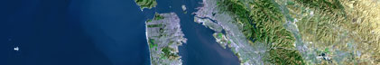
Location map
|

|
|
Bounding Coordinates
|
24.91817
-80.91133 -80.83083
24.83300
|
|
Ports
|
leave Key Largo, Florida
arrive Key Largo, Florida
|
|
Dates
|
08/21/1993 (JD 233) to 08/27/1993 (JD 239)
|
|
Analog Materials
|
list
|
|
Index map

|
|
|
Information Specialist
|
|
|
Crew
|
|
Gene Shinn
|
Chief Scientist, USGS St. Petersburg
|
|
Roy Gaensslen
|
Ship's Captain
|
|
Jim Flocks
|
Deck Hand, USGS St. Petersburg
|
|
Chris Reich
|
Deck Hand, USGS St. Petersburg
|
|
|
Equipment Used
|
|
|
Purpose
|
|
Install monitoring wells to evaluate groundwater dynamics and properties in Florida Bay in order to aid in the model development program element within the South Florida Ecosystem Program.
|
|
|
Information to be Derived
|
|
Groundwater attributes including flow rate, flow direction, water level, salinity and nutrient content.
|
|
|
Summary
|
|
Drilled three cores and installed wells in the western Florida Bay.
|
|
|
Notes
|
|
CAPTAIN'S LADY (50 Ft Charter) used with BARGE, HALIMEDA (small boat).
|
|
|
Got Help?
|
For 93ERM01, we would appreciate any information on -- contract, days at sea, dive count, funding, kms of navigation, national plan, NGDC Info, owner, project number, publications, scanned materials, seismic description, station count, station description, submersible, tabulated info.
|
|