|
! Converted to time format with year at start.
|
|
!
|
|
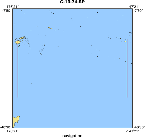
DATA COLLECTION OVERVIEW (use NGDC GEODAS CD to retrieve data)
|
|
|
|
MCG Data Collection ID --- C1374SP
|
|
Institution Data Collection ID --- C1713
|
|
NGDC ID --- 01010132
|
|
Funding --- (unspecified)
|
|
Project, Cruise & Leg --- c1713
|
|
Study region --- -17.00000,-33.00000,+178.00000,-149.00000
|
|
Chief Scientist(s) --- LANCELOT, YVES
|
|
Name of vessel --- CONRAD (surface ship)
|
|
Date field data collection started --- 11/22/74 SUVA, FIJI
|
|
Date field data collection ended --- 12/19/74 PAPEETE, TAHITI
|
|
Parameters surveyed ---
|
|
Bathymetry: surveyed, contained in data file
|
|
Magnetics: surveyed, contained in data file
|
|
Gravity: surveyed, contained in data file
|
|
High-resolution seismics: surveyed, but not contained in data file
|
|
Deep penetration seismics: (unspecified)
|
|
Format --- (I1,A8,F5.2,4I2,F5.3,F8.5,F9.5,I1,F6.4,F6.1,I2,i1,3F6.1,I1,F5.1,F6.0,F7.1,F6.1,F5.1,A8,4I1)
|
|
Date of data input to NGDC --- 07/30/87
|
|
Contributing institution --- LAMONT-DOHERTY GEOLOGICAL OBSERVATORY
|
|
Country --- U.S.A.
|
|
|
|
Navigation instrumentation --- SATELLITE
|
|
Position determination method --- SATELLITE / DEAD RECKONING
|
|
|
|
Bathymetry instrumentation --- 3.5
|
|
Additional forms of bathymetric data --- (unspecified)
|
|
General rate of bathymetry in file --- 3.0 minutes
|
|
General collection rate of bathymetry --- ONE SECOND
|
|
Assumed sound velocity --- 1463.0 m/sec
|
|
Bathymetric datum code --- No correction applied (sea level)
|
|
Bathmetry interpolation scheme --- (unspecified)
|
|
|
|
Magnetics instrumentation --- P
|
|
Additional forms of magnetics data --- (unspecified)
|
|
General rate of magnetics in file --- 3.2 minutes
|
|
General collection rate of magnetics --- (unspecified)
|
|
Magnetic sensor tow distance --- (unspecified)
|
|
Magnetic sensor depth --- (unspecified)
|
|
Two sensor horizontal separation --- (unspecified)
|
|
Residual magnetics reference field ---
|
|
Method of applying residual field --- (unspecified)
|
|
|
|
Gravity instrumentation --- BELL
|
|
Additional forms of gravity data --- (unspecified)
|
|
General rate of gravity in file --- 3.2 minutes
|
|
General collection rate of gravity --- (unspecified)
|
|
Theoretical gravity formula --- International 1930
|
|
Reference system --- Potsdam system
|
|
Corrections applied --- (unspecified)
|
|
Starting land tie --- (unspecified)
|
|
Ending land tie --- (unspecified)
|
|
|
|
Seismic instrumentation --- (unspecified)
|
|
Formats of seismic data --- (unspecified)
|