My
List |
Catalog #
|
Target
|
Mission
|
Instrument
|
Addition Date
|
Size
|

|
PIA12168 |
Mars |
Mars Reconnaissance Orbiter (MRO)
|
HiRISE
|
2009-08-12 |
502x426x3 |

|
- Title:
- Martian Dust Devil with Track and Shadow
|
|
|
PIA11893 |
Mars |
2001 Mars Odyssey
|
Thermal Emission Imaging System
|
2009-06-25 |
1310x2797x1 |

|
- Title:
- Sirenum Fossae
|
|
|
PIA11901 |
Mars |
2001 Mars Odyssey
|
Thermal Emission Imaging System
|
2009-07-07 |
320x1808x1 |

|
- Title:
- Holden Crater
|
|
|
PIA12160 |
Mars |
Mars Exploration Rover (MER)
|
Hazard Identification Camera
|
2009-07-31 |
1024x1024x1 |

|
- Title:
- Block Island in Sight
|
|
|
PIA12125 |
Mars |
Mars Exploration Rover (MER)
|
Navigation Camera
|
2009-07-15 |
7753x2186x3 |

|
- Title:
- Opportunity's Surroundings After Backwards Drive, Sol 1850 (Stereo)
|
|
|
PIA11903 |
Mars |
2001 Mars Odyssey
|
Thermal Emission Imaging System
|
2009-07-09 |
1435x2862x1 |

|
- Title:
- Dust Devil Tracks
|
|
|
PIA11975 |
Mars |
Mars Exploration Rover (MER)
|
Navigation Camera
|
2009-04-05 |
4045x4045x1 |

|
- Title:
- Time for a Change; Spirit's View on Sol 1843 (Polar)
|
|
|
PIA11990 |
Mars |
Mars Exploration Rover (MER)
|
Hazard Identification Camera
|
2009-04-20 |
1024x1024x1 |

|
- Title:
- After a Spirit Drive West of 'Home Plate'
|
|
|
PIA11899 |
Mars |
2001 Mars Odyssey
|
Thermal Emission Imaging System
|
2009-07-03 |
1377x2829x1 |

|
- Title:
- Dust Devil Tracks
|
|
|
PIA12143 |
Mars |
Mars Exploration Rover (MER)
|
Navigation Camera
|
2009-07-16 |
5894x1270x3 |

|
- Title:
- Spirit's View from "Troy" (Stereo)
|
|
|
PIA12136 |
Mars |
Mars Exploration Rover (MER)
|
Navigation Camera
|
2009-07-16 |
2638x1062x1 |

|
- Title:
- Spirit's Look Ahead After Sol 1866 Drive
|
|
|
PIA12128 |
Mars |
Mars Exploration Rover (MER)
|
Navigation Camera
|
2009-07-15 |
4000x4000x1 |

|
- Title:
- Opportunity's View After 72-Meter Drive, Sol 1912 (Vertical)
|
|
|
PIA12076 |
Mars |
2001 Mars Odyssey
|
Thermal Emission Imaging System
|
2009-06-22 |
447x928x3 |

|
- Title:
- Improved Infrared Imaging from Changed Odyssey Orbit
|
|
|
PIA11972 |
Mars |
Mars Exploration Rover (MER)
|
Navigation Camera
|
2009-04-05 |
4060x1031x1 |

|
- Title:
- Spirit's View Beside 'Home Plate' on Sol 1823
|
|
|
PIA11996 |
Mars |
Mars Exploration Rover (MER)
|
Navigation Camera
|
2009-04-23 |
1024x1024x1 |

|
- Title:
- 'Von Braun' Mound in Spirit's Drive Direction
|
|
|
PIA11877 |
Mars |
2001 Mars Odyssey
|
Thermal Emission Imaging System
|
2009-04-17 |
551x6236x1 |

|
- Title:
- More Storm Clouds
|
|
|
PIA11974 |
Mars |
Mars Exploration Rover (MER)
|
Navigation Camera
|
2009-04-05 |
7466x983x1 |

|
- Title:
- Time for a Change; Spirit's View on Sol 1843
|
|
|
PIA11879 |
Mars |
2001 Mars Odyssey
|
Thermal Emission Imaging System
|
2009-04-21 |
1201x5942x1 |

|
- Title:
- Rabe Crater Dunes
|
|
|
PIA11554 |
S Rings |
Cassini-Huygens
|
Imaging Science Subsystem - Wide Angle
|
2009-08-10 |
1004x979x1 |

|
- Title:
- Side by Side Shadows
|
|
|
PIA11480 |
S Rings |
Cassini-Huygens
|
Imaging Science Subsystem - Wide Angle
|
2009-04-28 |
872x830x1 |

|
- Title:
- Moons by the Bunch
|
|
|
PIA11484 |
S Rings |
Cassini-Huygens
|
Imaging Science Subsystem - Narrow Angle
|
2009-05-04 |
1006x1006x1 |

|
- Title:
- Ring-spanning Shadow
|
|
|
PIA11493 |
S Rings |
Cassini-Huygens
|
Imaging Science Subsystem - Wide Angle
|
2009-05-15 |
1008x1008x3 |

|
- Title:
- Glorious View
|
|
|
PIA11553 |
Prometheus |
Cassini-Huygens
|
Imaging Science Subsystem - Narrow Angle
|
2009-08-07 |
1018x714x1 |

|
- Title:
- Shadow and Streamer-channels
|
|
|
PIA12082 |
Enceladus |
Cassini-Huygens
|
Composite Infrared Spectrometer
|
2009-06-24 |
965x1348x3 |

|
- Title:
- Warm Tiger Stripes
|
|
|
PIA11536 |
Janus |
Cassini-Huygens
|
Imaging Science Subsystem - Narrow Angle
|
2009-07-15 |
1018x1018x1 |

|
- Title:
- Across the Encke Gap
|
|
|
PIA11511 |
Pan |
Cassini-Huygens
|
Imaging Science Subsystem - Narrow Angle
|
2009-06-10 |
954x954x1 |

|
- Title:
- Pan's Slender Shadow
|
|
|
PIA11528 |
Daphnis |
Cassini-Huygens
|
Imaging Science Subsystem - Narrow Angle
|
2009-07-03 |
1020x1020x1 |

|
- Title:
- Scallops at the Edges
|
|
|
PIA12111 |
Titan |
Cassini-Huygens
|
Radar Mapper
|
2009-07-16 |
814x587x1 |

|
- Title:
- South Polar Basin on Titan
|
|
|
PIA11485 |
Titan |
Cassini-Huygens
|
Imaging Science Subsystem - Wide Angle
|
2009-05-05 |
971x971x1 |

|
- Title:
- Hazy Halo
|
|
|
PIA11662 |
S Rings |
Cassini-Huygens
|
Imaging Science Subsystem - Narrow Angle
|
2009-08-07 |
1014x1320x1 |

|
- Title:
- Punching through the F Ring
|
|
|
PIA11534 |
Janus |
Cassini-Huygens
|
Imaging Science Subsystem - Narrow Angle
|
2009-07-13 |
568x584x1 |

|
- Title:
- Craters on Janus
|
|
|
PIA11654 |
Daphnis |
Cassini-Huygens
|
Imaging Science Subsystem - Narrow Angle
|
2009-06-11 |
1014x1014x1 |

|
- Title:
- Rippling Shadows
|
|
|
PIA11663 |
S Rings |
Cassini-Huygens
|
Imaging Science Subsystem - Narrow Angle
|
2009-08-07 |
1014x1320x1 |

|
- Title:
- Shadows in the F Ring
|
|
|
PIA11532 |
Dione |
Cassini-Huygens
|
Imaging Science Subsystem - Narrow Angle
|
2009-07-09 |
406x388x1 |

|
- Title:
- Wispy Line
|
|
|
PIA11542 |
Titan |
Cassini-Huygens
|
Imaging Science Subsystem - Narrow Angle
|
2009-07-23 |
1500x1500x1 |

|
- Title:
- Enchanted Titan
|
|
|
PIA11494 |
S Rings |
Cassini-Huygens
|
Imaging Science Subsystem - Narrow Angle
|
2009-05-18 |
1014x1014x1 |

|
- Title:
- Star Companions
|
|
|
PIA12005 |
Titan |
Cassini-Huygens
|
Visual and Infrared Mapping Spectrometer
|
2009-06-03 |
1284x842x3 |

|
- Title:
- Titan's South Polar Cloud Burst
|
|
|
PIA11533 |
Epimetheus |
Cassini-Huygens
|
Imaging Science Subsystem - Narrow Angle
|
2009-07-10 |
1017x1017x1 |

|
- Title:
- Epimetheus' Shadow
|
|
|
PIA11498 |
Tethys |
Cassini-Huygens
|
Imaging Science Subsystem - Wide Angle
|
2009-05-22 |
1014x1014x1 |

|
- Title:
- Shadow Slipping Through
|
|
|
PIA11550 |
Rhea |
Cassini-Huygens
|
Imaging Science Subsystem - Narrow Angle
|
2009-08-04 |
546x546x1 |

|
- Title:
- Low Contrast Rhea
|
|
|
PIA11489 |
S Rings |
Cassini-Huygens
|
Imaging Science Subsystem - Wide Angle
|
2009-05-11 |
1014x1014x1 |

|
- Title:
- Moon Shadow Adornment
|
|
|
PIA11518 |
Mimas |
Cassini-Huygens
|
Imaging Science Subsystem - Wide Angle
|
2009-06-19 |
829x719x3 |

|
- Title:
- From Rings to Planet
|
|
|
PIA11510 |
Dione |
Cassini-Huygens
|
Imaging Science Subsystem - Narrow Angle
|
2009-06-09 |
549x549x1 |

|
- Title:
- Down Dione Way
|
|
|
PIA11509 |
Prometheus |
Cassini-Huygens
|
Imaging Science Subsystem - Narrow Angle
|
2009-06-08 |
1014x1014x1 |

|
- Title:
- On His Merry Way
|
|
|
PIA12037 |
Titan |
Cassini-Huygens
|
Radar Mapper
|
2009-06-10 |
1798x818x1 |

|
- Title:
- The Story Titan's Dunes Tell
|
|
|
PIA11501 |
Titan |
Cassini-Huygens
|
Imaging Science Subsystem - Narrow Angle
|
2009-05-27 |
1500x1500x1 |

|
- Title:
- Streaking Through the South
|
|
|
PIA11526 |
Titan |
Cassini-Huygens
|
Imaging Science Subsystem - Wide Angle
|
2009-07-01 |
1004x1004x1 |

|
- Title:
- Atmospheric Halo
|
|
|
PIA11516 |
Tethys |
Cassini-Huygens
|
Imaging Science Subsystem - Narrow Angle
|
2009-06-17 |
582x582x1 |

|
- Title:
- Broad Impact on Tethys
|
|
|
PIA11514 |
Janus |
Cassini-Huygens
|
Imaging Science Subsystem - Narrow Angle
|
2009-06-15 |
600x600x1 |

|
- Title:
- Two Lights on Two-faced Janus
|
|
|
PIA11545 |
Mimas |
Cassini-Huygens
|
Imaging Science Subsystem - Wide Angle
|
2009-07-28 |
1017x655x1 |

|
- Title:
- Crooked Shadow
|
|
|
PIA11508 |
Titan |
Cassini-Huygens
|
Imaging Science Subsystem - Wide Angle
|
2009-06-05 |
566x566x1 |

|
- Title:
- Titan in Eclipse
|
|
|
PIA11547 |
Daphnis |
Cassini-Huygens
|
Imaging Science Subsystem - Narrow Angle
|
2009-07-30 |
1018x1018x1 |

|
- Title:
- Sawtooth Shadows
|
|
|
PIA11486 |
Tethys |
Cassini-Huygens
|
Imaging Science Subsystem - Wide Angle
|
2009-05-06 |
748x748x1 |

|
- Title:
- Tethys' Shadow
|
|
|
PIA11503 |
S Rings |
Cassini-Huygens
|
Imaging Science Subsystem - Narrow Angle
|
2009-05-29 |
1018x1450x1 |

|
- Title:
- Petite Moon
|
|
|
PIA11491 |
S Rings |
Cassini-Huygens
|
Imaging Science Subsystem - Narrow Angle
|
2009-05-13 |
1014x1014x1 |

|
- Title:
- Minuscule Moon Shadow
|
|
|
PIA11483 |
S Rings |
Cassini-Huygens
|
Imaging Science Subsystem - Wide Angle
|
2009-05-01 |
2058x1034x1 |

|
- Title:
- Trumpeting the Equinox
|
|
|
PIA11519 |
S Rings |
Cassini-Huygens
|
Imaging Science Subsystem - Narrow Angle
|
2009-06-22 |
1010x1010x1 |

|
- Title:
- Fascinating F Ring
|
|
|
PIA11504 |
Daphnis |
Cassini-Huygens
|
Imaging Science Subsystem - Narrow Angle
|
2009-06-01 |
1014x1014x1 |

|
- Title:
- Gravity-Induced Undulations
|
|
|
PIA11543 |
Pandora |
Cassini-Huygens
|
Imaging Science Subsystem - Narrow Angle
|
2009-07-24 |
1020x1020x1 |

|
- Title:
- Shadow Misses a Ring
|
|
|
PIA11513 |
S Rings |
Cassini-Huygens
|
Imaging Science Subsystem - Wide Angle
|
2009-06-12 |
1012x1005x3 |

|
- Title:
- Southern Color
|
|
|
PIA11556 |
Mimas |
Cassini-Huygens
|
Imaging Science Subsystem - Narrow Angle
|
2009-08-12 |
451x451x1 |

|
- Title:
- Mimas' Bulging Middle
|
|
|
PIA11527 |
Prometheus |
Cassini-Huygens
|
Imaging Science Subsystem - Narrow Angle
|
2009-07-02 |
642x1016x1 |

|
- Title:
- Between the Lines
|
|
|
PIA11502 |
S Rings |
Cassini-Huygens
|
Imaging Science Subsystem - Narrow Angle
|
2009-05-28 |
1014x1014x1 |

|
- Title:
- Encke Ringlets
|
|
|
PIA11492 |
Epimetheus |
Cassini-Huygens
|
Imaging Science Subsystem - Narrow Angle
|
2009-05-14 |
715x710x1 |

|
- Title:
- Belittled Moon
|
|
|
PIA11541 |
Mimas |
Cassini-Huygens
|
Imaging Science Subsystem - Narrow Angle
|
2009-07-22 |
1024x1024x1 |

|
- Title:
- Shadow in the Cassini Division
|
|
|
PIA11657 |
Mimas |
Cassini-Huygens
|
Imaging Science Subsystem - Wide Angle
|
2009-06-22 |
986x974x3 |

|
- Title:
- Across Resplendent Rings
|
|
|
PIA11499 |
Pandora |
Cassini-Huygens
|
Imaging Science Subsystem - Narrow Angle
|
2009-05-25 |
1006x1006x1 |

|
- Title:
- Slender Slice of Shadow
|
|
|
PIA11552 |
Tethys |
Cassini-Huygens
|
Imaging Science Subsystem - Narrow Angle
|
2009-08-06 |
593x593x1 |

|
- Title:
- Eye on Tethys
|
|
|
PIA11523 |
Tethys |
Cassini-Huygens
|
Imaging Science Subsystem - Wide Angle
|
2009-06-26 |
979x979x1 |

|
- Title:
- Exposing a Shadow
|
|
|
PIA11531 |
Prometheus |
Cassini-Huygens
|
Imaging Science Subsystem - Narrow Angle
|
2009-07-08 |
1008x1008x1 |

|
- Title:
- Bright Duo
|
|
|
PIA11478 |
S Rings |
Cassini-Huygens
|
Imaging Science Subsystem - Wide Angle
|
2009-04-24 |
974x974x3 |

|
- Title:
- Pastel Rings
|
|
|
PIA11656 |
Daphnis |
Cassini-Huygens
|
Imaging Science Subsystem - Narrow Angle
|
2009-06-11 |
834x834x1 |

|
- Title:
- Wavy Shadows
|
|
|
PIA11530 |
Epimetheus |
Cassini-Huygens
|
Imaging Science Subsystem - Narrow Angle
|
2009-07-07 |
470x470x1 |

|
- Title:
- Somewhat Flattened South
|
|
|
PIA11506 |
Tethys |
Cassini-Huygens
|
Imaging Science Subsystem - Narrow Angle
|
2009-06-03 |
1001x977x1 |

|
- Title:
- Tethys' Truncated Shadow
|
|
|
PIA12162 |
Titan |
Cassini-Huygens
|
Radar Mapper
|
2009-08-06 |
1036x874x1 |

|
- Title:
- Lake-like but Different
|
|
|
PIA11549 |
Pan |
Cassini-Huygens
|
Imaging Science Subsystem - Narrow Angle
|
2009-08-03 |
855x855x1 |

|
- Title:
- Lengthening Shadows
|
|
|
PIA11497 |
Prometheus |
Cassini-Huygens
|
Imaging Science Subsystem - Narrow Angle
|
2009-05-21 |
842x1006x1 |

|
- Title:
- Prometheus' Two-Step
|
|
|
PIA11515 |
Pandora |
Cassini-Huygens
|
Imaging Science Subsystem - Narrow Angle
|
2009-06-16 |
876x876x1 |

|
- Title:
- Diminutive Debut
|
|
|
PIA11479 |
Titan |
Cassini-Huygens
|
Imaging Science Subsystem - Narrow Angle
|
2009-04-27 |
1332x1332x1 |

|
- Title:
- Titan's Murky South Pole
|
|
|
PIA11488 |
S Rings |
Cassini-Huygens
|
Imaging Science Subsystem - Wide Angle
|
2009-05-08 |
1018x562x3 |

|
- Title:
- Reciprocating Rings
|
|
|
PIA12080 |
Enceladus |
Cassini-Huygens
|
|
2009-06-24 |
960x720x3 |

|
- Title:
- Melted Ice
|
|
|
PIA11653 |
Daphnis |
Cassini-Huygens
|
Imaging Science Subsystem - Narrow Angle
|
2009-06-11 |
1014x1014x1 |

|
- Title:
- Tiny Moon, Looming Shadows
|
|
|
PIA11537 |
Rhea |
Cassini-Huygens
|
Imaging Science Subsystem - Narrow Angle
|
2009-07-16 |
467x467x1 |

|
- Title:
- Craters on a Crescent
|
|
|
PIA11539 |
Tethys |
Cassini-Huygens
|
Imaging Science Subsystem - Narrow Angle
|
2009-07-20 |
1016x1016x1 |

|
- Title:
- Engulfing a Gap
|
|
|
PIA11521 |
S Rings |
Cassini-Huygens
|
Imaging Science Subsystem - Wide Angle
|
2009-06-24 |
1014x1014x1 |

|
- Title:
- Faint Spokes on a Ring
|
|
|
PIA11507 |
Atlas |
Cassini-Huygens
|
Imaging Science Subsystem - Narrow Angle
|
2009-06-04 |
1014x1014x1 |

|
- Title:
- Plying a Division
|
|
|
PIA11529 |
Pan |
Cassini-Huygens
|
Imaging Science Subsystem - Narrow Angle
|
2009-07-06 |
1016x1016x1 |

|
- Title:
- Shadow of Saucer-Shaped Moon
|
|
|
PIA11544 |
Epimetheus |
Cassini-Huygens
|
Imaging Science Subsystem - Narrow Angle
|
2009-07-27 |
1016x1016x1 |

|
- Title:
- Shadow on Bright B Ring
|
|
|
PIA11661 |
S Rings |
Cassini-Huygens
|
Imaging Science Subsystem - Narrow Angle
|
2009-06-22 |
700x700x1 |

|
- Title:
- Eclipsing Mimas

|
|
|
PIA11525 |
Tethys |
Cassini-Huygens
|
Imaging Science Subsystem - Wide Angle
|
2009-06-30 |
800x953x1 |

|
- Title:
- Long Shadow of Tethys
|
|
|
PIA12036 |
Titan |
Cassini-Huygens
|
Radar Mapper
|
2009-06-10 |
957x811x1 |

|
- Title:
- Southern Canyons of Titan
|
|
|
PIA11495 |
Tethys |
Cassini-Huygens
|
Imaging Science Subsystem - Narrow Angle
|
2009-05-19 |
600x600x1 |

|
- Title:
- Odysseus and Penelope
|
|
|
PIA11522 |
Titan |
Cassini-Huygens
|
Imaging Science Subsystem - Narrow Angle
|
2009-06-25 |
1500x1500x1 |

|
- Title:
- Centered on Senkyo
|
|
|
PIA11666 |
S Rings |
Cassini-Huygens
|
Imaging Science Subsystem - Narrow Angle
|
2009-08-07 |
1017x1122x1 |

|
- Title:
- Shadow Reaches the A Ring
|
|
|
PIA12081 |
Enceladus |
Cassini-Huygens
|
|
2009-06-24 |
1800x1350x3 |

|
- Title:
- Plume Vent Models
|
|
|
PIA11555 |
Tethys |
Cassini-Huygens
|
Imaging Science Subsystem - Wide Angle
|
2009-08-11 |
1016x1016x1 |

|
- Title:
- Cutting 'Cross the C Ring
|
|
|
PIA11548 |
Titan |
Cassini-Huygens
|
Imaging Science Subsystem - Wide Angle
|
2009-07-31 |
986x986x3 |

|
- Title:
- Colorful Northern Crescent
|
|
|
PIA11524 |
Atlas |
Cassini-Huygens
|
Imaging Science Subsystem - Narrow Angle
|
2009-06-29 |
1020x1020x1 |

|
- Title:
- Navigating the Blackness
|
|
|
PIA11512 |
Rhea |
Cassini-Huygens
|
Imaging Science Subsystem - Narrow Angle
|
2009-06-11 |
850x850x1 |

|
- Title:
- Sun-bleached Rhea
|
|
|
PIA11540 |
Mimas |
Cassini-Huygens
|
Imaging Science Subsystem - Narrow Angle
|
2009-07-21 |
383x373x1 |

|
- Title:
- Highlighting Herschel
|
|
|
PIA11500 |
S Rings |
Cassini-Huygens
|
Imaging Science Subsystem - Wide Angle
|
2009-05-26 |
1018x797x1 |

|
- Title:
- Between the Spokes
|
|
|
PIA11490 |
Enceladus |
Cassini-Huygens
|
Imaging Science Subsystem - Narrow Angle
|
2009-05-12 |
405x405x1 |

|
- Title:
- Shining a Second Light
|
|
|
PIA11546 |
Dione |
Cassini-Huygens
|
Imaging Science Subsystem - Narrow Angle
|
2009-07-29 |
700x700x1 |

|
- Title:
- Dione's Southern Basin
|
|
|
PIA11487 |
Dione |
Cassini-Huygens
|
Imaging Science Subsystem - Narrow Angle
|
2009-05-07 |
552x552x1 |

|
- Title:
- Looking Down on Dione
|
|
|
PIA11535 |
Prometheus |
Cassini-Huygens
|
Imaging Science Subsystem - Narrow Angle
|
2009-07-14 |
1010x1010x1 |

|
- Title:
- Prometheus' Trail
|
|
|
PIA11505 |
Tethys |
Cassini-Huygens
|
Imaging Science Subsystem - Narrow Angle
|
2009-06-02 |
679x679x1 |

|
- Title:
- A Little Off the Top
|
|
|
PIA11496 |
Daphnis |
Cassini-Huygens
|
Imaging Science Subsystem - Narrow Angle
|
2009-05-20 |
1014x1014x1 |

|
- Title:
- Daphnis' Waves
|
|
|
PIA11655 |
Daphnis |
Cassini-Huygens
|
Imaging Science Subsystem - Narrow Angle
|
2009-06-11 |
907x636x1 |

|
- Title:
- Wave Shadows in Motion
|
|
|
PIA11520 |
Enceladus |
Cassini-Huygens
|
Imaging Science Subsystem - Narrow Angle
|
2009-06-23 |
555x555x1 |

|
- Title:
- Serene Enceladus
|
|
|
PIA11551 |
Atlas |
Cassini-Huygens
|
Imaging Science Subsystem - Narrow Angle
|
2009-08-05 |
1014x1014x1 |

|
- Title:
- Atlas' Ring Shadow Premiere
|
|
|
PIA11481 |
Rhea |
Cassini-Huygens
|
Imaging Science Subsystem - Narrow Angle
|
2009-04-29 |
691x691x1 |

|
- Title:
- Shine On Crazy Wisps
|
|
|
PIA11517 |
Janus |
Cassini-Huygens
|
Imaging Science Subsystem - Narrow Angle
|
2009-06-18 |
1014x1014x1 |

|
- Title:
- Janus' Ring Shadow Premiere
|
|
|
PIA11660 |
Mimas |
Cassini-Huygens
|
Imaging Science Subsystem - Narrow Angle
|
2009-06-22 |
5125x5892x1 |

|
- Title:
- Weaving a Shadow
|
|
|
PIA11665 |
S Rings |
Cassini-Huygens
|
Imaging Science Subsystem - Narrow Angle
|
2009-08-07 |
1016x641x1 |

|
- Title:
- A Small Find Near Equinox
|
|
|
PIA11658 |
Mimas |
Cassini-Huygens
|
Imaging Science Subsystem - Narrow Angle
|
2009-06-22 |
6626x4966x1 |

|
- Title:
- A Shadow's Traverse
|
|
|
PIA12004 |
Titan |
Cassini-Huygens
|
Visual and Infrared Mapping Spectrometer
|
2009-06-03 |
1188x838x3 |

|
- Title:
- Titan's Lingering Clouds
|
|
|
PIA11538 |
Pan |
Cassini-Huygens
|
Imaging Science Subsystem - Narrow Angle
|
2009-07-17 |
1014x1014x1 |

|
- Title:
- Shadow Between Moons
|
|
|
PIA11659 |
Tethys |
Cassini-Huygens
|
Imaging Science Subsystem - Narrow Angle
|
2009-06-22 |
3912x1585x1 |

|
- Title:
- Shadow from the Dark Side
|
|
|
PIA12041 |
Mercury |
MESSENGER
|
Mercury Dual Imaging System - Narrow Angle
|
2009-03-24 |
852x860x1 |

|
- Title:
- "Weird Terrain" at the Antipode of Caloris
|
|
|
PIA11759 |
Mercury |
MESSENGER
|
Mercury Dual Imaging System - Narrow Angle
|
2008-11-11 |
1018x1024x1 |

|
- Title:
- Peak-Ring Basin Close-Up from the Second Mercury Flyby
|
|
|
PIA11415 |
Mercury |
MESSENGER
|
MASCS
|
2008-10-31 |
360x270x3 |

|
- Title:
- A Movie of MESSENGER's Observations of Mercury’s Exosphere
|
|
|
PIA12044 |
Mercury |
MESSENGER
|
Mercury Dual Imaging System - Narrow Angle
|
2009-04-14 |
1018x1024x1 |

|
- Title:
- Moody Sculpts Mercury's Surface
|
|
|
PIA11077 |
Mercury |
MESSENGER
|
Mercury Dual Imaging System - Narrow Angle
|
2008-09-03 |
692x1185x3 |

|
- Title:
- Faults in the Caloris Basin
|
|
|
PIA11771 |
Mercury |
MESSENGER
|
Mercury Dual Imaging System - Narrow Angle
|
2009-01-05 |
1018x1023x1 |

|
- Title:
- Amaral's Color Palette
|
|
|
PIA12052 |
Mercury |
MESSENGER
|
Mercury Dual Imaging System - Narrow Angle
Mercury Dual Imaging System - Wide Angle
|
2009-05-19 |
962x830x3 |

|
- Title:
- Overlaying Color onto Praxiteles Crater
|
|
|
PIA11397 |
Mercury |
MESSENGER
|
Mercury Dual Imaging System - Narrow Angle
|
2008-10-23 |
1028x1024x1 |

|
- Title:
- Gazing into the Mariner 10 “Gore”
|
|
|
PIA11400 |
Mercury |
MESSENGER
|
Mercury Dual Imaging System - Wide Angle
|
2008-10-27 |
1018x1022x1 |

|
- Title:
- Volcanic Plains on Mercury
|
|
|
PIA11773 |
Mercury |
MESSENGER
|
Mercury Dual Imaging System - Narrow Angle
|
2009-01-20 |
3000x1980x1 |

|
- Title:
- Volcanism on Mercury
|
|
|
PIA12048 |
Mercury |
MESSENGER
|
Mercury Dual Imaging System - Narrow Angle
|
2009-05-05 |
860x1227x3 |

|
- Title:
- Comparing the Size of Mercury's Rembrandt Basin with the East Coast of the USA
|
|
|
PIA11356 |
Mercury |
MESSENGER
|
Mercury Dual Imaging System - Narrow Angle
|
2008-10-09 |
1018x1024x1 |

|
- Title:
- Looking Back to the Source
|
|
|
PIA11414 |
Mercury |
MESSENGER
|
Mercury Dual Imaging System - Narrow Angle
MLA
|
2008-10-31 |
719x523x3 |

|
- Title:
- Mercury Laser Altimeter (MLA) Measures the Depths of Mercury's Craters
|
|
|
PIA12157 |
Mercury |
MESSENGER
|
Mercury Dual Imaging System - Narrow Angle
|
2009-07-28 |
7666x3833x1 |

|
- Title:
- Locations of Mercury's Newly Named Craters
|
|
|
PIA11368 |
Mercury |
MESSENGER
|
Mercury Dual Imaging System - Narrow Angle
|
2008-10-14 |
1018x1029x1 |

|
- Title:
- Astrolabe Rupes and More
|
|
|
PIA11366 |
Mercury |
MESSENGER
|
Mercury Dual Imaging System - Narrow Angle
|
2008-10-14 |
1024x1024x1 |

|
- Title:
- A Small Crater Makes a Bright Impact
|
|
|
PIA12034 |
Mercury |
MESSENGER
|
Mercury Dual Imaging System - Narrow Angle
|
2009-02-17 |
1018x1025x1 |

|
- Title:
- A Trio of Craters: Munch, Sander, and Poe
|
|
|
PIA12068 |
Mercury |
MESSENGER
|
Mercury Dual Imaging System - Narrow Angle
|
2009-06-09 |
1018x1024x1 |

|
- Title:
- Fading Away
|
|
|
PIA11246 |
Mercury |
MESSENGER
|
Mercury Dual Imaging System - Wide Angle
|
2008-10-07 |
1018x1024x1 |

|
- Title:
- MESSENGER Gathers Unprecedented Data about Mercury’s Surface
|
|
|
PIA11360 |
Mercury |
MESSENGER
|
Mercury Dual Imaging System - Narrow Angle
|
2008-10-10 |
1018x1024x1 |

|
- Title:
- Mercury Through Time
|
|
|
PIA11357 |
Mercury |
MESSENGER
|
Mercury Dual Imaging System - Narrow Angle
|
2008-10-09 |
1018x1024x1 |

|
- Title:
- An Intriguing Dark Halo
|
|
|
PIA11355 |
Mercury |
MESSENGER
|
Mercury Dual Imaging System - Narrow Angle
|
2008-10-09 |
1018x1024x1 |

|
- Title:
- Bright Ejecta Rays of Kuiper
|
|
|
PIA12050 |
Mercury |
MESSENGER
|
Mercury Dual Imaging System - Wide Angle
|
2009-05-05 |
860x467x3 |

|
- Title:
- Rudaki Plains in Color
|
|
|
PIA12039 |
Mercury |
MESSENGER
|
Mercury Dual Imaging System - Narrow Angle
|
2009-03-10 |
1581x1536x1 |

|
- Title:
- Low Angle Impacts: A Look at Qi Baishi and Hovnatanian
|
|
|
PIA11403 |
Mercury |
MESSENGER
|
Mercury Dual Imaging System - Wide Angle
|
2008-10-29 |
720x1296x3 |

|
- Title:
- MESSENGER’s Enhanced Coverage of Mercury’s Surface
|
|
|
PIA11768 |
Mercury |
MESSENGER
|
Mercury Dual Imaging System - Narrow Angle
Mercury Dual Imaging System - Wide Angle
|
2008-12-15 |
1018x1024x1 |

|
- Title:
- A Big and Brilliant Ray System
|
|
|
PIA11365 |
Mercury |
MESSENGER
|
Mercury Dual Imaging System - Wide Angle
|
2008-10-14 |
1218x800x3 |

|
- Title:
- Exposing Mercury’s Colors
|
|
|
PIA11078 |
Mercury |
MESSENGER
|
Mercury Dual Imaging System - Narrow Angle
Mercury Dual Imaging System - Wide Angle
|
2008-09-09 |
600x600x3 |

|
- Title:
- Mercury—in 3D!
|
|
|
PIA11248 |
Mercury |
MESSENGER
|
Mercury Dual Imaging System - Narrow Angle
|
2008-10-07 |
1024x1024x1 |

|
- Title:
- A Close-Up View of Previously Unseen Terrain
|
|
|
PIA11244 |
Mercury |
MESSENGER
|
Mercury Dual Imaging System - Narrow Angle
|
2008-10-06 |
1018x1024x1 |

|
- Title:
- Exploring Mercury’s Newly Seen Surface and Waiting for More
|
|
|
PIA11413 |
Mercury |
MESSENGER
|
Magnetometer
|
2008-10-31 |
360x270x3 |

|
- Title:
- A Movie of Magnetometer Measurements from the Second Mercury Flyby
|
|
|
PIA12045 |
Mercury |
MESSENGER
|
Mercury Dual Imaging System - Narrow Angle
|
2009-04-21 |
1018x1024x1 |

|
- Title:
- A Terminator View from Mercury Flyby 2
|
|
|
PIA11369 |
Mercury |
MESSENGER
|
Mercury Dual Imaging System - Narrow Angle
|
2008-10-16 |
1018x1024x1 |

|
- Title:
- Mercury as Seen in Both Narrow and Wide Views
|
|
|
PIA12046 |
Mercury |
MESSENGER
|
Mercury Dual Imaging System - Narrow Angle
|
2009-04-28 |
1018x827x1 |

|
- Title:
- An Uncommon Crater Named for the Uzbek Poet
|
|
|
PIA12083 |
Mercury |
MESSENGER
|
Mercury Dual Imaging System - Wide Angle
|
2009-06-30 |
870x729x3 |

|
- Title:
- Mapping Mercury's Crust
|
|
|
PIA11371 |
Mercury |
MESSENGER
|
Mercury Dual Imaging System - Narrow Angle
|
2008-10-20 |
1018x1024x1 |

|
- Title:
- “A” Spectacular Rayed Crater
|
|
|
PIA11398 |
Mercury |
MESSENGER
|
Mercury Dual Imaging System - Narrow Angle
|
2008-10-24 |
1018x789x1 |

|
- Title:
- Looking Toward Mercury’s North Pole
|
|
|
PIA11411 |
Mercury |
MESSENGER
|
Mercury Dual Imaging System - Wide Angle
|
2008-10-30 |
577x389x3 |

|
- Title:
- A Close-Up View of Mercury's Colors
|
|
|
PIA11352 |
Mercury |
MESSENGER
|
Mercury Dual Imaging System - Wide Angle
|
2008-10-08 |
1018x1024x1 |

|
- Title:
- The First Image After Closest Approach
|
|
|
PIA11249 |
Mercury |
MESSENGER
|
Mercury Dual Imaging System - Narrow Angle
|
2008-10-07 |
1018x1024x1 |

|
- Title:
- Detailed Look within a Previously Known Crater
|
|
|
PIA11406 |
Mercury |
MESSENGER
|
Mercury Dual Imaging System - Wide Angle
|
2008-10-29 |
720x486x3 |

|
- Title:
- Mercury in Color!
|
|
|
PIA11760 |
Mercury |
MESSENGER
|
Mercury Dual Imaging System - Narrow Angle
|
2008-11-18 |
1018x1026x1 |

|
- Title:
- Buon Giorno, Raphael!
|
|
|
PIA11402 |
Mercury |
MESSENGER
|
MASCS
|
2008-10-29 |
720x1300x3 |

|
- Title:
- First Simultaneous Measurements of Sodium and Calcium in Mercury’s Exosphere
|
|
|
PIA12043 |
Mercury |
MESSENGER
|
Mercury Dual Imaging System - Narrow Angle
|
2009-04-07 |
1018x1025x1 |

|
- Title:
- A View of Oskison in Mercury's North
|
|
|
PIA11362 |
Mercury |
MESSENGER
|
Mercury Dual Imaging System - Narrow Angle
|
2008-10-12 |
1018x1024x1 |

|
- Title:
- Dark Rays on Mercury
|
|
|
PIA11220 |
Mercury |
MESSENGER
|
Mercury Dual Imaging System - Narrow Angle
|
2008-09-22 |
512x512x1 |

|
- Title:
- MESSENGER and Mercury - Soon to Meet Again!
|
|
|
PIA12047 |
Mercury |
MESSENGER
|
Mercury Dual Imaging System - Narrow Angle
|
2009-04-30 |
750x937x1 |

|
- Title:
- MESSENGER Team Presents Latest Science Results
|
|
|
PIA11350 |
Mercury |
MESSENGER
|
Mercury Dual Imaging System - Narrow Angle
|
2008-10-08 |
1018x1024x1 |

|
- Title:
- Vivaldi: At Sunset and Now at Sunrise
|
|
|
PIA11416 |
Mercury |
MESSENGER
|
Mercury Dual Imaging System - Wide Angle
|
2008-10-31 |
360x243x3 |

|
- Title:
- A Color Movie of Mercury’s Surface
|
|
|
PIA11374 |
Mercury |
MESSENGER
|
Mercury Dual Imaging System - Narrow Angle
|
2008-10-22 |
1018x820x1 |

|
- Title:
- A View to the South…from the Other Side of Mercury
|
|
|
PIA11389 |
Mercury |
MESSENGER
|
Mercury Dual Imaging System - Narrow Angle
|
2009-01-27 |
1018x1024x1 |

|
- Title:
- A Patch of Black
|
|
|
PIA11370 |
Mercury |
MESSENGER
|
Mercury Dual Imaging System - Narrow Angle
|
2008-10-17 |
1024x1024x1 |

|
- Title:
- Mercury Shows Signs of Aging
|
|
|
PIA11076 |
Mercury |
MESSENGER
|
MASCS
|
2008-08-26 |
515x507x3 |

|
- Title:
- Exploring Mercury's "Tail"
|
|
|
PIA12054 |
Mercury |
MESSENGER
|
Mercury Dual Imaging System - Narrow Angle
|
2009-06-02 |
574x574x1 |

|
- Title:
- Using Reprojections to Examine Mercury's Surface
|
|
|
PIA11247 |
Mercury |
MESSENGER
|
Mercury Dual Imaging System - Wide Angle
|
2008-10-07 |
1024x1024x1 |

|
- Title:
- MESSENGER Encounters the Innermost Planet
|
|
|
PIA11221 |
Mercury |
MESSENGER
|
Imaging Science Subsystem - Narrow Angle
Mercury Dual Imaging System - Narrow Angle
|
2008-09-29 |
2377x1246x3 |

|
- Title:
- Imaging Plans for MESSENGER’s Second Mercury Flyby
|
|
|
PIA12116 |
Mercury |
MESSENGER
|
Mercury Dual Imaging System - Narrow Angle
|
2009-07-07 |
1018x1024x1 |

|
- Title:
- Lermontov's Turbulent History
|
|
|
PIA12042 |
Mercury |
MESSENGER
|
Mercury Dual Imaging System - Narrow Angle
|
2009-03-31 |
1018x1025x1 |

|
- Title:
- The Curious Case of Raditladi Basin
|
|
|
PIA11361 |
Mercury |
MESSENGER
|
Mercury Dual Imaging System - Narrow Angle
|
2008-10-11 |
2000x1005x1 |

|
- Title:
- A New Look at Old Terrain
|
|
|
PIA11351 |
Mercury |
MESSENGER
|
Mercury Dual Imaging System - Narrow Angle
|
2008-10-08 |
1018x1024x1 |

|
- Title:
- A View Over Mercury’s Horizon
|
|
|
PIA11763 |
Mercury |
MESSENGER
|
Mercury Dual Imaging System - Narrow Angle
|
2008-12-03 |
1018x1024x1 |

|
- Title:
- A Study in Dark and Light
|
|
|
PIA12038 |
Mercury |
MESSENGER
|
Mercury Dual Imaging System - Wide Angle
|
2009-03-03 |
1018x1024x1 |

|
- Title:
- Searching for Vulcanoids
|
|
|
PIA12149 |
Mercury |
MESSENGER
|
Mercury Dual Imaging System - Narrow Angle
|
2009-07-21 |
847x833x1 |

|
- Title:
- Picture of a Pit-Floor Crater
|
|
|
PIA11770 |
Mercury |
MESSENGER
|
Mercury Dual Imaging System - Narrow Angle
Mercury Dual Imaging System - Wide Angle
|
2008-12-23 |
1820x2460x3 |

|
- Title:
- 2008: Looking Back at the Year with MESSENGER Images
|
|
|
PIA11354 |
Mercury |
MESSENGER
MVM
|
Mercury Dual Imaging System - Narrow Angle
Imaging Science Subsystem - Narrow Angle
|
2008-10-08 |
1800x992x1 |

|
- Title:
- Filling the Gaps
|
|
|
PIA12135 |
Mercury |
MESSENGER
|
Mercury Dual Imaging System - Narrow Angle
|
2009-07-14 |
1536x2065x1 |

|
- Title:
- So Long, Mercury - Until We Meet Again!
|
|
|
PIA11772 |
Mercury |
MESSENGER
|
Mercury Dual Imaging System - Narrow Angle
|
2009-01-13 |
1018x1024x1 |

|
- Title:
- Shadows Showcase a Steep Scarp
|
|
|
PIA11767 |
Mercury |
MESSENGER
|
Mercury Dual Imaging System - Narrow Angle
|
2008-12-15 |
1600x1600x3 |

|
- Title:
- Departure Mosaics from the Second Mercury Flyby
|
|
|
PIA11762 |
Mercury |
MESSENGER
|
Mercury Dual Imaging System - Narrow Angle
|
2008-11-26 |
1760x1356x1 |

|
- Title:
- New Names for a Second Set of Craters on Mercury
|
|
|
PIA11407 |
Mercury |
MESSENGER
|
MASCS
|
2008-10-30 |
720x486x3 |

|
- Title:
- Comparing Mercury’s Exosphere between Two Flybys
|
|
|
PIA11219 |
Mercury |
MESSENGER
|
Mercury Dual Imaging System - Wide Angle
|
2008-09-16 |
1485x1940x3 |

|
- Title:
- Exploring Mercury’s Surface with MESSENGER’s Color Images
|
|
|
PIA11765 |
Mercury |
MESSENGER
|
Mercury Dual Imaging System - Wide Angle
|
2008-12-15 |
1018x1024x1 |

|
- Title:
- Five of Five: The Last Scene in a High-resolution Color Mosaic
|
|
|
PIA11353 |
Mercury |
MESSENGER
|
Mercury Dual Imaging System - Narrow Angle
|
2008-10-08 |
1024x1024x1 |

|
- Title:
- MESSENGER Looks out on a Limb
|
|
|
PIA11358 |
Mercury |
MESSENGER
|
Mercury Dual Imaging System - Narrow Angle
|
2008-10-10 |
1018x1024x1 |

|
- Title:
- A Cliff Runs Through It
|
|
|
PIA11245 |
Mercury |
MESSENGER
|
Mercury Dual Imaging System - Wide Angle
|
2008-10-07 |
1024x1024x1 |

|
- Title:
- Mercury as Never Seen Before
|
|
|
PIA11412 |
Mercury |
MESSENGER
|
Mercury Dual Imaging System - Narrow Angle
|
2008-10-31 |
360x360x1 |

|
- Title:
- MESSENGER’s Departing Shots
|
|
|
PIA11408 |
Mercury |
MESSENGER
|
Magnetometer
|
2008-10-30 |
615x900x3 |

|
- Title:
- MESSENGER Explores Interactions between Mercury’s Magnetosphere and the Solar Wind
|
|
|
PIA12051 |
Mercury |
MESSENGER
|
Mercury Dual Imaging System - Wide Angle
|
2009-05-12 |
683x1400x3 |

|
- Title:
- A Global View of Mercury's Surface
|
|
|
PIA12163 |
Mercury |
MESSENGER
|
Mercury Dual Imaging System - Narrow Angle
|
2009-08-04 |
1018x1022x3 |

|
- Title:
- A Jumble of Impacts
|
|
|
PIA12079 |
Mercury |
MESSENGER
|
Mercury Dual Imaging System - Wide Angle
|
2009-06-16 |
672x653x3 |

|
- Title:
- Colors Reveal What Lies Beneath
|
|
|
PIA11766 |
Mercury |
MESSENGER
|
Mercury Dual Imaging System - Narrow Angle
|
2008-12-15 |
1018x1024x1 |

|
- Title:
- Night Falls on Mercury
|
|
|
PIA11761 |
Mercury |
MESSENGER
|
Mercury Dual Imaging System - Narrow Angle
|
2008-11-24 |
1018x1023x1 |

|
- Title:
- A Rupes and a Ray
|
|
|
PIA11401 |
Mercury |
MESSENGER
|
Mercury Dual Imaging System - Narrow Angle
|
2008-10-28 |
1024x1024x1 |

|
- Title:
- At the Edge of a World
|
|
|
PIA12040 |
Mercury |
MESSENGER
|
Mercury Dual Imaging System - Narrow Angle
|
2009-03-17 |
1018x1024x1 |

|
- Title:
- A Peek into Praxiteles
|
|
|
PIA11363 |
Mercury |
MESSENGER
|
Mercury Dual Imaging System - Wide Angle
|
2008-10-13 |
1018x1024x1 |

|
- Title:
- What a Difference a Week Can Make
|
|
|
PIA11409 |
Mercury |
MESSENGER
|
MASCS
|
2008-10-30 |
720x486x3 |

|
- Title:
- First Detection of Magnesium in Mercury’s Exosphere
|
|
|
PIA11795 |
Mercury |
MESSENGER
|
Mercury Dual Imaging System - Narrow Angle
|
2009-02-10 |
1018x1024x1 |

|
- Title:
- Lavas, and Craters, and Scarps! (Oh, My!)
|
|
|
PIA12049 |
Mercury |
MESSENGER
|
Mercury Dual Imaging System - Narrow Angle
|
2009-05-05 |
860x867x1 |

|
- Title:
- The Newly Discovered Rembrandt Impact Basin
|
|
|
PIA11367 |
Mercury |
MESSENGER
|
Mercury Dual Imaging System - Narrow Angle
|
2008-10-14 |
2560x1237x3 |

|
- Title:
- Changing Stripes
|
|
|
PIA11769 |
Mercury |
MESSENGER
|
Mercury Dual Imaging System - Narrow Angle
|
2008-12-15 |
763x1024x1 |

|
- Title:
- MESSENGER Discovers an Unusual Large Basin on Mercury
|
|
|
PIA11372 |
Mercury |
MESSENGER
|
Mercury Dual Imaging System - Narrow Angle
|
2008-10-21 |
1018x1024x1 |

|
- Title:
- The Highest-resolution Image from MESSENGER’s Second Mercury Flyby
|
|
|
PIA11359 |
Mercury |
MESSENGER
|
Mercury Dual Imaging System - Narrow Angle
|
2008-10-10 |
1018x1023x1 |

|
- Title:
- MESSENGER Observes Arecibo
|
|
|
PIA11364 |
Mercury |
MESSENGER
|
Mercury Dual Imaging System - Wide Angle
|
2008-10-14 |
1920x2040x3 |

|
- Title:
- Mercury’s “True” Color is in the Eye of the Beholder
|
|
|
PIA11764 |
Mercury |
MESSENGER
|
Mercury Dual Imaging System - Narrow Angle
|
2008-12-08 |
1018x1024x1 |

|
- Title:
- Say Aloha to Nawahi!
|
|
|
PIA11405 |
Mercury |
MESSENGER
|
Mercury Dual Imaging System - Narrow Angle
MLA
|
2008-10-29 |
612x384x3 |

|
- Title:
- Mercury’s Topography from the Second Flyby
|
|
|
PIA11410 |
Mercury |
MESSENGER
|
Mercury Dual Imaging System - Wide Angle
|
2008-10-30 |
513x384x3 |

|
- Title:
- A Close-Up View of Mercury's Colors
|
|
|
PIA11404 |
Mercury |
MESSENGER
|
Magnetometer
|
2008-10-29 |
720x978x3 |

|
- Title:
- Magnetometer Results from MESSENGER’s Second Mercury Encounter
|
|
|
PIA12053 |
Mercury |
MESSENGER
|
Mercury Dual Imaging System - Narrow Angle
|
2009-05-26 |
957x1303x1 |

|
- Title:
- A Closer Look into Rembrandt Basin
|
|
|
PIA12035 |
Mercury |
MESSENGER
|
Mercury Dual Imaging System - Narrow Angle
|
2009-02-24 |
1018x1025x1 |

|
- Title:
- A Rough and Tumble World
|
|
|
PIA11784 |
Mercury |
MESSENGER
|
Mercury Dual Imaging System - Narrow Angle
|
2009-02-03 |
1018x1024x1 |

|
- Title:
- Enwonwu: A Young Crater on Mercury Named for an African Modernist Artist
|
|
|
PIA09233 |
Pluto |
New Horizons
|
LORRI
|
2007-04-02 |
900x900x3 |

|
- Title:
- New Horizons Sees Pluto (Sept. 24)
|
|
|
PIA00825 |
Pluto |
Hubble Space Telescope
|
Faint Object Camera
|
1998-03-28 |
2573x1945x1 |

|
- Title:
- The Surface of Pluto
|
|
|
PIA10234 |
Pluto |
New Horizons
|
LORRI
|
2008-01-24 |
649x648x3 |

|
- Title:
- Pluto in Hi-Def
|
|
|
PIA00827 |
Pluto |
Hubble Space Telescope
|
Faint Object Camera
|
1998-03-28 |
950x494x3 |

|
- Title:
- Hubble Portrait of the "Double Planet" Pluto & Charon
|
|
|
PIA09232 |
Pluto |
New Horizons
|
LORRI
|
2007-04-02 |
900x900x3 |

|
- Title:
- New Horizons Sees Pluto (Sept. 21)
|
|
|
PIA09234 |
Pluto |
New Horizons
|
LORRI
|
2007-04-02 |
896x896x3 |

|
- Title:
- New Horizons Sees Pluto (Animation)
|
|
|
PIA00826 |
Pluto |
Hubble Space Telescope
|
Faint Object Camera
|
1998-03-28 |
2813x1737x1 |

|
- Title:
- Map of Pluto's Surface
|
|
|
PIA10119 |
L1157 |
Spitzer Space Telescope
|
IRAC
|
2007-11-29 |
1171x1444x3 |

|
- Title:
- Baby Picture of our Solar System
|
|
|
PIA12074 |
Milky Way |
Spitzer Space Telescope
|
IRAC
|
2009-06-10 |
2934x2052x3 |

|
- Title:
- Baby Stars Finally Found in Jumbled Galactic Center
|
|
|
PIA10393 |
|
Hubble Space Telescope
|
Wide Field Planetary Camera 2
|
2008-04-24 |
3038x1580x3 |

|
- Title:
- NGC 6621/2
|
|
|
PIA11393 |
|
Galaxy Evolution Explorer (GALEX)
|
Ultraviolet/Visible Camera
|
2008-10-31 |
5400x2700x3 |

|
- Title:
- 'Ghost of Mirach' Rears its Spooky Head
|
|
|
PIA10955 |
|
Spitzer Space Telescope
|
IRAC
Multiband Imaging Photometer (MIPS)
|
2008-07-15 |
8000x4500x3 |

|
- Title:
- 'Peony Nebula' Star Settles for Silver Medal
|
|
|
PIA10926 |
|
Hubble Space Telescope
|
Advanced Camera for Surveys
Wide Field Planetary Camera 2
|
2008-07-01 |
1280x1188x3 |

|
- Title:
- Hubble Sees Stars and a Stripe in Celestial Fireworks
|
|
|
PIA10115 |
|
Galaxy Evolution Explorer (GALEX)
|
Ultraviolet/Visible Camera
|
2007-11-14 |
1122x1122x3 |

|
- Title:
- NGC 4569
|
|
|
PIA12134 |
Asteroid |
Deep Space Network (DSN)
|
Goldstone Solar System Radar
|
2009-08-06 |
834x429x1 |

|
- Title:
- Triple Asteroid System Triples Asteroid Observers Interest
|
|
|
PIA10207 |
Cassiopeia A |
Spitzer Space Telescope
|
Infrared Spectrograph (IRS)
|
2007-12-20 |
3000x2400x3 |

|
- Title:
- Dissecting the Wake of a Supernova Explosion
|
|
|
PIA11828 |
NGC 6240 |
Spitzer Space Telescope
|
IRAC
|
2009-03-16 |
3921x3805x3 |

|
- Title:
- Galaxies Collide to Create Hot, Huge Galaxy
|
|
|
PIA10372 |
Omega Centauri |
Spitzer Space Telescope
|
IRAC
Multiband Imaging Photometer (MIPS)
|
2008-04-10 |
1400x1400x3 |

|
- Title:
- Omega Centauri Looks Radiant in Infrared
|
|
|
PIA12071 |
M17 |
Spitzer Space Telescope
|
IRAC
|
2008-12-08 |
2674x2176x3 |

|
- Title:
- Celestial Sea of Stars
|
|
|
PIA10391 |
|
Hubble Space Telescope
|
Wide Field Planetary Camera 2
|
2008-04-24 |
2371x2371x3 |

|
- Title:
- Interacting Galaxies
|
|
|
PIA11726 |
|
Spitzer Space Telescope
|
IRAC
Multiband Imaging Photometer (MIPS)
|
2008-12-16 |
1500x1500x3 |

|
- Title:
- Devastated Stellar Neighborhood
|
|
|
PIA11226 |
NGC 6193 |
Chandra X-Ray Telescope
|
Chandra X-Ray Telescope
IRAC
|
2008-10-06 |
3300x3135x3 |

|
- Title:
- RCW 108: Massive Young Stars Trigger Stellar Birth
|
|
|
PIA11998 |
M33 |
Galaxy Evolution Explorer (GALEX)
Spitzer Space Telescope
|
Ultraviolet/Visible Camera
|
2009-04-28 |
2228x3462x3 |

|
- Title:
- NASA's Galaxy Mission Celebrates Sixth Anniversary
|
|
|
PIA10968 |
Messier 101 |
Spitzer Space Telescope
|
IRAC
Infrared Spectrograph (IRS)
Multiband Imaging Photometer (MIPS)
|
2008-07-21 |
2766x2766x3 |

|
- Title:
- "No Organics" Zone Circles Pinwheel
|
|
|
PIA10957 |
|
Hubble Space Telescope
|
Wide Field Planetary Camera 2
|
2008-08-10 |
1502x1482x3 |

|
- Title:
- Hubble Unveils Colorful and Turbulent Star-Birth Region on 100,000th Orbit Milestone
|
|
|
PIA12169 |
Cepheus B |
Chandra X-ray Observatory
Spitzer Space Telescope
|
Chandra X-ray Telescope
IRAC
|
2009-08-12 |
2749x3600x3 |

|
- Title:
- Trigger-Happy Cloud
|
|
|
PIA11969 |
M33 |
Spitzer Space Telescope
|
IRAC
Multiband Imaging Photometer (MIPS)
|
2009-04-03 |
4300x2800x3 |

|
- Title:
- M33: A Close Neighbor Reveals its True Size and Splendor (3-color composite)
|
|
|
PIA12000 |
M33 |
Galaxy Evolution Explorer (GALEX)
Spitzer Space Telescope
|
Ultraviolet/Visible Camera
|
2009-04-28 |
4402x4402x3 |

|
- Title:
- NASA's Galaxy Mission Celebrates Sixth Anniversary
|
|
|
PIA11748 |
Cassiopeia A |
Chandra X-ray Observatory
Spitzer Space Telescope
|
Chandra X-ray Telescope
IRAC
|
2009-01-06 |
719x479x3 |

|
- Title:
- Supernova Remnant in 3-D
|
|
|
PIA10111 |
HH 46/47 |
Spitzer Space Telescope
|
IRAC
|
2007-11-08 |
2000x1600x3 |

|
- Title:
- Bubbly Little Star
|
|
|
PIA11970 |
M33 |
Spitzer Space Telescope
|
IRAC
|
2009-04-03 |
4300x2800x3 |

|
- Title:
- M33: A Close Neighbor Reveals its True Size and Splendor
|
|
|
PIA10116 |
|
Galaxy Evolution Explorer (GALEX)
|
Ultraviolet/Visible Camera
|
2007-11-14 |
1200x1200x3 |

|
- Title:
- NGC 1316
|
|
|
PIA10389 |
|
Hubble Space Telescope
|
Wide Field Planetary Camera 2
|
2008-04-24 |
1660x1660x3 |

|
- Title:
- AM 1316-241
|
|
|
PIA12073 |
Messier 81 |
Spitzer Space Telescope
|
IRAC
|
2009-04-30 |
2336x1144x3 |

|
- Title:
- "Missing Link" Found
|
|
|
PIA11213 |
Cassiopeia A |
Spitzer Space Telescope
|
Multiband Imaging Photometer (MIPS)
|
2008-10-01 |
1769x1341x3 |

|
- Title:
- Supernova Flashback
|
|
|
PIA12067 |
Carina |
Dawn
|
Framing Camera
|
2009-06-04 |
1647x1635x3 |

|
- Title:
- Dawn's Framing Camera Views Carina
|
|
|
PIA10386 |
|
Hubble Space Telescope
|
Wide Field Planetary Camera 2
|
2008-04-24 |
2289x2289x3 |

|
- Title:
- NGC 454
|
|
|
PIA10363 |
HD 189733b |
Hubble Space Telescope
|
NICMOS
|
2008-03-27 |
4000x3000x3 |

|
- Title:
- Astronomers Detect First Organic Molecule on an Exoplanet (Artist's Concept)
|
|
|
PIA12001 |
|
Spitzer Space Telescope
|
IRAC
|
2009-04-30 |
1750x940x3 |

|
- Title:
- Why Are Galaxies So Smooth?
|
|
|
PIA11980 |
|
Spitzer Space Telescope
|
|
2009-04-07 |
3000x2400x3 |

|
- Title:
- Chemical Soups Around Cool Stars
|
|
|
PIA10182 |
Rho Ophiuchi |
Spitzer Space Telescope
|
IRAC
|
2008-02-11 |
6020x2905x3 |

|
- Title:
- Young Stars in Their Baby Blanket of Dust
|
|
|
PIA10387 |
|
Hubble Space Telescope
|
Wide Field Planetary Camera 2
|
2008-04-24 |
1052x1052x3 |

|
- Title:
- Collision Between Two Spiral Galaxies
|
|
|
PIA10748 |
Milky Way |
Spitzer Space Telescope
|
|
2008-06-03 |
5600x5600x3 |

|
- Title:
- Our Milky Way Gets a Makeover
|
|
|
PIA11985 |
NGC 6791 |
Kepler
|
Kepler Telescope
|
2009-04-16 |
2400x1800x3 |

|
- Title:
- Host to 'Hot Jupiter'
|
|
|
PIA12066 |
Cepheus |
Dawn
|
Framing Camera
|
2009-06-04 |
1024x1024x1 |

|
- Title:
- Star Field in the Constellation Cepheus
|
|
|
PIA11375 |
Epsilon Eridani |
Spitzer Space Telescope
|
|
2008-10-27 |
3000x1600x3 |

|
- Title:
- Double the Rubble
|
|
|
PIA10711 |
|
Spitzer Space Telescope
|
IRAC
Infrared Spectrograph (IRS)
Multiband Imaging Photometer (MIPS)
|
2008-05-28 |
925x925x3 |

|
- Title:
- Ghostly Ring
|
|
|
PIA11796 |
Messier 101 |
Hubble Space Telescope
Spitzer Space Telescope
|
IRAC
|
2009-02-10 |
7200x7200x3 |

|
- Title:
- Spitzer Space Telescope's View of Galaxy Messier 101
|
|
|
PIA12013 |
VB 10 |
PlanetQuest
|
|
2009-05-28 |
565x567x3 |

|
- Title:
- How to Find a Tiny Wobble in a Zippy Star
|
|
|
PIA10388 |
|
Hubble Space Telescope
|
Wide Field Planetary Camera 2
|
2008-04-24 |
1669x1669x3 |

|
- Title:
- AM 0500-620—Spiral Arms and Bright Knots
|
|
|
PIA11979 |
|
Spitzer Space Telescope
|
|
2009-04-07 |
3000x2400x3 |

|
- Title:
- Cool Stars May Have Different Prebiotic Chemical Mix
|
|
|
PIA10373 |
Messier 83 |
Galaxy Evolution Explorer (GALEX)
|
GALEX Telescope
Very Large Array
|
2008-04-16 |
2852x2852x3 |

|
- Title:
- Beyond the Borders of a Galaxy
|
|
|
PIA10600 |
|
Galaxy Evolution Explorer (GALEX)
|
|
2008-04-28 |
3840x3840x3 |

|
- Title:
- Galaxy Evolution Explorer Celebrates Five Years in Space
|
|
|
PIA11984 |
NGC 6791 |
Kepler
|
Kepler Telescope
|
2009-04-16 |
5876x5876x3 |

|
- Title:
- Kepler's Diamond Mine of Stars
|
|
|
PIA10114 |
|
Galaxy Evolution Explorer (GALEX)
|
Ultraviolet/Visible Camera
|
2007-11-14 |
1012x1012x3 |

|
- Title:
- NGC 1291
|
|
|
PIA11046 |
W5 |
Spitzer Space Telescope
|
IRAC
Multiband Imaging Photometer (MIPS)
|
2008-08-22 |
6436x7288x3 |

|
- Title:
- Spitzer Reveals Stellar 'Family Tree'
|
|
|
PIA12008 |
|
Spitzer Space Telescope
|
|
2009-05-13 |
3000x2400x3 |

|
- Title:
- Silicate Crystal Formation in the Disk of an Erupting Star
|
|
|
PIA10364 |
HD 189733b |
Spitzer Space Telescope
|
|
2008-03-27 |
1514x1499x3 |

|
- Title:
- NASA's Spitzer Finds Water Vapor on Hot, Alien Planet (Artist's Concept)
|
|
|
PIA11447 |
|
Spitzer Space Telescope
|
|
2008-12-10 |
3000x2400x3 |

|
- Title:
- Not-So-Bright Bulbs
|
|
|
PIA11392 |
|
Spitzer Space Telescope
|
IRAC
|
2009-01-28 |
638x477x3 |

|
- Title:
- Tour of Planet with Extreme Temperature Swings
|
|
|
PIA10390 |
|
Hubble Space Telescope
|
Wide Field Planetary Camera 2
|
2008-04-24 |
3271x1828x3 |

|
- Title:
- NGC 520
|
|
|
PIA10725 |
Cassiopeia A |
Spitzer Space Telescope
|
|
2008-05-29 |
5000x4965x3 |

|
- Title:
- Dance of the Light Echoes
|
|
|
PIA11747 |
|
Spitzer Space Telescope
|
IRAC
|
2009-01-06 |
708x799x3 |

|
- Title:
- Baby Jupiters Must Gain Weight Fast
|
|
|
PIA11417 |
|
Spitzer Space Telescope
|
Infrared Spectrograph (IRS)
|
2008-11-11 |
3000x2400x3 |

|
- Title:
- Quartz-like Crystals Found in Planetary Disks
|
|
|
PIA10392 |
|
Hubble Space Telescope
|
Wide Field Planetary Camera 2
|
2008-04-24 |
3481x3481x3 |

|
- Title:
- NGC 6090—a Pair of Spiral Galaxies
|
|
|
PIA10227 |
Abell 1763 |
Spitzer Space Telescope
|
|
2008-01-25 |
2688x1962x3 |

|
- Title:
- Celestial Cities and the Roads That Connect Them
|
|
|
PIA11805 |
|
Galaxy Evolution Explorer (GALEX)
|
Digitized Sky Survey
|
2009-02-18 |
2766x1977x3 |

|
- Title:
- Seeing Baby Dwarf Galaxies
|
|
|
PIA11435 |
|
Spitzer Space Telescope
|
Multiband Imaging Photometer (MIPS)
|
2008-12-03 |
943x945x3 |

|
- Title:
- Vivid View of Tycho's Supernova Remnant
|
|
|
PIA11999 |
M33 |
Galaxy Evolution Explorer (GALEX)
Spitzer Space Telescope
|
Ultraviolet/Visible Camera
|
2009-04-28 |
2228x3462x3 |

|
- Title:
- NASA's Galaxy Mission Celebrates Sixth Anniversary
|
|
|
PIA11391 |
|
Spitzer Space Telescope
|
IRAC
|
2009-01-28 |
3000x2400x3 |

|
- Title:
- Severe Exoplanetary Storm
|
|
|
PIA11376 |
Epsilon Eridani |
Spitzer Space Telescope
|
|
2008-10-27 |
3000x2400x3 |

|
- Title:
- Young Solar System in the Making
|
|
|
PIA10750 |
Milky Way |
Spitzer Space Telescope
|
IRAC
Multiband Imaging Photometer (MIPS)
|
2008-06-03 |
14400x10800x3 |

|
- Title:
- Spitzer Finds Clarity in the Inner Milky Way
|
|
|
PIA10113 |
|
Galaxy Evolution Explorer (GALEX)
|
Ultraviolet/Visible Camera
|
2007-11-14 |
1333x1063x3 |

|
- Title:
- NGC 300
|
|
|
PIA12164 |
|
Spitzer Space Telescope
|
IRAC
|
2009-08-05 |
1493x1319x3 |

|
- Title:
- Spitzer's First Warm Images
|
|
|
PIA12014 |
VB 10 |
|
|
2009-05-28 |
2400x3000x3 |

|
- Title:
- Bizarre Planetary System
|
|
|
PIA10200 |
M51 |
Galaxy Evolution Explorer (GALEX)
Spitzer Space Telescope
|
IRAC
Ultraviolet/Visible Camera
|
2007-12-13 |
1978x2850x3 |

|
- Title:
- A Classic Beauty
|
|
|
PIA10932 |
|
Spitzer Space Telescope
|
|
2008-07-10 |
936x936x3 |

|
- Title:
- Super Starburst Galaxy
|
|
|
PIA10221 |
|
Spitzer Space Telescope
|
|
2008-01-10 |
3000x2400x3 |

|
- Title:
- Galaxies of all Shapes Host Black Holes
|
|
|
PIA12151 |
NGC 1097 |
Spitzer Space Telescope
|
IRAC
|
2009-07-23 |
2056x2056x3 |

|
- Title:
- Coiled Creature of the Night
|
|
|
PIA11228 |
Comet |
Spitzer Space Telescope
|
IRAC
Multiband Imaging Photometer (MIPS)
|
2008-10-13 |
2984x3639x3 |

|
- Title:
- Anatomy of a Busted Comet
|
|
|
PIA10204 |
NGC 4258 |
Spitzer Space Telescope
|
IRAC
|
2007-12-18 |
3000x2501x3 |

|
- Title:
- Anomalous Arms
|
|
|
PIA11827 |
NGC 6543 |
Spitzer Space Telescope
|
IRAC
|
2009-03-12 |
1700x1700x3 |

|
- Title:
- Galactic Dust Bunnies Found to Contain Carbon After All
|
|
|
PIA11736 |
GD 40 |
Spitzer Space Telescope
|
|
2009-01-05 |
3000x2400x3 |

|
- Title:
- Silicates in Alien Asteroids
|
|
|
PIA10237 |
Abell 1689 |
Hubble Space Telescope
Spitzer Space Telescope
|
Advanced Camera for Surveys
Infrared Array Camera (IRAC)
NICMOS
|
2008-02-12 |
3813x3367x3 |

|
- Title:
- Astronomers Uncover One of the Youngest and Brightest Galaxies in the Early Universe
|
|
|
PIA10385 |
|
Hubble Space Telescope
|
Wide Field Planetary Camera 2
|
2008-04-24 |
1027x1027x3 |

|
- Title:
- Arp 148—Mayall's Object
|
|
|
PIA11173 |
|
Spitzer Space Telescope
|
IRAC
|
2008-09-18 |
1760x1160x3 |

|
- Title:
- Laser-Sharp Jet Splits Water
|
|
|
PIA11968 |
NGC 3242 |
Galaxy Evolution Explorer (GALEX)
|
Ultraviolet/Visible Camera
|
2009-04-03 |
2240x2240x3 |

|
- Title:
- The Extended Region Around the Planetary Nebula NGC 3242
|
|
|
PIA10967 |
Messier 101 |
Spitzer Space Telescope
|
IRAC
|
2008-07-21 |
2766x2766x3 |

|
- Title:
- Pinwheel Looks 'Fab' in Infrared
|
|
|
PIA10181 |
Rho Ophiuchi |
Spitzer Space Telescope
|
IRAC
Multiband Imaging Photometer (MIPS)
|
2008-02-11 |
6020x2905x3 |

|
- Title:
- Young Stars in Their Baby Blanket of Dust
|
|
|
PIA11735 |
|
Spitzer Space Telescope
|
|
2009-01-05 |
3000x2400x3 |

|
- Title:
- Asteroid 'Bites the Dust' Around Dead Star
|
|
|
PIA11986 |
NGC 6791 |
Kepler
|
Kepler Telescope
|
2009-04-16 |
2400x1800x3 |

|
- Title:
- Cluster of Stars in Kepler's Sight
|
|
|
PIA11390 |
|
Spitzer Space Telescope
|
IRAC
|
2009-01-28 |
3000x2400x3 |

|
- Title:
- Light from Red-Hot Planet
|
|
|
PIA12166 |
HD 172555 |
Spitzer Space Telescope
|
|
2009-08-10 |
3000x2400x3 |

|
- Title:
- Planetary Demolition Derby
|
|
|
PIA11227 |
NGC 346 |
Spitzer Space Telescope
|
IRAC
|
2008-10-08 |
1560x1560x3 |

|
- Title:
- Stellar Work of Art
|
|
|
PIA10374 |
Messier 83 |
Galaxy Evolution Explorer (GALEX)
|
GALEX Telescope
|
2008-04-16 |
2852x2852x3 |

|
- Title:
- Ultraviolet Extensions
|
|
|
PIA10724 |
Cassiopeia A |
Spitzer Space Telescope
|
|
2008-05-29 |
641x479x3 |

|
- Title:
- Cauldron of Light
|
|
|
PIA11047 |
W5 |
Spitzer Space Telescope
|
IRAC
|
2008-08-22 |
6436x7288x3 |

|
- Title:
- Spitzer Reveals Stellar 'Family Tree'
|
|
|
PIA11797 |
Messier 101 |
Hubble Space Telescope
Spitzer Space Telescope
|
Chandra X-ray Telescope
IRAC
Visible Light
|
2009-02-10 |
7200x7200x3 |

|
- Title:
- NASA's Great Observatories Celebrate the International Year of Astronomy
|
|
|
PIA12015 |
VB 10 |
|
|
2009-05-28 |
3000x2400x3 |

|
- Title:
- A Planet as Big as its Star
|
|
|
PIA10220 |
NGC 3621 |
Spitzer Space Telescope
|
Infrared Spectrograph (IRS)
|
2008-01-10 |
3000x2400x3 |

|
- Title:
- Slender Galaxy with Robust Black Hole
|
|
|
PIA10206 |
Cassiopeia A |
Spitzer Space Telescope
|
Infrared Spectrograph (IRS)
|
2007-12-20 |
960x960x3 |

|
- Title:
- Cosmic Ornament of Gas and Dust
|
|
|
PIA10723 |
|
Spitzer Space Telescope
|
|
2008-05-29 |
641x481x3 |

|
- Title:
- Dissecting a Light Echo
|
|
|
PIA11482 |
Pleiades |
Cassini-Huygens
|
Imaging Science Subsystem - Wide Angle
|
2009-04-30 |
1014x1014x1 |

|
- Title:
- Scoping the Sisters
|
|
|
PIA11983 |
|
Kepler
|
Kepler Telescope
|
2009-04-16 |
2385x2974x3 |

|
- Title:
- Where Kepler Sees
|
|
|
PIA11445 |
|
Spitzer Space Telescope
|
IRAC
|
2008-12-08 |
2674x2176x3 |

|
- Title:
- Celestial Sea of Stars
|
|
|
PIA10749 |
Milky Way |
Spitzer Space Telescope
|
IRAC
|
2008-06-03 |
14400x10800x3 |

|
- Title:
- Inner Milky Way Raging with Star Formation
|
|
|
PIA02214 |
Triton |
Voyager
|
Imaging Science Subsystem - Narrow Angle
|
1999-08-20 |
424x499x3 |

|
- Title:
- Triton
|
|
|
PIA00423 |
Triton |
Voyager
|
Imaging Science Subsystem - Narrow Angle
|
1998-06-08 |
2593x2593x3 |

|
- Title:
- Triton's Southern Hemisphere
|
|
|
PIA01491 |
Neptune |
Voyager
|
|
1998-10-30 |
2073x2678x3 |

|
- Title:
- Neptune and Triton
|
|
|
PIA00329 |
Triton |
Voyager
|
|
1998-06-04 |
1910x1268x3 |

|
- Title:
- Color Sequence of Triton Approach Images
|
|
|
PIA00052 |
Neptune |
Voyager
|
Imaging Science Subsystem - Narrow Angle
|
1999-08-30 |
700x852x3 |

|
- Title:
- Neptune Great Dark Spot in High Resolution
|
|
|
PIA02203 |
Triton |
Voyager
|
Imaging Science Subsystem - Narrow Angle
|
1999-08-01 |
450x900x1 |

|
- Title:
- Limb clouds over Triton
|
|
|
PIA02207 |
N Rings |
Voyager
|
Imaging Science Subsystem - Narrow Angle
|
1999-08-08 |
550x675x1 |

|
- Title:
- Neptune's rings
|
|
|
PIA02209 |
Neptune |
Voyager
|
Imaging Science Subsystem - Narrow Angle
|
1999-08-18 |
662x420x3 |

|
- Title:
- Neptune
|
|
|
PIA01994 |
Triton |
Voyager
|
Imaging Science Subsystem - Narrow Angle
|
1999-07-25 |
795x795x1 |

|
- Title:
- Triton - Neptune's largest satellite
|
|
|
PIA01537 |
Triton |
Voyager
|
|
1999-05-08 |
1894x1854x1 |

|
- Title:
- Triton Faults
|
|
|
PIA00340 |
Triton |
Voyager
|
|
1998-06-04 |
3000x3000x3 |

|
- Title:
- Montage of Neptune and Triton
|
|
|
PIA02234 |
Triton |
Voyager
|
Imaging Science Subsystem - Narrow Angle
|
2000-01-16 |
1000x1000x1 |

|
- Title:
- Triton
|
|
|
PIA01493 |
Neptune |
Voyager
|
|
1998-10-30 |
1469x1160x1 |

|
- Title:
- Neptune's Rings
|
|
|
PIA01538 |
Triton |
Voyager
|
|
1999-05-08 |
1885x1903x1 |

|
- Title:
- Complex Geologic History of Triton
|
|
|
PIA02222 |
Neptune |
Voyager
|
Imaging Science Subsystem - Narrow Angle
|
1999-10-29 |
400x400x1 |

|
- Title:
- Neptune
|
|
|
PIA02202 |
N Rings |
Voyager
|
Imaging Science Subsystem - Narrow Angle
|
1999-07-30 |
815x429x1 |

|
- Title:
- Neptune - full ring system
|
|
|
PIA00046 |
Neptune |
Voyager
|
Imaging Science Subsystem - Narrow Angle
|
1996-01-29 |
1000x1000x3 |

|
- Title:
- Neptune Full Disk
|
|
|
PIA02219 |
Neptune |
Voyager
|
Imaging Science Subsystem - Narrow Angle
|
1999-10-14 |
970x921x1 |

|
- Title:
- Neptune
|
|
|
PIA02205 |
Neptune |
Voyager
|
Imaging Science Subsystem - Narrow Angle
|
1999-08-08 |
400x318x1 |

|
- Title:
- Neptune
|
|
|
PIA01990 |
Neptune |
Voyager
|
Imaging Science Subsystem - Narrow Angle
|
1999-07-25 |
150x150x1 |

|
- Title:
- Neptune - dark oval
|
|
|
PIA02216 |
Triton |
Voyager
|
|
1999-08-25 |
3400x2500x1 |

|
- Title:
- Triton Mosaic
|
|
|
PIA00057 |
Neptune |
Voyager
|
|
1996-01-29 |
780x780x3 |

|
- Title:
- Neptune False Color Image of Haze
|
|
|
PIA02204 |
Neptune |
Voyager
|
Imaging Science Subsystem - Narrow Angle
|
1999-08-01 |
898x828x1 |

|
- Title:
- Neptune's bright crescent
|
|
|
PIA01999 |
Neptune |
Voyager
|
Imaging Science Subsystem - Narrow Angle
|
1999-07-25 |
1009x800x1 |

|
- Title:
- Neptune through a clear filter
|
|
|
PIA00045 |
Neptune |
Voyager
|
Imaging Science Subsystem - Narrow Angle
|
1996-01-29 |
400x970x1 |

|
- Title:
- Neptune - Changes in Great Dark Spot
|
|
|
PIA09927 |
Neptune |
European Organization for Astronomical Research in the Southern Hemisphere (ESO)
|
Mid-infrared Camera/Spectrometer (VISIR)
|
2007-09-18 |
720x540x3 |

|
- Title:
- Neptune's "Hot" South Pole
|
|
|
PIA01993 |
Neptune |
Voyager
|
Imaging Science Subsystem - Narrow Angle
|
1999-07-25 |
1800x1000x1 |

|
- Title:
- Neptune - two images
|
|
|
PIA01997 |
N Rings |
Voyager
|
Imaging Science Subsystem - Narrow Angle
|
1999-07-25 |
700x512x1 |

|
- Title:
- Rings of Neptune
|
|
|
PIA02245 |
Neptune |
Voyager
|
Imaging Science Subsystem - Narrow Angle
|
2000-02-16 |
650x650x3 |

|
- Title:
- Neptune's blue-green atmosphere
|
|
|
PIA01536 |
Triton |
Voyager
|
|
1999-05-08 |
1934x2292x3 |

|
- Title:
- Detail of Triton's Surface
|
|
|
PIA00063 |
Neptune |
Voyager
|
Imaging Science Subsystem - Wide Angle
|
1996-01-29 |
844x732x3 |

|
- Title:
- Neptune - True Color of Clouds
|
|
|
PIA02215 |
Neptune |
Voyager
|
|
1999-08-23 |
800x600x3 |

|
- Title:
- Crescents of Neptune and Triton
|
|
|
PIA01363 |
Neptune |
Voyager
|
Imaging Science Subsystem - Narrow Angle
|
1999-10-14 |
800x500x1 |

|
- Title:
- 3 images of Neptune
|
|
|
PIA00344 |
Triton |
Voyager
|
|
1998-06-04 |
1300x1280x3 |

|
- Title:
- Neptune on Triton's Horizon
|
|
|
PIA00051 |
Neptune |
Voyager
|
Imaging Science Subsystem - Wide Angle
|
1996-01-29 |
650x650x3 |

|
- Title:
- Neptune in False Color
|
|
|
PIA01284 |
Neptune |
Hubble Space Telescope
|
Wide Field Planetary Camera 2
|
1998-08-02 |
1152x710x3 |

|
- Title:
- Neptune in Primary Colors
|
|
|
PIA02212 |
Triton |
Voyager
|
Imaging Science Subsystem - Narrow Angle
|
1999-08-19 |
784x792x3 |

|
- Title:
- Triton
|
|
|
PIA01539 |
Neptune |
Voyager
|
|
1999-05-08 |
1479x1159x3 |

|
- Title:
- Post-encounter View of Neptune's South Pole
|
|
|
PIA02235 |
Triton |
Voyager
|
Imaging Science Subsystem - Narrow Angle
|
2000-01-16 |
3500x5500x1 |

|
- Title:
- Triton mosaic
|
|
|
PIA00058 |
Neptune |
Voyager
|
|
1996-01-29 |
682x596x3 |

|
- Title:
- Neptune Clouds Showing Vertical Relief
|
|
|
PIA02208 |
Triton |
Voyager
|
Imaging Science Subsystem - Narrow Angle
|
1999-08-08 |
935x772x1 |

|
- Title:
- Triton
|
|
|
PIA01996 |
Neptune |
Voyager
|
Imaging Science Subsystem - Narrow Angle
|
1999-07-25 |
512x480x1 |

|
- Title:
- Neptune - closest approach
|
|
|
PIA01982 |
Neptune |
Voyager
|
Imaging Science Subsystem - Narrow Angle
|
1999-10-14 |
470x449x1 |

|
- Title:
- Neptune's clouds
|
|
|
PIA02246 |
Triton |
Voyager
|
Imaging Science Subsystem - Narrow Angle
|
2000-02-16 |
450x450x3 |

|
- Title:
- Triton
|
|
|
PIA02213 |
Triton |
Voyager
|
Imaging Science Subsystem - Narrow Angle
|
1999-08-20 |
501x728x3 |

|
- Title:
- The Limb of Triton
|
|
|
PIA02221 |
Triton |
Voyager
|
Imaging Science Subsystem - Narrow Angle
|
1999-10-29 |
800x500x1 |

|
- Title:
- Triton
|
|
|
PIA00049 |
Neptune |
Voyager
|
Imaging Science Subsystem - Narrow Angle
|
1998-01-08 |
1000x1000x3 |

|
- Title:
- Neptune - Great Dark Spot, Scooter, Dark Spot 2
|
|
|
PIA02210 |
Neptune |
Voyager
|
Imaging Science Subsystem - Narrow Angle
|
1999-08-19 |
1000x1000x3 |

|
- Title:
- Neptune
|
|
|
PIA02200 |
Neptune |
Voyager
|
Imaging Science Subsystem - Narrow Angle
|
1999-07-25 |
373x438x1 |

|
- Title:
- Neptune - partial rings
|
|
|
PIA00061 |
Triton |
Voyager
|
|
1996-01-29 |
1000x1000x1 |

|
- Title:
- Triton High Resolution View of Northern Hemisphere
|
|
|
PIA00053 |
N Rings |
Voyager
|
Imaging Science Subsystem - Wide Angle
|
1996-01-29 |
785x1000x1 |

|
- Title:
- Neptune Rings and 1989N2
|
|
|
PIA00047 |
Neptune |
Voyager
|
|
1996-01-29 |
430x465x1 |

|
- Title:
- Neptune - Changes in Great Dark Spot
|
|
|
PIA00050 |
Neptune |
Voyager
|
Imaging Science Subsystem - Narrow Angle
|
1996-01-29 |
884x698x3 |

|
- Title:
- Neptune's Southern Hemisphere
|
|
|
PIA00056 |
Triton |
Voyager
|
Imaging Science Subsystem - Narrow Angle
|
1996-09-26 |
326x471x1 |

|
- Title:
- Triton - Detail of Dark and Light Material
|
|
|
PIA01991 |
Neptune |
Voyager
|
Imaging Science Subsystem - Narrow Angle
|
1999-07-25 |
545x445x1 |

|
- Title:
- Neptune - three new satellites
|
|
|
PIA02224 |
N Rings |
Voyager
|
Imaging Science Subsystem - Narrow Angle
|
1999-10-29 |
300x512x1 |

|
- Title:
- Neptune's rings
|
|
|
PIA01285 |
Neptune |
Hubble Space Telescope
|
Wide Field Planetary Camera 2
|
1998-08-02 |
800x500x3 |

|
- Title:
- Hubble's View of Neptune
|
|
|
PIA01287 |
Neptune |
Hubble Space Telescope
|
Wide Field Planetary Camera 2
|
1998-08-02 |
510x259x3 |

|
- Title:
- Hubble Space Telescope Wide Field Planetary Camera 2 Observations of Neptune
|
|
|
PIA00048 |
Neptune |
Voyager
|
Imaging Science Subsystem - Narrow Angle
|
1996-01-29 |
1200x1297x3 |

|
- Title:
- Neptune - Great Dark Spot and Scooter
|
|
|
PIA01492 |
Neptune |
Voyager
|
|
1998-10-30 |
2188x2185x3 |

|
- Title:
- Neptune Full Disk View
|
|
|
PIA01998 |
Neptune |
Voyager
|
Imaging Science Subsystem - Narrow Angle
|
1999-07-25 |
800x800x1 |

|
- Title:
- Neptune
|
|
|
PIA02256 |
N Rings |
Voyager
|
Imaging Science Subsystem - Narrow Angle
|
2000-04-01 |
308x243x1 |

|
- Title:
- Neptune: Ring Arcs
|
|
|
PIA00060 |
Triton |
Voyager
|
Imaging Science Subsystem - Narrow Angle
|
1996-09-26 |
923x264x3 |

|
- Title:
- Triton - False Color of 'Cantaloupe' Terrain
|
|
|
PIA00317 |
Triton |
Voyager
|
|
1998-06-04 |
4500x3500x3 |

|
- Title:
- Global Color Mosaic of Triton
|
|
|
PIA01995 |
Neptune |
Voyager
|
Imaging Science Subsystem - Narrow Angle
|
1999-07-25 |
425x720x1 |

|
- Title:
- Neptune's south polar region
|
|
|
PIA00064 |
Neptune |
Voyager
|
Imaging Science Subsystem - Narrow Angle
|
1996-01-29 |
934x722x1 |

|
- Title:
- Neptune's Dark Spot (D2) at High Resolution
|
|
|
PIA02211 |
Triton |
Voyager
|
Imaging Science Subsystem - Narrow Angle
|
1999-08-19 |
795x795x3 |

|
- Title:
- Triton
|
|
|
PIA02247 |
Triton |
Voyager
|
Imaging Science Subsystem - Narrow Angle
|
2000-02-16 |
800x800x3 |

|
- Title:
- Triton
|
|
|
PIA01542 |
Neptune |
Hubble Space Telescope
|
Wide Field Planetary Camera 2
|
1999-05-21 |
720x730x3 |

|
- Title:
- Neptune's Stormy Disposition
|
|
|
PIA01286 |
Neptune |
Hubble Space Telescope
|
Wide Field Planetary Camera 2
|
1998-08-02 |
800x450x1 |

|
- Title:
- Hubble Finds New Dark Spot on Neptune
|
|
|
PIA01992 |
Neptune |
Voyager
|
Imaging Science Subsystem - Narrow Angle
|
1999-07-25 |
1000x1000x1 |

|
- Title:
- Neptune - dark feature
|
|
|
PIA00059 |
Triton |
Voyager
|
Imaging Science Subsystem - Narrow Angle
|
1996-09-26 |
800x795x1 |

|
- Title:
- Triton South Polar Terrain
|
|
|
PIA00054 |
Nereid |
Voyager
|
|
1996-01-29 |
200x200x1 |

|
- Title:
- Nereid
|
|
|
PIA01142 |
Neptune |
Voyager
|
Imaging Science Subsystem - Narrow Angle
|
1998-01-08 |
945x870x3 |

|
- Title:
- Neptune Scooter
|
|
|
PIA02220 |
Neptune |
Voyager
|
Imaging Science Subsystem - Narrow Angle
|
1999-10-15 |
425x720x1 |

|
- Title:
- Neptune shadows
|
|
|
PIA02223 |
Neptune |
Voyager
|
Imaging Science Subsystem - Narrow Angle
|
1999-10-29 |
936x725x1 |

|
- Title:
- Neptune's small dark spot (D2)
|
|
|
PIA02143 |
Tempel 1 |
Deep Impact
|
Infrared Spectrometer (IRS)
|
2005-10-20 |
595x586x3 |

|
- Title:
- Temperature Map of Tempel 1
|
|
|
PIA02117 |
Tempel 1 |
Deep Impact
|
Medium Resolution Imager (MRI)
|
2005-07-04 |
516x290x1 |

|
- Title:
- Journey to a Comet (Animation)
|
|
|
PIA03146 |
Eros |
NEAR
|
Multi-Spectral Imager
|
2001-02-17 |
492x362x1 |

|
- Title:
- Final Eros Images: Range 700 meters (2,300 feet)
|
|
|
PIA02127 |
Tempel 1 |
Deep Impact
|
Impactor Targeting Sensor
|
2005-07-04 |
500x500x1 |

|
- Title:
- Hit Me With Your Best Shot
|
|
|
PIA02128 |
Tempel 1 |
Deep Impact
|
Impactor Targeting Sensor
|
2005-07-04 |
494x494x1 |

|
- Title:
- So Close You Can Almost Touch It
|
|
|
PIA09230 |
Asteroid |
New Horizons
|
MVIC
|
2007-04-02 |
300x300x1 |

|
- Title:
- New Horizons Tracks an Asteroid
|
|
|
PIA02131 |
Tempel 1 |
Deep Impact
|
Impactor Targeting Sensor
|
2005-07-04 |
1000x1016x1 |

|
- Title:
- Moment of Impact
|
|
|
PIA02137 |
Tempel 1 |
Deep Impact
|
High Resolution Imager (HRI)
|
2005-07-05 |
900x900x1 |

|
- Title:
- Tempel Alive with Light
|
|
|
PIA02102 |
Tempel 1 |
Deep Impact
|
Medium Resolution Imager (MRI)
|
2005-06-25 |
512x512x1 |

|
- Title:
- I Spy a Comet!
|
|
|
PIA03147 |
Eros |
NEAR
|
Multi-Spectral Imager
|
2001-02-17 |
492x392x1 |

|
- Title:
- Final Eros Images: Range 250 meters (820 feet)
|
|
|
PIA02100 |
Tempel 1 |
Deep Impact
|
Medium Resolution Imager (MRI)
|
2005-06-20 |
512x512x1 |

|
- Title:
- Getting Closer
|
|
|
PIA05579 |
Wild 2 |
Stardust
|
Stardust Navigation Camera
|
2004-03-18 |
1742x767x1 |

|
- Title:
- Comet Wild 2 - Stereo Image Pair
|
|
|
PIA02111 |
Tempel 1 |
Deep Impact
|
Medium Resolution Imager (MRI)
|
2005-07-01 |
720x169x3 |

|
- Title:
- Analyzing a Cometary 'Sneeze'
|
|
|
PIA02113 |
Tempel 1 |
Deep Impact
|
Medium Resolution Imager (MRI)
|
2005-06-30 |
512x512x1 |

|
- Title:
- Headed Toward the Light
|
|
|
PIA02123 |
Tempel 1 |
Deep Impact
|
High Resolution Imager (HRI)
|
2005-07-04 |
471x471x1 |

|
- Title:
- Gone in a Flash
|
|
|
PIA05578 |
Wild 2 |
Stardust
|
Stardust Navigation Camera
|
2004-03-18 |
2400x2400x3 |

|
- Title:
- Comet Wild 2 - Jet Release
|
|
|
PIA02135 |
Tempel 1 |
Deep Impact
|
Impactor Targeting Sensor
|
2005-07-04 |
616x458x1 |

|
- Title:
- One-Way Trip to Tempel
|
|
|
PIA03145 |
Eros |
NEAR
|
Multi-Spectral Imager
|
2001-02-17 |
492x392x1 |

|
- Title:
- Final Eros Images: Range 1,150 meters (3,773 feet)
|
|
|
PIA02121 |
Tempel 1 |
Deep Impact
|
Medium Resolution camera
|
2005-07-04 |
484x444x1 |

|
- Title:
- Bull's Eye!
|
|
|
PIA04496 |
Borrelly |
Deep Space 1 (DS1)
|
Star Tracker
|
2003-05-09 |
1400x1050x3 |

|
- Title:
- Artist's Concept of Deep Space 1 Encounter with Comet Borrelly
|
|
|
PIA03139 |
Eros |
NEAR
|
Multi-Spectral Imager
|
2001-02-17 |
766x532x3 |

|
- Title:
- The Subtle Colors of Eros
|
|
|
PIA07998 |
Tempel 1 |
Deep Impact
|
Medium Resolution Imager (MRI)
|
2005-06-16 |
512x512x1 |

|
- Title:
- Deep Impact View of Tempel 1
|
|
|
PIA03865 |
Borrelly |
Deep Space 1 (DS1)
|
Miniature Integrated Camera Spectrometer
|
2002-10-08 |
600x600x3 |

|
- Title:
- Composite of Comet Borrelly's Nucleus, Jets, Coma
|
|
|
PIA02144 |
Tempel 1 |
Deep Impact
|
Medium Resolution Imager (MRI)
|
2005-11-28 |
2608x1950x3 |

|
- Title:
- Tempel 1 Mission Update
|
|
|
PIA02132 |
Tempel 1 |
Deep Impact
|
High Resolution Imager (HRI)
Infrared Spectrometer
|
2005-07-04 |
275x232x3 |

|
- Title:
- Sunny Side of a Comet
|
|
|
PIA02141 |
Tempel 1 |
Deep Impact
|
High Resolution Imager (HRI)
|
2005-07-20 |
512x512x1 |

|
- Title:
- First Contact
|
|
|
PIA05004 |
Wild 2 |
Stardust
|
Stardust Navigation Camera
|
2004-01-06 |
2400x2618x1 |

|
- Title:
- Comet Wild 2 - Stardust Approach Image
|
|
|
PIA02122 |
Tempel 1 |
Hubble Space Telescope
|
Hubble Space Telescope
|
2005-07-04 |
800x350x1 |

|
- Title:
- Hubble Witnesses Comet Crash
|
|
|
PIA02114 |
Tempel 1 |
Deep Impact
|
Medium Resolution Imager (MRI)
|
2005-07-01 |
512x512x1 |

|
- Title:
- Less Than Three Days Away!
|
|
|
PIA02118 |
Tempel 1 |
Deep Impact
|
Chandra X-Ray Observatory
|
2005-07-04 |
458x425x3 |

|
- Title:
- X-ray Eyes on Tempel
|
|
|
PIA03141 |
Eros |
NEAR
|
Multi-Spectral Imager
|
2001-02-17 |
1653x894x1 |

|
- Title:
- The Environs of NEAR Shoemaker's Landing Site
|
|
|
PIA02106 |
Tempel 1 |
Deep Impact
|
|
2005-07-01 |
720x540x3 |

|
- Title:
- The Road to Tempel (Artist's Concept)
|
|
|
PIA08452 |
Comet |
Spitzer Space Telescope
|
Multiband Imaging Photometer (MIPS)
|
2006-05-10 |
6669x5091x3 |

|
- Title:
- A Million Comet Pieces
|
|
|
PIA02130 |
Tempel 1 |
Deep Impact
|
Medium Resolution Imager (MRI)
|
2005-07-04 |
239x222x1 |

|
- Title:
- Impactor No More (Animation)
|
|
|
PIA02885 |
Annefrank |
Stardust
|
Stardust Navigation Camera
|
2002-11-05 |
400x400x3 |

|
- Title:
- Stardust Image of Asteroid Annefrank
|
|
|
PIA10235 |
Ceres |
Hubble Space Telescope
|
Advanced Camera for Surveys
|
2005-09-07 |
250x250x3 |

|
- Title:
- Color View of Ceres
|
|
|
PIA03297 |
Tempel 1 |
Deep Impact
|
Medium Resolution Imager (MRI)
|
2005-06-17 |
492x492x1 |

|
- Title:
- Deep Impact View of Tempel 1
|
|
|
PIA03503 |
Borrelly |
Deep Space 1 (DS1)
|
Miniature Integrated Camera Spectrometer
|
2001-11-03 |
640x480x3 |

|
- Title:
- Comet Borrelly Nucleus Found to the Side
|
|
|
PIA03299 |
Tempel 1 |
Deep Impact
|
Medium Resolution Imager (MRI)
|
2005-06-19 |
512x512x1 |

|
- Title:
- Tempel Poses Next to a Star
|
|
|
PIA02129 |
Tempel 1 |
Deep Impact
|
Impactor Targeting Sensor
|
2005-07-04 |
480x480x1 |

|
- Title:
- Untouched Tempel
|
|
|
PIA02112 |
Tempel 1 |
Deep Impact
|
Medium Resolution Imager (MRI)
|
2005-06-29 |
512x512x1 |

|
- Title:
- Closing in on a Comet
|
|
|
PIA02103 |
Tempel 1 |
Deep Impact
|
Medium Resolution Imager (MRI)
|
2005-06-26 |
512x512x1 |

|
- Title:
- Comet Dead Ahead
|
|
|
PIA02107 |
Comet |
Spitzer Space Telescope
|
|
2005-07-01 |
646x486x3 |

|
- Title:
- Genesis of a Comet (Artist's Concept)
|
|
|
PIA03138 |
Eros |
NEAR
|
Multi-Spectral Imager
|
2001-02-17 |
984x788x1 |

|
- Title:
- Closing in on Eros
|
|
|
PIA03133 |
Eros |
NEAR
|
Multi-Spectral Imager
|
2001-02-17 |
292x492x1 |

|
- Title:
- On Eros' Slopes
|
|
|
PIA02142 |
Tempel 1 |
Deep Impact
|
High Resolution Imager (HRI)
|
2005-09-06 |
2048x2048x1 |

|
- Title:
- Tempel 1 Composite Map
|
|
|
PIA03128 |
Eros |
NEAR
|
Multi-Spectral Imager
|
2001-02-17 |
492x392x1 |

|
- Title:
- The Home Stretch Begins
|
|
|
PIA02105 |
Tempel 1 |
Deep Impact
|
Medium Resolution Imager (MRI)
|
2005-06-28 |
480x150x1 |

|
- Title:
- Cometary 'Sneeze'
|
|
|
PIA02138 |
Tempel 1 |
Deep Impact
|
Impactor Targeting Sensor
|
2005-07-06 |
247x241x1 |

|
- Title:
- Wipe Out
|
|
|
PIA02101 |
Tempel 1 |
Deep Impact
|
Medium Resolution Imager (MRI)
|
2005-06-24 |
512x512x1 |

|
- Title:
- Capturing the Coma
|
|
|
PIA06285 |
Wild 2 |
Stardust
|
Stardust Navigation Camera
|
2004-06-17 |
1159x1172x1 |

|
- Title:
- Wild 2 Close Look
|
|
|
PIA03504 |
Borrelly |
Deep Space 1 (DS1)
|
Miniature Integrated Camera Spectrometer
|
2001-11-03 |
500x500x1 |

|
- Title:
- Comet Borrelly's Varied Landscape
|
|
|
PIA03501 |
Borrelly |
Deep Space 1 (DS1)
|
Miniature Integrated Camera Spectrometer
|
2001-11-03 |
500x500x1 |

|
- Title:
- Several Jets and a Crater on Comet Borrelly
|
|
|
PIA02108 |
Comet |
|
|
2005-07-01 |
720x573x3 |

|
- Title:
- It Happens in a Flash
|
|
|
PIA05580 |
Wild 2 |
Stardust
|
Stardust Navigation Camera
|
2004-03-18 |
2400x2400x3 |

|
- Title:
- Comet Wild 2 - Anaglyph
|
|
|
PIA02116 |
Tempel 1 |
Deep Impact
|
Impactor Targeting Sensor
|
2005-07-04 |
512x512x1 |

|
- Title:
- Impactor Eyes Comet Target
|
|
|
PIA02125 |
Tempel 1 |
Deep Impact
|
Impactor Targeting Sensor
|
2005-07-04 |
256x256x1 |

|
- Title:
- We're Going In!
|
|
|
PIA03148 |
Eros |
NEAR
|
Multi-Spectral Imager
|
2001-02-17 |
492x392x1 |

|
- Title:
- Final Eros Images: Last, Closest Image of Eros
|
|
|
PIA07879 |
Tempel 1 |
Deep Impact
|
Medium Resolution Imager
|
2005-04-27 |
750x750x1 |

|
- Title:
- Deep Impact Spots Quarry
|
|
|
PIA03134 |
Eros |
NEAR
|
Multi-Spectral Imager
|
2001-02-17 |
352x492x1 |

|
- Title:
- Bright Crater Wall
|
|
|
PIA03132 |
Eros |
NEAR
|
Multi-Spectral Imager
|
2001-02-17 |
492x392x1 |

|
- Title:
- An Eraser Mark on Eros
|
|
|
PIA02140 |
Tempel 1 |
Deep Impact
|
High Resolution Imager (HRI)
|
2005-07-11 |
314x234x1 |

|
- Title:
- Tempel Fades into Night
|
|
|
PIA03136 |
Eros |
NEAR
|
Multi-Spectral Imager
|
2001-02-17 |
492x392x1 |

|
- Title:
- Lowest Altitude Diversity
|
|
|
PIA02124 |
Tempel 1 |
Deep Impact
|
Impactor Targeting Sensor
|
2005-07-04 |
256x256x1 |

|
- Title:
- Before the Crash
|
|
|
PIA02134 |
Tempel 1 |
Deep Impact
|
High Resolution Imager (HRI)
|
2005-07-04 |
720x540x1 |

|
- Title:
- Capturing the Flash
|
|
|
PIA07880 |
Tempel 1 |
Deep Impact
|
Impactor Target Sensor Camera
|
2005-04-27 |
872x714x1 |

|
- Title:
- Tempel 1 First Op-Nav
|
|
|
PIA03131 |
Eros |
NEAR
|
Multi-Spectral Imager
|
2001-02-17 |
372x472x1 |

|
- Title:
- Degraded Craters
|
|
|
PIA03505 |
Borrelly |
Deep Space 1 (DS1)
|
Miniature Integrated Camera Spectrometer
|
2001-11-03 |
500x500x1 |

|
- Title:
- Jets on comet Borrelly
|
|
|
PIA07923 |
Tempel 1 |
Deep Impact
|
|
2005-05-09 |
8598x5732x3 |

|
- Title:
- Artist's Concept of Deep Impact's Encounter with Comet Tempel 1
|
|
|
PIA03135 |
Eros |
NEAR
|
Multi-Spectral Imager
|
2001-02-17 |
392x492x1 |

|
- Title:
- Regolith
|
|
|
PIA02120 |
Tempel 1 |
Deep Impact
|
Impactor Targeting Sensor
|
2005-07-04 |
247x240x1 |

|
- Title:
- Face-to-Face With a Comet
|
|
|
PIA05571 |
Wild 2 |
Stardust
|
Stardust Navigation Camera
|
2004-01-02 |
390x352x1 |

|
- Title:
- Comet Wild 2 Up Close and Personal
|
|
|
PIA03144 |
Eros |
NEAR
|
Multi-Spectral Imager
|
2001-02-17 |
1482x1288x3 |

|
- Title:
- Landmarks at NEAR Shoemaker's Touchdown Site
|
|
|
PIA02126 |
Tempel 1 |
Deep Impact
|
Impactor Targeting Sensor
|
2005-07-04 |
494x494x1 |

|
- Title:
- Blinded by the Jets
|
|
|
PIA03506 |
Borrelly |
Deep Space 1 (DS1)
|
Miniature Integrated Camera Spectrometer
|
2001-11-03 |
500x500x1 |

|
- Title:
- Early close image of comet Borrelly
|
|
|
PIA02136 |
Tempel 1 |
Deep Impact
|
Autonomous Navigation System
|
2005-07-05 |
720x540x3 |

|
- Title:
- A Cyber-Astronaut's Final Moves
|
|
|
PIA03502 |
Borrelly |
Deep Space 1 (DS1)
|
Miniature Integrated Camera Spectrometer
|
2001-11-03 |
640x480x3 |

|
- Title:
- Comet Borrelly Slows Solar Wind
|
|
|
PIA03130 |
Eros |
NEAR
|
Multi-Spectral Imager
|
2001-02-17 |
492x392x1 |

|
- Title:
- Packed with Boulders
|
|
|
PIA03516 |
Tempel 1 |
Deep Impact
|
|
2005-06-02 |
2696x1921x3 |

|
- Title:
- Space Eyes See Comet Tempel 1 (Artist's Concept)
|
|
|
PIA04604 |
Borrelly |
Deep Space 1 (DS1)
|
Ion Engine
|
2003-07-02 |
1418x1112x3 |

|
- Title:
- Deep Space 1 Using its Ion Engine (Artist's Concept)
|
|
|
PIA03140 |
Eros |
NEAR
|
Multi-Spectral Imager
|
2001-02-17 |
1235x1037x1 |

|
- Title:
- Boulderado
|
|
|
PIA03142 |
Eros |
NEAR
|
Multi-Spectral Imager
|
2001-02-17 |
2667x2000x3 |

|
- Title:
- NEAR Shoemaker's Path
|
|
|
PIA06283 |
Wild 2 |
Stardust
|
Stardust Navigation Camera
|
2004-06-17 |
3000x1688x1 |

|
- Title:
- Wild 2: If You Were There
|
|
|
PIA03137 |
Eros |
NEAR
|
Multi-Spectral Imager
|
2001-02-17 |
1510x1063x1 |

|
- Title:
- A Southern Hemisphere Overview
|
|
|
PIA02115 |
Tempel 1 |
Deep Impact
|
Medium Resolution Imager (MRI)
|
2005-07-04 |
516x499x1 |

|
- Title:
- Separation Anxiety Over for Deep Impact
|
|
|
PIA02119 |
Tempel 1 |
Deep Impact
|
High Resolution Imager (HRI)
|
2005-07-04 |
516x402x1 |

|
- Title:
- Tempel 1 Nucleus
|
|
|
PIA06284 |
Wild 2 |
Stardust
|
Stardust Navigation Camera
|
2004-06-17 |
972x742x1 |

|
- Title:
- Wild 2 Features
|
|
|
PIA02133 |
Tempel 1 |
Deep Impact
|
High Resolution Imager (HRI)
|
2005-07-04 |
504x506x1 |

|
- Title:
- Looking Back at a Job Well Done
|
|
|
PIA07881 |
Tempel 1 |
|
Kitt Peak National Observatory's 2.1 m Telescope
|
2005-05-16 |
801x701x3 |

|
- Title:
- Kitt Peak Observes Comet
|
|
|
PIA08438 |
Comet |
Spitzer Space Telescope
|
Multiband Imaging Photometer (MIPS)
|
2006-05-05 |
2947x2035x3 |

|
- Title:
- Comet Stepping Stones
|
|
|
PIA02139 |
Tempel 1 |
Deep Impact
|
High Resolution Imager (HRI)
|
2005-07-08 |
512x512x3 |

|
- Title:
- Comet Tempel's Silhouette
|
|
|
PIA03129 |
Eros |
NEAR
|
Multi-Spectral Imager
|
2001-02-17 |
392x492x1 |

|
- Title:
- Mysterious Surface Details
|
|
|
PIA07266 |
Tempel 1 |
Deep Impact
|
Hale Telescope 200-inch
|
2005-01-18 |
224x319x3 |

|
- Title:
- Deep Impact on Its Way
|
|
|
PIA03298 |
Tempel 1 |
Deep Impact
|
Medium Resolution Imager (MRI)
|
2005-06-17 |
512x512x1 |

|
- Title:
- Deep Impact View of Tempel 1
|
|
|
PIA02104 |
Tempel 1 |
Deep Impact
|
Medium Resolution Imager (MRI)
|
2005-06-27 |
512x512x1 |

|
- Title:
- On Course for a Comet
|
|
|
PIA03143 |
Eros |
NEAR
|
Multi-Spectral Imager
|
2001-02-17 |
1100x825x1 |

|
- Title:
- Location of the NEAR Shoemaker Landing Site
|
|
|
PIA02886 |
Annefrank |
Stardust
|
Stardust Navigation Camera
|
2002-11-05 |
400x400x3 |

|
- Title:
- Annefrank Near Closest Approach
|
|
|
PIA03500 |
Borrelly |
Deep Space 1 (DS1)
|
Miniature Integrated Camera Spectrometer
|
2001-11-04 |
500x500x1 |

|
- Title:
- Highest Resolution Comet Picture Ever Reveals Rugged Terrain - Deep Space 1
|
|
|
PIA09355 |
Io |
New Horizons
|
LORRI
Solid-State Imaging
|
2007-05-01 |
3000x2025x3 |

|
- Title:
- Io Surface Changes
|
|
|
PIA03886 |
Io |
Galileo
|
Solid-State Imaging
|
2002-12-06 |
798x561x1 |

|
- Title:
- Mountains on Io at Sunset
|
|
|
PIA09255 |
Jupiter |
New Horizons
|
LEISA
|
2007-04-02 |
550x726x3 |

|
- Title:
- Storm Spectra
|
|
|
PIA12147 |
Jupiter |
|
IRTF
|
2009-07-20 |
806x1450x1 |

|
- Title:
- Jupiter Impact Scar
|
|
|
PIA03532 |
Io |
Galileo
|
Solid-State Imaging
|
2002-05-28 |
1122x842x1 |

|
- Title:
- Volcanic Depression and Shield Volcano, Io
|
|
|
PIA09249 |
J Rings |
New Horizons
|
LORRI
|
2007-04-02 |
835x626x1 |

|
- Title:
- Jupiter's Rings
|
|
|
PIA03888 |
Io |
Galileo
|
Solid-State Imaging
|
2002-12-06 |
720x431x3 |

|
- Title:
- Io's Gish Bar Volcanic Region in Infrared
|
|
|
PIA04433 |
Jupiter |
Cassini-Huygens
|
Magnetospheric Imaging Instrument
|
2003-02-27 |
1500x1125x3 |

|
- Title:
- Jupiter Torus Diagram
|
|
|
PIA09237 |
Jupiter |
New Horizons
|
LORRI
|
2007-04-02 |
850x512x1 |

|
- Title:
- Ganymede's Shadow
|
|
|
PIA10149 |
Europa |
|
|
2007-12-13 |
637x361x3 |

|
- Title:
- Europa Tide Movie
|
|
|
PIA10099 |
Io |
New Horizons
|
LEISA
Long Range Reconnaissance Imager (LORRI)
|
2007-10-09 |
959x704x3 |

|
- Title:
- Changes on Io
|
|
|
PIA10225 |
Jupiter |
|
IRTF
|
2008-01-25 |
1100x1200x3 |

|
- Title:
- Jupiter Eruptions Captured in Infrared
|
|
|
PIA03533 |
Io |
Galileo
|
Near Infrared Mapping Spectrometer
|
2002-05-28 |
720x480x3 |

|
- Title:
- Amirani Lava Flow on Io
|
|
|
PIA03529 |
Io |
Galileo
|
Solid-State Imaging
|
2002-05-28 |
1280x866x1 |

|
- Title:
- Galileo's Last View of Tvashtar, Io
|
|
|
PIA10100 |
Io |
New Horizons
|
LEISA
Long Range Reconnaissance Imager (LORRI)
|
2007-10-09 |
610x912x3 |

|
- Title:
- Io Eclipse Montage
|
|
|
PIA03781 |
Ganymede |
Galileo
Voyager
|
Imaging Science Subsystem
Imaging Science Subsystem - Narrow Angle
|
2002-05-10 |
8817x4382x3 |

|
- Title:
- Global Map of Ganymede
|
|
|
PIA03527 |
Io |
Galileo
|
Solid-State Imaging
|
2002-05-28 |
1174x1024x1 |

|
- Title:
- Detailed View of Mountain and Craters at Tohil, Io
|
|
|
PIA07782 |
Jupiter |
Cassini-Huygens
|
Imaging Science Subsystem - Narrow Angle
|
2006-03-27 |
3601x1801x3 |

|
- Title:
- Cassini's Best Maps of Jupiter (Cylindrical Map)
|
|
|
PIA09248 |
Io |
New Horizons
|
LORRI
|
2007-04-02 |
420x420x1 |

|
- Title:
- Tvashtar's Plume
|
|
|
PIA02598 |
Io |
Galileo
|
Solid-State Imaging
|
2001-12-10 |
5065x3361x1 |

|
- Title:
- Lava Channel at Io's Emakong Patera
|
|
|
PIA03535 |
Io |
Galileo
|
Near Infrared Mapping Spectrometer
|
2002-05-28 |
974x509x3 |

|
- Title:
- Io in Infrared, Night and Day
|
|
|
PIA03531 |
Io |
Galileo
|
Solid-State Imaging
|
2002-05-28 |
1280x929x1 |

|
- Title:
- New plume vent near Zamama, Io
|
|
|
PIA09235 |
Jupiter |
New Horizons
|
LORRI
|
2007-04-02 |
3600x3600x1 |

|
- Title:
- On Approach: Jupiter and Io
|
|
|
PIA09361 |
Europa |
New Horizons
|
LORRI
|
2007-05-01 |
1019x816x1 |

|
- Title:
- Europa Rising
|
|
|
PIA09921 |
Jupiter |
New Horizons
|
LORRI
|
2007-05-01 |
494x366x1 |

|
- Title:
- Shepherd Moons
|
|
|
PIA09243 |
Jupiter |
New Horizons
|
LORRI
|
2007-04-02 |
1011x968x1 |

|
- Title:
- Full Jupiter Mosaic
|
|
|
PIA08899 |
Jupiter |
Cassini-Huygens
|
Imaging Science Subsystem - Narrow Angle
|
2007-03-19 |
336x262x3 |

|
- Title:
- Hello Again, Jupiter!
|
|
|
PIA05077 |
Ganymede |
Galileo
|
Solid-State Imaging
|
2004-08-13 |
720x540x3 |

|
- Title:
- Lumps Within Ganymede
|
|
|
PIA09236 |
Jupiter |
New Horizons
|
LORRI
|
2007-04-02 |
438x263x1 |

|
- Title:
- A Day on Jupiter (Animation)
|
|
|
PIA03600 |
Io |
Galileo
|
Solid-State Imaging
|
2001-12-10 |
954x1035x1 |

|
- Title:
- Tall Mountain, Tohil Mons, on Io
|
|
|
PIA09231 |
Jupiter |
New Horizons
|
LORRI
|
2007-04-02 |
256x256x1 |

|
- Title:
- Jupiter Ahoy!
|
|
|
PIA09257 |
Io |
Galileo
Voyager
|
Solid-State Imaging
|
2007-04-02 |
11445x3643x3 |

|
- Title:
- Io in Motion
|
|
|
PIA02599 |
Io |
Galileo
|
Solid-State Imaging
|
2001-12-10 |
736x680x3 |

|
- Title:
- Colorful Tupan Patera, Io
|
|
|
PIA09357 |
Io |
New Horizons
|
LORRI
|
2007-05-01 |
496x370x3 |

|
- Title:
- Tvashtar Movie
|
|
|
PIA09241 |
Jupiter |
New Horizons
|
LORRI
|
2007-04-02 |
1440x480x1 |

|
- Title:
- Jupiter Atmospheric Map
|
|
|
PIA04532 |
Jupiter |
Mars Global Surveyor (MGS)
|
Mars Orbiter Camera
|
2003-05-22 |
4655x961x3 |

|
- Title:
- Jupiter and its Galilean Satellites as viewed from Mars
|
|
|
PIA10102 |
Io |
New Horizons
|
LEISA
Long Range Reconnaissance Imager (LORRI)
Multispectral Visible Imaging Camera (MVIC)
|
2007-10-09 |
2700x3600x3 |

|
- Title:
- Jupiter-Io Montage
|
|
|
PIA10076 |
Jupiter |
New Horizons
|
LEISA
|
2007-10-09 |
600x986x3 |

|
- Title:
- Ammonia Ice Clouds on Jupiter
|
|
|
PIA03864 |
Jupiter |
Galileo
Hubble Space Telescope
|
Wide Field Planetary Camera 2
|
2002-10-08 |
650x300x3 |

|
- Title:
- Cold Hole Over Jupiter's Pole
|
|
|
PIA03603 |
Io |
Galileo
|
Photopolarimeter-Radiometer
|
2001-12-10 |
1655x1339x3 |

|
- Title:
- Nighttime Temperatures on Southern Io
|
|
|
PIA09245 |
Ganymede |
New Horizons
|
LORRI
|
2007-04-02 |
380x380x1 |

|
- Title:
- Ganymede
|
|
|
PIA03528 |
Io |
Galileo
|
Solid-State Imaging
|
2002-05-28 |
1280x963x1 |

|
- Title:
- Collapsing Cliff at Telegonus Mensa, Io
|
|
|
PIA09250 |
Io |
New Horizons
|
LORRI
|
2007-04-02 |
498x494x1 |

|
- Title:
- A Brilliant Plume
|
|
|
PIA10098 |
Jupiter |
New Horizons
|
MVIC
|
2007-10-09 |
761x1843x3 |

|
- Title:
- Atmospheric Structure
|
|
|
PIA04432 |
Jupiter |
Cassini-Huygens
|
Magnetospheric Imaging Instrument
|
2003-02-27 |
959x981x3 |

|
- Title:
- Massive Gas Cloud Around Jupiter
|
|
|
PIA04866 |
Jupiter |
Cassini-Huygens
|
Imaging Science Subsystem - Narrow Angle
|
2003-11-13 |
1920x2400x3 |

|
- Title:
- Cassini Jupiter Portrait
|
|
|
PIA09358 |
Io |
New Horizons
|
LEISA
Long Range Reconnaissance Imager (LORRI)
Multispectral Visible Imaging Camera (MVIC)
|
2007-05-01 |
3000x2025x3 |

|
- Title:
- Io Through Different 'Eyes'
|
|
|
PIA10103 |
Io |
New Horizons
|
LEISA
Multispectral Visible Imaging Camera (MVIC)
|
2007-10-16 |
599x597x3 |

|
- Title:
- Io and Europa Meet Again
|
|
|
PIA03530 |
Io |
Galileo
|
Solid-State Imaging
|
2002-05-28 |
800x800x1 |

|
- Title:
- Galileo's Best View of Loki Volcano on Io
|
|
|
PIA10097 |
Jupiter |
New Horizons
|
MVIC
|
2007-10-09 |
963x450x3 |

|
- Title:
- Atmospheric Waves
|
|
|
PIA09254 |
Io |
New Horizons
|
MVIC
|
2007-04-02 |
249x235x3 |
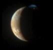
|
- Title:
- A Burst of Color
|
|
|
PIA03534 |
Io |
Galileo
|
Near Infrared Mapping Spectrometer
|
2002-05-28 |
816x600x3 |

|
- Title:
- Io in Infrared with Giant Plume's New Hot Spot
|
|
|
PIA09353 |
Io |
New Horizons
|
LORRI
|
2007-05-01 |
343x339x1 |

|
- Title:
- Io in Eclipse
|
|
|
PIA09342 |
Jupiter |
New Horizons
|
LORRI
|
2007-05-01 |
3000x2025x1 |

|
- Title:
- Jupiter's Rings: Sharpest View
|
|
|
PIA03602 |
Io |
Galileo
|
Near Infrared Mapping Spectrometer
|
2001-12-10 |
540x360x3 |

|
- Title:
- A New Hot Spot on Northern Io
|
|
|
PIA09240 |
Jupiter |
New Horizons
|
LORRI
|
2007-04-02 |
1035x677x1 |

|
- Title:
- Storms and Moons
|
|
|
PIA09244 |
Io |
New Horizons
|
LORRI
|
2007-04-02 |
500x256x1 |

|
- Title:
- An Eruption on Io
|
|
|
PIA09339 |
Jupiter |
New Horizons
|
MVIC
|
2007-05-01 |
2293x3401x1 |

|
- Title:
- Jupiter's High-Altitude Clouds
|
|
|
PIA09253 |
Jupiter |
New Horizons
|
LORRI
|
2007-04-02 |
1818x1899x1 |

|
- Title:
- LORRI Takes an Even Closer Look at the Little Red Spot
|
|
|
PIA09251 |
Jupiter |
New Horizons
|
LEISA
|
2007-04-02 |
792x387x1 |

|
- Title:
- A Look from LEISA
|
|
|
PIA09341 |
Jupiter |
Hubble Space Telescope
New Horizons
|
LORRI
|
2007-05-01 |
962x682x3 |

|
- Title:
- Best Color Image of Jupiter's Little Red Spot
|
|
|
PIA07248 |
Amalthea |
Galileo
Voyager
|
Solid-State Imaging
|
2005-05-31 |
1800x541x3 |

|
- Title:
- Amalthea, A Rubble-Pile Moon
|
|
|
PIA10096 |
Jupiter |
New Horizons
|
LORRI
|
2007-10-09 |
960x720x1 |

|
- Title:
- Polar Lightning on Jupiter
|
|
|
PIA09360 |
Io |
New Horizons
|
LORRI
|
2007-05-01 |
399x397x1 |

|
- Title:
- A "Plumefall" on Io
|
|
|
PIA09340 |
Jupiter |
New Horizons
|
LEISA
|
2007-05-01 |
3000x2025x3 |

|
- Title:
- Probing Storm Activity on Jupiter
|
|
|
PIA12148 |
Jupiter |
|
IRTF
|
2009-07-20 |
640x350x1 |

|
- Title:
- Jupiter Impact Scar
|
|
|
PIA02593 |
Callisto |
Galileo
|
Solid-State Imaging
|
2001-11-29 |
1280x774x1 |

|
- Title:
- Opposite Side of Callisto from Valhalla Impact
|
|
|
PIA09354 |
Io |
New Horizons
|
LORRI
|
2007-05-01 |
179x179x1 |

|
- Title:
- Io in Eclipse 2
|
|
|
PIA03887 |
Io |
Galileo
|
Solid-State Imaging
|
2002-12-06 |
4200x3200x3 |

|
- Title:
- Potential Source of Sulfur Flow on Io
|
|
|
PIA03474 |
Jupiter |
Cassini-Huygens
|
Imaging Science Subsystem
|
2002-03-13 |
1602x512x1 |

|
- Title:
- Ultraviolet View Shows Jupiter's Stratosphere
|
|
|
PIA09922 |
Jupiter |
New Horizons
|
Visual and Infrared Imaging/Spectrometer
|
2007-10-09 |
224x273x3 |

|
- Title:
- Ammonia Clouds on Jupiter
|
|
|
PIA09238 |
Jupiter |
New Horizons
|
LORRI
|
2007-04-02 |
850x512x1 |

|
- Title:
- Moons around Jupiter
|
|
|
PIA09258 |
Callisto |
New Horizons
|
LORRI
|
2007-04-09 |
500x302x1 |

|
- Title:
- Capturing Callisto
|
|
|
PIA09264 |
Io |
New Horizons
|
MVIC
|
2007-04-17 |
386x199x3 |

|
- Title:
- The Colors of the Night
|
|
|
PIA09356 |
Ganymede |
New Horizons
|
LEISA
Long Range Reconnaissance Imager (LORRI)
|
2007-05-01 |
814x343x3 |

|
- Title:
- Ganymede in Visible and Infrared Light
|
|
|
PIA09352 |
Jupiter |
New Horizons
|
LORRI
|
2007-05-01 |
3000x2025x1 |

|
- Title:
- Jupiter's Moons: Family Portrait
|
|
|
PIA10101 |
Io |
New Horizons
|
LORRI
Ultraviolet Light
|
2007-10-09 |
504x720x3 |

|
- Title:
- Tvashtar Montage
|
|
|
PIA09242 |
Jupiter |
New Horizons
|
LORRI
|
2007-04-02 |
1440x480x1 |

|
- Title:
- A 'Moving' Jupiter Global Map (Animation)
|
|
|
PIA10249 |
Io |
New Horizons
|
MVIC
|
2008-02-28 |
600x300x3 |

|
- Title:
- Seeing Red
|
|
|
PIA03601 |
Io |
Galileo
|
Near Infrared Mapping Spectrometer
|
2001-12-10 |
740x340x3 |

|
- Title:
- Io's Tupan Caldera in Infrared
|
|
|
PIA03878 |
Europa |
Galileo
|
Solid-State Imaging
|
2002-10-30 |
849x660x3 |

|
- Title:
- Ruddy "Freckles" on Europa
|
|
|
PIA03885 |
Io |
Galileo
|
Solid-State Imaging
|
2002-12-06 |
1907x2955x3 |

|
- Title:
- Io's Culann-Tohil Region in Color
|
|
|
PIA09239 |
Jupiter |
New Horizons
|
LORRI
|
2007-04-02 |
899x596x1 |

|
- Title:
- Io and Ganymede
|
|
|
PIA09359 |
Io |
New Horizons
|
LORRI
|
2007-05-01 |
399x852x1 |

|
- Title:
- Tvashtar Composite
|
|
|
PIA10131 |
Europa |
|
|
2007-12-13 |
6060x3000x3 |

|
- Title:
- Thick or Thin Ice Shell on Europa?
|
|
|
PIA09246 |
Europa |
New Horizons
|
LORRI
|
2007-04-02 |
256x256x1 |

|
- Title:
- Europa
|
|
|
PIA09665 |
Io |
New Horizons
|
LORRI
|
2007-05-14 |
512x512x1 |

|
- Title:
- Tvashtar in Motion
|
|
|
PIA02597 |
Io |
Galileo
|
Solid-State Imaging
|
2001-11-27 |
798x401x1 |

|
- Title:
- Slumping Cliff on Io in High Resolution
|
|
|
PIA10224 |
Jupiter |
Hubble Space Telescope
|
Visible Light
|
2008-01-25 |
2000x2682x3 |

|
- Title:
- Jupiter Eruptions
|
|
|
PIA03476 |
Jupiter |
Cassini-Huygens
|
|
2002-02-27 |
1288x728x3 |

|
- Title:
- Jupiter's Magnetosphere Made Visible
|
|
|
PIA09247 |
Jupiter |
New Horizons
|
LORRI
|
2007-04-02 |
1740x1940x1 |

|
- Title:
- The Little Red Spot: Closest View Yet
|
|
|
PIA03884 |
Io |
Galileo
|
Solid-State Imaging
|
2002-12-06 |
1262x1043x1 |

|
- Title:
- Recent Eruption at Gish Bar Patera on Io
|
|
|
PIA03876 |
Callisto |
Galileo
Voyager
|
Imaging Science Subsystem
Solid-State Imaging
|
2002-10-17 |
8860x4490x3 |

|
- Title:
- Callisto Hemispherical Globes
|
|
|
PIA09256 |
Jupiter |
New Horizons
|
MVIC
|
2007-04-09 |
419x307x3 |

|
- Title:
- Two Moons Meet over Jupiter
|
|
|
PIA07784 |
Jupiter |
Cassini-Huygens
|
Imaging Science Subsystem - Narrow Angle
|
2006-03-27 |
2231x2266x3 |

|
- Title:
- Cassini's Best Maps of Jupiter (South Polar Map)
|
|
|
PIA03526 |
Europa |
Galileo
Voyager
|
|
2002-02-16 |
8812x4381x3 |

|
- Title:
- Europa Hemispherical Globes
|
|
|
PIA03473 |
Jupiter |
Cassini-Huygens
|
Imaging Science Subsystem
|
2002-03-13 |
512x512x1 |

|
- Title:
- Ultraviolet Movie of Jupiter's Polar Stratosphere
|
|
|
PIA07783 |
Jupiter |
Cassini-Huygens
|
Imaging Science Subsystem - Narrow Angle
|
2006-03-27 |
2231x2266x3 |

|
- Title:
- Cassini's Best Maps of Jupiter (North Polar Map)
|
|
|
PIA03478 |
Jupiter |
Cassini-Huygens
|
Imaging Radar
|
2002-02-27 |
1700x2200x3 |

|
- Title:
- Inner Radiation Belts of Jupiter
|
|
|
PIA09252 |
Jupiter |
New Horizons
|
Alice UVS
|
2007-04-02 |
736x810x3 |

|
- Title:
- Alice Views Jupiter and Io
|
|
|
PIA00245 |
Venus |
Magellan
|
Imaging Radar
|
1996-03-13 |
2048x2048x1 |

|
- Title:
- Venus - 600 Kilometer Segment of Longest Channel on Venus
|
|
|
PIA00269 |
Venus |
Magellan
|
Imaging Radar
|
1996-03-14 |
1860x2048x1 |

|
- Title:
- Venus - Stereo Image Pair of Crater Geopert-Meyer
|
|
|
PIA00467 |
Venus |
Magellan
|
Imaging Radar
|
1996-10-23 |
480x1022x1 |

|
- Title:
- Venus - Lavinia Region
|
|
|
PIA00252 |
Venus |
Magellan
|
Imaging Radar
|
1996-03-14 |
4096x4096x3 |

|
- Title:
- Venus - Computer Simulated Global View of Northern Hemisphere
|
|
|
PIA00272 |
Venus |
Magellan
|
Imaging Radar
|
1996-07-19 |
4096x5120x3 |

|
- Title:
- Venus - Simulated Color of Ushas Mons
|
|
|
PIA00097 |
Venus |
Magellan
|
Imaging Radar
|
1998-06-03 |
647x425x1 |

|
- Title:
- Three-dimensional perspective views of Venusian Terrains composed of reduced resolution left-looking synthetic-aperture radar images merged with altimetry data from the Magellan spacecraft.
|
|
|
PIA00312 |
Venus |
Magellan
|
Imaging Radar
|
1998-06-04 |
1500x1500x3 |

|
- Title:
- Perspective View of Venus (Center Latitude 0 Degree N., Center Longitude 163 Degrees E.)
|
|
|
PIA00471 |
Venus |
Magellan
|
Imaging Radar
|
1996-10-23 |
2082x1736x1 |

|
- Title:
- Venus - Complex Lava Flows at Sif Mons
|
|
|
PIA00159 |
Venus |
Magellan
|
Imaging Radar
|
1998-06-04 |
4064x4064x3 |

|
- Title:
- Hemispheric View of Venus Centered at 180 Degrees East Longitude
|
|
|
PIA00256 |
Venus |
Magellan
|
Imaging Radar
|
1996-09-30 |
6519x6258x3 |

|
- Title:
- Venus - Simple Cylindrical Map of Surface (Eastern Half)
|
|
|
PIA00477 |
Venus |
Magellan
|
Imaging Radar
|
1996-11-26 |
1633x1392x1 |

|
- Title:
- Venus - Possible Remnants of a Meteoroid in Lakshmi Region
|
|
|
PIA00310 |
Venus |
Magellan
|
Imaging Radar
|
1998-06-04 |
2100x1500x3 |

|
- Title:
- Perspective View of Venus (Center Latitude 0 Degree N., Center Longitude 129 Degrees E.)
|
|
|
PIA00251 |
Venus |
Magellan
|
Imaging Radar
|
1996-03-14 |
1280x1024x1 |

|
- Title:
- Venus - Stereoscopic Images of Volcanic Domes
|
|
|
PIA00096 |
Venus |
Magellan
|
Imaging Radar
|
1998-06-03 |
723x425x1 |

|
- Title:
- Three-dimensional perspective views of Venusian Terrains composed of reduced resolution left-looking synthetic-aperture radar images merged with altimetry data from the Magellan spacecraft.
|
|
|
PIA03167 |
Venus |
Magellan
|
Arecibo Radar Data
Radar System
|
2001-08-27 |
15464x9249x3 |

|
- Title:
- Venus Hemispherical Globes (with place names)
|
|
|
PIA00309 |
Venus |
Magellan
|
Imaging Radar
|
1998-06-04 |
1500x1500x3 |

|
- Title:
- Perspective View of Venus (Center Latitude 0 Degree N., Center Longitude 77 Degrees E.)
|
|
|
PIA00201 |
Venus |
Magellan
|
Imaging Radar
|
1996-03-08 |
4789x4682x1 |

|
- Title:
- Venus - Volcanic features in Atla Region
|
|
|
PIA00460 |
Venus |
Magellan
|
Imaging Radar
|
1996-09-26 |
8192x7168x1 |

|
- Title:
- Venus - Venera 8 Landing Site in Navka Region
|
|
|
PIA00200 |
Venus |
Magellan
|
Imaging Radar
|
1996-08-16 |
5000x4000x3 |

|
- Title:
- Venus - False Color Perspective of Sif and Gula Mons
|
|
|
PIA00157 |
Venus |
Magellan
|
Imaging Radar
|
1998-06-04 |
4064x4064x3 |

|
- Title:
- Hemispheric View of Venus Centered at 0 Degrees East Longitude
|
|
|
PIA00246 |
Venus |
Magellan
|
Imaging Radar
|
1996-03-13 |
5000x4000x3 |

|
- Title:
- Venus - 3D Perspective View of Eastern Edge of Alpha Regio
|
|
|
PIA00481 |
Venus |
Magellan
|
Imaging Radar
|
1996-12-02 |
5000x4000x3 |

|
- Title:
- Venus - Three-Dimensional Perspective View of Alpha Regio
|
|
|
PIA00462 |
Venus |
Magellan
|
Imaging Radar
|
1996-09-26 |
1024x1024x1 |

|
- Title:
- Venus - Multiple-Floored, Irregular Impact Crater
|
|
|
PIA00258 |
Venus |
Magellan
|
Imaging Radar
|
1996-03-14 |
2943x2354x3 |

|
- Title:
- Venus - False Color of Eistla Regio
|
|
|
PIA00160 |
Venus |
Magellan
|
Imaging Radar
|
1998-06-04 |
4064x4064x3 |

|
- Title:
- Hemispheric View of Venus Centered at 270 Degrees East Longitude
|
|
|
PIA10123 |
Venus |
MESSENGER
|
Mercury Dual Imaging System - Wide Angle
|
2006-11-24 |
1048x528x1 |

|
- Title:
- Approaching Venus
|
|
|
PIA00307 |
Venus |
Magellan
|
Imaging Radar
|
1998-06-04 |
2000x1600x3 |

|
- Title:
- Perspective View of Venus (Center Latitude 45 Degrees N., Center Longitude 11 Degrees E.)
|
|
|
PIA00257 |
Venus |
Magellan
|
Imaging Radar
|
1996-03-14 |
4096x4096x3 |

|
- Title:
- Venus - Computer Simulated Global View Centered at 0 Degrees East Longitude
|
|
|
PIA00105 |
Venus |
Magellan
|
Imaging Radar
|
1996-11-12 |
2930x3664x3 |

|
- Title:
- Venus - Simulated Color of Leda Planitia
|
|
|
PIA00244 |
Venus |
Magellan
|
Imaging Radar
|
1996-03-13 |
3280x2470x1 |

|
- Title:
- Venus - Volcanic Domes East of Beta Regio
|
|
|
PIA00107 |
Venus |
Magellan
|
Imaging Radar
|
1996-11-12 |
4000x3000x3 |

|
- Title:
- Venus - 3D Perspective View of Sapas Mons
|
|
|
PIA00268 |
Venus |
Magellan
|
Imaging Radar
|
1996-03-14 |
4000x3000x3 |

|
- Title:
- Venus - 3D Perspective View of Latona Corona and Dali Chasma
|
|
|
PIA00259 |
Venus |
Magellan
|
Imaging Radar
|
1996-03-14 |
3520x4400x3 |

|
- Title:
- Venus - False Color of Bereghinya Planitia
|
|
|
PIA00255 |
Venus |
Magellan
|
Imaging Radar
|
1996-09-30 |
6519x6258x3 |

|
- Title:
- Venus - Simple Cylindrical Map of Surface (Western Half)
|
|
|
PIA00271 |
Venus |
Magellan
|
Imaging Radar
|
1996-07-18 |
4096x4096x3 |

|
- Title:
- Venus - Computer Simulated Global View of the Northern Hemisphere
|
|
|
PIA00253 |
Venus |
Magellan
|
Imaging Radar
|
1996-09-23 |
1700x2500x1 |

|
- Title:
- Venus - Sinuous Channel
|
|
|
PIA00249 |
Venus |
Magellan
|
Imaging Radar
|
1996-03-14 |
1000x1000x1 |

|
- Title:
- Venus - Danu Montes and Lakshmi Planum
|
|
|
PIA00466 |
Venus |
Magellan
|
Imaging Radar
|
1996-09-26 |
390x600x1 |

|
- Title:
- Venus - Large Impact Crater in the Eistla Region
|
|
|
PIA00101 |
Venus |
Magellan
|
Imaging Radar
|
1996-08-13 |
5120x5120x1 |

|
- Title:
- Artemis Corona (C2-MIDR)
|
|
|
PIA00095 |
Venus |
Magellan
|
Imaging Radar
|
1998-06-03 |
647x425x1 |

|
- Title:
- Three-dimensional perspective views of Venusian Terrains composed of reduced resolution left-looking synthetic-aperture radar images merged with altimetry data from the Magellan spacecraft.
|
|
|
PIA00243 |
Venus |
Magellan
|
Imaging Radar
|
1996-03-07 |
1020x1016x1 |

|
- Title:
- Venus - Volcano in Parga Chasma
|
|
|
PIA00093 |
Venus |
Pioneer Venus
|
Imaging Radar
|
1998-06-03 |
500x568x3 |

|
- Title:
- Perspective View of Ishtar Terra
|
|
|
PIA00248 |
Venus |
Magellan
|
Imaging Radar
|
1996-03-14 |
1280x1024x1 |

|
- Title:
- Venus - Aphrodite Terra
|
|
|
PIA00098 |
Venus |
Magellan
|
Imaging Radar
|
1998-06-03 |
723x425x1 |

|
- Title:
- Three-dimensional perspective views of Venusian Terrains composed of reduced resolution left-looking synthetic-aperture radar images merged with altimetry data from the Magellan spacecraft.
|
|
|
PIA00473 |
Venus |
Magellan
|
Imaging Radar
|
1996-11-20 |
480x591x1 |

|
- Title:
- Venus - Sag Caldera 'Sachs Patera
|
|
|
PIA00217 |
Venus |
Magellan
|
Imaging Radar
|
1997-01-16 |
8131x7169x1 |

|
- Title:
- Arecibo/Magellan Composite of Quetzalpetlatl Corona
|
|
|
PIA00463 |
Venus |
Magellan
|
Imaging Radar
|
1996-09-26 |
1620x1620x1 |

|
- Title:
- Venus - Barton Crater
|
|
|
PIA00478 |
Venus |
Magellan
|
Imaging Radar
|
1996-11-26 |
10240x10240x1 |

|
- Title:
- Venus - Global View Centered at 180 degrees
|
|
|
PIA00461 |
Venus |
Magellan
|
Imaging Radar
|
1996-09-26 |
6940x5940x1 |

|
- Title:
- Venus - Mosaic of Bahet and Onatah Coronae
|
|
|
PIA00261 |
Venus |
Magellan
|
Imaging Radar
|
1996-03-14 |
2600x2400x1 |

|
- Title:
- Venus - Volcanos in Guinevere Planitia
|
|
|
PIA00479 |
Venus |
Magellan
|
Imaging Radar
|
1996-11-26 |
2500x2950x1 |

|
- Title:
- Venus - Complex Crater 'Dickinson' in NE Atalanta Region
|
|
|
PIA00267 |
Venus |
Magellan
|
Imaging Radar
|
1996-03-14 |
6416x5800x1 |

|
- Title:
- Venus - Cycle 1, 2, and 3 Images of Imdr Region
|
|
|
PIA00262 |
Venus |
Magellan
|
Imaging Radar
|
1996-03-14 |
1452x1314x1 |

|
- Title:
- Venus - Landslide in Navka Region
|
|
|
PIA00475 |
Venus |
Magellan
|
Imaging Radar
|
1996-11-20 |
880x850x1 |

|
- Title:
- Venus - Crater 'Stefania' in N. Sedna Planitia
|
|
|
PIA00311 |
Venus |
Magellan
|
Imaging Radar
|
1998-06-04 |
2100x900x3 |

|
- Title:
- Perspective View of Venus (Center Latitude 15 Degrees S., Center Longitude 129 Degrees E.)
|
|
|
PIA10124 |
Venus |
MESSENGER
|
Mercury Dual Imaging System - Wide Angle
|
2007-06-05 |
1024x1024x1 |

|
- Title:
- Approaching Venus Image #2
|
|
|
PIA00007 |
Venus |
Magellan
|
Imaging Radar
|
1996-06-03 |
4064x4064x3 |

|
- Title:
- Hemispheric View of Venus Centered at the North Pole
|
|
|
PIA00270 |
Venus |
Magellan
|
Imaging Radar
|
1996-09-23 |
4096x4096x3 |

|
- Title:
- Venus - Computer Simulated Global View Centered at 90 Degrees East Longitude
|
|
|
PIA00106 |
Venus |
Magellan
|
Imaging Radar
|
1996-08-01 |
4000x3000x3 |

|
- Title:
- Venus - 3D Perspective View of Maat Mons
|
|
|
PIA00103 |
Venus |
Magellan
|
Imaging Radar
|
1996-11-12 |
5000x4000x3 |

|
- Title:
- Venus - 3D Perspective View of Lavinia Planitia
|
|
|
PIA00483 |
Venus |
Magellan
|
Imaging Radar
|
1996-11-14 |
2560x1024x1 |

|
- Title:
- Venus - Outflow Channel in South Navka
|
|
|
PIA04594 |
Venus |
Mariner
|
|
2003-06-27 |
1515x1218x3 |

|
- Title:
- Mariner 2
|
|
|
PIA00469 |
Venus |
Magellan
|
Imaging Radar
|
1996-10-23 |
1737x818x1 |

|
- Title:
- Venus - Complex Network of Narrow Fractures Near Hestia Rupes Region
|
|
|
PIA00218 |
Venus |
Magellan
|
Imaging Radar
|
1996-09-20 |
3072x2048x1 |

|
- Title:
- Venus - Interior of Ovda Regio
|
|
|
PIA00315 |
Venus |
Magellan
|
Imaging Radar
|
1998-06-04 |
700x1400x3 |

|
- Title:
- Looking Westward Across the Fortuna Tessera (Left Member of a Synthetic Stereo Pair)
|
|
|
PIA00263 |
Venus |
Magellan
|
Imaging Radar
|
1996-03-14 |
1812x1716x1 |

|
- Title:
- Venus - Landslide Deposits
|
|
|
PIA00465 |
Venus |
Magellan
|
Imaging Radar
|
1996-09-26 |
3640x2213x1 |

|
- Title:
- Venus - Comparison of Venera and Magellan Resolutions
|
|
|
PIA00464 |
Venus |
Magellan
|
Imaging Radar
|
1996-09-26 |
8180x7150x1 |

|
- Title:
- Venus - Magellan Data Superimposed on Pioneer Venus Data - Devana Chasma and Phoebe Regio
|
|
|
PIA00472 |
Venus |
Magellan
|
Imaging Radar
|
1996-11-20 |
975x1024x1 |

|
- Title:
- Venus - Impact Crater 'Jeanne
|
|
|
PIA00316 |
Venus |
Magellan
|
Imaging Radar
|
1998-06-04 |
700x1400x3 |

|
- Title:
- Looking Westward Across the Fortuna Tessera (Right Member of a Synthetic Stereo Pair)
|
|
|
PIA00474 |
Venus |
Magellan
|
Imaging Radar
|
1996-11-20 |
530x572x1 |

|
- Title:
- Venus - Impact Crater in Eastern Navka Region
|
|
|
PIA00313 |
Venus |
Magellan
|
Imaging Radar
|
1998-06-04 |
700x1400x3 |

|
- Title:
- Sedna Planitia (Left Member of a Synthetic Stereo Pair)
|
|
|
PIA00487 |
Venus |
Magellan
|
Imaging Radar
|
1996-11-14 |
1126x1015x1 |

|
- Title:
- Venus - Volcanic Domes on Flank of Volcanic Maat in East Ovda Region
|
|
|
PIA00264 |
Venus |
Magellan
|
Imaging Radar
|
1996-03-14 |
1896x1944x1 |

|
- Title:
- Venus - Volcano With Massive Landslides
|
|
|
PIA00482 |
Venus |
Magellan
|
Imaging Radar
|
1996-11-07 |
1000x1000x1 |

|
- Title:
- Venus - Dark Volcanic Lava Flows
|
|
|
PIA00104 |
Venus |
Magellan
|
Imaging Radar
|
1996-11-12 |
4096x4096x3 |

|
- Title:
- Venus - Computer Simulated Global View Centered at 180 Degrees East Longitude
|
|
|
PIA00468 |
Venus |
Magellan
|
Imaging Radar
|
1996-10-23 |
730x1024x1 |

|
- Title:
- Venus - 'Transitional' Crater
|
|
|
PIA00486 |
Venus |
Magellan
|
Imaging Radar
|
1996-11-14 |
2510x3072x1 |

|
- Title:
- Venus - System of Lava Flows and Ridge Belt
|
|
|
PIA00254 |
Venus |
Magellan
|
Imaging Radar
|
1996-03-14 |
5000x4000x3 |

|
- Title:
- Venus - 3D Perspective View of Maat Mons
|
|
|
PIA00247 |
Venus |
Magellan
|
Imaging Radar
|
1996-03-13 |
1750x3100x1 |

|
- Title:
- Venus - Left and Right Looking Images of Lavinia Region
|
|
|
PIA00266 |
Venus |
Magellan
|
Imaging Radar
|
1996-03-14 |
1600x1200x3 |

|
- Title:
- Venus - Oblique View of Crater Riley
|
|
|
PIA03151 |
Venus |
Magellan
|
Arecibo Radar Data
Radar System
|
2001-03-15 |
13966x8887x3 |

|
- Title:
- Venus Hemispherical Globes
|
|
|
PIA00086 |
Venus |
Magellan
|
Imaging Radar
|
1996-09-13 |
8192x7168x1 |

|
- Title:
- Mosaic of Large Impact Craters
|
|
|
PIA00306 |
Venus |
Magellan
|
Imaging Radar
|
1998-06-04 |
2000x940x3 |

|
- Title:
- Perspective View of Venus (Center Latitude 45 Degrees N., Center Longitude 350 Degrees E.)
|
|
|
PIA00146 |
Venus |
Magellan
|
Imaging Radar
|
1996-08-13 |
13650x9556x1 |

|
- Title:
- Venus - Ovda Regio
|
|
|
PIA00308 |
Venus |
Magellan
|
Imaging Radar
|
1998-06-04 |
1500x1500x3 |

|
- Title:
- Perspective View of Venus (Center Latitude 15 Degrees N., Center Longitude 77 Degrees E.)
|
|
|
PIA00150 |
Venus |
Magellan
|
Imaging Radar
|
1998-06-04 |
576x400x1 |

|
- Title:
- Three-dimensional perspective views of Venusian Terrains composed of reduced resolution left-looking synthetic-aperture radar images merged with altimetry data from the Magellan spacecraft.
|
|
|
PIA10125 |
Venus |
MESSENGER
|
Mercury Dual Imaging System - Wide Angle
|
2007-06-05 |
608x919x1 |

|
- Title:
- MESSENGER Bids Farewell to Venus
|
|
|
PIA00102 |
Venus |
Magellan
|
Imaging Radar
|
1996-11-12 |
5000x4000x3 |

|
- Title:
- Venus - 3D Perspective View of Estla Regio
|
|
|
PIA00470 |
Venus |
Magellan
|
Imaging Radar
|
1996-10-23 |
1024x1024x1 |

|
- Title:
- Venus - Complex Crater 'Buck' in Navka Region
|
|
|
PIA00265 |
Venus |
Magellan
|
Imaging Radar
|
1996-03-14 |
3306x2114x3 |

|
- Title:
- Venus - False Color of Volcanic Plains
|
|
|
PIA00158 |
Venus |
Magellan
|
Imaging Radar
|
1998-06-04 |
4064x4064x3 |

|
- Title:
- Hemispheric View of Venus Centered at 90 Degrees East Longitude
|
|
|
PIA00260 |
Venus |
Magellan
|
Imaging Radar
|
1996-03-14 |
2558x4190x1 |

|
- Title:
- Venus - Comparison of Left and Right Looking Views of Imdr Region
|
|
|
PIA00008 |
Venus |
Magellan
|
Imaging Radar
|
1996-06-03 |
4064x4064x3 |

|
- Title:
- Hemispheric View of Venus Centered at the South Pole
|
|
|
PIA00314 |
Venus |
Magellan
|
Imaging Radar
|
1998-06-04 |
700x1400x3 |

|
- Title:
- Sedna Planitia (Right Member of a Synthetic Stereo Pair)
|
|
|
PIA00485 |
Venus |
Magellan
|
Imaging Radar
|
1996-11-14 |
1880x1504x1 |

|
- Title:
- Venus - A Large Elongated Caldera 'Sacajawea Patera
|
|
|
PIA00480 |
Venus |
Magellan
|
Imaging Radar
|
1996-11-26 |
5475x5341x1 |

|
- Title:
- Venus - Impact Crater 'Isabella
|
|
|
PIA00476 |
Venus |
Magellan
|
Imaging Radar
|
1996-11-22 |
517x592x1 |

|
- Title:
- Venus - Multi-Floor Irregular Crater
|
|
|
PIA01544 |
Venus |
Hubble Space Telescope
|
Imaging Science Subsystem - Narrow Angle
|
1999-05-18 |
170x248x3 |

|
- Title:
- Venus
|
|
|
PIA00250 |
Venus |
Magellan
|
Imaging Radar
|
1996-03-14 |
1694x2817x1 |

|
- Title:
- Venus - Wanda Crater in Akna Montes
|
|
|
PIA03150 |
Sol (our sun) |
SOHO
|
Extreme Ultraviolet Imaging Telescope
|
2001-02-17 |
1067x1067x3 |

|
- Title:
- Color Composite of Solar Features
|
|
|
PIA00450 |
Sol (our sun) |
Voyager
|
Imaging Science Subsystem - Wide Angle
|
1996-09-13 |
3430x2650x3 |

|
- Title:
- Solar System Portrait - View of the Sun, Earth and Venus
|
|
|
PIA09326 |
Sol (our sun) |
Solar TErrestrial RElations Observatory (STEREO)
|
SECCHI/Extreme Ultraviolet Imaging Telescope
|
2007-04-27 |
1920x1080x3 |

|
- Title:
- Right Limb of the South Pole of the Sun, March 18, 2007
|
|
|
PIA05553 |
Sol (our sun) |
Mars Exploration Rover (MER)
|
Panoramic Camera
|
2004-03-12 |
360x360x5 |

|
- Title:
- Martian Moon Blocks Sun
|
|
|
PIA09327 |
Sol (our sun) |
Solar TErrestrial RElations Observatory (STEREO)
|
SECCHI/Extreme Ultraviolet Imaging Telescope
|
2007-04-27 |
1920x1080x3 |

|
- Title:
- Right Limb of the South Pole of the Sun, March 18, 2007 (Anaglyph)
|
|
|
PIA09322 |
Sol (our sun) |
Solar TErrestrial RElations Observatory (STEREO)
|
SECCHI/Extreme Ultraviolet Imaging Telescope
|
2007-04-27 |
1920x1080x3 |

|
- Title:
- Close-up View of an Active Region of the Sun, March 23, 2007
|
|
|
PIA09330 |
Sol (our sun) |
Solar TErrestrial RElations Observatory (STEREO)
|
SECCHI/Extreme Ultraviolet Imaging Telescope
|
2007-04-27 |
1920x1080x3 |

|
- Title:
- South Pole of the Sun, March 20, 2007
|
|
|
PIA09331 |
Sol (our sun) |
Solar TErrestrial RElations Observatory (STEREO)
|
SECCHI/Extreme Ultraviolet Imaging Telescope
|
2007-04-27 |
1920x1080x3 |

|
- Title:
- South Pole of the Sun, March 20, 2007 (Anaglyph)
|
|
|
PIA09323 |
Sol (our sun) |
Solar TErrestrial RElations Observatory (STEREO)
|
SECCHI/Extreme Ultraviolet Imaging Telescope
|
2007-04-27 |
1920x1080x3 |

|
- Title:
- Close-up View of an Active Region of the Sun, March 23, 2007 (Anaglyph)
|
|
|
PIA00451 |
Sol (our sun) |
Voyager
|
Imaging Science Subsystem - Wide Angle
|
1996-09-13 |
4000x1200x3 |

|
- Title:
- Solar System Portrait - 60 Frame Mosaic
|
|
|
PIA09321 |
Sol (our sun) |
Solar TErrestrial RElations Observatory (STEREO)
|
SECCHI/Extreme Ultraviolet Imaging Telescope
|
2007-04-27 |
1920x1080x3 |

|
- Title:
- Full Disk Image of the Sun, March 26, 2007 (Anaglyph)
|
|
|
PIA09329 |
Sol (our sun) |
Solar TErrestrial RElations Observatory (STEREO)
|
SECCHI/Extreme Ultraviolet Imaging Telescope
|
2007-04-27 |
1920x1080x3 |

|
- Title:
- North Pole of the Sun, March 20, 2007 (Anaglyph)
|
|
|
PIA09333 |
Sol (our sun) |
Solar TErrestrial RElations Observatory (STEREO)
|
SECCHI/Extreme Ultraviolet Imaging Telescope
|
2007-04-27 |
1920x1080x3 |

|
- Title:
- Left Limb of North Pole of the Sun, March 20, 2007 (Anaglyph)
|
|
|
PIA05554 |
Sol (our sun) |
Mars Exploration Rover (MER)
|
Panoramic Camera
|
2004-03-13 |
1080x360x1 |

|
- Title:
- Martian Moon Eclipses Sun, in Stages
|
|
|
PIA09324 |
Sol (our sun) |
Solar TErrestrial RElations Observatory (STEREO)
|
SECCHI/Extreme Ultraviolet Imaging Telescope
|
2007-04-27 |
1920x1080x3 |

|
- Title:
- Closer View of the Equatorial Region of the Sun, March 24, 2007
|
|
|
PIA03149 |
Sol (our sun) |
SOHO
|
Extreme Ultraviolet Imaging Telescope
|
2001-02-17 |
2100x2034x3 |

|
- Title:
- Handle-shaped Prominence
|
|
|
PIA05041 |
Sol (our sun) |
Mars Exploration Rover (MER)
|
Panoramic Camera
|
2004-01-10 |
1600x1200x1 |

|
- Title:
- Martian Sunsets More Than Just Pretty
|
|
|
PIA05518 |
Sol (our sun) |
Mars Exploration Rover (MER)
|
Panoramic Camera
|
2004-03-08 |
399x198x3 |

|
- Title:
- Martian Eclipses: Deimos and Phobos
|
|
|
PIA09325 |
Sol (our sun) |
Solar TErrestrial RElations Observatory (STEREO)
|
SECCHI/Extreme Ultraviolet Imaging Telescope
|
2007-04-27 |
1920x1080x3 |

|
- Title:
- Closer View of the Equatorial Region of the Sun, March 24, 2007 (Anaglyph)
|
|
|
PIA05556 |
Deimos |
Mars Exploration Rover (MER)
|
Panoramic Camera
|
2004-03-12 |
360x360x5 |

|
- Title:
- Deimos Crosses Face of Sun
|
|
|
PIA09320 |
Sol (our sun) |
Solar TErrestrial RElations Observatory (STEREO)
|
SECCHI/Extreme Ultraviolet Imaging Telescope
|
2007-04-27 |
1920x1080x3 |

|
- Title:
- Full Disk Image of the Sun, March 26, 2007
|
|
|
PIA09328 |
Sol (our sun) |
Solar TErrestrial RElations Observatory (STEREO)
|
SECCHI/Extreme Ultraviolet Imaging Telescope
|
2007-04-27 |
1920x1080x3 |

|
- Title:
- North Pole of the Sun, March 20, 2007
|
|
|
PIA09332 |
Sol (our sun) |
Solar TErrestrial RElations Observatory (STEREO)
|
SECCHI/Extreme Ultraviolet Imaging Telescope
|
2007-04-27 |
1920x1080x3 |

|
- Title:
- Left Limb of North Pole of the Sun, March 20, 2007
|
|
|
PIA01490 |
Miranda |
Voyager
|
|
1998-10-30 |
1581x1600x1 |

|
- Title:
- South Polar View of Miranda
|
|
|
PIA01352 |
Oberon |
Voyager
|
Imaging Science Subsystem - Narrow Angle
|
1998-10-13 |
1500x1500x1 |

|
- Title:
- Uranus' largest moon Oberon
|
|
|
PIA01360 |
Uranus |
Voyager
|
Imaging Science Subsystem - Narrow Angle
|
1998-12-05 |
1567x929x3 |

|
- Title:
- Uranus, towards the planet's pole of rotation.
|
|
|
PIA00346 |
Uranus |
Voyager
|
|
1998-06-04 |
540x800x3 |

|
- Title:
- Color Voyager 2 Image Showing Crescent Uranus
|
|
|
PIA00040 |
Umbriel |
Voyager
|
Imaging Science Subsystem - Narrow Angle
|
1996-01-31 |
400x400x1 |

|
- Title:
- Umbriel at Closest Approach
|
|
|
PIA00035 |
U Rings |
Voyager
|
|
1996-01-29 |
998x1499x1 |

|
- Title:
- Uranus' Tenth Ring
|
|
|
PIA00369 |
Uranus |
Voyager
|
Imaging Science Subsystem - Narrow Angle
|
1996-10-23 |
506x958x1 |

|
- Title:
- Uranus Cloud Movement
|
|
|
PIA01354 |
Miranda |
Voyager
|
Imaging Science Subsystem - Narrow Angle
|
1998-11-13 |
800x800x1 |

|
- Title:
- Uranus' innermost satellite Miranda
|
|
|
PIA01355 |
U Rings |
Voyager
|
Imaging Science Subsystem - Narrow Angle
|
1998-11-13 |
800x800x1 |

|
- Title:
- Outer part of the Uranian ring system
|
|
|
PIA01283 |
Uranus |
Hubble Space Telescope
|
Wide Field Planetary Camera 2
|
1998-08-02 |
737x256x1 |

|
- Title:
- Hubble the Rotation of Uranus
|
|
|
PIA01983 |
U Rings |
Voyager
|
Imaging Science Subsystem - Narrow Angle
|
1999-06-30 |
878x528x1 |

|
- Title:
- Epsilon Ring of Uranus
|
|
|
PIA01350 |
U Rings |
Voyager
|
Imaging Science Subsystem - Narrow Angle
|
1998-11-11 |
400x200x1 |

|
- Title:
- Rings of Uranus at 1.44 kilometers
|
|
|
PIA02217 |
Miranda |
Voyager
|
|
1999-08-24 |
595x595x1 |

|
- Title:
- Miranda
|
|
|
PIA01489 |
Uranus |
Voyager
|
|
1998-10-30 |
954x962x3 |

|
- Title:
- Uranus' Atmosphere
|
|
|
PIA01488 |
Uranus |
Voyager
|
|
1998-11-02 |
2118x2618x3 |

|
- Title:
- Uranus' Upper Atmosphere
|
|
|
PIA01356 |
Ariel |
Voyager
|
Imaging Science Subsystem - Narrow Angle
|
1998-12-05 |
512x512x1 |

|
- Title:
- Ariel's transecting valleys
|
|
|
PIA00032 |
Uranus |
Voyager
|
Imaging Science Subsystem - Narrow Angle
|
1996-08-01 |
2000x1000x3 |

|
- Title:
- Uranus in True and False Color
|
|
|
PIA00368 |
U Rings |
Voyager
|
Imaging Science Subsystem - Narrow Angle
|
1996-11-26 |
996x1009x1 |

|
- Title:
- Uranus Satellites
|
|
|
PIA01351 |
Ariel |
Voyager
|
Imaging Science Subsystem - Narrow Angle
|
1998-12-05 |
1275x1275x1 |

|
- Title:
- Bright patches on Ariel
|
|
|
PIA01979 |
Titania |
Voyager
|
Imaging Science Subsystem - Narrow Angle
|
1999-06-19 |
784x560x1 |

|
- Title:
- Full-disk View of Titania
|
|
|
PIA00034 |
Oberon |
Voyager
|
|
1996-01-29 |
500x500x3 |

|
- Title:
- Oberon at Voyager Closest Approach
|
|
|
PIA00370 |
Uranus |
Voyager
|
Imaging Science Subsystem - Narrow Angle
|
1996-11-26 |
700x700x3 |

|
- Title:
- Uranus - Discrete Cloud
|
|
|
PIA01975 |
Miranda |
Voyager
|
Imaging Science Subsystem - Narrow Angle
|
1999-06-22 |
975x195x1 |

|
- Title:
- Uranus - Family Portrait
|
|
|
PIA01980 |
Miranda |
Voyager
|
Imaging Science Subsystem - Narrow Angle
|
1999-06-19 |
375x223x1 |

|
- Title:
- Uranus Satellite - Miranda
|
|
|
PIA01534 |
Ariel |
Voyager
|
|
1999-05-08 |
1330x1508x1 |

|
- Title:
- Ariel's Densely Pitted Surface
|
|
|
PIA01984 |
U Rings |
Voyager
|
Imaging Science Subsystem - Narrow Angle
|
1999-06-30 |
1600x1050x1 |

|
- Title:
- Uranus' Rings
|
|
|
PIA00142 |
U Rings |
Voyager
|
Imaging Science Subsystem - Wide Angle
|
1996-01-29 |
782x763x1 |

|
- Title:
- Uranus Ring System
|
|
|
PIA01985 |
U Rings |
Voyager
|
Imaging Science Subsystem - Narrow Angle
|
1999-06-30 |
719x386x1 |

|
- Title:
- Rings of Uranus
|
|
|
PIA00042 |
Miranda |
Voyager
|
Imaging Science Subsystem - Narrow Angle
|
1999-08-30 |
459x600x3 |

|
- Title:
- Miranda - Highest Resolution Color Picture
|
|
|
PIA00143 |
Uranus |
Voyager
|
Imaging Science Subsystem - Wide Angle
|
1996-01-29 |
794x960x3 |

|
- Title:
- Uranus - Final Image
|
|
|
PIA01280 |
Uranus |
Hubble Space Telescope
|
Wide Field Planetary Camera 2
|
1998-08-02 |
450x293x3 |

|
- Title:
- Hubble Captures Detailed Image of Uranus' Atmosphere
|
|
|
PIA00141 |
Miranda |
Voyager
|
Imaging Science Subsystem - Narrow Angle
|
1996-01-29 |
774x787x1 |

|
- Title:
- Miranda's Geologic History (variety of terrain)
|
|
|
PIA01981 |
U Rings |
Voyager
|
Imaging Science Subsystem - Narrow Angle
|
1999-06-19 |
996x996x1 |

|
- Title:
- Rings of Uranus
|
|
|
PIA01535 |
Uranus |
Voyager
|
|
1999-05-08 |
923x963x3 |

|
- Title:
- Uranus' Atmosphere
|
|
|
PIA00039 |
Titania |
Voyager
|
Imaging Science Subsystem - Narrow Angle
|
1996-01-29 |
640x760x1 |

|
- Title:
- Titania - Highest Resolution Voyager Picture
|
|
|
PIA01977 |
U Rings |
Voyager
|
Imaging Science Subsystem - Narrow Angle
|
1999-06-21 |
754x735x1 |

|
- Title:
- Uranus Rings
|
|
|
PIA00037 |
Ariel |
Voyager
|
Imaging Science Subsystem - Narrow Angle
|
2000-06-02 |
800x800x1 |

|
- Title:
- Ariel at Voyager Closest Approach
|
|
|
PIA02218 |
Miranda |
Voyager
|
|
1999-08-24 |
1020x1020x1 |

|
- Title:
- Miranda
|
|
|
PIA00140 |
Miranda |
Voyager
|
Imaging Science Subsystem - Narrow Angle
|
1996-01-29 |
789x768x1 |

|
- Title:
- Miranda Fractures, Grooves and Craters
|
|
|
PIA01278 |
Uranus |
Hubble Space Telescope
|
Wide Field Planetary Camera 2
|
1999-05-21 |
1074x737x3 |

|
- Title:
- Hubble Tracks Clouds on Uranus
|
|
|
PIA01282 |
Uranus |
Hubble Space Telescope
|
Wide Field Planetary Camera 2
|
1998-08-02 |
600x800x1 |

|
- Title:
- Hubble Observes the Planet Uranus
|
|
|
PIA01279 |
Uranus |
Hubble Space Telescope
|
Wide Field Planetary Camera 2
|
1998-08-02 |
1125x900x3 |

|
- Title:
- Hubble Spots Northern Hemispheric Clouds on Uranus
|
|
|
PIA01281 |
Uranus |
Hubble Space Telescope
|
Wide Field Planetary Camera 2
|
1998-08-02 |
490x512x1 |

|
- Title:
- Hubble Observes the Moons and Rings of Uranus
|
|
|
PIA01978 |
Titania |
Voyager
|
Imaging Science Subsystem - Narrow Angle
|
1999-06-19 |
150x440x1 |

|
- Title:
- Uranus Moon - Titania
|
|
|
PIA00036 |
Titania |
Voyager
|
Imaging Science Subsystem - Narrow Angle
|
1996-01-29 |
700x700x3 |

|
- Title:
- Titania High-Resolution Color Composite
|
|
|
PIA01391 |
Uranus |
Voyager
|
Imaging Science Subsystem - Narrow Angle
|
1999-01-08 |
1000x1000x3 |

|
- Title:
- Uranus
|
|
|
PIA00033 |
U Rings |
Voyager
|
|
1996-01-29 |
399x500x3 |

|
- Title:
- Uranus Rings in False Color
|
|
|
PIA00038 |
Miranda |
Voyager
|
|
1996-01-29 |
764x785x1 |

|
- Title:
- Miranda - 'Chevron' Grooves
|
|
|
PIA00041 |
Ariel |
Voyager
|
Imaging Science Subsystem - Narrow Angle
|
1996-01-29 |
845x650x3 |
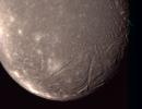
|
- Title:
- Ariel - Highest Resolution Color Picture
|
|
|
PIA01487 |
U Rings |
Voyager
|
|
1998-10-30 |
1760x2450x1 |

|
- Title:
- Uranus' Far-flung Rings
|
|
|
PIA02963 |
Uranus |
Hubble Space Telescope
|
Wide Field Planetary Camera 2
|
2000-08-24 |
2400x2433x3 |

|
- Title:
- Hubble Finds Many Bright Clouds on Uranus
|
|
|
PIA01976 |
U Rings |
Voyager
|
Imaging Science Subsystem - Narrow Angle
|
1999-06-19 |
740x725x1 |

|
- Title:
- Uranus Rings and Two Moons
|
|
|
PIA01361 |
Oberon |
Voyager
|
Imaging Science Subsystem - Narrow Angle
|
1999-08-20 |
2537x800x3 |

|
- Title:
- Uranus - Montage of Uranus' Five Largest Satellites
|
|
|
PIA00043 |
Miranda |
Voyager
|
|
1996-08-01 |
2500x2200x1 |

|
- Title:
- Miranda - High Resolution Mosaic
|
|
|
PIA00044 |
Miranda |
Voyager
|
Imaging Science Subsystem - Narrow Angle
|
1996-01-29 |
1016x1002x1 |

|
- Title:
- Miranda High Resolution of Large Fault
|
|
|
PIA12072 |
|
Lunar Reconnaissance Orbiter (LRO)
|
|
2009-06-18 |
2880x1944x3 |

|
- Title:
- Lunar Reconnaissance Orbiter (LRO) (Artist's Concept)
|
|
|
PIA11188 |
|
Kepler
|
Photometer
|
2008-09-23 |
2136x3216x3 |

|
- Title:
- NASA's Kepler Spacecraft in a Clean Room
|
|
|
PIA10940 |
|
Phoenix
|
|
2008-07-11 |
3508x2481x3 |

|
- Title:
- First Atomic Force Microscope Image from Mars
|
|
|
PIA12099 |
|
Mars Exploration Rover (MER)
|
|
2009-06-30 |
1856x1371x3 |

|
- Title:
- Preparing a Test Mixture
|
|
|
PIA12156 |
|
Mars Exploration Rover (MER)
|
|
2009-07-24 |
2071x966x3 |

|
- Title:
- Sandbox Tracks from Rover Testing
|
|
|
PIA11195 |
|
James Webb Telescope
|
Mid-Infrared Instrument (MIRI)
|
2008-09-24 |
640x480x3 |

|
- Title:
- Shake, Rattle and Roll: James Webb Telescope Components Pass Tests
|
|
|
PIA12024 |
|
Dawn
|
|
2009-05-29 |
1500x1200x3 |

|
- Title:
- Dawn Spacecraft After Installation of High Gain Antenna
|
|
|
PIA12017 |
|
Dawn
|
|
2009-05-29 |
2000x3008x3 |

|
- Title:
- Payload Fairing Installation Around the Dawn Spacecraft
|
|
|
PIA11432 |
|
Mars Science Laboratory (MSL)
|
|
2008-11-19 |
3000x2100x3 |

|
- Title:
- Four Finalist Landing Site Candidates for Mars Science Laboratory
|
|
|
PIA12023 |
|
Dawn
|
|
2009-05-29 |
1500x1200x3 |

|
- Title:
- Exposed Interior of Dawn Spacecraft
|
|
|
PIA11426 |
|
Mars Science Laboratory (MSL)
|
|
2008-11-19 |
2736x3648x3 |

|
- Title:
- Bridle Device in Mars Science Laboratory Descent Stage
|
|
|
PIA11433 |
|
Mars Reconnaissance Orbiter (MRO)
|
|
2008-11-20 |
3400x4400x3 |

|
- Title:
- Three Craters
|
|
|
PIA12088 |
|
Lunar Reconnaissance Orbiter (LRO)
|
Diviner
|
2009-07-07 |
4000x3000x3 |

|
- Title:
- Diviner Following Integration to the Lunar Reconnaissance Orbiter (LRO)
|
|
|
PIA12144 |
|
Mars Exploration Rover (MER)
|
|
2009-07-16 |
1966x917x3 |

|
- Title:
- Observing a Rover Pivot Test
|
|
|
PIA11449 |
|
Earth System Science Pathfinder (ESSP)
|
|
2008-12-13 |
8192x8192x3 |

|
- Title:
- Artist’s Concept of the Orbiting Carbon Observatory
|
|
|
PIA11808 |
|
Mars Science Laboratory (MSL)
|
|
2009-02-24 |
3264x2448x3 |

|
- Title:
- Mars Science Laboratory Rover and Descent Stage
|
|
|
PIA11199 |
|
Phoenix
|
|
2008-09-30 |
720x540x3 |

|
- Title:
- Temperature Measurements Taken by Phoenix Spacecraft
|
|
|
PIA12089 |
|
Lunar Reconnaissance Orbiter (LRO)
|
Diviner
|
2009-07-07 |
821x463x3 |

|
- Title:
- Diviner Undergoing Post Thermal Vacuum Range of Motion Testing
|
|
|
PIA12087 |
|
Lunar Reconnaissance Orbiter (LRO)
|
Diviner
|
2009-07-07 |
4000x3000x3 |

|
- Title:
- Close-up of Diviner Solar Calibration Target
|
|
|
PIA11995 |
|
Mars Science Laboratory (MSL)
|
|
2009-04-22 |
4991x3239x3 |

|
- Title:
- Mars Parachute Testing in World's Largest Wind Tunnel
|
|
|
PIA10784 |
|
Phoenix
|
TEGA
|
2008-06-11 |
1367x1122x3 |
|
- Title:
- Thermal and Evolved-Gas Analyzer Illustration
|
|
|
PIA12084 |
|
Lunar Reconnaissance Orbiter (LRO)
|
Diviner
|
2009-07-07 |
4288x2848x3 |

|
- Title:
- The Diviner Instrument Prior to Shipment
|
|
|
PIA12011 |
|
Wide-field Infrared Survey Explorer (WISE)
|
|
2009-05-18 |
1200x1800x3 |

|
- Title:
- Wide-field Infrared Survey Explorer (Artist's Concept)
|
|
|
PIA11437 |
|
Mars Science Laboratory (MSL)
|
|
2008-12-04 |
1214x910x3 |

|
- Title:
- Mars Science Laboratory Spacecraft Assembled for Testing
|
|
|
PIA11430 |
|
Mars Science Laboratory (MSL)
|
|
2008-11-19 |
3427x5120x3 |

|
- Title:
- Aeroshell for Mars Science Laboratory
|
|
|
PIA12031 |
|
Dawn
|
|
2009-05-29 |
1200x675x3 |

|
- Title:
- Dawn Spacecraft Orbiting Ceres (Artist's Concept)
|
|
|
PIA12103 |
|
Mars Exploration Rover (MER)
|
|
2009-07-01 |
2288x1318x3 |

|
- Title:
- Test Setup for Effort to Free Spirit
|
|
|
PIA12032 |
|
Dawn
|
|
2009-05-29 |
1200x675x3 |

|
- Title:
- Dawn Spacecraft Leaving Earth (Artist's Concept)
|
|
|
PIA12100 |
|
Mars Exploration Rover (MER)
|
|
2009-06-30 |
1704x1458x3 |

|
- Title:
- Filling the Simulated Sandtrap
|
|
|
PIA12085 |
|
Lunar Reconnaissance Orbiter (LRO)
|
Diviner
|
2009-07-07 |
2288x1712x3 |

|
- Title:
- Final Preparations for Diviner Thermal Balance Testing at JPL
|
|
|
PIA11713 |
Mars |
Phoenix
|
Thermal and Electrical Conductivity Probe
|
2008-12-15 |
1200x971x3 |

|
- Title:
- Adsorbed Water Illustration
|
|
|
PIA12069 |
|
Mars Science Laboratory (MSL)
|
|
2009-06-12 |
2662x2132x3 |

|
- Title:
- The Rover Gets Strong-Armed
|
|
|
PIA11431 |
|
Mars Science Laboratory (MSL)
|
|
2008-11-19 |
900x670x3 |

|
- Title:
- Size Comparison: Three Generations of Mars Rovers
|
|
|
PIA12033 |
|
Dawn
|
|
2009-05-29 |
7968x5003x3 |

|
- Title:
- Dawn Spacecraft with Vesta and Ceres (Artist's Concept)
|
|
|
PIA12030 |
|
Dawn
|
|
2009-05-29 |
1200x675x3 |

|
- Title:
- Dawn Spacecraft Gathering Spectral Data from Vesta (Artist's Concept)
|
|
|
PIA11027 |
|
Phoenix
|
TEGA
|
2008-08-04 |
1280x720x3 |

|
- Title:
- Testing of Icy-Soil Sample Delivery in Simulated Martian Conditions (Animation)
|
|
|
PIA12145 |
|
Mars Exploration Rover (MER)
|
|
2009-07-16 |
2287x1067x3 |

|
- Title:
- Preparing for Rover Pivot Test
|
|
|
PIA12150 |
|
Mars Exploration Rover (MER)
|
|
2009-07-21 |
1798x839x3 |

|
- Title:
- Testing Sequences of Wheel Turns
|
|
|
PIA11981 |
|
Mars Science Laboratory (MSL)
|
|
2009-04-14 |
4062x2703x3 |

|
- Title:
- Mars Science Laboratory Parachute Qualification Testing
|
|
|
PIA10798 |
|
Phoenix
|
MECA
|
2008-06-13 |
800x451x3 |

|
- Title:
- Schematic Animation of Phoenix's Microscope Station
|
|
|
PIA10959 |
|
Phoenix
|
Robotic Arm
|
2008-07-15 |
469x409x3 |

|
- Title:
- Phoenix Robotic Arm Scoop with Rasp
|
|
|
PIA12114 |
|
|
|
2009-07-07 |
3300x2485x3 |

|
- Title:
- Photojournal Home Page Graphic 2009
|
|
|
PIA11711 |
Mars |
Phoenix
|
Thermal and Electrical Conductivity Probe
|
2008-12-15 |
1152x1152x3 |

|
- Title:
- Overnight Changes Recorded by Phoenix Conductivity Probe
|
|
|
PIA11439 |
|
Mars Science Laboratory (MSL)
|
|
2008-12-04 |
1214x910x3 |

|
- Title:
- Mars Science Laboratory's Descent Stage
|
|
|
PIA12022 |
|
Dawn
|
|
2009-05-29 |
1500x1200x3 |

|
- Title:
- Dawn Spacecraft After Installation of High Gain Antenna
|
|
|
PIA11715 |
Mars |
Phoenix
|
|
2008-12-15 |
960x720x3 |

|
- Title:
- Contour Map of Mars' Surface Beside Phoenix
|
|
|
PIA11824 |
|
Kepler
|
|
2009-03-06 |
1463x900x3 |

|
- Title:
- Kepler in Space
|
|
|
PIA11427 |
|
Mars Science Laboratory (MSL)
|
|
2008-11-19 |
852x531x3 |

|
- Title:
- Wheel for Mars Science Laboratory Rover
|
|
|
PIA12029 |
|
Dawn
|
|
2009-05-29 |
2100x804x3 |

|
- Title:
- Earth's Reflection in Dawn Spacecraft (Artist's Concept)
|
|
|
PIA12101 |
|
Mars Exploration Rover (MER)
|
|
2009-06-30 |
1243x928x3 |

|
- Title:
- Test Rover Sinks into Prepared Soil
|
|
|
PIA11733 |
|
Kepler
|
|
2008-12-18 |
2416x3608x3 |

|
- Title:
- The Kepler Spacecraft
|
|
|
PIA11825 |
|
Kepler
|
|
2009-03-06 |
1140x2025x3 |

|
- Title:
- Kepler Spacecraft
|
|
|
PIA11994 |
|
Mars Science Laboratory (MSL)
|
|
2009-04-22 |
3349x4894x3 |

|
- Title:
- Large Parachute for NASA's Mars Science Laboratory
|
|
|
PIA11170 |
|
Earth Observing System (EOS)
|
Atmospheric Infrared Sounder (AIRS)
|
2008-09-17 |
722x485x3 |

|
- Title:
- Light Travels Through AIRS Optics
|
|
|
PIA11041 |
Mars |
Phoenix
|
MECA
|
2008-08-14 |
3172x2157x1 |

|
- Title:
- Sharp Tips on the Atomic Force Microscope
|
|
|
PIA12118 |
|
Mars Exploration Rover (MER)
|
|
2009-07-10 |
1388x648x3 |

|
- Title:
- After a Crabwalk Test
|
|
|
PIA11196 |
|
James Webb Telescope
|
Mid-Infrared Instrument (MIRI)
|
2008-09-24 |
638x582x3 |

|
- Title:
- Shake, Rattle and Roll: James Webb Telescope Components Pass Tests
|
|
|
PIA12117 |
|
Mars Science Laboratory (MSL)
|
|
2009-07-10 |
2446x2943x3 |

|
- Title:
- Large Heat Shield for Mars Science Laboratory
|
|
|
PIA11429 |
|
Mars Science Laboratory (MSL)
|
|
2008-11-19 |
3684x2834x3 |

|
- Title:
- Mars Science Laboratory Rover Taking Shape
|
|
|
PIA11198 |
|
Phoenix
|
|
2008-09-30 |
720x540x3 |

|
- Title:
- Declining Sunshine for Phoenix Lander
|
|
|
PIA10916 |
|
Phoenix
|
MECA
|
2008-06-26 |
1081x876x3 |

|
- Title:
- A Wet Chemistry Laboratory Cell
|
|
|
PIA12025 |
|
Dawn
|
|
2009-05-29 |
1350x1200x3 |

|
- Title:
- Dawn Spacecraft's Xenon Tank
|
|
|
PIA12018 |
|
Dawn
|
|
2009-05-29 |
2000x3008x3 |

|
- Title:
- Dawn Spacecraft Ready for Payload Fairing Installation
|
|
|
PIA12086 |
|
Lunar Reconnaissance Orbiter (LRO)
|
|
2009-07-07 |
456x342x3 |

|
- Title:
- Loading Lunar Reconnaissance Orbiter (LRO) in the Thermal Vacuum Chamber
|
|
|
PIA11714 |
Mars |
Phoenix
|
|
2008-12-15 |
3456x3000x3 |

|
- Title:
- Mars Obliquity Cycle Illustration
|
|
|
PIA10799 |
|
Phoenix
|
MECA
|
2008-06-13 |
960x540x3 |

|
- Title:
- Animated Optical Microscope Zoom in from Phoenix Launch to Martian Surface
|
|
|
PIA11436 |
|
Mars Science Laboratory (MSL)
|
|
2008-12-04 |
1107x827x3 |

|
- Title:
- Newest is Biggest: Three Generations of NASA Mars Rovers
|
|
|
PIA11992 |
|
Mars Science Laboratory (MSL)
|
|
2009-04-22 |
4256x2832x3 |

|
- Title:
- Parachute Opening During Tests for Mars Science Laboratory
|
|
|
PIA12026 |
|
Dawn
|
|
2009-05-29 |
779x958x3 |

|
- Title:
- Illustration of Dawn Spacecraft Inside View
|
|
|
PIA10915 |
|
Phoenix
|
MECA
|
2008-06-26 |
1238x629x3 |

|
- Title:
- Phoenix's Wet Chemistry Lab
|
|
|
PIA12021 |
|
Dawn
|
|
2009-05-29 |
2048x1536x3 |

|
- Title:
- Dawn Spacecraft Moved into Thermal Vacuum Chamber
|
|
|
PIA12028 |
|
Dawn
|
|
2009-05-29 |
1377x1500x3 |

|
- Title:
- Dawn Spacecraft Being Assembled
|
|
|
PIA11438 |
|
Mars Science Laboratory (MSL)
|
|
2008-12-04 |
1290x897x3 |

|
- Title:
- Wheels and Suspension on Mars Science Laboratory Rover
|
|
|
PIA11448 |
|
Earth System Science Pathfinder (ESSP)
|
|
2008-12-13 |
10666x6000x3 |

|
- Title:
- Artist’s Concept of the Orbiting Carbon Observatory
|
|
|
PIA11800 |
|
|
|
2009-02-12 |
5775x3627x3 |

|
- Title:
- Our Solar System Features Eight Planets
|
|
|
PIA12019 |
|
Dawn
|
|
2009-05-29 |
2008x3000x3 |

|
- Title:
- Dawn Spacecraft Secured
|
|
|
PIA11040 |
Mars |
Phoenix
|
MECA
|
2008-08-14 |
1279x720x3 |

|
- Title:
- Atomic Force Microscope Operation
|
|
|
PIA12119 |
|
Mars Exploration Rover (MER)
|
|
2009-07-13 |
2345x1094x3 |

|
- Title:
- Position Markers in Preparation for Test
|
|
|
PIA11428 |
|
Mars Science Laboratory (MSL)
|
|
2008-11-19 |
1200x678x3 |

|
- Title:
- Device for Lowering Mars Science Laboratory Rover to the Surface
|
|
|
PIA12109 |
|
Mars Exploration Rover (MER)
|
|
2009-07-06 |
3008x2000x3 |

|
- Title:
- Assessing Movement of Test Rover
|
|
|
PIA12115 |
|
Mars Exploration Rover (MER)
|
|
2009-07-08 |
1166x544x3 |

|
- Title:
- Preparing for Next Test
|
|
|
PIA10962 |
|
Phoenix
|
Robotic Arm
|
2008-07-15 |
2560x1920x3 |

|
- Title:
- Phoenix Robotic Arm Rasp
|
|
|
PIA11422 |
|
Mars Science Laboratory (MSL)
|
|
2008-11-18 |
2200x1668x3 |

|
- Title:
- Next NASA Mars Rover Gets Its Wheels
|
|
|
PIA11423 |
|
Mars Science Laboratory (MSL)
|
|
2008-11-18 |
1024x576x3 |

|
- Title:
- So Happy Together
|
|
|
PIA11440 |
|
Mars Science Laboratory (MSL)
|
|
2008-12-04 |
1204x903x3 |

|
- Title:
- Cruise Stage of NASA's Mars Science Laboratory
|
|
|
PIA12027 |
|
Dawn
|
|
2009-05-29 |
1500x1484x3 |

|
- Title:
- Illustration of Dawn Spacecraft Core Structure
|
|
|
PIA10917 |
|
Phoenix
|
MECA
|
2008-06-26 |
988x544x3 |

|
- Title:
- Phoenix's Wet Chemistry Laboratory Units
|
|
|
PIA11425 |
|
Mars Science Laboratory (MSL)
|
|
2008-11-19 |
2736x3648x3 |

|
- Title:
- Descent Stage of Mars Science Laboratory During Assembly
|
|
|
PIA11712 |
Mars |
Phoenix
|
|
2008-12-15 |
960x720x3 |

|
- Title:
- Geomorphic Map of Region Around Phoenix Mars Lander
|
|
|
PIA10961 |
|
Phoenix
|
Robotic Arm
|
2008-07-15 |
2560x1920x3 |

|
- Title:
- Rasp Tool on Phoenix Robotic Arm Model
|
|
|
PIA12159 |
|
Mars Exploration Rover (MER)
|
|
2009-07-30 |
3008x1726x3 |

|
- Title:
- Uphill Climb
|
|
|
PIA11233 |
|
Earth System Science Pathfinder (ESSP)
|
|
2008-10-09 |
1434x830x3 |

|
- Title:
- Artist's Concept of the Orbiting Carbon Observatory
|
|
|
PIA10960 |
|
Phoenix
|
Robotic Arm
|
2008-07-15 |
1764x1251x3 |

|
- Title:
- Testing the Robotic Arm Rasp on Earth
|
|
|
PIA10969 |
|
|
|
2008-07-21 |
1600x1600x3 |

|
- Title:
- Solar System Montage with Eight Planets
|
|
|
PIA12020 |
|
Dawn
|
|
2009-05-29 |
1500x1200x3 |

|
- Title:
- Dawn Spacecraft in Thermal Vacuum Chamber
|
|
|
PIA12016 |
|
Dawn
|
|
2009-05-29 |
500x270x1 |

|
- Title:
- Image of Dawn Spacecraft 600,000 miles From Earth
|
|
|
PIA11993 |
|
Mars Science Laboratory (MSL)
|
|
2009-04-22 |
4256x2832x3 |

|
- Title:
- Parachute Opening During Tests for Mars Science Laboratory
|
|
|
PIA10914 |
|
Phoenix
|
MECA
|
2008-06-26 |
720x540x3 |

|
- Title:
- Phoenix's Wet Chemistry Lab
|
|
|
PIA11136 |
Enceladus |
Cassini-Huygens
|
Imaging Science Subsystem
|
2008-12-15 |
768x769x3 |

|
- Title:
- Enceladus' Jets
|
|
|
PIA10754 |
Mars |
Phoenix
|
Surface Stereo Imager (SSI)
|
2008-06-04 |
256x256x1 |

|
- Title:
- Telltale Animation (Sol 9)
|
|
|
PIA10708 |
Mars |
Phoenix
|
Robotic Arm
Surface Stereo Imager (SSI)
|
2008-05-27 |
960x540x1 |

|
- Title:
- Ready to Unfurl
|
|
|
PIA11137 |
Enceladus |
Cassini-Huygens
|
Imaging Science Subsystem
|
2008-12-15 |
640x479x1 |

|
- Title:
- Reconstructing the Past on Enceladus
|
|
|
PIA10753 |
Mars |
Phoenix
|
Surface Stereo Imager (SSI)
|
2008-06-04 |
256x256x1 |

|
- Title:
- Telltale Animation (Sol 8)
|
|
|
PIA10709 |
Mars |
Phoenix
|
Robotic Arm
Surface Stereo Imager (SSI)
|
2008-05-27 |
960x540x3 |

|
- Title:
- How to Take a Picture of A Robotic Arm
|
|
|
PIA10783 |
Mars |
Phoenix
|
Robotic Arm
Surface Stereo Imager (SSI)
|
2008-06-10 |
1024x1024x1 |

|
- Title:
- Sprinkle Test by Phoenix's Robotic Arm (Movie)
|
|
|
PIA10669 |
Mars |
Mars Reconnaissance Orbiter (MRO)
Phoenix
|
HiRISE
|
2008-05-24 |
516x268x3 |

|
- Title:
- Zooming in on Landing Site
|
|
|
PIA11030 |
Mars |
Phoenix
|
Surface Stereo Imager (SSI)
|
2008-08-04 |
720x486x3 |

|
- Title:
- Zenith Movie showing Phoenix's Lidar Beam (Animation)
|
|
|
PIA10704 |
|
Phoenix
|
HiRISE
|
2008-05-27 |
800x452x3 |

|
- Title:
- Simulated Imaging of Phoenix Landing Site
|
|
|
PIA11210 |
Mars |
Phoenix
|
Mars Descent Imager
|
2008-09-30 |
1281x721x3 |

|
- Title:
- Animation of MARDI Instrument
|
|
|
PIA11060 |
Mars |
Phoenix
|
Surface Stereo Imager (SSI)
|
2008-09-03 |
256x256x1 |

|
- Title:
- Ice Clouds in Martian Arctic (Accelerated Movie)
|
|
|
PIA11418 |
Mars |
Mars Reconnaissance Orbiter (MRO)
|
Mars Color Imager (MARCI)
|
2008-11-12 |
512x512x3 |

|
- Title:
- MRO MARCI Weather Report for the week of 3 November 2008 – 9 November 2008
|
|
|
PIA10692 |
|
Phoenix
|
Surface Stereo Imager (SSI)
|
2008-05-26 |
800x452x3 |

|
- Title:
- How Phoenix Gets a Look at its Footing
|
|
|
PIA10714 |
|
Phoenix
|
Robotic Arm
|
2008-05-28 |
960x540x3 |

|
- Title:
- Phoenix Stretches its Arm
|
|
|
PIA10794 |
Mars |
Phoenix
|
Robotic Arm
Surface Stereo Imager (SSI)
|
2008-06-13 |
1024x1024x1 |

|
- Title:
- Digging Movie from Phoenix's Sol 18
|
|
|
PIA11444 |
Mars |
Mars Reconnaissance Orbiter (MRO)
|
HiRISE
|
2008-12-04 |
1278x719x3 |

|
- Title:
- Flyover Animation of Becquerel Crater on Mars
|
|
|
PIA11235 |
Mars |
Phoenix
|
Surface Stereo Imager (SSI)
|
2008-10-16 |
118x256x1 |

|
- Title:
- Telltale Instrument Waving in the Martian Wind
|
|
|
PIA10695 |
|
Phoenix
|
|
2008-05-26 |
800x452x3 |

|
- Title:
- How Phoenix Talks to Earth
|
|
|
PIA10902 |
Mars |
Phoenix
|
Robotic Arm
Surface Stereo Imager (SSI)
|
2008-06-13 |
1024x1024x3 |

|
- Title:
- First Dodo Trench with White Layer Visible in Dig Area
|
|
|
PIA11007 |
Mars |
Phoenix
|
Surface Stereo Imager (SSI)
|
2008-08-04 |
1500x352x3 |

|
- Title:
- Full-Circle Color Panorama of Phoenix Landing Site on Northern Mars
|
|
|
PIA11215 |
Saturn |
Cassini-Huygens
|
Visual and Infrared Mapping Spectrometer
|
2008-10-13 |
1034x1034x3 |

|
- Title:
- Infrared Movie of Saturn's North Polar Region
|
|
|
PIA10694 |
Mars |
Phoenix
|
MOLA
Surface Stereo Imager (SSI)
|
2008-05-26 |
640x360x3 |

|
- Title:
- Phoenix's Position on Mars
|
|
|
PIA11831 |
Titan |
Cassini-Huygens
|
Radar Mapper
|
2009-03-24 |
1844x2920x3 |

|
- Title:
- Hotei
|
|
|
PIA10918 |
Mars |
Phoenix
|
Robotic Arm Camera (RAC)
Surface Stereo Imager (SSI)
|
2008-06-26 |
640x88x3 |

|
- Title:
- Pan and Zoom of 'Rosy Red' Soil in Scoop
|
|
|
PIA11734 |
Mars |
Phoenix
|
Surface Stereo Imager (SSI)
|
2008-12-21 |
26642x6250x3 |

|
- Title:
- Full-Circle Color Panorama of Phoenix Landing Site on Northern Mars
|
|
|
PIA10719 |
Mars |
Phoenix
|
Surface Stereo Imager (SSI)
|
2008-05-28 |
640x360x3 |

|
- Title:
- Phoenix Sol 2 Northwestern Panorama
|
|
|
PIA11144 |
Rhea |
Cassini-Huygens
|
Imaging Science Subsystem - Wide Angle
|
2008-12-30 |
763x761x3 |

|
- Title:
- 'Tis the Season for Spokes
|
|
|
PIA10791 |
Mars |
Phoenix
|
Surface Stereo Imager (SSI)
|
2008-06-13 |
642x358x3 |

|
- Title:
- Phoenix Animation Looking North
|
|
|
PIA11209 |
Mars |
Phoenix
|
Surface Stereo Imager (SSI)
|
2008-09-30 |
801x449x3 |

|
- Title:
- Full-Circle Color Panorama of Phoenix Lander Deck and Landing Site on Northern Mars, Animation
|
|
|
PIA10693 |
Mars |
Phoenix
|
Surface Stereo Imager (SSI)
|
2008-05-26 |
640x360x3 |

|
- Title:
- Looking out Across the Martian Polar Plains
|
|
|
PIA10768 |
Mars |
Phoenix
|
Surface Stereo Imager (SSI)
|
2008-06-04 |
800x452x3 |

|
- Title:
- Flyover Video of Phoenix Work Area
|
|
|
PIA10678 |
Mars |
Phoenix
|
|
2008-05-24 |
1279x719x3 |

|
- Title:
- How to Correct a Trajectory
|
|
|
PIA10757 |
Mars |
Phoenix
|
Surface Stereo Imager (SSI)
|
2008-06-04 |
640x360x3 |

|
- Title:
- Phoenix Telltale Movement
|
|
|
PIA11031 |
Mars |
Phoenix
|
Surface Stereo Imager (SSI)
|
2008-08-04 |
540x540x1 |

|
- Title:
- Snow White Trench (Animation)
|
|
|
PIA11184 |
Mars |
Phoenix
|
Surface Stereo Imager (SSI)
|
2008-09-20 |
256x256x1 |

|
- Title:
- Clouds Move Across Mars Horizon
|
|
|
PIA10760 |
Mars |
Phoenix
|
Robotic Arm Camera (RAC)
|
2008-06-04 |
800x452x3 |

|
- Title:
- How Phoenix Looks Under Itself
|
|
|
PIA10752 |
Mars |
Phoenix
|
Surface Stereo Imager (SSI)
|
2008-06-03 |
640x640x1 |

|
- Title:
- Scoopful of Martian Soil After Release
|
|
|
PIA10756 |
|
Phoenix
|
Surface Stereo Imager (SSI)
|
2008-06-04 |
1024x576x3 |

|
- Title:
- How Phoenix Measures Wind Speed and Direction
|
|
|
PIA10667 |
|
Phoenix
|
|
2008-05-22 |
810x451x3 |

|
- Title:
- Phoenix's Path to Mars
|
|
|
PIA10715 |
Mars |
Phoenix
|
Robotic Arm Camera (RAC)
Surface Stereo Imager (SSI)
|
2008-05-28 |
960x540x3 |

|
- Title:
- View from Above of Phoenix's Stowed Robotic Arm Camera
|
|
|
PIA10901 |
Mars |
Phoenix
|
Surface Stereo Imager (SSI)
|
2008-06-13 |
1024x1024x3 |

|
- Title:
- Animation of "Dodo" and "Goldilocks" Trenches
|
|
|
PIA10673 |
|
Phoenix
|
|
2008-05-24 |
516x370x3 |

|
- Title:
- Water Hammer Test
|
|
|
PIA10792 |
Mars |
Phoenix
|
Surface Stereo Imager (SSI)
|
2008-06-13 |
640x360x3 |

|
- Title:
- Animation of Panorama of Phoenix Landing Area Looking Southeast
|
|
|
PIA10787 |
Mars |
Phoenix
|
Surface Stereo Imager (SSI)
|
2008-06-13 |
512x256x1 |

|
- Title:
- Blowing in the Wind Animations
|
|
|
PIA11029 |
Mars |
Mars Global Surveyor (MGS)
Phoenix
|
MOLA
|
2008-08-04 |
640x360x3 |

|
- Title:
- Wind-Related Topography in Phoenix's Region of Mars (Animation)
|
|
|
PIA10790 |
Mars |
Phoenix
|
Surface Stereo Imager (SSI)
|
2008-06-13 |
800x450x1 |

|
- Title:
- Flyover Animation of Phoenix Workspace
|
|
|
PIA11026 |
Mars |
Phoenix
|
TEGA
|
2008-08-04 |
800x454x3 |

|
- Title:
- TEGA Sample Delivery and Analysis (Animation)
|
|
|
PIA11028 |
Mars |
Phoenix
|
Surface Stereo Imager (SSI)
|
2008-08-04 |
958x538x3 |

|
- Title:
- How Phoenix Creates Color Images (Animation)
|
|
|
PIA11211 |
Mars |
Phoenix
|
Surface Stereo Imager (SSI)
|
2008-09-30 |
721x485x3 |

|
- Title:
- Phoenix's Laser Beam in Action on Mars
|
|
|
PIA11716 |
Mars |
Phoenix
|
Surface Stereo Imager (SSI)
|
2008-12-15 |
256x256x3 |

|
- Title:
- Dark Skies and Clouds Move in at Phoenix site
|
|
|
PIA10740 |
Mars |
Phoenix
|
Surface Stereo Imager (SSI)
|
2008-05-30 |
960x540x1 |

|
- Title:
- Phoenix Site Panorama
|
|
|
PIA10696 |
|
Phoenix
|
Surface Stereo Imager (SSI)
|
2008-05-26 |
800x452x3 |

|
- Title:
- How to Take a Picture of a Spacecraft Landing
|
|
|
PIA11234 |
Mars |
Phoenix
|
Surface Stereo Imager (SSI)
|
2008-10-16 |
1024x256x1 |

|
- Title:
- Dust Storm Moving Near Phoenix Lander
|
|
|
PIA10718 |
Mars |
Phoenix
|
Surface Stereo Imager (SSI)
|
2008-05-28 |
959x540x3 |

|
- Title:
- Phoenix Work Area Animation
|
|
|
PIA10700 |
Mars |
Phoenix
|
Surface Stereo Imager (SSI)
|
2008-05-27 |
960x540x1 |

|
- Title:
- Animation Showing Backshell and Parachute
|
|
|
PIA11830 |
Titan |
Cassini-Huygens
|
Radar Mapper
|
2009-03-24 |
2748x1750x3 |

|
- Title:
- Ganesa Macula
|
|
|
PIA10672 |
Mars |
Mars Reconnaissance Orbiter (MRO)
Phoenix
|
Mars Color Imager (MARCI)
|
2008-05-24 |
516x516x3 |

|
- Title:
- Clear Skies Ahead
|
|
|
PIA11212 |
Mars |
Phoenix
|
Robotic Arm
TEGA
|
2008-09-30 |
800x454x3 |

|
- Title:
- Animation of TEGA Sample Delivery and Analysis
|
|
|
PIA11000 |
Mars |
Phoenix
|
Robotic Arm Camera (RAC)
|
2008-07-29 |
512x256x1 |

|
- Title:
- 'Snow Queen' Animation
|
|
|
PIA10736 |
Mars |
Phoenix
|
Surface Stereo Imager (SSI)
|
2008-05-30 |
512x512x1 |

|
- Title:
- Weather Station's Lidar in Action
|
|
|
PIA10755 |
Mars |
Phoenix
|
Surface Stereo Imager (SSI)
|
2008-06-04 |
256x256x1 |

|
- Title:
- Telltale Animation (Sol 9)
|
|
|
PIA10782 |
Mars |
Phoenix
|
Robotic Arm Camera (RAC)
TEGA
|
2008-06-09 |
512x256x1 |

|
- Title:
- Small Effect of Vibrating Martian Soil Sample on Oven Door
|
|
|
PIA11151 |
Mars |
Phoenix
|
Surface Stereo Imager (SSI)
|
2008-09-14 |
256x256x1 |

|
- Title:
- Nighttime Clouds in Martian Arctic (Accelerated Movie)
|
|
|
PIA11152 |
Mars |
Phoenix
|
Surface Stereo Imager (SSI)
|
2008-09-14 |
118x256x1 |

|
- Title:
- Phoenix Telltale Movie with Clouds, Sol 103
|
|
|
PIA10788 |
Mars |
Mars Reconnaissance Orbiter (MRO)
Phoenix
|
Mars Color Imager (MARCI)
|
2008-06-13 |
798x447x3 |

|
- Title:
- Martian Dust Storm on May 18, 2008
|
|
|
PIA10974 |
Mars |
Phoenix
|
Surface Stereo Imager (SSI)
|
2008-07-23 |
512x1024x1 |

|
- Title:
- Before & After of Rasping on Sol 56
|
|
|
PIA10941 |
Mars |
Phoenix
|
Robotic Arm Camera (RAC)
|
2008-07-11 |
512x256x1 |

|
- Title:
- Phoenix Conductivity Probe Inserted in Martian Soil
|
|
|
PIA11155 |
Mars |
Phoenix
|
Surface Stereo Imager (SSI)
|
2008-09-14 |
1024x1024x1 |

|
- Title:
- Martian Dust Devil Movie, Phoenix Sol 104
|
|
|
PIA11143 |
Rhea |
Cassini-Huygens
|
Imaging Science Subsystem - Narrow Angle
|
2008-12-30 |
695x660x3 |

|
- Title:
- Darkness Falls on Rhea
|
|
|
PIA10793 |
Mars |
Phoenix
|
Robotic Arm
Surface Stereo Imager (SSI)
|
2008-06-13 |
2905x1935x3 |

|
- Title:
- Animation of Panorama of Phoenix’s Solar Panel and Robotic Arm
|
|
|
PIA11557 |
S Rings |
Cassini-Huygens
|
Imaging Science Subsystem - Wide Angle
|
2009-08-13 |
970x970x1 |

|
- Title:
- Sampling Saturn and a Shadow
|
|
|
PIA09601 |
Earth |
Earth Observing System (EOS)
|
CloudSat Profiling Radar (CPR)
MODIS
|
2007-06-07 |
1277x1539x3 |

|
- Title:
- Tropical Cyclone Gonu Viewed by CloudSat
|
|
|
PIA09602 |
Earth |
Jason-1 (TOPEX/Poseidon)
|
Altimeter
|
2007-06-08 |
1018x583x3 |

|
- Title:
- Jason Tracks Powerful Tropical Cyclone Gonu's High Winds, Waves
|
|
|
PIA10616 |
Earth |
Earth Observing System (EOS)
|
ASTER
|
2007-10-12 |
3718x7302x3 |

|
- Title:
- Curonian Spit, Lithuania and Russia
|
|
|
PIA10236 |
Earth |
Earth Observing System (EOS)
|
CloudSat Profiling Radar (CPR)
|
2008-02-08 |
682x850x3 |

|
- Title:
- CloudSat Profiles Tornadic Outbreak
|
|
|
PIA08538 |
Earth |
Earth Observing System (EOS)
|
CloudSat Profiling Radar (CPR)
|
2006-06-12 |
600x105x3 |

|
- Title:
- Tropical Storm Alberto, Seen Through New "Eyes"
|
|
|
PIA01910 |
Earth |
Earth Observing System (EOS)
|
ASTER
|
2006-05-01 |
1073x800x3 |

|
- Title:
- Northern Arizona Volcanoes
|
|
|
PIA03669 |
Earth |
Stardust
|
Stardust Capsule
|
2006-01-17 |
3008x2000x3 |

|
- Title:
- Sample Return Capsule
|
|
|
PIA09938 |
Earth |
Earth Observing System (EOS)
|
Atmospheric Infrared Sounder (AIRS)
|
2007-07-24 |
2931x2223x3 |

|
- Title:
- AIRS Ozone Burden During Antarctic Winter: Time Series from 8/1/2005 to
9/30/2005
|
|
|
PIA10649 |
Earth |
Earth Observing System (EOS)
|
Atmospheric Infrared Sounder (AIRS)
|
2007-09-03 |
900x695x3 |

|
- Title:
- Hurricane Felix
|
|
|
PIA09940 |
Earth |
Earth Observing System (EOS)
|
Atmospheric Infrared Sounder (AIRS)
|
2007-07-24 |
2102x1276x3 |

|
- Title:
- AIRS Detection of Dust: Global Map for July 2003
|
|
|
PIA09968 |
Earth |
Earth Observing System (EOS)
|
ASTER
|
2007-08-31 |
369x518x3 |

|
- Title:
- Lava Flow at Kilauea, Hawaii
|
|
|
PIA09603 |
Earth |
Earth Observing System (EOS)
|
ASTER
|
2007-06-12 |
1000x400x3 |

|
- Title:
- Geyser Valley on the Kamchatka Peninsula
|
|
|
PIA09969 |
Earth |
Earth Observing System (EOS)
|
ASTER
|
2007-09-04 |
752x846x3 |

|
- Title:
- Fire in Southern Greece
|
|
|
PIA01918 |
Earth |
Earth Observing System (EOS)
|
ASTER
|
2006-09-01 |
2176x3416x3 |

|
- Title:
- John F. Kennedy Space Center
|
|
|
PIA01913 |
Earth |
Earth Observing System (EOS)
|
ASTER
|
2006-06-19 |
4074x2082x3 |

|
- Title:
- Attu, Alaska
|
|
|
PIA12104 |
Earth |
Gravity Recovery and Climate Experiment (GRACE)
|
K-Band Ranging System
|
2007-12-11 |
1200x1200x3 |

|
- Title:
- Global Gravity: Africa and Europe
|
|
|
PIA04388 |
Earth |
Earth Observing System (EOS)
|
Multi-angle Imaging SpectroRadiometer (MISR)
|
2006-09-06 |
3882x1486x3 |

|
- Title:
- Smoke Plume Dispersal from the World Trade Center Disaster
|
|
|
PIA00508 |
Earth |
Earth Observing System (EOS)
|
Atmospheric Infrared Sounder (AIRS)
|
2006-08-22 |
900x695x3 |

|
- Title:
- Tropical Depression Debbie in the Atlantic
|
|
|
PIA10110 |
Earth |
Jason-1 (TOPEX/Poseidon)
|
Altimeter
|
2007-11-07 |
900x900x3 |

|
- Title:
- La Niña Persists
|
|
|
PIA02149 |
Earth |
Earth Observing System (EOS)
|
ASTER
|
2006-02-02 |
577x598x3 |

|
- Title:
- Augustine Volcano, Cook Inlet, Alaska (January 31, 2006)
|
|
|
PIA01917 |
Earth |
Earth Observing System (EOS)
|
ASTER
|
2006-08-11 |
3960x4210x3 |

|
- Title:
- The Channel Tunnel
|
|
|
PIA10112 |
Earth |
Earth Observing System (EOS)
|
ASTER
|
2007-11-08 |
3000x5002x3 |

|
- Title:
- Witch Wildland Fire, California
|
|
|
PIA01919 |
Earth |
Earth Observing System (EOS)
|
ASTER
|
2006-09-15 |
2514x1686x3 |

|
- Title:
- Corinth Canal, Greece
|
|
|
PIA03665 |
Earth |
Jason-1 (TOPEX/Poseidon)
|
Altimeter
|
2006-01-13 |
900x900x3 |

|
- Title:
- She's Back? La Niña Developing?
|
|
|
PIA10617 |
Earth |
Earth Observing System (EOS)
|
ASTER
|
2007-10-25 |
1403x1127x3 |

|
- Title:
- Morenci Mine, AZ
|
|
|
PIA10612 |
Earth |
Earth Observing System (EOS)
|
ASTER
|
2007-08-24 |
1600x3000x3 |

|
- Title:
- Astana, Kazakhstan
|
|
|
PIA06675 |
Earth |
Shuttle Radar Topography Mission (SRTM)
|
C-Band Radar
X-Band Radar
|
2005-12-09 |
1234x899x3 |

|
- Title:
- Ambae Island, Vanuatu (South Pacific)
|
|
|
PIA09699 |
Earth |
Earth Observing System (EOS)
|
ASTER
|
2007-07-03 |
1200x800x3 |

|
- Title:
- Lexington and Concord, Massachusetts
|
|
|
PIA00507 |
Earth |
Earth Observing System (EOS)
|
Atmospheric Infrared Sounder (AIRS)
|
2006-08-17 |
900x695x3 |

|
- Title:
- Hurricane Hector in the Eastern Pacific
|
|
|
PIA02435 |
Earth |
Earth Observing System (EOS)
|
ASTER
|
2006-03-01 |
1056x1168x3 |

|
- Title:
- Uplift and Subsidence Associated with the Great Aceh-Andaman Earthquake
of 2004
|
|
|
PIA10614 |
Earth |
Earth Observing System (EOS)
|
ASTER
|
2007-09-20 |
2000x1600x3 |

|
- Title:
- Lake Powell
|
|
|
PIA03670 |
Earth |
Stardust
|
Stardust Capsule
|
2006-01-17 |
3008x2000x3 |

|
- Title:
- Lifting Sample Return Capsule
|
|
|
PIA08651 |
Earth |
Earth Observing System (EOS)
|
CloudSat Profiling Radar (CPR)
|
2006-08-09 |
733x541x3 |

|
- Title:
- Typhoon Prapiroon viewed by CloudSat
|
|
|
PIA03248 |
Earth |
Stardust
|
|
2005-12-22 |
717x417x3 |

|
- Title:
- Entry, Descent, Landing Animation (Animation)
|
|
|
PIA09600 |
Earth |
QuikScat
|
SeaWinds Scatterometer
|
2007-06-06 |
1418x1071x3 |

|
- Title:
- Tropical Cyclone Gonu Observed by QuikSCAT
|
|
|
PIA08501 |
Earth |
Jason-1 (TOPEX/Poseidon)
|
Altimeter
|
2006-05-30 |
900x900x3 |

|
- Title:
- Pacific Climate Calm
|
|
|
PIA09379 |
Earth |
Earth Observing System (EOS)
|
CloudSat Profiling Radar (CPR)
Moderate Resolution Imaging Spectroradiometer (MODIS)
|
2007-05-10 |
864x1108x3 |

|
- Title:
- CloudSat Profiles Tropical Storm Andrea
|
|
|
PIA03671 |
Earth |
Stardust
|
Stardust Capsule
|
2006-01-17 |
1000x665x3 |

|
- Title:
- Stardust Sample Return
|
|
|
PIA09362 |
Earth |
Earth Observing System (EOS)
|
Multi-angle Imaging SpectroRadiometer (MISR)
|
2007-05-04 |
1217x835x3 |

|
- Title:
- St. Louis, Missouri
|
|
|
PIA08599 |
Earth |
Earth Observing System (EOS)
|
CloudSat Profiling Radar (CPR)
|
2006-07-13 |
940x162x3 |

|
- Title:
- CloudSat Overflight of Hurricane Bud
|
|
|
PIA01909 |
Earth |
Earth Observing System (EOS)
|
ASTER
|
2006-01-19 |
1956x2996x3 |

|
- Title:
- Teshekpuk Lake, Alaska
|
|
|
PIA03247 |
Earth |
Stardust
|
|
2005-12-22 |
600x444x3 |

|
- Title:
- Rehearsal: Infrared Views of Landing and Retrieval (Animation)
|
|
|
PIA10646 |
Earth |
Earth Observing System (EOS)
|
Atmospheric Infrared Sounder (AIRS)
|
2007-08-15 |
1000x1000x3 |

|
- Title:
- Hurricane Dean
|
|
|
PIA01914 |
Earth |
Earth Observing System (EOS)
|
ASTER
|
2006-07-05 |
4980x4200x3 |

|
- Title:
- World Cup Final
|
|
|
PIA01912 |
Earth |
Earth Observing System (EOS)
|
ASTER
|
2006-05-30 |
1400x2220x3 |

|
- Title:
- Bay of Fundy
|
|
|
PIA10620 |
Earth |
Earth Observing System (EOS)
|
ASTER
|
2007-12-11 |
3792x3796x3 |

|
- Title:
- Mackenzie River Delta, Canada
|
|
|
PIA09941 |
Earth |
Earth Observing System (EOS)
|
Atmospheric Infrared Sounder (AIRS)
|
2007-07-24 |
6444x5172x3 |

|
- Title:
- AIRS-Retrieved Global Tropospheric Methane for August 2005
|
|
|
PIA00510 |
Earth |
Earth Observing System (EOS)
|
Atmospheric Infrared Sounder (AIRS)
|
2006-08-28 |
900x695x3 |

|
- Title:
- Tropical Storm Ernesto over Cuba
|
|
|
PIA09110 |
Earth |
QuikScat
|
SeaWinds Scatterometer
|
2007-01-09 |
1321x1623x3 |

|
- Title:
- QuikScat Shows Rough Seas/Atmospheric Conditions at Time of Two Java Sea
Disasters
|
|
|
PIA01911 |
Earth |
Earth Observing System (EOS)
|
ASTER
|
2006-05-15 |
2200x4020x3 |

|
- Title:
- Shrimp Farms, Ecuador
|
|
|
PIA10090 |
Earth |
Earth Observing System (EOS)
|
Multi-angle Imaging SpectroRadiometer (MISR)
|
2007-10-24 |
4432x2880x3 |

|
- Title:
- MISR Multi-angle Views of Sunday Morning Fires
|
|
|
PIA02148 |
Earth |
Earth Observing System (EOS)
|
ASTER
|
2006-02-02 |
1280x720x3 |

|
- Title:
- Augustine Volcano, Cook Inlet, Alaska (January 12, 2006)
|
|
|
PIA01939 |
Earth |
Jason-1 (TOPEX/Poseidon)
|
Altimeter
|
2006-10-10 |
900x900x3 |

|
- Title:
- Jason Satellite Observes Mild El Nino in 2006
|
|
|
PIA10618 |
Earth |
Earth Observing System (EOS)
|
ASTER
|
2007-11-13 |
3804x3450x3 |

|
- Title:
- Saltfjellet-Svartisen Park, Norway
|
|
|
PIA08652 |
Earth |
Earth Observing System (EOS)
|
Atmospheric Infrared Sounder (AIRS)
|
2006-08-10 |
900x695x3 |

|
- Title:
- Typhoon Saomai as seen by AIRS
|
|
|
PIA09937 |
Earth |
Earth Observing System (EOS)
|
Atmospheric Infrared Sounder (AIRS)
|
2007-07-24 |
1980x1524x3 |

|
- Title:
- Sulfur Dioxide Plume from Mt. Etna Eruption 2002 as Detected with AIRS Data
|
|
|
PIA08518 |
Earth |
Earth Observing System (EOS)
|
CloudSat Profiling Radar (CPR)
|
2006-06-06 |
1188x208x3 |

|
- Title:
- CloudSat Image of a Polar Night Storm Near Antarctica
|
|
|
PIA08613 |
Earth |
Earth Observing System (EOS)
|
Atmospheric Infrared Sounder (AIRS)
|
2006-07-20 |
900x695x3 |
|
- Title:
- Tropical Storm Beryl as Observed by NASA's Spaceborne Atmospheric Infrared
Sounder (AIRS)
|
|
|
PIA10648 |
Earth |
Earth Observing System (EOS)
|
Atmospheric Infrared Sounder (AIRS)
|
2007-08-18 |
1000x1000x3 |

|
- Title:
- Typhoon Sepat
|
|
|
PIA03246 |
Earth |
Stardust
|
|
2005-12-22 |
708x476x3 |

|
- Title:
- Rehearsal: Sample Canister in Cleanroom (Animation)
|
|
|
PIA10619 |
Earth |
Earth Observing System (EOS)
|
ASTER
|
2007-11-26 |
3000x1700x3 |

|
- Title:
- Millennium Open Pit Mine, Alberta, Canada
|
|
|
PIA01899 |
Earth |
Earth Observing System (EOS)
|
ASTER
|
2006-11-09 |
1362x2011x3 |

|
- Title:
- Home Reef, South Pacific
|
|
|
PIA09334 |
Earth |
Earth Observing System (EOS)
|
ASTER
|
2007-04-30 |
2560x1400x3 |

|
- Title:
- Volcanic Eruptions in Kamchatka
|
|
|
PIA10130 |
Moon |
Gravity Recovery and Interior Laboratory (GRAIL)
|
|
2007-12-11 |
1778x1000x3 |

|
- Title:
- New NASA Mission to Reveal Moon's Internal Structure and Evolution (Artist's Concept)
|
|
|
PIA10622 |
Earth |
Earth Observing System (EOS)
|
ASTER
|
2008-01-30 |
3047x7555x3 |

|
- Title:
- Belcher Islands, Canada
|
|
|
PIA08642 |
Earth |
Earth Observing System (EOS)
|
CloudSat Profiling Radar (CPR)
|
2006-07-25 |
960x498x3 |

|
- Title:
- NASA's CloudSat Captures Hurricane Daniel's Transformation
|
|
|
PIA09698 |
Earth |
Earth Observing System (EOS)
|
ASTER
|
2007-06-28 |
1000x1000x3 |

|
- Title:
- Fire near South Lake Tahoe, California
|
|
|
PIA02158 |
Earth |
Earth Observing System (EOS)
|
ASTER
|
2007-08-07 |
754x769x3 |

|
- Title:
- Zaca Fire
|
|
|
PIA09208 |
Earth |
Jason-1 (TOPEX/Poseidon)
|
Altimeter
|
2007-03-02 |
900x900x3 |

|
- Title:
- Pacific Shows Signs of Morphing From Warm El Nino To Cool La Nina
|
|
|
PIA01916 |
Earth |
Earth Observing System (EOS)
|
ASTER
|
2006-08-02 |
1230x3209x3 |

|
- Title:
- The Dead Sea
|
|
|
PIA03245 |
Earth |
Stardust
|
|
2005-12-22 |
714x481x3 |

|
- Title:
- Spacecraft -- Capsule Separation (Animation)
|
|
|
PIA00511 |
Earth |
Earth Observing System (EOS)
|
Atmospheric Infrared Sounder (AIRS)
|
2006-08-29 |
900x695x3 |

|
- Title:
- Typhoon Ioke in the Western Pacific
|
|
|
PIA09038 |
Earth |
Jason-1 (TOPEX/Poseidon)
|
Altimeter
|
2006-12-07 |
900x900x3 |

|
- Title:
- Jason Celebrates 5th Anniversary as El Niño Builds, Warm Kelvin Wave Surges Toward South America
|
|
|
PIA03249 |
Earth |
Stardust
|
|
2005-12-22 |
715x481x3 |

|
- Title:
- Spacecraft Trajectory (Animation)
|
|
|
PIA10621 |
Earth |
Earth Observing System (EOS)
|
ASTER
|
2008-01-17 |
2319x2037x3 |

|
- Title:
- Delhi, India
|
|
|
PIA09269 |
Earth |
Earth Observing System (EOS)
|
Atmospheric Infrared Sounder (AIRS)
|
2007-05-18 |
1200x900x3 |

|
- Title:
- AIRS Global Map of Carbon Dioxide from Space
|
|
|
PIA01900 |
Earth |
Earth Observing System (EOS)
|
ASTER
|
2006-11-08 |
1794x1425x3 |

|
- Title:
- Esperanza Fire near Palm Springs, California
|
|
|
PIA08600 |
Earth |
Earth Observing System (EOS)
|
Multi-angle Imaging SpectroRadiometer (MISR)
|
2006-07-13 |
1000x896x3 |

|
- Title:
- A Strengthening Eastern Pacific Storm
|
|
|
PIA01915 |
Earth |
Earth Observing System (EOS)
|
ASTER
|
2006-07-17 |
758x1208x3 |

|
- Title:
- Internal Ocean Waves
|
|
|
PIA00512 |
Earth |
Earth Observing System (EOS)
|
Atmospheric Infrared Sounder (AIRS)
|
2006-09-03 |
900x695x3 |

|
- Title:
- Tropical Depression 6 (Florence) in the Atlantic
|
|
|
PIA08790 |
Earth |
Earth Observing System (EOS)
|
ASTER
|
2006-09-30 |
2066x1499x3 |

|
- Title:
- Day Fire in Ventura County
|
|
|
PIA06669 |
Earth |
Shuttle Radar Topography Mission (SRTM)
|
C-Band Imaging Radar
X-Band Radar
|
2006-01-25 |
1586x1965x3 |

|
- Title:
- Crater Highlands, Tanzania
|
|
|
PIA09978 |
Earth |
QuikScat
|
SeaWinds Scatterometer
|
2007-09-07 |
1820x1560x3 |

|
- Title:
- NASA Measures Fitow's Winds by Satellite
|
|
|
PIA10647 |
Earth |
Earth Observing System (EOS)
|
Atmospheric Infrared Sounder (AIRS)
|
2007-08-15 |
1000x1000x3 |

|
- Title:
- Tropical Storm Erin
|
|
|
PIA10624 |
Earth |
Earth Observing System (EOS)
|
ASTER
|
2008-02-19 |
1607x1480x3 |

|
- Title:
- Kondyor Massif, Russia
|
|
|
PIA10089 |
Earth |
QuikScat
|
SeaWinds Scatterometer
|
2007-10-23 |
800x875x3 |

|
- Title:
- NASA's QuikScat Maps Southern California's Destructive Santa Ana Winds
|
|
|
PIA00523 |
Earth |
Earth Observing System (EOS)
|
Atmospheric Infrared Sounder (AIRS)
|
2007-01-19 |
504x360x3 |

|
- Title:
- Average Tropical Relative Humidity from AIRS, Dec-Feb 2002-2005
|
|
|
PIA09936 |
Earth |
Earth Observing System (EOS)
|
Atmospheric Infrared Sounder (AIRS)
|
2007-07-24 |
2500x1875x3 |

|
- Title:
- AIRS Map of Carbon Monoxide Draped on Globe: Time Series from 8/1/2005 to
9/30/2005
|
|
|
PIA08323 |
Earth |
Cassini-Huygens
|
Imaging Science Subsystem - Wide Angle
|
2006-09-19 |
243x226x1 |

|
- Title:
- Pale Blue Orb
|
|
|
PIA10615 |
Earth |
Earth Observing System (EOS)
|
ASTER
|
2007-10-02 |
1605x2700x3 |

|
- Title:
- Naica Mine, Chihuahua, Mexico
|
|
|
PIA10613 |
Earth |
Earth Observing System (EOS)
|
ASTER
|
2007-09-14 |
3066x3186x3 |

|
- Title:
- Uvs Nuur, Mongolia
|
|
|
PIA08517 |
Earth |
Earth Observing System (EOS)
|
CloudSat Profiling Radar (CPR)
|
2006-06-06 |
1190x209x3 |

|
- Title:
- CloudSat First Image of a Warm Front Storm Over the Norwegian Sea
|
|
|
PIA10088 |
Earth |
Earth Observing System (EOS)
|
Atmospheric Infrared Sounder (AIRS)
|
2007-10-23 |
1000x1000x3 |

|
- Title:
- Swirls of Smoke and Dust Blow Out to Sea
|
|
|
PIA08519 |
Earth |
Earth Observing System (EOS)
|
CloudSat Profiling Radar (CPR)
|
2006-06-06 |
1194x211x3 |

|
- Title:
- CloudSat Image of Tropical Thunderstorms Over Africa
|
|
|
PIA00509 |
Earth |
Earth Observing System (EOS)
|
Atmospheric Infrared Sounder (AIRS)
|
2006-08-22 |
900x695x3 |

|
- Title:
- Hurricane Ileana in the Eastern Pacific
|
|
|
PIA09923 |
Earth |
Earth Observing System (EOS)
|
Atmospheric Infrared Sounder (AIRS)
|
2007-09-11 |
1280x720x3 |

|
- Title:
- Visualization of Fires in Greece as seen by the Atmospheric Infrared Sounder
|
|
|
PIA10645 |
Earth |
Earth Observing System (EOS)
|
Atmospheric Infrared Sounder (AIRS)
|
2007-05-16 |
720x486x3 |

|
- Title:
- AIRS Mid-Tropospheric CO2, Version 5, July 2003
|
|
|
PIA09697 |
Earth |
Earth Observing System (EOS)
|
CloudSat Profiling Radar (CPR)
|
2007-06-28 |
1095x542x3 |

|
- Title:
- Rain Floods Central Texas
|
|
|
PIA10623 |
Earth |
Earth Observing System (EOS)
|
ASTER
|
2008-02-07 |
626x464x3 |

|
- Title:
- Anatahan Volcano, Mariana Islands
|
|
|
PIA01716 |
Earth |
Spaceborne Imaging Radar-C/X-Band Synthetic Aperture Radar
|
|
1999-01-27 |
670x900x3 |

|
- Title:
- Space Radar Image of Oberpfaffenhofen, Germany
|
|
|
PIA01753 |
Earth |
Spaceborne Imaging Radar-C/X-Band Synthetic Aperture Radar
|
|
1999-05-01 |
726x651x3 |

|
- Title:
- Space Radar Image of Mammoth Mountain, California
|
|
|
PIA01755 |
Earth |
Spaceborne Imaging Radar-C/X-Band Synthetic Aperture Radar
|
|
1999-05-01 |
406x1000x3 |

|
- Title:
- Space Radar Image of Lozere Department, Mende, France
|
|
|
PIA01794 |
Earth |
Spaceborne Imaging Radar-C/X-Band Synthetic Aperture Radar
|
|
1999-04-15 |
2050x2998x3 |

|
- Title:
- Space Radar Image of Great Wall of China
|
|
|
PIA01742 |
Earth |
Spaceborne Imaging Radar-C/X-Band Synthetic Aperture Radar
|
|
1999-05-01 |
1361x2890x3 |

|
- Title:
- Space Radar Image of Altona, Manitoba, Canada
|
|
|
PIA01775 |
Earth |
Spaceborne Imaging Radar-C/X-Band Synthetic Aperture Radar
|
|
1999-04-15 |
4000x2600x3 |

|
- Title:
- Space Radar Image of Star City, Russia
|
|
|
PIA01759 |
Earth |
Spaceborne Imaging Radar-C/X-Band Synthetic Aperture Radar
|
|
1999-05-01 |
1101x900x3 |

|
- Title:
- SPace Radar Image of Fort Irwin, California
|
|
|
PIA01784 |
Earth |
Spaceborne Imaging Radar-C/X-Band Synthetic Aperture Radar
|
|
1999-04-15 |
2749x4938x3 |

|
- Title:
- Space Radar Image of Mississippi Delta
|
|
|
PIA01725 |
Earth |
Spaceborne Imaging Radar-C/X-Band Synthetic Aperture Radar
|
|
1999-05-01 |
639x697x3 |

|
- Title:
- Space Radar Image of Niya ruins, Taklamakan desert
|
|
|
PIA01745 |
Earth |
Spaceborne Imaging Radar-C/X-Band Synthetic Aperture Radar
|
|
1999-05-01 |
1020x1020x1 |

|
- Title:
- Space Radar Image of Glascow, Missouri
|
|
|
PIA01717 |
Earth |
Spaceborne Imaging Radar-C/X-Band Synthetic Aperture Radar
|
|
1999-01-27 |
1440x862x3 |

|
- Title:
- Space Radar Image of Kilauea, Hawaii in 3-D
|
|
|
PIA01766 |
Earth |
Spaceborne Imaging Radar-C/X-Band Synthetic Aperture Radar
|
|
1999-05-01 |
2254x2248x3 |

|
- Title:
- Space Radar Image of Kliuchevskoi Volcano,Russia
|
|
|
PIA01738 |
Earth |
Spaceborne Imaging Radar-C/X-Band Synthetic Aperture Radar
|
|
1999-05-01 |
692x1326x1 |

|
- Title:
- Space Radar Image of Los Angeles, California
|
|
|
PIA01754 |
Earth |
Spaceborne Imaging Radar-C/X-Band Synthetic Aperture Radar
|
|
1999-05-01 |
2048x1365x3 |

|
- Title:
- Space Radar Image of Baikal Lake, Russia
|
|
|
PIA01777 |
Earth |
Spaceborne Imaging Radar-C/X-Band Synthetic Aperture Radar
|
|
1999-04-15 |
3000x3716x3 |

|
- Title:
- Space Radar Image of Sakura-Jima Volcano, Japan
|
|
|
PIA00727 |
Earth |
Galileo
|
|
1997-09-10 |
620x480x3 |

|
- Title:
- Deployment of Galileo and the IUS
|
|
|
PIA01781 |
Earth |
Spaceborne Imaging Radar-C/X-Band Synthetic Aperture Radar
|
|
1999-04-15 |
1550x2096x3 |

|
- Title:
- Space Radar Image of San Rafael Glacier, Chile
|
|
|
PIA01706 |
Earth |
Spaceborne Imaging Radar-C/X-Band Synthetic Aperture Radar
|
|
1999-01-27 |
768x2026x3 |

|
- Title:
- Space Radar Image of Manaus, Brazil
|
|
|
PIA01769 |
Earth |
Spaceborne Imaging Radar-C/X-Band Synthetic Aperture Radar
|
|
1999-05-01 |
2000x1500x3 |

|
- Title:
- Space Radar Image of Long Valley, California in 3-D
|
|
|
PIA01788 |
Earth |
Spaceborne Imaging Radar-C/X-Band Synthetic Aperture Radar
|
|
1999-04-15 |
1600x1928x3 |

|
- Title:
- Space Radar Image of Harvard Forest
|
|
|
PIA01714 |
Earth |
Spaceborne Imaging Radar-C/X-Band Synthetic Aperture Radar
|
|
1999-01-27 |
1700x2200x3 |

|
- Title:
- Space Radar Image of Raco Biomass Map
|
|
|
PIA01749 |
Earth |
Spaceborne Imaging Radar-C/X-Band Synthetic Aperture Radar
|
|
1999-05-01 |
1383x1540x3 |

|
- Title:
- space Radar Image of Long Valley, California
|
|
|
PIA01787 |
Earth |
Spaceborne Imaging Radar-C/X-Band Synthetic Aperture Radar
|
|
1999-04-15 |
1480x1480x1 |

|
- Title:
- Space Radar Image of West Texas - SAR scan
|
|
|
PIA01734 |
Earth |
Spaceborne Imaging Radar-C/X-Band Synthetic Aperture Radar
|
|
1999-05-01 |
911x2119x3 |

|
- Title:
- Space Radar Image of Raco, Michigan, ecological test site
|
|
|
PIA01722 |
Earth |
Spaceborne Imaging Radar-C/X-Band Synthetic Aperture Radar
|
|
1999-01-27 |
798x585x1 |

|
- Title:
- Space Radar Image of Colombian Volcano
|
|
|
PIA01741 |
Earth |
Spaceborne Imaging Radar-C/X-Band Synthetic Aperture Radar
|
|
1999-05-01 |
1024x750x3 |

|
- Title:
- Space Radar Image of Yellowstone Park, Wyoming
|
|
|
PIA01776 |
Earth |
Spaceborne Imaging Radar-C/X-Band Synthetic Aperture Radar
|
|
1999-04-15 |
4100x1812x3 |

|
- Title:
- Space Radar Image of Mt. Etna, Italy
|
|
|
PIA01728 |
Earth |
Spaceborne Imaging Radar-C/X-Band Synthetic Aperture Radar
|
|
1999-05-01 |
840x2700x3 |

|
- Title:
- Space Radar Image of Kliuchevskoi, Russia
|
|
|
PIA01795 |
Earth |
Spaceborne Imaging Radar-C/X-Band Synthetic Aperture Radar
|
|
1999-04-15 |
2709x2097x3 |

|
- Title:
- Space Radar Image of Florence, Italy
|
|
|
PIA01731 |
Earth |
Spaceborne Imaging Radar-C/X-Band Synthetic Aperture Radar
|
|
1999-05-01 |
1280x924x3 |

|
- Title:
- Space Radar Image of Kliuchevskoi Volcano, Russia
|
|
|
PIA00749 |
Earth |
Cassini-Huygens
|
|
1997-10-23 |
2280x1800x3 |

|
- Title:
- Launch of Cassini Orbiter and Huygens Probe on Titan IV
|
|
|
PIA01715 |
Earth |
Spaceborne Imaging Radar-C/X-Band Synthetic Aperture Radar
|
|
1999-01-27 |
1280x1024x3 |

|
- Title:
- Space Radar Image of Mammoth, California
|
|
|
PIA01786 |
Earth |
Spaceborne Imaging Radar-C/X-Band Synthetic Aperture Radar
|
|
1999-04-15 |
3500x1436x3 |

|
- Title:
- Space Radar Image of Weddell Sea Ice
|
|
|
PIA01782 |
Earth |
Spaceborne Imaging Radar-C/X-Band Synthetic Aperture Radar
|
|
1999-04-15 |
4500x3600x3 |

|
- Title:
- Space Radar Image of Central Java, Indonesia
|
|
|
PIA01727 |
Earth |
Spaceborne Imaging Radar-C/X-Band Synthetic Aperture Radar
|
|
1999-05-01 |
944x1025x3 |

|
- Title:
- Space Radar Image of Mt. Rainer, Washington
|
|
|
PIA01726 |
Earth |
Spaceborne Imaging Radar-C/X-Band Synthetic Aperture Radar
|
|
1999-05-01 |
939x681x3 |

|
- Title:
- Space Radar Image of the Silk route in Niya, Taklamak, China
|
|
|
PIA01791 |
Earth |
Spaceborne Imaging Radar-C/X-Band Synthetic Aperture Radar
|
|
1999-04-15 |
3200x4700x3 |

|
- Title:
- Space Radar Image of San Francisco, California
|
|
|
PIA01740 |
Earth |
Spaceborne Imaging Radar-C/X-Band Synthetic Aperture Radar
|
|
1999-05-01 |
1142x982x3 |

|
- Title:
- Space Radar Image of Manaus region of Brazil
|
|
|
PIA01709 |
Earth |
Spaceborne Imaging Radar-C/X-Band Synthetic Aperture Radar
|
|
1999-01-27 |
1116x1130x3 |

|
- Title:
- SPace Radar Image of Mt. Pinatubo, Philippines
|
|
|
PIA01719 |
Earth |
Spaceborne Imaging Radar-C/X-Band Synthetic Aperture Radar
|
|
1999-01-27 |
1114x1295x3 |

|
- Title:
- Space Radar Image of Flevoland, Netherlands
|
|
|
PIA00404 |
Moon |
Galileo
|
|
1998-06-08 |
3053x3053x3 |

|
- Title:
- Moon - North Polar Mosaic, Color
|
|
|
PIA01751 |
Earth |
Spaceborne Imaging Radar-C/X-Band Synthetic Aperture Radar
|
|
1999-05-01 |
692x1024x1 |

|
- Title:
- Space Radar Image of San Francisco, California
|
|
|
PIA01721 |
Earth |
Spaceborne Imaging Radar-C/X-Band Synthetic Aperture Radar
|
|
1999-01-27 |
1075x2000x3 |

|
- Title:
- Space Radar Image of the Lost City of Ubar
|
|
|
PIA01708 |
Earth |
Spaceborne Imaging Radar-C/X-Band Synthetic Aperture Radar
|
|
1999-01-27 |
1440x972x3 |

|
- Title:
- Space Radar Image Isla Isabela in 3-D
|
|
|
PIA01747 |
Earth |
Spaceborne Imaging Radar-C/X-Band Synthetic Aperture Radar
|
|
1999-06-25 |
1536x1024x3 |

|
- Title:
- Space Radar Image Of Kennedy Space Center, Florida
|
|
|
PIA01700 |
Earth |
Spaceborne Imaging Radar-C/X-Band Synthetic Aperture Radar
|
|
1999-01-27 |
804x1330x3 |

|
- Title:
- Space Radar Image of Raco, Michigan
|
|
|
PIA01720 |
Earth |
Spaceborne Imaging Radar-C/X-Band Synthetic Aperture Radar
|
|
1999-01-27 |
690x2309x1 |

|
- Title:
- Space Radar Image of Namib Desert in Southern Namib
|
|
|
PIA01758 |
Earth |
Spaceborne Imaging Radar-C/X-Band Synthetic Aperture Radar
|
|
1999-05-01 |
914x1818x3 |

|
- Title:
- Space Radar Image of Kilauea Volcano, Hawaii
|
|
|
PIA01730 |
Earth |
Spaceborne Imaging Radar-C/X-Band Synthetic Aperture Radar
|
|
1999-05-01 |
1301x1247x3 |

|
- Title:
- Space Radar Image of Raco, Michigan
|
|
|
PIA01739 |
Earth |
Spaceborne Imaging Radar-C/X-Band Synthetic Aperture Radar
|
|
1999-05-01 |
952x1000x3 |

|
- Title:
- Space Radar Image of Colima Volcano, Jalisco, Mexico
|
|
|
PIA01703 |
Earth |
Spaceborne Imaging Radar-C/X-Band Synthetic Aperture Radar
|
|
1999-01-27 |
1536x972x3 |

|
- Title:
- Space Radar Image of Death Valley in 3-D
|
|
|
PIA01729 |
Earth |
Spaceborne Imaging Radar-C/X-Band Synthetic Aperture Radar
|
|
1999-05-01 |
1375x892x1 |

|
- Title:
- Space Radar Image of Chernobyl
|
|
|
PIA01050 |
Earth |
Cassini-Huygens
|
|
1997-10-23 |
1901x2850x3 |

|
- Title:
- Launch of Cassini Orbiter and Huygens Probe on Titan IV
|
|
|
PIA01767 |
Earth |
Spaceborne Imaging Radar-C/X-Band Synthetic Aperture Radar
|
|
1999-05-01 |
853x993x3 |
|
- Title:
- Space Radar Image of Rabaul Volcano, New Guinea
|
|
|
PIA01724 |
Earth |
Spaceborne Imaging Radar-C/X-Band Synthetic Aperture Radar
|
|
1999-01-27 |
990x2655x3 |

|
- Title:
- Space Radar Image of Central African Gorilla Habitat
|
|
|
PIA01748 |
Earth |
Spaceborne Imaging Radar-C/X-Band Synthetic Aperture Radar
|
|
1999-05-01 |
1840x2750x1 |

|
- Title:
- Space Radar Image of North Sea, Germany
|
|
|
PIA01735 |
Earth |
Spaceborne Imaging Radar-C/X-Band Synthetic Aperture Radar
|
|
1999-05-01 |
788x983x3 |

|
- Title:
- Space Radar Image of Manaus, Brazil
|
|
|
PIA01704 |
Earth |
Spaceborne Imaging Radar-C/X-Band Synthetic Aperture Radar
|
|
1999-01-27 |
698x2299x3 |

|
- Title:
- Space Radar Image of Oetzal, Austria
|
|
|
PIA01744 |
Earth |
Spaceborne Imaging Radar-C/X-Band Synthetic Aperture Radar
|
|
1999-05-01 |
1020x1020x3 |

|
- Title:
- Space Radar Image of Missouri River, Glasgow, Missouri
|
|
|
PIA01768 |
Earth |
Spaceborne Imaging Radar-C/X-Band Synthetic Aperture Radar
|
|
1999-05-01 |
2250x4500x3 |

|
- Title:
- Space Radar Image of Taal Volcano, Philippines
|
|
|
PIA00405 |
Moon |
Galileo
|
|
1998-06-08 |
1986x1986x3 |

|
- Title:
- Moon
|
|
|
PIA01783 |
Earth |
Spaceborne Imaging Radar-C/X-Band Synthetic Aperture Radar
|
|
1999-04-15 |
1494x2665x3 |

|
- Title:
- Space Radar Image of Houston, Texas
|
|
|
PIA00726 |
Earth |
Galileo
|
|
1997-09-10 |
420x480x3 |

|
- Title:
- Launch of Galileo on STS-34 Atlantis
|
|
|
PIA01723 |
Earth |
Spaceborne Imaging Radar-C/X-Band Synthetic Aperture Radar
|
|
1999-01-27 |
376x828x3 |

|
- Title:
- Space Radar Image of the Yucatan Impact Crater Site
|
|
|
PIA01764 |
Earth |
Spaceborne Imaging Radar-C/X-Band Synthetic Aperture Radar
|
|
1999-05-01 |
740x2035x3 |

|
- Title:
- Space Radar Image of Bahia
|
|
|
PIA01752 |
Earth |
Spaceborne Imaging Radar-C/X-Band Synthetic Aperture Radar
|
|
1999-05-01 |
664x750x1 |

|
- Title:
- Space Radar Image of Moscow, Russia
|
|
|
PIA01733 |
Earth |
Spaceborne Imaging Radar-C/X-Band Synthetic Aperture Radar
|
|
1999-05-01 |
1251x2734x3 |

|
- Title:
- Space Radar Image of Bebedauro, Brazil, seasonal
|
|
|
PIA01710 |
Earth |
Spaceborne Imaging Radar-C/X-Band Synthetic Aperture Radar
|
|
1999-01-27 |
1042x1433x3 |

|
- Title:
- Space Radar Image of Kilauea, Hawaii
|
|
|
PIA01785 |
Earth |
Spaceborne Imaging Radar-C/X-Band Synthetic Aperture Radar
|
|
1999-05-01 |
2000x1600x3 |

|
- Title:
- Space Radar Image of Long Island Optical/Radar
|
|
|
PIA01732 |
Earth |
Spaceborne Imaging Radar-C/X-Band Synthetic Aperture Radar
|
|
1999-05-01 |
1211x1025x3 |

|
- Title:
- Space Radar Image of Prince Albert, Canada, seasonal
|
|
|
PIA01702 |
Earth |
Spaceborne Imaging Radar-C/X-Band Synthetic Aperture Radar
|
|
1999-01-27 |
788x1838x3 |

|
- Title:
- Space Radar Image of Prince Albert, Canada
|
|
|
PIA01736 |
Earth |
Spaceborne Imaging Radar-C/X-Band Synthetic Aperture Radar
|
|
1999-05-01 |
916x807x3 |

|
- Title:
- Space Radar Image of Karisoke & Virunga Volcanoes
|
|
|
PIA01778 |
Earth |
Spaceborne Imaging Radar-C/X-Band Synthetic Aperture Radar
|
|
1999-04-15 |
1999x2327x3 |

|
- Title:
- Space Radar Image of Patagonian Ice Fields
|
|
|
PIA00747 |
Earth |
Cassini-Huygens
|
|
1997-10-23 |
1520x2280x3 |

|
- Title:
- Cassini Orbiter and Huygens Probe aboard the Titan IV
|
|
|
PIA01718 |
Earth |
Spaceborne Imaging Radar-C/X-Band Synthetic Aperture Radar
|
|
1999-01-27 |
1440x961x3 |

|
- Title:
- Space Radar Image of Mammoth, California in 3-D
|
|
|
PIA01711 |
Earth |
Spaceborne Imaging Radar-C/X-Band Synthetic Aperture Radar
|
|
1999-01-27 |
736x994x3 |

|
- Title:
- Space Radar Image of Safsaf, North Africa
|
|
|
PIA01760 |
Earth |
Spaceborne Imaging Radar-C/X-Band Synthetic Aperture Radar
|
|
1999-05-01 |
2290x1727x3 |

|
- Title:
- Space Radar Image of Oetzal, Austria
|
|
|
PIA01746 |
Earth |
Spaceborne Imaging Radar-C/X-Band Synthetic Aperture Radar
|
|
1999-05-01 |
864x1322x3 |

|
- Title:
- Space Radar Image of Mammoth Mountain, California
|
|
|
PIA00557 |
Earth |
|
|
2001-03-30 |
1352x1390x3 |

|
- Title:
- Izmit, Turkey 1999 Earthquake Interferogram
|
|
|
PIA01705 |
Earth |
Spaceborne Imaging Radar-C/X-Band Synthetic Aperture Radar
|
|
1999-01-27 |
866x1813x3 |

|
- Title:
- Space Radar Image of Mammoth, California
|
|
|
PIA01765 |
Earth |
Spaceborne Imaging Radar-C/X-Band Synthetic Aperture Radar
|
|
1999-05-01 |
1202x835x3 |

|
- Title:
- Space Radar Image of Kiluchevskoi, Volcano, Russia
|
|
|
PIA01761 |
Earth |
Spaceborne Imaging Radar-C/X-Band Synthetic Aperture Radar
|
|
1999-05-01 |
1024x1024x3 |

|
- Title:
- Space Radar Image of Kilauea Volcano, Hawaii
|
|
|
PIA01780 |
Earth |
Spaceborne Imaging Radar-C/X-Band Synthetic Aperture Radar
|
|
1999-04-15 |
1875x3180x3 |

|
- Title:
- Space Radar Image of Vesuvius, Italy
|
|
|
PIA01757 |
Earth |
Spaceborne Imaging Radar-C/X-Band Synthetic Aperture Radar
|
|
1999-05-01 |
2000x1500x3 |

|
- Title:
- Space Radar Image of Long Valley, California - 3D view
|
|
|
PIA01779 |
Earth |
Spaceborne Imaging Radar-C/X-Band Synthetic Aperture Radar
|
|
1999-04-15 |
3600x2180x3 |

|
- Title:
- Space Radar Image of Teide Volcano
|
|
|
PIA00013 |
Earth |
Voyager
|
|
1996-08-29 |
565x790x3 |

|
- Title:
- Crescent Earth and Moon
|
|
|
PIA01051 |
Earth |
Cassini-Huygens
|
|
1997-10-23 |
1800x2280x3 |

|
- Title:
- Launch of Cassini Orbiter and Huygens Probe on Titan IV
|
|
|
PIA01796 |
Earth |
Spaceborne Imaging Radar-C/X-Band Synthetic Aperture Radar
|
|
1999-04-15 |
3998x2166x3 |

|
- Title:
- Space Radar Image of Pishan, China
|
|
|
PIA01789 |
Earth |
Spaceborne Imaging Radar-C/X-Band Synthetic Aperture Radar
|
|
1999-04-15 |
4125x3170x3 |

|
- Title:
- Space Radar Image of Los Angeles, California
|
|
|
PIA01480 |
Earth |
Voyager
|
|
1998-10-30 |
2012x2994x3 |

|
- Title:
- Voyager 2 Launch
|
|
|
PIA01701 |
Earth |
Spaceborne Imaging Radar-C/X-Band Synthetic Aperture Radar
|
|
1999-01-27 |
784x1765x1 |

|
- Title:
- Space Radar Image of Death Valley, California
|
|
|
PIA01743 |
Earth |
Spaceborne Imaging Radar-C/X-Band Synthetic Aperture Radar
|
|
1999-05-01 |
1392x1152x3 |

|
- Title:
- Space Radar Image of Mount Pinatubo Volcano, Philippines
|
|
|
PIA01793 |
Earth |
Spaceborne Imaging Radar-C/X-Band Synthetic Aperture Radar
|
|
1999-04-15 |
2200x1750x3 |

|
- Title:
- Space Radar Image of Giza Egypt - with enlargement
|
|
|
PIA00748 |
Earth |
Cassini-Huygens
|
|
1997-10-23 |
1536x2304x3 |

|
- Title:
- Launch of Cassini Orbiter and Huygens Probe on Titan IV
|
|
|
PIA01712 |
Earth |
Spaceborne Imaging Radar-C/X-Band Synthetic Aperture Radar
|
|
1999-01-27 |
1280x1024x3 |

|
- Title:
- Space Radar Image of Manaus, Brazil
|
|
|
PIA01770 |
Earth |
Spaceborne Imaging Radar-C/X-Band Synthetic Aperture Radar
|
|
1999-05-01 |
3300x2550x3 |
|
- Title:
- Space Radar Image of Long Valley, California -Interferometry/Topography
|
|
|
PIA01750 |
Earth |
Spaceborne Imaging Radar-C/X-Band Synthetic Aperture Radar
|
|
1999-05-01 |
2000x3000x1 |

|
- Title:
- Space Radar Image of Hong Kong, China
|
|
|
PIA01737 |
Earth |
Spaceborne Imaging Radar-C/X-Band Synthetic Aperture Radar
|
|
1999-05-01 |
756x2688x3 |

|
- Title:
- Space Radar Image of Weddell Sea, Antarctica
|
|
|
PIA01713 |
Earth |
Spaceborne Imaging Radar-C/X-Band Synthetic Aperture Radar
|
|
1999-01-27 |
1700x2200x3 |

|
- Title:
- Space Radar Image of Raco Vegetation Map
|
|
|
PIA01762 |
Earth |
Spaceborne Imaging Radar-C/X-Band Synthetic Aperture Radar
|
|
1999-05-01 |
1024x1024x3 |

|
- Title:
- Space Radar Image of Kilauea, Hawaii
|
|
|
PIA02635 |
Earth |
Earth Observing System (EOS)
|
Multi-angle Imaging SpectroRadiometer (MISR)
|
2000-12-06 |
1011x1422x3 |

|
- Title:
- Atmospheric Vortices near Guadalupe Island
|
|
|
PIA03508 |
Earth |
Airborne Synthetic Aperture Radar (AIRSAR)
|
AirSAR
|
2001-11-04 |
899x630x3 |

|
- Title:
- Perspective View of Umnak Island, Aleutian Islands, Alaska (#2)
|
|
|
PIA02450 |
Earth |
Earth Observing System (EOS)
|
Multi-angle Imaging SpectroRadiometer (MISR)
|
2000-03-11 |
1383x512x3 |

|
- Title:
- MISR's First Views of James Bay, Canada
|
|
|
PIA00558 |
Earth |
2001 Mars Odyssey
|
Thermal Emission Imaging System
|
2001-04-26 |
3000x1681x3 |

|
- Title:
- 2001 Mars Odyssey Images Earth (Visible and Infrared)
|
|
|
PIA00002 |
Moon |
DSPSE
|
Ultraviolet/Visible Camera
|
1996-06-03 |
7738x7730x1 |

|
- Title:
- North Pole Region of the Moon as Seen by Clementine
|
|
|
PIA00559 |
Earth |
2001 Mars Odyssey
|
Thermal Emission Imaging System
|
2001-05-01 |
3124x1342x1 |

|
- Title:
- The Earth and Moon As Seen by 2001 Mars Odyssey's Thermal Emission Imaging System
|
|
|
PIA02615 |
Earth |
Earth Observing System (EOS)
|
Multi-angle Imaging SpectroRadiometer (MISR)
|
2000-07-26 |
950x801x3 |

|
- Title:
- MISR View of Georgian Bay, Ontario, Canada
|
|
|
PIA02323 |
Moon |
Cassini-Huygens
|
Imaging Science Subsystem - Narrow Angle
|
1999-09-01 |
712x512x1 |

|
- Title:
- Narrow Angle movie
|
|
|
PIA02637 |
Earth |
Earth Observing System (EOS)
|
Multi-angle Imaging SpectroRadiometer (MISR)
|
2000-12-20 |
1955x1248x3 |

|
- Title:
- Northern California and San Francisco Bay
|
|
|
PIA03512 |
Earth |
Airborne Synthetic Aperture Radar (AIRSAR)
|
AirSAR
|
2001-11-04 |
1467x711x3 |

|
- Title:
- Mt. Pinatubo, Phillippines - Perspective View
|
|
|
PIA00304 |
Moon |
DSPSE
|
Ultraviolet/Visible Camera
|
1998-06-04 |
1719x1719x1 |

|
- Title:
- Farside View of Earth's Moon as Seen by the Clementine Spacecraft
|
|
|
PIA03871 |
Earth |
Airborne Synthetic Aperture Radar (AIRSAR)
|
AirSAR
|
2002-10-11 |
1898x1734x3 |

|
- Title:
- Radar Image with Color as Height, Nokor Pheas Trapeng, Cambodia
|
|
|
PIA04266 |
Earth |
|
AirSAR
|
2003-03-25 |
783x1192x3 |

|
- Title:
- Fraser, Colorado
|
|
|
PIA03870 |
Earth |
Airborne Synthetic Aperture Radar (AIRSAR)
|
AirSAR
|
2002-10-11 |
949x867x3 |

|
- Title:
- Radar Image with Color as Height, Ancharn Kuy, Cambodia
|
|
|
PIA02321 |
Moon |
Cassini-Huygens
|
Imaging Science Subsystem - Narrow Angle
|
1999-09-10 |
1084x1025x1 |

|
- Title:
- Single Still Image
|
|
|
PIA02600 |
Earth |
Earth Observing System (EOS)
|
Multi-angle Imaging SpectroRadiometer (MISR)
|
2000-04-19 |
1906x981x3 |

|
- Title:
- Nicaraguan Volcanoes, 26 February 2000
|
|
|
PIA02605 |
Earth |
Earth Observing System (EOS)
|
ASTER
|
2000-04-26 |
4100x4980x3 |
|
- Title:
- ASTER Images San Francisco Bay Area
|
|
|
PIA02625 |
Earth |
Earth Observing System (EOS)
|
Multi-angle Imaging SpectroRadiometer (MISR)
|
2000-09-27 |
1148x819x3 |

|
- Title:
- MISR Stereo Imaging Distinguishes Smoke from Cloud
|
|
|
PIA02991 |
Earth |
Defense Meteorological Satellite Program (DMSP)
|
|
2000-11-09 |
2400x1200x3 |

|
- Title:
- Global City Lights
|
|
|
PIA03868 |
Earth |
Airborne Synthetic Aperture Radar (AIRSAR)
|
AirSAR
|
2002-10-11 |
1288x976x3 |

|
- Title:
- Radar Image with Color as Height, Lovea, Cambodia
|
|
|
PIA02632 |
Earth |
Earth Observing System (EOS)
|
Multi-angle Imaging SpectroRadiometer (MISR)
|
2000-11-15 |
1918x1424x3 |

|
- Title:
- MISR Views Southern Florida
|
|
|
PIA03879 |
Earth |
Earth Observing System (EOS)
|
ASTER
|
2002-10-29 |
1400x1100x3 |

|
- Title:
- Isle of Jersey
|
|
|
PIA02610 |
Earth |
Earth Observing System (EOS)
|
Multi-angle Imaging SpectroRadiometer (MISR)
|
2000-06-20 |
2548x3800x3 |

|
- Title:
- MISR Views Florida
|
|
|
PIA02604 |
Earth |
Earth Observing System (EOS)
|
ASTER
|
2000-04-26 |
2100x1445x3 |

|
- Title:
- ASTER Images the Island of Hawaii
|
|
|
PIA02601 |
Earth |
Earth Observing System (EOS)
|
Multi-angle Imaging SpectroRadiometer (MISR)
|
2000-04-19 |
1920x1079x3 |

|
- Title:
- Multi-Angle Views of the Appalachian Mountains, 6 March 2000
|
|
|
PIA00001 |
Moon |
DSPSE
|
Ultraviolet/Visible Camera
|
1996-06-03 |
7943x7943x1 |

|
- Title:
- South Pole Region of the Moon as Seen by Clementine
|
|
|
PIA02626 |
Earth |
Earth Observing System (EOS)
|
Multi-angle Imaging SpectroRadiometer (MISR)
|
2000-10-04 |
1149x750x3 |

|
- Title:
- MISR Views the Middle East
|
|
|
PIA03157 |
Earth |
Airborne Synthetic Aperture Radar (AIRSAR)
|
AirSAR
|
2001-03-07 |
1321x825x3 |

|
- Title:
- Altamaha River Delta, Georgia Sea Islands
|
|
|
PIA02621 |
Earth |
Earth Observing System (EOS)
|
Multi-angle Imaging SpectroRadiometer (MISR)
|
2000-08-30 |
1440x753x3 |

|
- Title:
- MISR Images Zambia and Botswana
|
|
|
PIA02629 |
Earth |
Earth Observing System (EOS)
|
Multi-angle Imaging SpectroRadiometer (MISR)
|
2000-10-25 |
2094x1092x3 |

|
- Title:
- Hurricane Debby and the Appalachians Highlight New MISR Data Products
|
|
|
PIA02853 |
Earth |
Airborne Synthetic Aperture Radar (AIRSAR)
|
AirSAR
|
2000-12-11 |
1992x2018x3 |
|
- Title:
- Upolu Island, Western Samoa
|
|
|
PIA02631 |
Earth |
Earth Observing System (EOS)
|
Multi-angle Imaging SpectroRadiometer (MISR)
|
2000-11-08 |
1606x1293x3 |

|
- Title:
- Summer Turns to Autumn in New England
|
|
|
PIA02616 |
Earth |
Earth Observing System (EOS)
|
Multi-angle Imaging SpectroRadiometer (MISR)
|
2000-08-02 |
959x861x3 |

|
- Title:
- MISR Views the Big Island of Hawaii
|
|
|
PIA02452 |
Earth |
Earth Observing System (EOS)
|
ASTER
|
2000-03-11 |
2160x2251x1 |

|
- Title:
- ASTER's First Views of Red Sea, Ethiopia - Thermal-Infrared (TIR) Image (monochrome)
|
|
|
PIA02620 |
Earth |
Earth Observing System (EOS)
|
Multi-angle Imaging SpectroRadiometer (MISR)
|
2000-08-23 |
1152x505x3 |

|
- Title:
- MISR Images Northeastern Botswana
|
|
|
PIA02609 |
Earth |
Earth Observing System (EOS)
|
Multi-angle Imaging SpectroRadiometer (MISR)
|
2000-06-20 |
2220x2048x3 |

|
- Title:
- MISR Views Delaware Bay, Chesapeake Bay, and the Appalachian Mountains
|
|
|
PIA00090 |
Moon |
DSPSE
|
Ultraviolet/Visible Camera
|
1998-06-03 |
4316x4299x3 |

|
- Title:
- Multispectral Mosaic of the Aristarchus Crater and Plateau
|
|
|
PIA02619 |
Earth |
Earth Observing System (EOS)
|
Multi-angle Imaging SpectroRadiometer (MISR)
|
2000-08-18 |
1436x1311x3 |

|
- Title:
- MISR Images Forest Fires and Hurricane
|
|
|
PIA03866 |
Earth |
Airborne Synthetic Aperture Radar (AIRSAR)
|
AirSAR
|
2002-10-11 |
1064x976x3 |

|
- Title:
- Radar Image with Color as Height, Sman Teng, Temple, Cambodia
|
|
|
PIA00305 |
Moon |
DSPSE
|
Ultraviolet/Visible Camera
|
1998-06-04 |
1719x1719x1 |

|
- Title:
- West Limb View of Earth's Moon as Seen by the Clementine Spacecraft
|
|
|
PIA03869 |
Earth |
Airborne Synthetic Aperture Radar (AIRSAR)
|
AirSAR
|
2002-10-11 |
1288x976x3 |

|
- Title:
- Radar Image with Color as Height, Hariharalaya, Cambodia
|
|
|
PIA01806 |
Earth |
Airborne Synthetic Aperture Radar (AIRSAR)
|
AirSAR
|
1999-04-15 |
1081x2137x3 |

|
- Title:
- Space Radar Image of Missouri River - TOPSAR
|
|
|
PIA02617 |
Earth |
Earth Observing System (EOS)
|
Multi-angle Imaging SpectroRadiometer (MISR)
|
2000-08-09 |
1152x550x3 |

|
- Title:
- MISR Views Southern California
|
|
|
PIA03867 |
Earth |
Airborne Synthetic Aperture Radar (AIRSAR)
|
AirSAR
|
2002-10-11 |
670x671x3 |

|
- Title:
- Radar Image with Color as Height, Old Khmer Road, Cambodia
|
|
|
PIA00434 |
Moon |
DSPSE
|
Star Tracker
|
1999-06-12 |
1168x1552x1 |

|
- Title:
- Clementine Observes the Moon, Solar Corona, and Venus
|
|
|
PIA02614 |
Earth |
Earth Observing System (EOS)
|
Multi-angle Imaging SpectroRadiometer (MISR)
|
2000-07-19 |
1149x668x3 |

|
- Title:
- MISR Views Northern Australia
|
|
|
PIA02611 |
Earth |
Earth Observing System (EOS)
|
Multi-angle Imaging SpectroRadiometer (MISR)
|
2000-07-08 |
584x900x3 |

|
- Title:
- MISR Views Hurricane Carlotta
|
|
|
PIA02603 |
Earth |
Earth Observing System (EOS)
|
Multi-angle Imaging SpectroRadiometer (MISR)
|
2000-04-19 |
1520x1264x3 |

|
- Title:
- Multi-angle Images of Hudson Bay and James Bay, Canada, 24 February 2000
|
|
|
PIA02606 |
Earth |
Earth Observing System (EOS)
|
ASTER
|
2000-04-26 |
4100x5400x3 |

|
- Title:
- ASTER Images San Francisco Bay Area
|
|
|
PIA00303 |
Moon |
DSPSE
|
Ultraviolet/Visible Camera
|
1998-06-04 |
1719x1719x1 |

|
- Title:
- East Limb View of Earth's Moon as Seen by the Clementine Spacecraft
|
|
|
PIA02618 |
Earth |
Earth Observing System (EOS)
|
Multi-angle Imaging SpectroRadiometer (MISR)
|
2000-08-16 |
938x790x3 |

|
- Title:
- MISR Images Wildfires in Northwestern US
|
|
|
PIA03511 |
Earth |
Airborne Synthetic Aperture Radar (AIRSAR)
|
AirSAR
|
2001-11-04 |
899x630x1 |

|
- Title:
- Perspective View of Okmok Volcano, Aleutian Islands, Alaska (#2)
|
|
|
PIA02451 |
Earth |
Earth Observing System (EOS)
|
ASTER
|
2000-03-11 |
2263x2027x1 |

|
- Title:
- ASTER's First Views of San Francisco River, Brazil - Visible/near Infrared (VNIR) Image (monochrome)
|
|
|
PIA03731 |
Earth |
Earth Observing System (EOS)
|
Multi-angle Imaging SpectroRadiometer (MISR)
|
2002-10-30 |
2328x1614x3 |

|
- Title:
- Dust Shrouds the Eastern Mediterranean
|
|
|
PIA03507 |
Earth |
Airborne Synthetic Aperture Radar (AIRSAR)
|
AirSAR
|
2001-11-04 |
899x630x3 |

|
- Title:
- Perspective View of Umnak Island, Aleutian Islands, Alaska (#1)
|
|
|
PIA02624 |
Earth |
Earth Observing System (EOS)
|
Multi-angle Imaging SpectroRadiometer (MISR)
|
2000-09-20 |
826x560x3 |

|
- Title:
- MISR and AirMISR Simultaneously Observe African Grassland Fires
|
|
|
PIA02854 |
Earth |
Airborne Synthetic Aperture Radar (AIRSAR)
|
AirSAR
|
2000-12-11 |
2401x11984x3 |

|
- Title:
- Upolu Island, Western Samoa
|
|
|
PIA02622 |
Earth |
Earth Observing System (EOS)
|
Multi-angle Imaging SpectroRadiometer (MISR)
|
2000-09-06 |
1256x705x3 |

|
- Title:
- MISR Views a Fire-Scarred Landscape
|
|
|
PIA00302 |
Moon |
DSPSE
|
Ultraviolet/Visible Camera
|
1998-06-04 |
1719x1719x1 |

|
- Title:
- Nearside of Earth's Moon as Seen by the Clementine Spacecraft
|
|
|
PIA02634 |
Earth |
Earth Observing System (EOS)
|
Multi-angle Imaging SpectroRadiometer (MISR)
|
2000-11-29 |
1591x1382x3 |

|
- Title:
- MISR Scans the Texas-Oklahoma Border
|
|
|
PIA02602 |
Earth |
Earth Observing System (EOS)
|
Multi-angle Imaging SpectroRadiometer (MISR)
|
2000-04-19 |
2536x800x3 |

|
- Title:
- Multi-Angle View of the Canary Islands
|
|
|
PIA02628 |
Earth |
Earth Observing System (EOS)
|
Multi-angle Imaging SpectroRadiometer (MISR)
|
2000-10-18 |
1728x1043x3 |

|
- Title:
- MISR Sees the Sierra Nevadas in Stereo
|
|
|
PIA02623 |
Earth |
Earth Observing System (EOS)
|
Multi-angle Imaging SpectroRadiometer (MISR)
|
2000-09-13 |
500x549x3 |

|
- Title:
- MISR Looks at Sydney and the Southeastern Australia Coast
|
|
|
PIA03510 |
Earth |
Airborne Synthetic Aperture Radar (AIRSAR)
|
AirSAR
|
2001-11-04 |
597x597x1 |

|
- Title:
- Perspective View of Okmok Volcano, Aleutian Islands, Alaska (#1)
|
|
|
PIA02639 |
Earth |
Earth Observing System (EOS)
|
Multi-angle Imaging SpectroRadiometer (MISR)
|
2001-01-03 |
1476x1681x3 |

|
- Title:
- Icebergs in the Ross Sea, Antarctica
|
|
|
PIA02608 |
Earth |
Earth Observing System (EOS)
|
ASTER
|
2000-04-26 |
1174x1447x3 |

|
- Title:
- ASTER Images Mt. Usu Volcano
|
|
|
PIA02324 |
Moon |
Cassini-Huygens
|
Imaging Science Subsystem - Wide Angle
|
1999-09-01 |
413x300x1 |

|
- Title:
- Wide Angle Movie
|
|
|
PIA02453 |
Earth |
Earth Observing System (EOS)
|
ASTER
|
2000-03-11 |
2288x2288x3 |

|
- Title:
- ASTER's First Views of Rift Valley, Ethiopia - Thermal-Infrared (TIR) Image (color)
|
|
|
PIA02630 |
Earth |
Earth Observing System (EOS)
|
Multi-angle Imaging SpectroRadiometer (MISR)
|
2000-11-03 |
1256x1097x3 |

|
- Title:
- MISR Views New York and Southern New England
|
|
|
PIA02638 |
Earth |
Earth Observing System (EOS)
|
Multi-angle Imaging SpectroRadiometer (MISR)
|
2000-12-27 |
1488x1564x3 |

|
- Title:
- MISR Sights the Bering Strait
|
|
|
PIA03513 |
Earth |
Airborne Synthetic Aperture Radar (AIRSAR)
|
AirSAR
|
2001-11-04 |
1000x875x3 |

|
- Title:
- Mt. Pinatubo, Phillipines - Comparison of November, 1996 and September, 2000
|
|
|
PIA02633 |
Earth |
Earth Observing System (EOS)
|
Multi-angle Imaging SpectroRadiometer (MISR)
|
2000-11-22 |
670x1005x3 |

|
- Title:
- MISR Looks at Cape Cod
|
|
|
PIA02627 |
Earth |
Earth Observing System (EOS)
|
Multi-angle Imaging SpectroRadiometer (MISR)
|
2000-10-11 |
2259x894x3 |

|
- Title:
- MISR Looks at Yugoslavia
|
|
|
PIA02636 |
Earth |
Earth Observing System (EOS)
|
Multi-angle Imaging SpectroRadiometer (MISR)
|
2000-12-13 |
1600x1261x3 |
|
- Title:
- Into the Eye of the Storm
|
|
|
PIA00432 |
Earth |
DSPSE
|
Ultraviolet/Visible Camera
|
1999-06-12 |
969x1385x3 |

|
- Title:
- Clementine Images of Earth and Moon
|
|
|
PIA03509 |
Earth |
Airborne Synthetic Aperture Radar (AIRSAR)
|
AirSAR
|
2001-11-04 |
3000x2878x3 |

|
- Title:
- Shaded Relief Mosaic of Umnak Island, Aleutian Islands, Alaska
|
|
|
PIA02607 |
Earth |
Earth Observing System (EOS)
|
ASTER
|
2000-04-26 |
4100x6177x3 |

|
- Title:
- ASTER Images Tokyo
|
|
|
PIA02322 |
Moon |
Cassini-Huygens
|
Imaging Science Subsystem - Narrow Angle
|
1999-09-10 |
1424x1024x1 |

|
- Title:
- Triptych of the Moon
|
|
|
PIA03443 |
Earth |
Earth Observing System (EOS)
|
Multi-angle Imaging SpectroRadiometer (MISR)
|
2002-02-06 |
1500x1778x3 |

|
- Title:
- Western United States beyond the Four Corners
|
|
|
PIA03343 |
Earth |
Landsat
Shuttle Radar Topography Mission (SRTM)
|
C-Band Interferometric Radar
Thematic Mapper
|
2002-02-06 |
925x2385x3 |

|
- Title:
- Anaglyph, Salt Lake City, Utah
|
|
|
PIA03466 |
Earth |
Earth Observing System (EOS)
|
ASTER
|
2002-02-07 |
1500x1137x3 |

|
- Title:
- Salt Lake City, Utah, Perspective View
|
|
|
PIA03444 |
Earth |
Earth Observing System (EOS)
|
Multi-angle Imaging SpectroRadiometer (MISR)
|
2002-02-13 |
1084x1300x3 |

|
- Title:
- Where on Earth...? MISR Mystery Image Quiz #6:
Lagoa dos Patos
|
|
|
PIA03464 |
Earth |
Earth Observing System (EOS)
|
ASTER
|
2002-02-07 |
4100x8220x3 |

|
- Title:
- Salt Lake City, Utah
|
|
|
PIA00326 |
Earth |
Earth Observing System (EOS)
|
Atmospheric Infrared Sounder (AIRS)
|
2002-06-14 |
2144x1184x3 |

|
- Title:
- AIRS First Light Data: Eastern Mediterranean, June 14, 2002
|
|
|
PIA03337 |
Earth |
Landsat
Shuttle Radar Topography Mission (SRTM)
|
C-Band Interferometric Radar
Thematic Mapper
|
2002-02-01 |
670x311x3 |

|
- Title:
- Nyiragongo volcano, Congo, Pre-eruption Perspective View, SRTM / Landsat
|
|
|
PIA03333 |
Earth |
Shuttle Radar Topography Mission (SRTM)
|
C-Band Interferometric Radar
|
2002-01-22 |
2640x3000x3 |

|
- Title:
- Shaded Relief with Color as Height, California Mosaic
|
|
|
PIA03446 |
Earth |
Earth Observing System (EOS)
|
Multi-angle Imaging SpectroRadiometer (MISR)
|
2002-02-27 |
2034x1128x3 |

|
- Title:
- Southern Québec in Late Winter
|
|
|
PIA00341 |
Earth |
Earth Observing System (EOS)
|
Atmospheric Infrared Sounder (AIRS)
|
2002-07-03 |
362x814x3 |

|
- Title:
- AIRS First Light Data: Typhoon Ramasun, July 3, 2002
|
|
|
PIA03514 |
Earth |
Earth Observing System (EOS)
|
ASTER
|
2002-01-03 |
516x946x3 |

|
- Title:
- Shiveluch Volcano, Kamchatka Peninsula, Russia
|
|
|
PIA03445 |
Earth |
Earth Observing System (EOS)
|
Multi-angle Imaging SpectroRadiometer (MISR)
|
2002-02-20 |
1684x1860x3 |

|
- Title:
- Dusty Skies over Southern California
|
|
|
PIA11099 |
Earth |
Earth Observing System (EOS)
|
ASTER
|
2001-10-22 |
1000x700x3 |

|
- Title:
- Sand Dunes, Afghanistan
|
|
|
PIA03705 |
Earth |
Earth Observing System (EOS)
|
Multi-angle Imaging SpectroRadiometer (MISR)
|
2002-05-01 |
2060x1242x3 |

|
- Title:
- Dust Obscures Liaoning Province, China
|
|
|
PIA03703 |
Earth |
Earth Observing System (EOS)
|
Multi-angle Imaging SpectroRadiometer (MISR)
|
2002-04-17 |
1280x680x3 |

|
- Title:
- Southern Florida's River of Grass
|
|
|
PIA03344 |
Earth |
Landsat
Shuttle Radar Topography Mission (SRTM)
|
C-Band Interferometric Radar
Thematic Mapper
|
2002-02-06 |
950x1444x3 |

|
- Title:
- Stereo Pair, Salt Lake City, Utah
|
|
|
PIA03335 |
Earth |
Landsat
Shuttle Radar Topography Mission (SRTM)
|
C-Band Interferometric Radar
Thematic Mapper
|
2002-01-31 |
1151x815x3 |

|
- Title:
- Perspective View with Landsat Overlay, San Francisco Bay Area, Calif.
|
|
|
PIA03491 |
Earth |
Earth Observing System (EOS)
|
ASTER
|
2002-04-03 |
1100x1750x3 |

|
- Title:
- New York State
|
|
|
PIA03330 |
Earth |
Landsat
Shuttle Radar Topography Mission (SRTM)
|
C-Band Interferometric Radar
Thematic Mapper
|
2002-01-22 |
1150x724x3 |

|
- Title:
- Perspective View with Landsat Overlay, San Diego, Calif.
|
|
|
PIA11159 |
Earth |
Earth Observing System (EOS)
|
ASTER
|
2001-10-22 |
713x729x3 |

|
- Title:
- Chile Altiplano Unconformity
|
|
|
PIA03700 |
Earth |
Earth Observing System (EOS)
|
Multi-angle Imaging SpectroRadiometer (MISR)
|
2002-03-27 |
1017x1444x3 |

|
- Title:
- Icebergs Adrift in the Amundsen Sea
|
|
|
PIA03435 |
Earth |
Earth Observing System (EOS)
|
Multi-angle Imaging SpectroRadiometer (MISR)
|
2001-12-12 |
1161x940x3 |

|
- Title:
- Where on Earth...? MISR Mystery Image Quiz #5:
Galapagos Islands
|
|
|
PIA03328 |
Earth |
Landsat
Shuttle Radar Topography Mission (SRTM)
|
C-Band Interferometric Radar
Thematic Mapper
|
2002-01-22 |
1152x870x3 |

|
- Title:
- Perspective View with Landsat Overlay, Mount Shasta, Calif.
|
|
|
PIA11165 |
Earth |
Earth Observing System (EOS)
|
ASTER
|
2001-10-22 |
3138x2611x3 |

|
- Title:
- Oregon Forests
|
|
|
PIA03442 |
Earth |
Earth Observing System (EOS)
|
Multi-angle Imaging SpectroRadiometer (MISR)
|
2002-02-06 |
1635x1038x3 |

|
- Title:
- Winter and Summer Views of the Salt Lake Region
|
|
|
PIA11160 |
Earth |
Earth Observing System (EOS)
|
ASTER
|
2001-10-22 |
1200x1354x3 |

|
- Title:
- Mt. St. Helens
|
|
|
PIA03436 |
Earth |
Earth Observing System (EOS)
|
Multi-angle Imaging SpectroRadiometer (MISR)
|
2001-12-19 |
1548x1713x3 |

|
- Title:
- Christmas Mountains Wrapped in Holiday Colors
|
|
|
PIA03340 |
Earth |
Landsat
Shuttle Radar Topography Mission (SRTM)
|
C-Band Interferometric Radar
Thematic Mapper
|
2002-02-01 |
1384x2022x3 |

|
- Title:
- Nyiragongo volcano, Congo, Anaglyph, SRTM / Landsat
|
|
|
PIA11164 |
Earth |
Earth Observing System (EOS)
|
ASTER
|
2001-10-22 |
1960x2100x3 |

|
- Title:
- Saline Valley
|
|
|
PIA03428 |
Earth |
Earth Observing System (EOS)
|
Multi-angle Imaging SpectroRadiometer (MISR)
|
2001-10-24 |
1864x1659x3 |

|
- Title:
- Aerosols over India
|
|
|
PIA11163 |
Earth |
Earth Observing System (EOS)
|
ASTER
|
2001-10-22 |
1711x1575x3 |

|
- Title:
- Madrid
|
|
|
PIA03713 |
Earth |
Earth Observing System (EOS)
|
Multi-angle Imaging SpectroRadiometer (MISR)
|
2002-06-26 |
1276x1050x3 |

|
- Title:
- Smoke from Colorado Wildfires
|
|
|
PIA03463 |
Earth |
Earth Observing System (EOS)
|
ASTER
|
2002-02-01 |
600x1250x3 |

|
- Title:
- Railroad Valley, Nevada
|
|
|
PIA03432 |
Earth |
Earth Observing System (EOS)
|
Multi-angle Imaging SpectroRadiometer (MISR)
|
2001-11-21 |
1940x1200x3 |

|
- Title:
- Wetlands of the Gulf Coast
|
|
|
PIA03348 |
Earth |
Landsat
Shuttle Radar Topography Mission (SRTM)
|
C-Band Interferometric Radar
Thematic Mapper
|
2002-04-05 |
3000x2063x3 |

|
- Title:
- Perspective View with Landsat Overlay, Los Angeles Basin
|
|
|
PIA03447 |
Earth |
Earth Observing System (EOS)
|
Multi-angle Imaging SpectroRadiometer (MISR)
|
2002-03-06 |
1500x1282x3 |

|
- Title:
- Red Tide Strands South African Rock Lobsters
|
|
|
PIA03434 |
Earth |
Earth Observing System (EOS)
|
Multi-angle Imaging SpectroRadiometer (MISR)
|
2001-12-05 |
1156x886x3 |

|
- Title:
- Manicouagan Impact Structure, Quebec
|
|
|
PIA11158 |
Earth |
Earth Observing System (EOS)
|
ASTER
|
2001-10-22 |
3636x4008x3 |

|
- Title:
- Hugli River Delta, India
|
|
|
PIA03431 |
Earth |
Earth Observing System (EOS)
|
Multi-angle Imaging SpectroRadiometer (MISR)
|
2001-11-14 |
822x432x3 |

|
- Title:
- Birth of a Large Iceberg in Pine Island Bay, Antarctica
|
|
|
PIA03449 |
Earth |
Earth Observing System (EOS)
|
Multi-angle Imaging SpectroRadiometer (MISR)
|
2002-03-20 |
1026x688x3 |

|
- Title:
- Smoke over Sumatra, Indonesia
|
|
|
PIA03331 |
Earth |
Landsat
Shuttle Radar Topography Mission (SRTM)
|
C-Band Interferometric Radar
Thematic Mapper
|
2002-01-22 |
1150x810x3 |

|
- Title:
- Perspective View with Landsat Overlay, Sacramento, Calif.
|
|
|
PIA03349 |
Earth |
Shuttle Radar Topography Mission (SRTM)
|
C-Band Interferometric Radar
|
2002-04-22 |
7200x7200x3 |

|
- Title:
- Shaded Relief and Radar Image with Color as Height, Bosporus Strait and Istanbul, Turkey
|
|
|
PIA03438 |
Earth |
Earth Observing System (EOS)
|
Multi-angle Imaging SpectroRadiometer (MISR)
|
2002-01-09 |
2380x1360x3 |

|
- Title:
- Smoke Blankets New South Wales, Australia
|
|
|
PIA03339 |
Earth |
Landsat
Shuttle Radar Topography Mission (SRTM)
|
C-Band Interferometric Radar
Thematic Mapper
|
2002-02-01 |
670x1350x3 |

|
- Title:
- Nyiragongo Volcano, Congo, Map View with Lava, Landsat / ASTER / SRTM
|
|
|
PIA11097 |
Earth |
Earth Observing System (EOS)
|
ASTER
|
2001-10-22 |
1273x925x3 |

|
- Title:
- Nasca Lines, Peru
|
|
|
PIA11167 |
Earth |
Earth Observing System (EOS)
|
ASTER
|
2001-10-22 |
2280x3887x3 |

|
- Title:
- Strait of Gibraltar
|
|
|
PIA03342 |
Earth |
Landsat
Shuttle Radar Topography Mission (SRTM)
|
C-Band Interferometric Radar
Thematic Mapper
|
2002-02-06 |
3100x553x3 |

|
- Title:
- Perspective View with Landsat Overlay, Salt Lake City, Utah
|
|
|
PIA03341 |
Earth |
Landsat
Shuttle Radar Topography Mission (SRTM)
|
C-Band Interferometric Radar
Thematic Mapper
|
2002-02-06 |
2154x2442x3 |

|
- Title:
- Perspective View with Landsat Overlay, Salt Lake City Olympics Venues, Utah
|
|
|
PIA03345 |
Earth |
Landsat
Shuttle Radar Topography Mission (SRTM)
|
C-Band Interferometric Radar
Thematic Mapper
|
2002-02-28 |
1958x799x3 |

|
- Title:
- Anaglyph, Metro Los Angeles, Calif.: Malibu to Mount Baldy
|
|
|
PIA11098 |
Earth |
Earth Observing System (EOS)
|
ASTER
|
2001-10-22 |
700x800x3 |

|
- Title:
- Jerusalem
|
|
|
PIA03497 |
Earth |
Earth Observing System (EOS)
|
ASTER
|
2002-06-11 |
3594x3819x3 |

|
- Title:
- Mississippi River Delta
|
|
|
PIA03441 |
Earth |
Earth Observing System (EOS)
|
Multi-angle Imaging SpectroRadiometer (MISR)
|
2002-01-30 |
1534x1618x3 |

|
- Title:
- Coccoliths in the Celtic Sea
|
|
|
PIA03430 |
Earth |
Earth Observing System (EOS)
|
Multi-angle Imaging SpectroRadiometer (MISR)
|
2001-11-07 |
1276x1731x3 |

|
- Title:
- Extratropical Cyclone in the Southern Ocean
|
|
|
PIA03437 |
Earth |
Earth Observing System (EOS)
|
Multi-angle Imaging SpectroRadiometer (MISR)
|
2002-01-02 |
1484x1159x3 |

|
- Title:
- Penguins in Peril
|
|
|
PIA11168 |
Earth |
Earth Observing System (EOS)
|
ASTER
|
2001-10-22 |
1528x1322x3 |

|
- Title:
- Paris
|
|
|
PIA03701 |
Earth |
Earth Observing System (EOS)
|
Multi-angle Imaging SpectroRadiometer (MISR)
|
2002-04-03 |
1152x1500x3 |

|
- Title:
- Where on Earth...? MISR Mystery Image Quiz #7:
Torey Lakes, Central Asia
|
|
|
PIA03440 |
Earth |
Earth Observing System (EOS)
|
Multi-angle Imaging SpectroRadiometer (MISR)
|
2002-01-23 |
2026x1366x3 |

|
- Title:
- Volga Delta and the Caspian Sea
|
|
|
PIA03347 |
Earth |
Shuttle Radar Topography Mission (SRTM)
|
C-Band Interferometric Radar
|
2002-04-04 |
6000x8000x3 |

|
- Title:
- Shaded Relief with Color as Height, California Mosaic with Insets
|
|
|
PIA03433 |
Earth |
Earth Observing System (EOS)
|
Multi-angle Imaging SpectroRadiometer (MISR)
|
2001-11-28 |
1698x2372x3 |

|
- Title:
- Ship Tracks in a Stratiform Cloud Layer
|
|
|
PIA03493 |
Earth |
Earth Observing System (EOS)
|
ASTER
|
2002-04-19 |
1200x600x3 |

|
- Title:
- Chiliques volcano, Chile
|
|
|
PIA03475 |
Earth |
Earth Observing System (EOS)
|
ASTER
|
2002-02-26 |
1650x1800x3 |

|
- Title:
- Malaspina Glacier, Alaska
|
|
|
PIA03460 |
Earth |
TOPEX/Poseidon (Jason-1)
|
Altimeter
|
2001-11-07 |
900x900x3 |

|
- Title:
- Pacific Decadal Oscillation
|
|
|
PIA03338 |
Earth |
Landsat
Shuttle Radar Topography Mission (SRTM)
|
C-Band Interferometric Radar
Thematic Mapper
|
2002-02-01 |
670x311x3 |

|
- Title:
- Nyiragongo volcano, Congo, Perspective View with Lava SRTM / ASTER / Landsat
|
|
|
PIA03336 |
Earth |
Landsat
Shuttle Radar Topography Mission (SRTM)
|
C-Band Interferometric Radar
Thematic Mapper
|
2002-01-31 |
1152x870x3 |

|
- Title:
- Perspective View with Landsat Overlay, Mount Shasta, Calif.
|
|
|
PIA03706 |
Earth |
Earth Observing System (EOS)
|
Multi-angle Imaging SpectroRadiometer (MISR)
|
2002-05-08 |
1532x1408x3 |

|
- Title:
- Smoke from Fires in Southern Mexico
|
|
|
PIA03334 |
Earth |
Landsat
Shuttle Radar Topography Mission (SRTM)
|
C-Band Interferometric Radar
Thematic Mapper
|
2002-01-22 |
1152x870x3 |

|
- Title:
- Perspective View with Landsat Overlay, Palm Springs, Calif.
|
|
|
PIA03708 |
Earth |
Earth Observing System (EOS)
|
Multi-angle Imaging SpectroRadiometer (MISR)
|
2002-05-15 |
1079x802x3 |

|
- Title:
- Where on Earth...? MISR Mystery Image Quiz #8:
Yarlung Tsangpo River, China
|
|
|
PIA03710 |
Earth |
Earth Observing System (EOS)
|
Multi-angle Imaging SpectroRadiometer (MISR)
|
2002-05-29 |
1100x872x3 |

|
- Title:
- Closed Large Cell Clouds in the South Pacific
|
|
|
PIA03850 |
Earth |
TOPEX/Poseidon (Jason-1)
|
Altimeter
|
2002-07-03 |
900x900x3 |

|
- Title:
- Pacific Ocean in Holding Pattern for El Niño
|
|
|
PIA03707 |
Earth |
Earth Observing System (EOS)
|
Multi-angle Imaging SpectroRadiometer (MISR)
|
2002-05-10 |
538x818x3 |

|
- Title:
- Tornado Cuts Through La Plata, Maryland
|
|
|
PIA03711 |
Earth |
Earth Observing System (EOS)
|
Multi-angle Imaging SpectroRadiometer (MISR)
|
2002-06-12 |
1660x933x3 |

|
- Title:
- Spectacular Mountain Views of Northwest Colorado
|
|
|
PIA03498 |
Earth |
Earth Observing System (EOS)
|
ASTER
|
2002-06-11 |
2840x2155x3 |

|
- Title:
- Sydney, Australia
|
|
|
PIA03332 |
Earth |
Landsat
Shuttle Radar Topography Mission (SRTM)
|
C-Band Interferometric Radar
Thematic Mapper
|
2002-01-22 |
1725x928x3 |

|
- Title:
- Perspective View with Landsat Overlay, Metro Los Angeles, Calif.: Malibu to Mount Baldy
|
|
|
PIA03702 |
Earth |
Earth Observing System (EOS)
|
Multi-angle Imaging SpectroRadiometer (MISR)
|
2002-04-10 |
1106x675x3 |

|
- Title:
- Unique Views of a Shattered Ice Shelf
|
|
|
PIA03429 |
Earth |
Earth Observing System (EOS)
|
Multi-angle Imaging SpectroRadiometer (MISR)
|
2001-10-31 |
1605x1650x3 |

|
- Title:
- Where on Earth...? MISR Mystery Image Quiz #4:
Mali, Africa
|
|
|
PIA03709 |
Earth |
Earth Observing System (EOS)
|
Multi-angle Imaging SpectroRadiometer (MISR)
|
2002-05-22 |
1063x1565x3 |

|
- Title:
- Okefenokee Swamp Fire, Georgia
|
|
|
PIA11162 |
Earth |
Earth Observing System (EOS)
|
ASTER
|
2001-10-22 |
3851x2645x3 |

|
- Title:
- Pyrenees Mtns., Spain
|
|
|
PIA03448 |
Earth |
Earth Observing System (EOS)
|
Multi-angle Imaging SpectroRadiometer (MISR)
|
2002-03-13 |
1328x1229x3 |

|
- Title:
- A Vortex Street in the Arctic
|
|
|
PIA03346 |
Earth |
Shuttle Radar Topography Mission (SRTM)
|
C-Band Interferometric Radar
|
2002-03-29 |
7200x7200x3 |

|
- Title:
- Shaded Relief with Color as Height, St. Louis, Missouri
|
|
|
PIA03490 |
Earth |
Earth Observing System (EOS)
|
ASTER
|
2002-03-12 |
1208x797x3 |

|
- Title:
- Meteor Crater, AZ
|
|
|
PIA11157 |
Earth |
Earth Observing System (EOS)
|
ASTER
|
2001-10-22 |
1800x2200x3 |

|
- Title:
- Calcutta
|
|
|
PIA03439 |
Earth |
Earth Observing System (EOS)
|
Multi-angle Imaging SpectroRadiometer (MISR)
|
2002-01-16 |
1728x1974x3 |

|
- Title:
- Snow-Covered Peaks of the Wasatch and Uinta Mountains
|
|
|
PIA11166 |
Earth |
Earth Observing System (EOS)
|
ASTER
|
2001-10-22 |
340x256x3 |

|
- Title:
- Mt. Fuji, Japan
|
|
|
PIA03704 |
Earth |
Earth Observing System (EOS)
|
Multi-angle Imaging SpectroRadiometer (MISR)
|
2002-04-24 |
1020x651x3 |

|
- Title:
- Closed Small Cell Clouds in the South Pacific
|
|
|
PIA03714 |
Earth |
Earth Observing System (EOS)
|
Multi-angle Imaging SpectroRadiometer (MISR)
|
2002-07-03 |
1214x1700x3 |

|
- Title:
- Mars Researchers Rendezvous on Remote Arctic Island
|
|
|
PIA03494 |
Earth |
Earth Observing System (EOS)
|
ASTER
|
2002-05-07 |
1200x600x3 |

|
- Title:
- La Plata, Maryland
|
|
|
PIA03712 |
Earth |
Earth Observing System (EOS)
|
Multi-angle Imaging SpectroRadiometer (MISR)
|
2002-06-19 |
1632x582x3 |

|
- Title:
- Darkened Skies over the Pacific
|
|
|
PIA11161 |
Earth |
Earth Observing System (EOS)
|
ASTER
|
2001-10-22 |
1567x1811x3 |

|
- Title:
- Coachella Valley, CA
|
|
|
PIA03499 |
Earth |
Earth Observing System (EOS)
|
ASTER
|
2002-06-18 |
2146x2349x3 |

|
- Title:
- Hayman Fire, Colorado
|
|
|
PIA03462 |
Earth |
Earth Observing System (EOS)
|
ASTER
|
2002-02-01 |
692x829x3 |

|
- Title:
- Nyiragonga Volcano
|
|
|
PIA03329 |
Earth |
Landsat
Shuttle Radar Topography Mission (SRTM)
|
C-Band Interferometric Radar
Thematic Mapper
|
2002-01-22 |
1152x870x3 |

|
- Title:
- Perspective View with Landsat Overlay, San Francisco Bay Area, Calif.
|
|
|
PIA03465 |
Earth |
Earth Observing System (EOS)
|
ASTER
|
2002-02-07 |
4100x8221x3 |

|
- Title:
- Salt Lake City, Utah, Winter 2001
|
|
|
PIA03492 |
Earth |
Earth Observing System (EOS)
|
ASTER
|
2002-04-19 |
1597x1082x3 |

|
- Title:
- Cascade Mtns. Oregon
|
|
|
PIA02665 |
Earth |
Earth Observing System (EOS)
|
ASTER
|
2001-07-21 |
4368x4140x3 |

|
- Title:
- Istanbul, Turkey
|
|
|
PIA03457 |
Earth |
TOPEX/Poseidon (Jason-1)
|
Altimeter
|
2001-08-27 |
900x900x3 |

|
- Title:
- Pacific Decadal Oscillation Still Rules in Pacific; No Niño Anytime Soon
|
|
|
PIA03402 |
Earth |
Earth Observing System (EOS)
|
Multi-angle Imaging SpectroRadiometer (MISR)
|
2001-04-18 |
1925x1219x3 |

|
- Title:
- The Grand Canyon
|
|
|
PIA03315 |
Earth |
Landsat
Shuttle Radar Topography Mission (SRTM)
|
C-Band Interferometric Radar
Thematic Mapper
|
2001-07-19 |
1152x870x3 |

|
- Title:
- SRTM Perspective View with Landsat Overlay: Costa Rica Coastal Plain
|
|
|
PIA02673 |
Earth |
Earth Observing System (EOS)
|
ASTER
|
2001-07-21 |
1191x1230x3 |

|
- Title:
- Santorini, Greece
|
|
|
PIA00556 |
Earth |
TOPEX/Poseidon (Jason-1)
|
Altimeter
|
2001-03-28 |
900x900x3 |

|
- Title:
- Warm Ocean Temperatures Blanket the Far-Western Pacific
|
|
|
PIA11092 |
Earth |
Earth Observing System (EOS)
|
ASTER
|
2001-10-22 |
1694x921x3 |

|
- Title:
- Arizona Forest Fire
|
|
|
PIA11091 |
Earth |
Earth Observing System (EOS)
|
ASTER
|
2001-10-22 |
3002x2477x3 |

|
- Title:
- Mt. Vesuvius, Italy
|
|
|
PIA03304 |
Earth |
Landsat
Shuttle Radar Topography Mission (SRTM)
|
C-Band Interferometric Radar
Thematic Mapper
|
2001-04-26 |
1576x1096x3 |

|
- Title:
- SRTM Perspective View with Landsat Overlay: Rann of Kachchh, India
|
|
|
PIA03401 |
Earth |
Earth Observing System (EOS)
|
Multi-angle Imaging SpectroRadiometer (MISR)
|
2001-04-11 |
1629x1816x3 |

|
- Title:
- Australia's Great Barrier Reef
|
|
|
PIA02679 |
Earth |
Earth Observing System (EOS)
|
ASTER
|
2001-08-27 |
4376x4820x3 |

|
- Title:
- Los Angeles from Space
|
|
|
PIA03414 |
Earth |
Earth Observing System (EOS)
|
Multi-angle Imaging SpectroRadiometer (MISR)
|
2001-07-18 |
1712x1204x3 |

|
- Title:
- Fire in the Land of 100,000 Lakes
|
|
|
PIA03407 |
Earth |
Earth Observing System (EOS)
|
Multi-angle Imaging SpectroRadiometer (MISR)
|
2001-05-23 |
1300x1550x3 |

|
- Title:
- Smoke and Clouds over Russia
|
|
|
PIA00121 |
Earth |
Galileo
|
Solid-State Imaging
|
2001-02-28 |
452x746x3 |

|
- Title:
- Earth - Eastern Australia Coast
|
|
|
PIA11090 |
Earth |
Earth Observing System (EOS)
|
ASTER
|
2001-10-22 |
2000x2500x3 |

|
- Title:
- Escondida Mine, Chile
|
|
|
PIA02650 |
Earth |
Earth Observing System (EOS)
|
Multi-angle Imaging SpectroRadiometer (MISR)
|
2001-03-28 |
2000x1315x3 |

|
- Title:
- Pine Island Glacier, Antarctica
|
|
|
PIA03423 |
Earth |
Earth Observing System (EOS)
|
Multi-angle Imaging SpectroRadiometer (MISR)
|
2001-09-19 |
1737x981x3 |

|
- Title:
- Deepest Canyons of the Andes
|
|
|
PIA02647 |
Earth |
Earth Observing System (EOS)
|
Multi-angle Imaging SpectroRadiometer (MISR)
|
2001-03-07 |
1604x1745x3 |

|
- Title:
- The Nile
|
|
|
PIA03419 |
Earth |
Earth Observing System (EOS)
|
Multi-angle Imaging SpectroRadiometer (MISR)
|
2001-08-22 |
1480x1952x3 |

|
- Title:
- Summer in the Arctic National Wildlife Refuge
|
|
|
PIA03418 |
Earth |
Earth Observing System (EOS)
|
Multi-angle Imaging SpectroRadiometer (MISR)
|
2001-08-15 |
1290x890x3 |

|
- Title:
- A CLAMS-Eye View of Earth
|
|
|
PIA02676 |
Earth |
Earth Observing System (EOS)
|
ASTER
|
2001-08-01 |
2000x2400x3 |

|
- Title:
- Coal Mining, Germany
|
|
|
PIA02677 |
Earth |
Earth Observing System (EOS)
|
ASTER
|
2001-08-03 |
1600x2000x3 |

|
- Title:
- Lava flows during the continuing eruption of Mt. Etna, Italy
|
|
|
PIA03319 |
Earth |
Shuttle Radar Topography Mission (SRTM)
|
C-Band Interferometric Radar
|
2001-08-03 |
7201x3601x3 |

|
- Title:
- SRTM Colored Height and Shaded Relief: Piñon Canyon region, Colorado
|
|
|
PIA03314 |
Earth |
Shuttle Radar Topography Mission (SRTM)
|
C-Band Interferometric Radar
|
2001-07-05 |
1550x1763x3 |

|
- Title:
- SRTM Colored Height and Shaded Relief: Sredinnyy Khrebet, Kamchatka Peninsula, Russia
|
|
|
PIA03307 |
Earth |
Landsat
Shuttle Radar Topography Mission (SRTM)
|
C-Band Interferometric Radar
Thematic Mapper
|
2001-05-24 |
941x1304x3 |

|
- Title:
- SRTM Anaglyph: Roads versus Dikes near Bhuj, India
|
|
|
PIA03424 |
Earth |
Earth Observing System (EOS)
|
Multi-angle Imaging SpectroRadiometer (MISR)
|
2001-09-26 |
1290x1510x3 |

|
- Title:
- Where on Earth...? MISR Mystery Image Quiz #3:
Lofoten Islands, Norway
|
|
|
PIA02671 |
Earth |
Earth Observing System (EOS)
|
ASTER
|
2001-07-21 |
4048x3824x3 |

|
- Title:
- Lake Garda, Italy
|
|
|
PIA03305 |
Earth |
Landsat
Shuttle Radar Topography Mission (SRTM)
|
C-Band Interferometric Radar
Thematic Mapper
|
2001-05-18 |
4096x2304x3 |

|
- Title:
- SRTM Perspective View with Landsat Overlay: Mt. Pinos, California
|
|
|
PIA03310 |
Earth |
Shuttle Radar Topography Mission (SRTM)
|
C-Band Interferometric Radar
|
2001-06-14 |
1835x1240x3 |

|
- Title:
- SRTM Colored Height and Shaded Relief: Laguna Mellquina, Andes Mountains, Argentina
|
|
|
PIA02664 |
Earth |
Earth Observing System (EOS)
|
ASTER
|
2001-07-21 |
1282x1603x3 |

|
- Title:
- College Fjord, Prince Williams Sound
|
|
|
PIA03323 |
Earth |
Shuttle Radar Topography Mission (SRTM)
|
C-Band Interferometric Radar
|
2001-08-16 |
1090x1480x3 |

|
- Title:
- SRTM Anaglyph: Lava plateaus, Argentina
|
|
|
PIA03416 |
Earth |
Earth Observing System (EOS)
|
Multi-angle Imaging SpectroRadiometer (MISR)
|
2001-08-01 |
1736x1328x3 |

|
- Title:
- Smoke over Jackson Hole, Wyoming
|
|
|
PIA03300 |
Earth |
Shuttle Radar Topography Mission (SRTM)
|
C-Band Interferometric Radar
|
2001-04-12 |
875x552x3 |

|
- Title:
- SRTM Colored and Shaded Topography: Haro and Kas Hills, India
|
|
|
PIA02649 |
Earth |
Earth Observing System (EOS)
|
Multi-angle Imaging SpectroRadiometer (MISR)
|
2001-03-21 |
1513x1590x3 |

|
- Title:
- An Irish Tale: One City, Two Asteroids
|
|
|
PIA03425 |
Earth |
Earth Observing System (EOS)
|
Multi-angle Imaging SpectroRadiometer (MISR)
|
2001-10-04 |
1700x1456x3 |

|
- Title:
- Hurricane Juliette
|
|
|
PIA11087 |
Earth |
Earth Observing System (EOS)
|
ASTER
|
2001-10-22 |
837x690x3 |

|
- Title:
- Urbanization: Riyadh, Saudi Arabia
|
|
|
PIA11096 |
Earth |
Earth Observing System (EOS)
|
ASTER
|
2001-10-22 |
2254x1887x3 |

|
- Title:
- Las Vegas
|
|
|
PIA03427 |
Earth |
Earth Observing System (EOS)
|
Multi-angle Imaging SpectroRadiometer (MISR)
|
2001-10-17 |
846x606x3 |

|
- Title:
- Deforestation near Rio Branco, Brazil
|
|
|
PIA03421 |
Earth |
Earth Observing System (EOS)
|
Multi-angle Imaging SpectroRadiometer (MISR)
|
2001-09-05 |
1223x1208x3 |

|
- Title:
- A Panoramic View of the Emigrant Gap Fire, California
|
|
|
PIA02668 |
Earth |
Earth Observing System (EOS)
|
ASTER
|
2001-07-21 |
2000x1500x3 |

|
- Title:
- 3D View of Grand Canyon, Arizona
|
|
|
PIA03325 |
Earth |
Shuttle Radar Topography Mission (SRTM)
|
C-Band Interferometric Radar
|
2001-08-24 |
1630x1200x3 |

|
- Title:
- SRTM Anaglyph: Near Zapala, Argentina
|
|
|
PIA11088 |
Earth |
Earth Observing System (EOS)
|
ASTER
|
2001-10-22 |
4100x4200x3 |

|
- Title:
- Idaho Fires
|
|
|
PIA02648 |
Earth |
Earth Observing System (EOS)
|
Multi-angle Imaging SpectroRadiometer (MISR)
|
2001-03-14 |
1349x1277x3 |

|
- Title:
- Swirls of Lace
|
|
|
PIA03404 |
Earth |
Earth Observing System (EOS)
|
Multi-angle Imaging SpectroRadiometer (MISR)
|
2001-05-02 |
1750x1502x3 |

|
- Title:
- MISR Participates in Aerosol Characterization Experiment over Asia
|
|
|
PIA03303 |
Earth |
Landsat
Shuttle Radar Topography Mission (SRTM)
|
C-Band Interferometric Radar
Thematic Mapper
|
2001-05-02 |
477x745x3 |

|
- Title:
- SRTM Anaglyph: Haro and Kas Hills
|
|
|
PIA03458 |
Earth |
European Remote Sensing Satellite Mission (ERS)
|
|
2001-10-17 |
2380x3122x3 |

|
- Title:
- Lost Hills, California Interferogram
|
|
|
PIA00115 |
Earth |
Galileo
|
Solid-State Imaging
|
2001-02-28 |
538x758x3 |

|
- Title:
- Earth - Simpson Desert, Central Australia
|
|
|
PIA02674 |
Earth |
Earth Observing System (EOS)
|
ASTER
|
2001-07-21 |
516x946x3 |

|
- Title:
- Eruption of Shiveluch Volcano, Kamchatka, Russia
|
|
|
PIA02669 |
Earth |
Earth Observing System (EOS)
|
ASTER
|
2001-07-21 |
800x800x3 |

|
- Title:
- Great Wall of China
|
|
|
PIA03301 |
Earth |
Landsat
Shuttle Radar Topography Mission (SRTM)
|
C-Band Interferometric Radar
Thematic Mapper
|
2001-04-12 |
1579x1094x3 |

|
- Title:
- SRTM Perspective View with Landsat Overlay: Bhuj and Anjar, India
|
|
|
PIA03313 |
Earth |
Shuttle Radar Topography Mission (SRTM)
|
C-Band Interferometric Radar
|
2001-07-05 |
1600x1763x3 |

|
- Title:
- SRTM Anaglyph: Sredinnyy Khrebet, Kamchatka Peninsula, Russia
|
|
|
PIA03320 |
Earth |
Shuttle Radar Topography Mission (SRTM)
|
C-Band Interferometric Radar
|
2001-08-03 |
2501x1201x3 |

|
- Title:
- SRTM Anaglyph: Piñon Canyon region, Colorado
|
|
|
PIA03311 |
Earth |
Shuttle Radar Topography Mission (SRTM)
|
C-Band Interferometric Radar
|
2001-06-14 |
1935x1240x3 |

|
- Title:
- SRTM Anaglyph: Laguna Mellquina, Andes Mountains, Argentina
|
|
|
PIA02675 |
Earth |
Earth Observing System (EOS)
|
ASTER
|
2001-07-26 |
2000x2011x3 |

|
- Title:
- Anchorage, AK
|
|
|
PIA03417 |
Earth |
Earth Observing System (EOS)
|
Multi-angle Imaging SpectroRadiometer (MISR)
|
2001-08-08 |
1292x1044x3 |

|
- Title:
- Where on Earth...? MISR Mystery Image Quiz #2:
Lake Constance, Europe
|
|
|
PIA03413 |
Earth |
Earth Observing System (EOS)
|
Multi-angle Imaging SpectroRadiometer (MISR)
|
2001-07-11 |
1434x1232x3 |

|
- Title:
- Spring Flooding on the Mississippi
|
|
|
PIA02796 |
Earth |
Landsat
Shuttle Radar Topography Mission (SRTM)
|
C-Band Interferometric Radar
Thematic Mapper
|
2001-04-05 |
932x900x3 |

|
- Title:
- SRTM Stereo Pair: Bhuj, India, Two Weeks After earthquake
|
|
|
PIA03415 |
Earth |
Earth Observing System (EOS)
|
Multi-angle Imaging SpectroRadiometer (MISR)
|
2001-07-25 |
1594x1444x3 |

|
- Title:
- Eruption of Mt. Etna
|
|
|
PIA03327 |
Earth |
Shuttle Radar Topography Mission (SRTM)
|
C-Band Interferometric Radar
|
2001-09-01 |
1810x1215x3 |

|
- Title:
- SRTM Colored Height and Shaded Relief: Las Bayas, Argentina
|
|
|
PIA11095 |
Earth |
Earth Observing System (EOS)
|
ASTER
|
2001-10-22 |
2547x3222x1 |

|
- Title:
- Pine Island Glacier, Antarctica
|
|
|
PIA03408 |
Earth |
Earth Observing System (EOS)
|
Multi-angle Imaging SpectroRadiometer (MISR)
|
2001-05-30 |
1870x1280x3 |

|
- Title:
- Saskatchewan and Manitoba
|
|
|
PIA03306 |
Earth |
Landsat
Shuttle Radar Topography Mission (SRTM)
|
C-Band Interferometric Radar
Thematic Mapper
|
2001-05-18 |
4096x2304x3 |

|
- Title:
- SRTM Perspective View with Landsat Overlay: Santa Barbara Coastline, California
|
|
|
PIA03302 |
Earth |
Landsat
Shuttle Radar Topography Mission (SRTM)
|
C-Band Interferometric Radar
Thematic Mapper
|
2001-05-02 |
984x966x3 |

|
- Title:
- SRTM Stereo Pair: Haro and Kas Hills, India
|
|
|
PIA03422 |
Earth |
Earth Observing System (EOS)
|
Multi-angle Imaging SpectroRadiometer (MISR)
|
2001-09-13 |
1268x1908x3 |

|
- Title:
- Mixing Waters and Moving Ships off the North Carolina Coast
|
|
|
PIA01908 |
Earth |
Earth Observing System (EOS)
|
ASTER
|
2001-10-22 |
2000x1500x3 |

|
- Title:
- Perspective view over the Grand Canyon, Arizona
|
|
|
PIA02678 |
Earth |
Earth Observing System (EOS)
|
ASTER
|
2001-08-03 |
576x720x3 |

|
- Title:
- Sulfur Dioxide Plume During the Continuing Eruption of Mt. Etna, Italy
|
|
|
PIA03317 |
Earth |
Shuttle Radar Topography Mission (SRTM)
|
C-Band Interferometric Radar
|
2001-07-26 |
2020x1350x3 |

|
- Title:
- SRTM Anaglyph: Corral de Piedra, Argentina
|
|
|
PIA02799 |
Earth |
Shuttle Radar Topography Mission (SRTM)
|
C-Band Interferometric Radar
|
2001-04-05 |
2400x1593x3 |

|
- Title:
- SRTM Radar Image with Color as Height: Kachchh, Gujarat, India
|
|
|
PIA03324 |
Earth |
Shuttle Radar Topography Mission (SRTM)
|
C-Band Interferometric Radar
|
2001-08-24 |
1530x1200x3 |

|
- Title:
- SRTM Colored Height and Shaded Relief: Near Zapala, Argentina
|
|
|
PIA03412 |
Earth |
Earth Observing System (EOS)
|
Multi-angle Imaging SpectroRadiometer (MISR)
|
2001-07-02 |
1215x1191x3 |

|
- Title:
- A Spaceborne Perspective on the Red, White, and Blue
|
|
|
PIA02670 |
Earth |
Earth Observing System (EOS)
|
ASTER
|
2001-07-21 |
2412x1925x3 |

|
- Title:
- Patagonia Glacier, Chile
|
|
|
PIA03420 |
Earth |
Earth Observing System (EOS)
Galileo
|
Multi-Angle Imaging SpectroRadiometer
Solid-State Imaging
|
2001-08-29 |
983x1250x3 |

|
- Title:
- Nile River Fluctuations Near Khartoum, Sudan
|
|
|
PIA03406 |
Earth |
Earth Observing System (EOS)
|
Multi-angle Imaging SpectroRadiometer (MISR)
|
2001-05-16 |
1536x1579x3 |

|
- Title:
- Front Range of the Rockies
|
|
|
PIA02797 |
Earth |
Landsat
Shuttle Radar Topography Mission (SRTM)
|
C-Band Interferometric Radar
Thematic Mapper
|
2001-04-05 |
451x691x3 |

|
- Title:
- SRTM Anaglyph: Bhuj, India, Two Weeks After earthquake
|
|
|
PIA03321 |
Earth |
Landsat
Shuttle Radar Topography Mission (SRTM)
|
C-Band Interferometric Radar
Thematic Mapper
|
2001-08-03 |
1152x870x3 |

|
- Title:
- SRTM Perspective View with Landsat Overlay: Cucharas Canyon & Spanish Peaks, Colorado
|
|
|
PIA02646 |
Earth |
Earth Observing System (EOS)
|
Multi-angle Imaging SpectroRadiometer (MISR)
|
2001-02-28 |
954x839x3 |

|
- Title:
- Roof of the World and the Abode of Snow
|
|
|
PIA03405 |
Earth |
Earth Observing System (EOS)
|
Multi-angle Imaging SpectroRadiometer (MISR)
|
2001-05-09 |
1845x1701x3 |

|
- Title:
- Fingerprints in the Dust
|
|
|
PIA02672 |
Earth |
Earth Observing System (EOS)
|
ASTER
|
2001-07-21 |
4200x3600x3 |

|
- Title:
- Oahu, Hawaii
|
|
|
PIA03316 |
Earth |
Landsat
Shuttle Radar Topography Mission (SRTM)
|
C-Band Interferometric Radar
Thematic Mapper
|
2001-07-19 |
1152x870x3 |

|
- Title:
- SRTM Perspective View with Landsat Overlay: San Jose, Costa Rica
|
|
|
PIA03411 |
Earth |
Earth Observing System (EOS)
|
Multi-angle Imaging SpectroRadiometer (MISR)
|
2001-06-27 |
1595x1553x3 |

|
- Title:
- Where on Earth...? MISR Mystery Image Quiz #1:
Republic of Fiji
|
|
|
PIA03409 |
Earth |
Earth Observing System (EOS)
|
Multi-angle Imaging SpectroRadiometer (MISR)
|
2001-06-13 |
923x798x3 |

|
- Title:
- Watching the Creation of Southern California's Largest Reservoir
|
|
|
PIA03312 |
Earth |
Shuttle Radar Topography Mission (SRTM)
|
C-Band Interferometric Radar
|
2001-06-22 |
1240x900x3 |

|
- Title:
- SRTM Perspective of Colored Height and Shaded Relief Laguna Mellquina, Andes Mountains, Argentina
|
|
|
PIA03322 |
Earth |
Shuttle Radar Topography Mission (SRTM)
|
C-Band Interferometric Radar
|
2001-08-16 |
1040x1480x3 |

|
- Title:
- SRTM Colored Height and Shaded Relief: Lava plateaus in Argentina
|
|
|
PIA03410 |
Earth |
Earth Observing System (EOS)
|
Multi-angle Imaging SpectroRadiometer (MISR)
|
2001-06-20 |
1356x1932x3 |

|
- Title:
- New Zealand's Southern Alps
|
|
|
PIA03426 |
Earth |
Earth Observing System (EOS)
|
Multi-angle Imaging SpectroRadiometer (MISR)
|
2001-10-10 |
730x900x3 |

|
- Title:
- The Land of Ice and Fire
|
|
|
PIA02663 |
Earth |
Earth Observing System (EOS)
|
ASTER
|
2001-07-21 |
1228x709x3 |

|
- Title:
- 3D View of Death Valley, California
|
|
|
PIA11089 |
Earth |
Earth Observing System (EOS)
|
ASTER
|
2001-10-22 |
1388x1167x3 |

|
- Title:
- Baltimore, MD
|
|
|
PIA03403 |
Earth |
Earth Observing System (EOS)
|
Multi-angle Imaging SpectroRadiometer (MISR)
|
2001-04-25 |
2023x1621x3 |

|
- Title:
- Liquefaction Effects from the Bhuj earthquake
|
|
|
PIA11093 |
Earth |
Earth Observing System (EOS)
|
ASTER
|
2001-10-22 |
600x540x3 |

|
- Title:
- Hawaii Lava Flows
|
|
|
PIA03309 |
Earth |
Landsat
Shuttle Radar Topography Mission (SRTM)
|
C-Band Interferometric Radar
Thematic Mapper
|
2001-05-31 |
398x710x3 |

|
- Title:
- SRTM Anaglyph: Northwest of Bhuj, India
|
|
|
PIA11094 |
Earth |
Earth Observing System (EOS)
|
ASTER
|
2001-10-22 |
1300x1000x3 |

|
- Title:
- Thar Desert
|
|
|
PIA03400 |
Earth |
Earth Observing System (EOS)
|
Multi-angle Imaging SpectroRadiometer (MISR)
|
2001-04-04 |
990x1792x3 |

|
- Title:
- Tropical Storms Bud and Dera
|
|
|
PIA03308 |
Earth |
Landsat
Shuttle Radar Topography Mission (SRTM)
|
C-Band Interferometric Radar
Thematic Mapper
|
2001-05-31 |
826x900x3 |

|
- Title:
- SRTM Stereo Pair: Northwest of Bhuj, India
|
|
|
PIA03318 |
Earth |
Shuttle Radar Topography Mission (SRTM)
|
C-Band Interferometric Radar
|
2001-07-26 |
1920x1350x3 |

|
- Title:
- SRTM Colored Height and Shaded Relief: Corral de Piedra, Argentina
|
|
|
PIA03326 |
Earth |
Shuttle Radar Topography Mission (SRTM)
|
C-Band Interferometric Radar
|
2001-09-01 |
1910x1215x3 |

|
- Title:
- SRTM Anaglyph: Las Bayas, Argentina
|
|
|
PIA02798 |
Earth |
Landsat
Shuttle Radar Topography Mission (SRTM)
|
C-Band Interferometric Radar
Thematic Mapper
|
2001-04-05 |
1574x626x3 |

|
- Title:
- SRTM Perspective View with Landsat Overlay: Bhuj, India
|
|
|
PIA01861 |
Earth |
Spaceborne Imaging Radar-C/X-Band Synthetic Aperture Radar
|
|
1999-04-15 |
1537x1081x3 |

|
- Title:
- Space Radar Image of Sacramento, California
|
|
|
PIA01821 |
Earth |
Spaceborne Imaging Radar-C/X-Band Synthetic Aperture Radar
|
|
1999-04-15 |
2817x2273x3 |

|
- Title:
- Space Radar Image of Randonia Rain Cell
|
|
|
PIA01824 |
Earth |
Spaceborne Imaging Radar-C/X-Band Synthetic Aperture Radar
|
|
1999-04-15 |
3612x3502x3 |

|
- Title:
- Space Radar Image of Athens, Greece
|
|
|
PIA01541 |
Moon |
Hubble Space Telescope
|
Wide Field Planetary Camera 2
|
1999-05-21 |
1125x754x1 |

|
- Title:
- Crater Copernicus
|
|
|
PIA01859 |
Earth |
Spaceborne Imaging Radar-C/X-Band Synthetic Aperture Radar
|
|
1999-04-15 |
2733x2656x3 |

|
- Title:
- Space Radar Image of Rhine River, France and Germany
|
|
|
PIA01763 |
Earth |
Spaceborne Imaging Radar-C/X-Band Synthetic Aperture Radar
|
X-Band Radar
|
1999-05-01 |
1024x1024x1 |

|
- Title:
- Space Radar Image of Kilauea, Hawaii - interferometry 1
|
|
|
PIA01860 |
Earth |
Spaceborne Imaging Radar-C/X-Band Synthetic Aperture Radar
|
|
1999-04-15 |
4236x2788x3 |

|
- Title:
- Space Radar Image of Ventura County, California
|
|
|
PIA01823 |
Earth |
Spaceborne Imaging Radar-C/X-Band Synthetic Aperture Radar
|
|
1999-04-15 |
4000x2100x3 |

|
- Title:
- Space Radar Image of Samara, Russia
|
|
|
PIA01841 |
Earth |
Spaceborne Imaging Radar-C/X-Band Synthetic Aperture Radar
|
|
1999-04-15 |
1920x1080x3 |

|
- Title:
- Space Radar Image of Missoula, Montana in 3-D
|
|
|
PIA01844 |
Earth |
Spaceborne Imaging Radar-C/X-Band Synthetic Aperture Radar
|
|
1999-04-15 |
1196x627x3 |

|
- Title:
- Space Radar Image of Calcutta, West Bengal, India
|
|
|
PIA01836 |
Earth |
Spaceborne Imaging Radar-C/X-Band Synthetic Aperture Radar
|
|
1999-04-15 |
2233x3024x3 |

|
- Title:
- Space Radar Image of Nile River Delta, Egypt
|
|
|
PIA01967 |
Earth |
Voyager
|
Imaging Science Subsystem - Narrow Angle
|
1999-05-15 |
565x790x3 |

|
- Title:
- Crescent-shaped Earth and Moon
|
|
|
PIA01858 |
Earth |
Spaceborne Imaging Radar-C/X-Band Synthetic Aperture Radar
|
|
1999-04-15 |
2949x1949x3 |

|
- Title:
- Space Radar Image of Maui, Hawaii
|
|
|
PIA01827 |
Earth |
Spaceborne Imaging Radar-C/X-Band Synthetic Aperture Radar
|
|
1999-04-15 |
3997x3408x3 |
|
- Title:
- Space Radar Image of Ruiz Volcano, Colombia
|
|
|
PIA01815 |
Earth |
Spaceborne Imaging Radar-C/X-Band Synthetic Aperture Radar
|
|
1999-04-15 |
2016x1951x3 |

|
- Title:
- Space Radar Image of Washington D.C.
|
|
|
PIA01814 |
Earth |
Spaceborne Imaging Radar-C/X-Band Synthetic Aperture Radar
|
|
1999-04-15 |
1750x2950x3 |

|
- Title:
- Space Radar Image of Jerusalem and the Dead Sea
|
|
|
PIA01847 |
Earth |
Spaceborne Imaging Radar-C/X-Band Synthetic Aperture Radar
|
|
1999-04-15 |
2177x2057x3 |

|
- Title:
- Space Radar Image of Phnom Phen, Cambodia
|
|
|
PIA01833 |
Earth |
Spaceborne Imaging Radar-C/X-Band Synthetic Aperture Radar
|
|
1999-04-15 |
2206x1758x3 |

|
- Title:
- Space Radar of Image Aorounga Impact Crater, Chad
|
|
|
PIA01839 |
Earth |
Spaceborne Imaging Radar-C/X-Band Synthetic Aperture Radar
|
|
1999-04-15 |
2805x2472x3 |

|
- Title:
- Space Radar Image of Belgrade, Serbia
|
|
|
PIA01852 |
Earth |
Spaceborne Imaging Radar-C/X-Band Synthetic Aperture Radar
|
|
1999-04-15 |
3841x4593x3 |

|
- Title:
- Space Radar Image of Pinacate Volcanic Field, Mexico
|
|
|
PIA01853 |
Earth |
Spaceborne Imaging Radar-C/X-Band Synthetic Aperture Radar
|
|
1999-04-15 |
4001x2640x3 |

|
- Title:
- Space Radar Image of Taipei, Taiwan
|
|
|
PIA01818 |
Earth |
Spaceborne Imaging Radar-C/X-Band Synthetic Aperture Radar
|
|
1999-04-15 |
2820x4000x3 |

|
- Title:
- Space Radar Image of Colorado River
|
|
|
PIA01848 |
Earth |
Spaceborne Imaging Radar-C/X-Band Synthetic Aperture Radar
|
|
1999-04-15 |
3295x1662x3 |

|
- Title:
- Space Radar Image of County Kerry, Ireland
|
|
|
PIA01822 |
Earth |
Spaceborne Imaging Radar-C/X-Band Synthetic Aperture Radar
|
|
1999-04-15 |
2540x4396x3 |

|
- Title:
- Space Radar Image of Egypt Sand Dunes
|
|
|
PIA01862 |
Earth |
Spaceborne Imaging Radar-C/X-Band Synthetic Aperture Radar
|
|
1999-04-15 |
2985x2361x3 |

|
- Title:
- Space Radar Image of Hampton Roads, Virginia
|
|
|
PIA01849 |
Earth |
Spaceborne Imaging Radar-C/X-Band Synthetic Aperture Radar
|
|
1999-04-15 |
3000x3500x3 |

|
- Title:
- Space Radar Image of Wenatchee, Washington
|
|
|
PIA01842 |
Earth |
Spaceborne Imaging Radar-C/X-Band Synthetic Aperture Radar
|
|
1999-04-15 |
1648x2449x3 |

|
- Title:
- Space Radar Image of Honolulu, Oahu, Hawaii
|
|
|
PIA01863 |
Earth |
Spaceborne Imaging Radar-C/X-Band Synthetic Aperture Radar
|
|
1999-04-15 |
3537x2708x3 |

|
- Title:
- Space Radar Image of Eastern Morocco
|
|
|
PIA01846 |
Earth |
Spaceborne Imaging Radar-C/X-Band Synthetic Aperture Radar
|
|
1999-04-15 |
5881x4501x3 |

|
- Title:
- Space Radar Image of Tuva, Central Asia
|
|
|
PIA01811 |
Earth |
Spaceborne Imaging Radar-C/X-Band Synthetic Aperture Radar
|
|
1999-04-15 |
2004x3000x3 |

|
- Title:
- Space Radar Image of Reunion Island
|
|
|
PIA01810 |
Earth |
Spaceborne Imaging Radar-C/X-Band Synthetic Aperture Radar
|
|
1999-04-15 |
2000x2026x3 |

|
- Title:
- Space Radar Image of North Ecuador
|
|
|
PIA01828 |
Earth |
Spaceborne Imaging Radar-C/X-Band Synthetic Aperture Radar
|
|
1999-04-15 |
3000x2612x3 |

|
- Title:
- Space Radar Image of Sydney, Australia
|
|
|
PIA01851 |
Earth |
Spaceborne Imaging Radar-C/X-Band Synthetic Aperture Radar
|
|
1999-04-15 |
6000x3852x3 |

|
- Title:
- Space Radar Image of Barstow, California
|
|
|
PIA01819 |
Earth |
Spaceborne Imaging Radar-C/X-Band Synthetic Aperture Radar
|
|
1999-04-15 |
4000x2850x3 |

|
- Title:
- Space Radar Image of Craters of the Moon, Idaho
|
|
|
PIA01830 |
Earth |
Spaceborne Imaging Radar-C/X-Band Synthetic Aperture Radar
|
|
1999-04-15 |
3321x2916x3 |

|
- Title:
- Space Radar Image of Victoria, Canada
|
|
|
PIA01843 |
Earth |
Spaceborne Imaging Radar-C/X-Band Synthetic Aperture Radar
|
|
1999-04-15 |
1792x2496x3 |

|
- Title:
- Space Radar Image of Hong Kong
|
|
|
PIA01813 |
Earth |
Spaceborne Imaging Radar-C/X-Band Synthetic Aperture Radar
|
|
1999-04-15 |
2840x1243x3 |

|
- Title:
- Space Radar Image of La Paz, Bolivia
|
|
|
PIA01845 |
Earth |
Spaceborne Imaging Radar-C/X-Band Synthetic Aperture Radar
|
|
1999-04-15 |
2466x2881x3 |

|
- Title:
- Space Radar Image of Munich, Germany
|
|
|
PIA01835 |
Earth |
Spaceborne Imaging Radar-C/X-Band Synthetic Aperture Radar
|
|
1999-05-01 |
3536x5297x3 |

|
- Title:
- Space Radar Image of Orange County, California (annotated version)
|
|
|
PIA01812 |
Earth |
Spaceborne Imaging Radar-C/X-Band Synthetic Aperture Radar
|
|
1999-04-15 |
1365x3000x3 |

|
- Title:
- Space Radar Image of Boston, Massachusetts
|
|
|
PIA01820 |
Earth |
Spaceborne Imaging Radar-C/X-Band Synthetic Aperture Radar
|
|
1999-04-15 |
2495x4970x3 |

|
- Title:
- Space Radar Image of Central Plain, Oman
|
|
|
PIA01756 |
Earth |
Spaceborne Imaging Radar-C/X-Band Synthetic Aperture Radar
|
X-Band Radar
|
1999-05-01 |
1840x2760x1 |

|
- Title:
- Space Radar Image of Kennedy Space Center, Florida
|
|
|
PIA01857 |
Earth |
Spaceborne Imaging Radar-C/X-Band Synthetic Aperture Radar
|
|
1999-04-15 |
6539x3444x3 |

|
- Title:
- Space Radar Image of Cape Cod, Massachusetts
|
|
|
PIA01837 |
Earth |
Spaceborne Imaging Radar-C/X-Band Synthetic Aperture Radar
|
|
1999-04-15 |
2325x1521x3 |

|
- Title:
- Space Radar Image of Mineral Resources, China
|
|
|
PIA01826 |
Earth |
Spaceborne Imaging Radar-C/X-Band Synthetic Aperture Radar
|
|
1999-04-15 |
2913x2485x3 |

|
- Title:
- Space Radar Image of Santa Cruz Island, California
|
|
|
PIA01850 |
Earth |
Spaceborne Imaging Radar-C/X-Band Synthetic Aperture Radar
|
|
1999-04-15 |
2808x3500x3 |

|
- Title:
- Space Radar Image of Dnieper River, Ukraine
|
|
|
PIA01817 |
Earth |
Spaceborne Imaging Radar-C/X-Band Synthetic Aperture Radar
|
|
1999-04-15 |
3425x2778x3 |

|
- Title:
- Space Radar Image of St. Louis, Missouri
|
|
|
PIA01838 |
Earth |
Spaceborne Imaging Radar-C/X-Band Synthetic Aperture Radar
|
|
1999-04-15 |
2050x3120x3 |

|
- Title:
- Space Radar Image of Great Wall of China
|
|
|
PIA01831 |
Earth |
Spaceborne Imaging Radar-C/X-Band Synthetic Aperture Radar
|
|
1999-04-15 |
2447x1789x3 |

|
- Title:
- Space Radar Image of Possible String of Impact Creaters
|
|
|
PIA01829 |
Earth |
Spaceborne Imaging Radar-C/X-Band Synthetic Aperture Radar
|
|
1999-04-15 |
2000x2400x3 |

|
- Title:
- Space Radar Image of Canberra, Australia
|
|
|
PIA01825 |
Earth |
Spaceborne Imaging Radar-C/X-Band Synthetic Aperture Radar
|
|
1999-04-15 |
2413x4151x3 |

|
- Title:
- Space Radar Image of Safsaf Oasis, Egypt
|
|
|
PIA00031 |
Earth |
TOPEX/Poseidon (Jason-1)
|
Altimeter
|
1999-06-21 |
901x900x3 |

|
- Title:
- TOPEX El Niño/La Niña -La Niña Begins to Fade, April 7, 1999
|
|
|
PIA01840 |
Earth |
Spaceborne Imaging Radar-C/X-Band Synthetic Aperture Radar
|
|
1999-04-15 |
1920x1080x3 |

|
- Title:
- Space Radar Image of Rocky Mountains, Montana
|
|
|
PIA03055 |
Earth |
Jason-1 (TOPEX/Poseidon)
|
Altimeter
|
2005-10-21 |
1650x1275x3 |

|
- Title:
- Wilma's Trek Through Warm Caribbean/Gulf Waters
|
|
|
PIA04367 |
Earth |
Earth Observing System (EOS)
|
Multi-angle Imaging SpectroRadiometer (MISR)
|
2004-09-14 |
1693x1262x3 |

|
- Title:
- Cloud Height Maps for Hurricanes Frances and Ivan
|
|
|
PIA06667 |
Earth |
Shuttle Radar Topography Mission (SRTM)
|
C-Band Radar
X-Band Radar
|
2004-09-15 |
9100x11220x3 |

|
- Title:
- Gulf Coast, Shaded Relief and Colored Height
|
|
|
PIA06660 |
Earth |
Landsat
Shuttle Radar Topography Mission (SRTM)
|
Spaceborne Imaging Radar
C/X-Band Synthetic Aperture Radar
|
2005-01-06 |
1414x810x3 |

|
- Title:
- Bora Bora, Tahaa, and Raiatea, French Polynesia, Landsat and SIR-C Images
Compared to SRTM Shaded Relief and Colored Height
|
|
|
PIA04381 |
Earth |
Earth Observing System (EOS)
|
Multi-angle Imaging SpectroRadiometer (MISR)
|
2005-06-22 |
1362x1004x3 |

|
- Title:
- Where on Earth...? MISR Mystery Image Quiz #22: Ganges Plain
|
|
|
PIA04375 |
Earth |
Earth Observing System (EOS)
|
Multi-angle Imaging SpectroRadiometer (MISR)
|
2005-03-09 |
1371x1181x3 |

|
- Title:
- Where on Earth...? MISR Mystery Image Quiz #21:
ACTINAE
|
|
|
PIA04371 |
Earth |
Earth Observing System (EOS)
|
Multi-angle Imaging SpectroRadiometer (MISR)
|
2004-11-10 |
1723x1838x3 |

|
- Title:
- Floodwaters Renew Zambia's Kafue Wetland
|
|
|
PIA04363 |
Earth |
Earth Observing System (EOS)
|
Multi-angle Imaging SpectroRadiometer (MISR)
|
2004-07-21 |
2927x1778x3 |

|
- Title:
- Smoke Signals from the Alaska and Yukon Fires
|
|
|
PIA00438 |
Earth |
Earth Observing System (EOS)
|
Atmospheric Infrared Sounder (AIRS)
|
2004-07-23 |
1000x1000x3 |

|
- Title:
- Hurricane Celia off the Pacific Coast of Mexico
|
|
|
PIA04369 |
Earth |
Earth Observing System (EOS)
|
Multi-angle Imaging SpectroRadiometer (MISR)
|
2004-10-02 |
1336x924x3 |

|
- Title:
- Red Plankton in the Arabian Sea
|
|
|
PIA04361 |
Earth |
Earth Observing System (EOS)
Shuttle Radar Topography Mission (SRTM)
|
C-Band Interferometric Radar
Multi-angle Imaging SpectroRadiometer (MISR)
|
2004-06-23 |
4149x2299x3 |

|
- Title:
- Natural Color Mosaic of North America
|
|
|
PIA06310 |
Earth |
European Remote Sensing Satellite Mission (ERS)
Landsat
|
Synthetic Aperture Radar (SAR)
Thematic Mapper (TM)
|
2004-06-25 |
1473x1200x3 |

|
- Title:
- Shahdad, Southeast Iran, Radar Interferometry -- Silent Earthquake, Perspective View
|
|
|
PIA03056 |
Earth |
QuikScat
|
SeaWinds Scatterometer
|
2005-10-21 |
1599x1566x3 |

|
- Title:
- Wilma's Winds Whip Mexico's Yucatan
|
|
|
PIA04159 |
Earth |
Mars Reconnaissance Orbiter (MRO)
|
Mars Color Imager (MARCI)
|
2005-08-22 |
85x75x3 |

|
- Title:
- Calibration Image of Earth by Mars Color Imager
|
|
|
PIA00431 |
Earth |
Earth Observing System (EOS)
|
Atmospheric Infrared Sounder (AIRS)
|
2004-09-15 |
900x695x3 |

|
- Title:
- Hurricane Ivan as Observed by NASA's Spaceborne Atmospheric Infrared
Sounder (AIRS)
|
|
|
PIA06311 |
Earth |
Envisat
|
Advanced Synthetic Aperture Radar (ASAR)
|
2004-06-25 |
710x609x3 |

|
- Title:
- Bam, Iran, Radar Interferometry -- Earthquake
|
|
|
PIA04383 |
Earth |
Earth Observing System (EOS)
|
Multi-angle Imaging SpectroRadiometer (MISR)
|
2005-08-31 |
3008x3164x3 |

|
- Title:
- The Roiling Clouds of Katrina
|
|
|
PIA00440 |
Earth |
Earth Observing System (EOS)
|
Atmospheric Infrared Sounder (AIRS)
|
2004-08-03 |
792x998x3 |

|
- Title:
- Hurricane Alex as Observed by NASA's Spaceborne Atmospheric Infrared
Sounder (AIRS)
|
|
|
PIA06663 |
Earth |
Shuttle Radar Topography Mission (SRTM)
|
Spaceborne Imaging Radar
C/X-Band Synthetic Aperture Radar
|
2005-01-06 |
2919x1565x3 |

|
- Title:
- Davenport Ranges, Northern Territory, Australia, SRTM Shaded Relief and
Colored Height
|
|
|
PIA07415 |
Earth |
QuikScat
|
SeaWinds Scatterometer
|
2005-03-03 |
1456x1548x3 |

|
- Title:
- Cyclones in the Pacific
|
|
|
PIA04385 |
Earth |
Earth Observing System (EOS)
|
Multi-angle Imaging SpectroRadiometer (MISR)
|
2005-09-21 |
2820x1626x3 |

|
- Title:
- Flooding in the Aftermath of Hurricane Katrina
|
|
|
PIA10122 |
Earth |
MESSENGER
|
Mercury Dual Imaging System - Wide Angle
|
2005-08-02 |
2060x1024x3 |

|
- Title:
- Twins Image
|
|
|
PIA03029 |
Earth |
QuikScat
|
SeaWinds Scatterometer
|
2005-10-12 |
3869x2421x3 |

|
- Title:
- Distribution Patterns of Land
Surface Water from Hurricanes Katrina and Rita
|
|
|
PIA00449 |
Earth |
Earth Observing System (EOS)
|
Atmospheric Infrared Sounder (AIRS)
|
2005-09-22 |
900x695x3 |

|
- Title:
- Hurricane Rita as Observed byNASA's Spaceborne Atmospheric Infrared Sounder (AIRS)
|
|
|
PIA04373 |
Earth |
Earth Observing System (EOS)
|
Multi-angle Imaging SpectroRadiometer (MISR)
|
2005-01-26 |
1516x1504x3 |

|
- Title:
- Deep Ocean Tsunami Waves off the Sri Lankan Coast
|
|
|
PIA06664 |
Earth |
Shuttle Radar Topography Mission (SRTM)
|
Spaceborne Imaging Radar
C/X-Band Synthetic Aperture Radar
|
2005-01-06 |
1610x1100x3 |

|
- Title:
- Tweed Extinct Volcano, Australia, Stereo Pair of SRTM Shaded Relief and
Colored Height
|
|
|
PIA07478 |
Earth |
Earth Observing System (EOS)
|
ASTER
|
2005-03-18 |
1595x1458x3 |

|
- Title:
- Mount St. Helens
|
|
|
PIA06661 |
Earth |
Shuttle Radar Topography Mission (SRTM)
|
Spaceborne Imaging Radar
C/X-Band Synthetic Aperture Radar
|
2005-01-06 |
5342x1746x3 |

|
- Title:
- Alpine Fault, New Zealand, SRTM Shaded Relief and Colored Height
|
|
|
PIA07938 |
Earth |
Earth Observing System (EOS)
|
Atmospheric Infrared Sounder (AIRS)
|
2005-08-24 |
3200x2400x3 |

|
- Title:
- AIRS Storm Front Approaching California (animation)
|
|
|
PIA07969 |
Earth |
QuikScat
|
SeaWinds Scatterometer
|
2005-07-18 |
1535x1575x3 |

|
- Title:
- Hurricane Emily
|
|
|
PIA04368 |
Earth |
Earth Observing System (EOS)
|
Multi-angle Imaging SpectroRadiometer (MISR)
|
2004-09-29 |
3292x3608x3 |

|
- Title:
- Hurricane Jeanne Cloud Height and Motion
|
|
|
PIA04174 |
Earth |
Shuttle Radar Topography Mission (SRTM)
|
C-Band Imaging Radar
X-Band Radar
|
2005-08-29 |
3000x2519x3 |

|
- Title:
- New Orleans Topography, Radar Image with Colored Height
|
|
|
PIA04386 |
Earth |
Earth Observing System (EOS)
|
Multi-angle Imaging SpectroRadiometer (MISR)
|
2005-10-26 |
1814x1310x3 |

|
- Title:
- Tracking Hurricane Wilma Across the Caribbean
|
|
|
PIA06672 |
Earth |
Shuttle Radar Topography Mission (SRTM)
|
C-Band Imaging Radar
X-Band Radar
|
2005-03-16 |
6587x8336x3 |

|
- Title:
- Ireland, Shaded Relief and Colored Height
|
|
|
PIA10120 |
Earth |
MESSENGER
|
Mercury Dual Imaging System - Wide Angle
|
2005-08-02 |
507x507x3 |

|
- Title:
- Earth Departure Movie
|
|
|
PIA06381 |
Earth |
Jason-1 (TOPEX/Poseidon)
|
Altimeter
|
2004-07-13 |
900x900x3 |

|
- Title:
- Pacific Decadal Oscillation Influences Drought (June 27, 2004)
|
|
|
PIA04968 |
Earth |
Landsat
Shuttle Radar Topography Mission (SRTM)
|
C-Band Radar
X-Band Radar
|
2004-07-03 |
5000x1700x3 |

|
- Title:
- Library of Congress Model, Anaglyph
|
|
|
PIA06428 |
Earth |
Jason-1 (TOPEX/Poseidon)
|
Altimeter
|
2005-09-21 |
1650x1275x3 |

|
- Title:
- Rita Roars Through a Warm Gulf (September 21, 2005)
|
|
|
PIA07255 |
Earth |
Earth Observing System (EOS)
|
Microwave Limb Sounder
|
2005-06-02 |
720x540x3 |

|
- Title:
- Aura Microwave Limb Sounder Animation Illustrating the Interaction Between
Temperatures and Chemicals Involved in Ozone Destruction, 2004-2005 Arctic Winter
|
|
|
PIA04387 |
Earth |
Earth Observing System (EOS)
|
Multi-angle Imaging SpectroRadiometer (MISR)
|
2005-11-23 |
1720x1355x3 |

|
- Title:
- Where on Earth...? MISR Mystery Image Quiz #23: Oregon, California
|
|
|
PIA08002 |
Moon |
Mars Reconnaissance Orbiter (MRO)
|
HiRISE
|
2005-09-10 |
410x443x1 |

|
- Title:
- High-Resolution Mars Camera Test Image of Moon
|
|
|
PIA06429 |
Earth |
Earth Observing System (EOS)
|
ASTER
|
2005-09-14 |
821x1200x3 |

|
- Title:
- Hurricane Season 2005: Katrina
|
|
|
PIA04364 |
Earth |
Earth Observing System (EOS)
|
Multi-angle Imaging SpectroRadiometer (MISR)
|
2004-08-04 |
1365x1480x3 |

|
- Title:
- Where on Earth...? MISR Mystery Image Quiz #19:
The Black Sea
|
|
|
PIA05078 |
Earth |
Jason-1 (TOPEX/Poseidon)
|
Altimeter
|
2004-11-16 |
900x900x3 |

|
- Title:
- El Nino: Pumping Up or Fizzling Out?
|
|
|
PIA07994 |
Earth |
Earth Observing System (EOS)
|
Microwave Limb Sounder
|
2005-06-02 |
1013x939x3 |

|
- Title:
- Microwave Limb Sounder Measurements Depicting the Relationship Between Nitrous Oxide Levels and Ozone Loss, 2004-2005 Arctic Winter
|
|
|
PIA04376 |
Earth |
Earth Observing System (EOS)
|
Multi-angle Imaging SpectroRadiometer (MISR)
|
2005-03-23 |
2076x1670x3 |

|
- Title:
- Where Europe meets Africa
|
|
|
PIA00441 |
Earth |
Earth Observing System (EOS)
|
Atmospheric Infrared Sounder (AIRS)
|
2004-08-12 |
900x695x3 |

|
- Title:
- Tropical Storm Bonnie as Observed by NASA's Spaceborne Atmospheric
Infrared Sounder (AIRS)
|
|
|
PIA07968 |
Earth |
QuikScat
|
SeaWinds Scatterometer
|
2005-07-18 |
1280x1440x3 |

|
- Title:
- Super Typhoon Haitang
|
|
|
PIA04380 |
Earth |
Earth Observing System (EOS)
|
Multi-angle Imaging SpectroRadiometer (MISR)
|
2005-06-08 |
1058x696x3 |

|
- Title:
- Rice Cultivation in Northwest Italy
|
|
|
PIA06666 |
Earth |
Shuttle Radar Topography Mission (SRTM)
|
C-Band Radar
X-Band Radar
|
2004-09-03 |
8200x5389x3 |

|
- Title:
- Southern Florida, Shaded Relief and Colored Height
|
|
|
PIA00436 |
Earth |
Earth Observing System (EOS)
|
Atmospheric Infrared Sounder (AIRS)
|
2004-07-14 |
1000x1000x3 |

|
- Title:
- Tropical Storm Blas off the Pacific Coast of Mexico
|
|
|
PIA06342 |
Earth |
Jason-1 (TOPEX/Poseidon)
|
Altimeter
|
2005-09-26 |
658x551x3 |

|
- Title:
- NASA Data Helps Track Heat Potential Fueling Rita
|
|
|
PIA04372 |
Earth |
Earth Observing System (EOS)
|
Multi-angle Imaging SpectroRadiometer (MISR)
|
2005-01-12 |
1245x1090x3 |

|
- Title:
- Breaking Tsunami Waves along India's Eastern Coast
|
|
|
PIA04377 |
Earth |
Earth Observing System (EOS)
|
Multi-angle Imaging SpectroRadiometer (MISR)
|
2005-04-13 |
2037x1732x3 |

|
- Title:
- Waves on White: Ice or Clouds?
|
|
|
PIA04362 |
Earth |
Earth Observing System (EOS)
|
Multi-angle Imaging SpectroRadiometer (MISR)
|
2004-07-07 |
3141x2477x3 |

|
- Title:
- Fire and Deforestation near the Xingu River
|
|
|
PIA04160 |
Earth |
Mars Reconnaissance Orbiter (MRO)
|
Mars Color Imager (MARCI)
|
2005-08-22 |
700x80x1 |

|
- Title:
- Calibration View of Earth and the Moon by Mars Color Imager
|
|
|
PIA06873 |
Earth |
Earth Observing System (EOS)
|
ASTER
|
2004-09-22 |
870x390x3 |

|
- Title:
- Damage by Hurricane Ivan over Pensacola Bay, Florida
|
|
|
PIA07432 |
Earth |
QuikScat
|
SeaWinds Scatterometer
|
2005-08-25 |
835x773x3 |

|
- Title:
- Tropical Storm Katrina
|
|
|
PIA00439 |
Earth |
Earth Observing System (EOS)
|
Atmospheric Infrared Sounder (AIRS)
|
2004-07-26 |
1000x1000x3 |

|
- Title:
- Hurricane Darby off the Pacific Coast of Mexico
|
|
|
PIA04379 |
Earth |
Earth Observing System (EOS)
|
Multi-angle Imaging SpectroRadiometer (MISR)
|
2005-05-18 |
1786x943x3 |

|
- Title:
- Drought in the Black Hills
|
|
|
PIA04365 |
Earth |
Earth Observing System (EOS)
|
Multi-angle Imaging SpectroRadiometer (MISR)
|
2004-08-18 |
1526x1162x3 |

|
- Title:
- Smoke Soars to Stratospheric Heights
|
|
|
PIA06751 |
Earth |
Jason-1 (TOPEX/Poseidon)
|
Altimeter
|
2004-08-04 |
900x900x3 |

|
- Title:
- Warm Pacific Water Wave Heads East, But No El Niño Yet
|
|
|
PIA04969 |
Earth |
Shuttle Radar Topography Mission (SRTM)
|
C-Band Radar
X-Band Radar
|
2004-07-13 |
3987x10607x3 |

|
- Title:
- Western Tibet, Shaded Relief with Color as Height
|
|
|
PIA03539 |
Earth |
Earth Observing System (EOS)
|
Multi-angle Imaging SpectroRadiometer (MISR)
|
2005-07-28 |
1222x3591x3 |

|
- Title:
- Saharan Dust Cloud Sails Toward U.S.
|
|
|
PIA08004 |
Moon |
Mars Reconnaissance Orbiter (MRO)
|
HiRISE
|
2005-09-13 |
532x663x3 |

|
- Title:
- High-Resolution Mars Camera Test Image of Moon (Infrared)
|
|
|
PIA07456 |
Earth |
Jason-1 (TOPEX/Poseidon)
|
Altimeter
|
2005-03-14 |
900x900x3 |

|
- Title:
- El Niño: The Weak, Getting Weaker
|
|
|
PIA04378 |
Earth |
Earth Observing System (EOS)
|
Multi-angle Imaging SpectroRadiometer (MISR)
|
2005-05-04 |
1264x1445x3 |

|
- Title:
- Seasonal Changes in Earth's Surface Albedo
|
|
|
PIA00448 |
Earth |
Earth Observing System (EOS)
|
Atmospheric Infrared Sounder (AIRS)
|
2005-07-15 |
480x187x3 |

|
- Title:
- Sahara Dust Cloud
|
|
|
PIA04370 |
Earth |
Earth Observing System (EOS)
|
Multi-angle Imaging SpectroRadiometer (MISR)
|
2004-10-27 |
1669x2088x3 |

|
- Title:
- Where on Earth...? MISR Mystery Image Quiz # 20:
Zambia, the Democratic Republic of the Congo, Mozambique, and Zimbabwe
|
|
|
PIA06427 |
Earth |
Jason-1 (TOPEX/Poseidon)
|
Altimeter
|
2005-09-22 |
825x638x3 |

|
- Title:
- Rita Roars Through a Warm Gulf (September 22, 2005)
|
|
|
PIA06665 |
Earth |
Shuttle Radar Topography Mission (SRTM)
|
C-Band Radar
X-Band Radar
|
2004-12-09 |
5200x4858x3 |

|
- Title:
- Australia, Shaded Relief and Colored Height
|
|
|
PIA00433 |
Earth |
Earth Observing System (EOS)
|
Atmospheric Infrared Sounder (AIRS)
|
2004-08-30 |
500x342x3 |

|
- Title:
- Hurricane Frances as Observed by NASA's Spaceborne Atmospheric Infrared
Sounder (AIRS) - Total Water Vapor Time Series
|
|
|
PIA06380 |
Earth |
Jason-1 (TOPEX/Poseidon)
|
Altimeter
|
2004-07-13 |
900x900x3 |

|
- Title:
- Pacific Decadal Oscillation Influences Drought (June 15, 2004)
|
|
|
PIA06670 |
Earth |
Shuttle Radar Topography Mission (SRTM)
|
C-Band Interferometric Radar
|
2005-01-14 |
3000x5200x3 |

|
- Title:
- Sri Lanka, Colored Height
|
|
|
PIA04384 |
Earth |
Earth Observing System (EOS)
|
Multi-angle Imaging SpectroRadiometer (MISR)
|
2005-09-07 |
1050x1792x3 |

|
- Title:
- Cloud Spirals and Outflow in Tropical Storm Katrina
|
|
|
PIA03028 |
Earth |
Earth Observing System (EOS)
|
ASTER
|
2005-10-12 |
1936x1860x3 |

|
- Title:
- Landslide in Kashmir
|
|
|
PIA04176 |
Earth |
QuikScat
|
SeaWinds Scatterometer
|
2005-08-29 |
1272x1531x3 |

|
- Title:
- Hurricane Katrina
|
|
|
PIA03032 |
Earth |
Earth Observing System (EOS)
|
Interferometric Synthetic Aperture Radar
|
2005-10-13 |
1793x1706x3 |

|
- Title:
- New Forecast of San Francisco Earthquake Risk
|
|
|
PIA03030 |
Earth |
Earth Observing System (EOS)
|
ASTER
|
2005-10-12 |
2496x1523x3 |

|
- Title:
- Landslide in Kashmir (3D Perspective)
|
|
|
PIA07254 |
Earth |
Earth Observing System (EOS)
|
Ozone Monitoring Instrument
|
2005-06-02 |
2215x6554x3 |

|
- Title:
- Selected Measurements of Total Arctic Column Ozone Amounts from Aura's Ozone Monitoring Instrument, 2004-2005 Arctic Winter
|
|
|
PIA04374 |
Earth |
Earth Observing System (EOS)
|
Multi-angle Imaging SpectroRadiometer (MISR)
|
2005-02-23 |
1548x1224x3 |

|
- Title:
- Five Years of MISR Global Aerosol Observations
|
|
|
PIA07219 |
Earth |
Jason-1 (TOPEX/Poseidon)
|
Altimeter
|
2005-01-12 |
1590x1800x3 |

|
- Title:
- NASA/French Satellite Data Reveal New Details of Tsunami
|
|
|
PIA06662 |
Earth |
Shuttle Radar Topography Mission (SRTM)
|
C-Band Radar
X-Band Radar
|
2004-12-14 |
4500x5800x3 |

|
- Title:
- New Zealand, SRTM Shaded Relief and Colored Height
|
|
|
PIA07100 |
Earth |
QuikScat
|
SeaWinds Scatterometer
|
2004-12-09 |
1414x1540x3 |

|
- Title:
- Typhoon Nanmadol
|
|
|
PIA10121 |
Earth |
MESSENGER
|
Mercury Dual Imaging System - Wide Angle
|
2005-08-02 |
4500x2238x3 |

|
- Title:
- Galapagos Islands Image
|
|
|
PIA06375 |
Earth |
Earth Observing System (EOS)
|
ASTER
|
2004-07-09 |
2713x2262x3 |

|
- Title:
- Willow Fire Near Payson, Arizona
|
|
|
PIA06674 |
Earth |
Shuttle Radar Topography Mission (SRTM)
|
C-Band Imaging Radar
X-Band Imaging Radar
|
2005-09-22 |
3621x1525x3 |

|
- Title:
- Hurricane Rita Track
Radar Image with Topographic Overlay
|
|
|
PIA04382 |
Earth |
Earth Observing System (EOS)
|
Multi-angle Imaging SpectroRadiometer (MISR)
|
2005-08-03 |
2390x1110x3 |

|
- Title:
- The Size of Dust and Smoke
|
|
|
PIA00435 |
Earth |
Earth Observing System (EOS)
|
Atmospheric Infrared Sounder (AIRS)
|
2004-08-30 |
490x471x3 |

|
- Title:
- Hurricane Frances as Observed by NASA's Spaceborne Atmospheric Infrared Sounder (AIRS) and SeaWinds Scatterometer
|
|
|
PIA07252 |
Earth |
Earth Observing System (EOS)
|
Microwave Limb Sounder
|
2005-06-02 |
642x335x3 |

|
- Title:
- Aura's Microwave Limb Sounder Estimates of Ozone Loss, 2004/2005 Arctic Winter
|
|
|
PIA04175 |
Earth |
Shuttle Radar Topography Mission (SRTM)
|
C-Band Imaging Radar
X-Band Radar
|
2005-08-29 |
1800x2061x3 |

|
- Title:
- Mississippi Delta, Radar Image with Colored Height
|
|
|
PIA12070 |
Earth |
Earth Observing System (EOS)
|
ASTER
|
2004-10-11 |
2771x3000x3 |

|
- Title:
- Alluvial Fan, China
|
|
|
PIA07227 |
Earth |
Earth Observing System (EOS)
|
ASTER
|
2005-01-12 |
1320x1840x3 |

|
- Title:
- New NASA Imagery Sheds Additional Perspectives on Tsunami
|
|
|
PIA04178 |
Earth |
Earth Observing System (EOS)
|
Atmospheric Infrared Sounder (AIRS)
|
2005-08-30 |
900x695x3 |

|
- Title:
- Hurricane Katrina as Observed by NASA's Spaceborne Atmospheric Infrared Sounder (AIRS)
|
|
|
PIA04366 |
Earth |
Earth Observing System (EOS)
|
Multi-angle Imaging SpectroRadiometer (MISR)
|
2004-09-01 |
2544x1527x3 |

|
- Title:
- A Summer View of Russia's Lena Delta and Olenek
|
|
|
PIA03625 |
Earth |
Gravity Recovery and Climate Experiment (GRACE)
|
K-Band Ranging System
|
2005-12-06 |
1302x1326x3 |

|
- Title:
- Earthquake Signal Visible in GRACE Data
|
|
|
PIA04967 |
Earth |
Landsat
Shuttle Radar Topography Mission (SRTM)
|
C-Band Radar
X-Band Radar
|
2004-07-03 |
5000x1700x3 |

|
- Title:
- Library of Congress Model, Perspective View
|
|
|
PIA06671 |
Earth |
Earth Observing System (EOS)
Shuttle Radar Topography Mission (SRTM)
|
ASTER
SIR-C/X-SAR
|
2005-01-14 |
1987x1840x3 |

|
- Title:
- Tsunami Inundation, North of Phuket, Thailand
ASTER Images and SRTM Elevation Model
|
|
|
PIA08005 |
Moon |
Mars Reconnaissance Orbiter (MRO)
|
HiRISE
|
2005-09-10 |
2999x2249x3 |

|
- Title:
- Full-Frame Reference for Test Photo of Moon
|
|
|
PIA06668 |
Earth |
Shuttle Radar Topography Mission (SRTM)
|
C-Band Imaging Radar
X-Band Radar
|
2004-10-01 |
2300x1730x3 |

|
- Title:
- Mount Saint Helens, Washington, USA,
SRTM Perspective: Shaded Relief and Colored
Height
|
|
|
PIA02790 |
Earth |
Landsat
Shuttle Radar Topography Mission (SRTM)
|
C-Band Interferometric Radar
Thematic Mapper
|
2000-12-14 |
1152x870x3 |

|
- Title:
- SRTM Perspective View with Landsat Overlay: San Joaquin Valley, California
|
|
|
PIA02767 |
Earth |
Landsat
Shuttle Radar Topography Mission (SRTM)
|
C-Band Interferometric Radar
Thematic Mapper
|
2000-07-27 |
2088x1795x3 |

|
- Title:
- SRTM Stereo Pair: Meseta de Somuncura, Patagonia, Argentina
|
|
|
PIA02782 |
Earth |
Landsat
Shuttle Radar Topography Mission (SRTM)
|
C-Band Interferometric Radar
Thematic Mapper
|
2000-10-20 |
1150x1039x3 |

|
- Title:
- SRTM Stereo Pair with Landsat Overlay: Miquelon and Saint Pierre Islands
|
|
|
PIA02781 |
Earth |
Landsat
Shuttle Radar Topography Mission (SRTM)
|
C-Band Interferometric Radar
Thematic Mapper
|
2000-10-20 |
1212x1518x3 |

|
- Title:
- SRTM Anaglyph with Landsat Overlay: Miquelon and Saint Pierre Islands
|
|
|
PIA02762 |
Earth |
Landsat
Shuttle Radar Topography Mission (SRTM)
|
C-Band Interferometric Radar
Thematic Mapper
|
2000-07-13 |
1631x956x3 |

|
- Title:
- Anaglyph: Basalt Cliffs, Patagonia, Argentina
|
|
|
PIA02667 |
Earth |
Earth Observing System (EOS)
|
ASTER
|
2000-10-20 |
2138x2738x3 |

|
- Title:
- ASTER View of Sharm El Sheik, Egypt
|
|
|
PIA02791 |
Earth |
Shuttle Radar Topography Mission (SRTM)
|
C-Band Interferometric Radar
|
2000-12-21 |
3463x4313x3 |

|
- Title:
- Radar Image with Color as Height: Tokyo, Honshu, Japan
|
|
|
PIA02761 |
Earth |
Landsat
Shuttle Radar Topography Mission (SRTM)
|
C-Band Interferometric Radar
Thematic Mapper
|
2000-06-29 |
506x798x3 |

|
- Title:
- Anaglyph: Patagonia, Argentina
|
|
|
PIA02645 |
Earth |
Earth Observing System (EOS)
|
Multi-angle Imaging SpectroRadiometer (MISR)
|
2001-02-21 |
1500x867x3 |

|
- Title:
- Green Summer and Icy Winter in James Bay
|
|
|
PIA02785 |
Earth |
Shuttle Radar Topography Mission (SRTM)
|
C-Band Interferometric Radar
|
2000-11-02 |
1118x718x3 |

|
- Title:
- SRTM Stereo Pair: Fiji Islands
|
|
|
PIA02659 |
Earth |
Earth Observing System (EOS)
|
ASTER
|
2000-10-06 |
1595x1925x3 |

|
- Title:
- ASTER Mexicali
|
|
|
PIA02755 |
Earth |
Landsat
Shuttle Radar Topography Mission (SRTM)
|
C-Band Interferometric Radar
Thematic Mapper
|
2000-06-22 |
2920x4236x3 |

|
- Title:
- Anaglyph, Patagonia, Argentina
|
|
|
PIA02776 |
Earth |
Landsat
Shuttle Radar Topography Mission (SRTM)
|
C-Band Interferometric Radar
Thematic Mapper
|
2000-09-21 |
1951x1803x3 |

|
- Title:
- SRTM Stereo Pair with Landsat Overlay: Los Angeles to San Joaquin Valley, California
|
|
|
PIA02971 |
Earth |
RadarSat
|
Imaging Radar
|
2000-09-20 |
1406x472x1 |

|
- Title:
- Comparative Views of Arctic Sea Ice Growth
|
|
|
PIA02765 |
Earth |
Landsat
Shuttle Radar Topography Mission (SRTM)
|
C-Band Interferometric Radar
Thematic Mapper
|
2000-07-20 |
1526x1243x3 |

|
- Title:
- Stereo Pair: Inverted Topography, Patagonia, Argentina
|
|
|
PIA02641 |
Earth |
Earth Observing System (EOS)
|
Multi-angle Imaging SpectroRadiometer (MISR)
|
2001-01-17 |
1595x1000x3 |

|
- Title:
- Winter Snowfall Turns an Emerald White
|
|
|
PIA02783 |
Earth |
Landsat
Shuttle Radar Topography Mission (SRTM)
|
C-Band Interferometric Radar
Thematic Mapper
|
2000-10-27 |
720x540x3 |

|
- Title:
- SRTM Perspective View with Landsat Overlay: Manhattan Island, New York
|
|
|
PIA02662 |
Earth |
Earth Observing System (EOS)
|
ASTER
|
2000-10-06 |
1211x911x3 |

|
- Title:
- ASTER Waves
|
|
|
PIA02787 |
Earth |
Landsat
Shuttle Radar Topography Mission (SRTM)
|
C-Band Interferometric Radar
Thematic Mapper
|
2000-12-07 |
1152x870x3 |

|
- Title:
- SRTM Perspective View with Landsat Overlay: Ventura, and Lake Casitas, California
|
|
|
PIA02935 |
Earth |
TOPEX/Poseidon (Jason-1)
|
Altimeter
|
2000-07-06 |
900x900x3 |

|
- Title:
- TOPEX/El Niño Watch - Strong, Long-lasting La Niña Just Fading Away, June 19, 2000
|
|
|
PIA02978 |
Moon |
Surveyor
|
|
2000-11-04 |
873x414x1 |

|
- Title:
- Surveyor 5 Footpad Resting on the Lunar Soil
|
|
|
PIA02994 |
Earth |
SIR-A
|
|
2000-11-14 |
1152x894x3 |

|
- Title:
- Radar view of New Guinea
|
|
|
PIA02969 |
Earth |
TOPEX/Poseidon (Jason-1)
|
Altimeter
|
2000-08-30 |
900x900x3 |

|
- Title:
- TOPEX/El Niño Watch - Los Niños may be Gone, But Pacific Pattern Remains August 14, 2000
|
|
|
PIA02657 |
Earth |
Earth Observing System (EOS)
|
ASTER
|
2000-10-06 |
2280x3887x3 |

|
- Title:
- ASTER Gibraltar
|
|
|
PIA02770 |
Earth |
Landsat
Shuttle Radar Topography Mission (SRTM)
|
C-Band Interferometric Radar
Thematic Mapper
|
2000-08-17 |
2148x1755x1 |

|
- Title:
- SRTM Radar - Landsat Image Comparison, Patagonia, Argentina
|
|
|
PIA02784 |
Earth |
Shuttle Radar Topography Mission (SRTM)
|
C-Band Interferometric Radar
|
2000-11-02 |
1703x1181x3 |

|
- Title:
- SRTM Anaglyph: Fiji Islands
|
|
|
PIA02986 |
Earth |
SIR-A
|
|
2000-11-04 |
2452x3228x3 |

|
- Title:
- Radar view of China
|
|
|
PIA03212 |
Earth |
Landsat
|
|
2001-02-09 |
439x593x3 |

|
- Title:
- Barringer Meteor Crater, Arizona
|
|
|
PIA02771 |
Earth |
Earth Observing System (EOS)
Shuttle Radar Topography Mission (SRTM)
|
ASTER
C-Band Interferometric Radar
|
2000-08-10 |
1866x605x3 |

|
- Title:
- ASTER-SRTM Perspective of Mount Oyama Volcano, Miyake-Jima Island, Japan
|
|
|
PIA02977 |
Moon |
Surveyor
|
|
2000-11-04 |
625x480x1 |

|
- Title:
- Photomosaic of Tycho Crater - Surveyor 7
|
|
|
PIA01047 |
Earth |
QuikScat
|
SeaWinds Scatterometer
|
2000-08-23 |
640x565x3 |

|
- Title:
- Typhoon Bilis
|
|
|
PIA02786 |
Earth |
Landsat
Shuttle Radar Topography Mission (SRTM)
|
C-Band Interferometric Radar
Thematic Mapper
|
2000-11-15 |
1152x870x3 |

|
- Title:
- San Andreas Fault in the Carrizo Plain
|
|
|
PIA02788 |
Earth |
Landsat
Shuttle Radar Topography Mission (SRTM)
|
C-Band Interferometric Radar
Thematic Mapper
|
2000-12-07 |
1152x870x3 |

|
- Title:
- SRTM Perspective View with Landsat Overlay: Mt. Pinos and San Joaquin Valley, California
|
|
|
PIA02789 |
Earth |
Landsat
Shuttle Radar Topography Mission (SRTM)
|
C-Band Interferometric Radar
Thematic Mapper
|
2000-12-14 |
1152x870x3 |

|
- Title:
- SRTM Perspective View with Landsat Overlay: Santa Paula, and Santa Clara River Valley, California
|
|
|
PIA02988 |
Earth |
Landsat
|
|
2000-11-04 |
3739x3795x3 |

|
- Title:
- Early Landsat View of Los Angeles and Vicinity
|
|
|
PIA02794 |
Earth |
Landsat
Shuttle Radar Topography Mission (SRTM)
|
C-Band Interferometric Radar
Thematic Mapper
|
2001-01-11 |
1152x870x3 |

|
- Title:
- SRTM Perspective View with Landsat Overlay: Santa Barbara, California
|
|
|
PIA02778 |
Earth |
Landsat
Shuttle Radar Topography Mission (SRTM)
|
C-Band Interferometric Radar
Thematic Mapper
|
2000-09-28 |
4000x3000x3 |

|
- Title:
- SRTM Perspective View with Landsat Overlay: Syracuse, Oneida Lake, Upstate New York
|
|
|
PIA02640 |
Earth |
Earth Observing System (EOS)
|
Multi-angle Imaging SpectroRadiometer (MISR)
|
2001-01-10 |
1149x1046x3 |

|
- Title:
- Airborne Particulates over Southern Africa
|
|
|
PIA02779 |
Earth |
Landsat
Shuttle Radar Topography Mission (SRTM)
|
C-Band Interferometric Radar
Thematic Mapper
|
2000-10-05 |
973x779x3 |

|
- Title:
- SRTM Perspective View with Landsat Overlay: Santa Monica Bay to Mount Baden-Powell, California
|
|
|
PIA02656 |
Earth |
Earth Observing System (EOS)
|
ASTER
|
2000-10-06 |
2470x1828x3 |

|
- Title:
- ASTER Dunes
|
|
|
PIA02651 |
Earth |
European Remote Sensing Satellite Mission (ERS)
|
|
2000-08-17 |
2135x2386x3 |

|
- Title:
- Hayward Fault, California Interferogram
|
|
|
PIA02766 |
Earth |
Landsat
Shuttle Radar Topography Mission (SRTM)
|
C-Band Interferometric Radar
Thematic Mapper
|
2000-07-27 |
999x1335x3 |

|
- Title:
- SRTM Anaglyph: Meseta de Somuncura, Patagonia, Argentina (Near Los Menucos)
|
|
|
PIA02764 |
Earth |
Landsat
Shuttle Radar Topography Mission (SRTM)
|
C-Band Interferometric Radar
Thematic Mapper
|
2000-07-20 |
718x907x3 |

|
- Title:
- SRTM Anaglyph: Inverted Topography, Patagonia, Argentina
|
|
|
PIA02974 |
Moon |
Ranger
|
|
2000-11-04 |
685x720x1 |

|
- Title:
- Guericke Crater as seen by Ranger 7
|
|
|
PIA02654 |
Earth |
Earth Observing System (EOS)
|
ASTER
|
2000-10-06 |
4980x4200x3 |

|
- Title:
- ASTER Andes
|
|
|
PIA02975 |
Moon |
Ranger
|
|
2000-11-04 |
720x707x1 |

|
- Title:
- First Image of the Moon taken by a U.S. Spacecraft
|
|
|
PIA02976 |
Moon |
Surveyor
|
|
2000-11-04 |
2579x2563x1 |

|
- Title:
- Surveyor 1 Shadow
|
|
|
PIA02756 |
Earth |
Landsat
Shuttle Radar Topography Mission (SRTM)
|
C-Band Interferometric Radar
Thematic Mapper
|
2000-06-22 |
2995x3129x3 |

|
- Title:
- Stereo Pair, Patagonia, Argentina
|
|
|
PIA02768 |
Earth |
Landsat
Shuttle Radar Topography Mission (SRTM)
|
C-Band Interferometric Radar
Thematic Mapper
|
2000-08-03 |
576x800x3 |

|
- Title:
- Perspective View, Landsat Overlay, Salalah, Oman, Southern Arabian Peninsula
|
|
|
PIA02643 |
Earth |
Earth Observing System (EOS)
|
Multi-angle Imaging SpectroRadiometer (MISR)
|
2001-02-07 |
1639x1810x3 |

|
- Title:
- Mouth of the Amazon
|
|
|
PIA02660 |
Earth |
Earth Observing System (EOS)
|
ASTER
|
2000-10-06 |
1528x1322x3 |

|
- Title:
- ASTER Paris
|
|
|
PIA02775 |
Earth |
Landsat
Shuttle Radar Topography Mission (SRTM)
|
C-Band Interferometric Radar
Thematic Mapper
|
2000-09-14 |
3069x785x3 |

|
- Title:
- Perspective with Landsat Overlay: Antelope Valley, California
|
|
|
PIA02777 |
Earth |
Landsat
Shuttle Radar Topography Mission (SRTM)
|
C-Band Interferometric Radar
Thematic Mapper
|
2000-09-21 |
1786x2356x3 |

|
- Title:
- SRTM Anaglyph with Landsat Overlay: Los Angeles to San Joaquin Valley, California
|
|
|
PIA02773 |
Earth |
Landsat
Shuttle Radar Topography Mission (SRTM)
|
C-Band Interferometric Radar
Thematic Mapper
|
2000-08-31 |
984x1125x3 |

|
- Title:
- SRTM Stereo Pair: Wheeler Ridge, California
|
|
|
PIA02658 |
Earth |
Earth Observing System (EOS)
|
ASTER
|
2000-10-06 |
2645x1050x3 |

|
- Title:
- ASTER Tibet
|
|
|
PIA02772 |
Earth |
Landsat
Shuttle Radar Topography Mission (SRTM)
|
C-Band Interferometric Radar
Thematic Mapper
|
2000-08-31 |
499x801x3 |

|
- Title:
- SRTM Anaglyph: Wheeler Ridge, California
|
|
|
PIA02661 |
Earth |
Earth Observing System (EOS)
|
ASTER
|
2000-10-06 |
2412x4065x3 |

|
- Title:
- ASTER Suez Canal
|
|
|
PIA02774 |
Earth |
Landsat
Shuttle Radar Topography Mission (SRTM)
|
C-Band Interferometric Radar
Thematic Mapperr
|
2000-09-07 |
1443x1175x3 |

|
- Title:
- Perspective with Landsat Overlay: Mojave to Ventura, California
|
|
|
PIA02780 |
Earth |
Landsat
Shuttle Radar Topography Mission (SRTM)
|
C-Band Interferometric Radar
Thematic Mapper
|
2000-10-12 |
1099x639x3 |

|
- Title:
- SRTM Perspective View with Landsat Overlay: San Fernando Valley, California
|
|
|
PIA02644 |
Earth |
Earth Observing System (EOS)
|
Multi-angle Imaging SpectroRadiometer (MISR)
|
2001-02-14 |
876x1056x3 |

|
- Title:
- Fog and Haze in California's San Joaquin Valley
|
|
|
PIA02760 |
Earth |
Landsat
Shuttle Radar Topography Mission (SRTM)
|
C-Band Interferometric Radar
Thematic Mapper
|
2000-06-29 |
1102x1105x3 |

|
- Title:
- Stereo Pair: Patagonia, Argentina
|
|
|
PIA02970 |
Earth |
RadarSat
|
Imaging Radar
|
2000-09-20 |
720x520x3 |

|
- Title:
- Global View of the Arctic Ocean
|
|
|
PIA02763 |
Earth |
Landsat
Shuttle Radar Topography Mission (SRTM)
|
C-Band Interferometric Radar
Thematic Mapper
|
2000-07-13 |
2437x1466x3 |

|
- Title:
- Stereo Pair: Basalt Cliffs, Patagonia, Argentina
|
|
|
PIA02793 |
Earth |
Shuttle Radar Topography Mission (SRTM)
|
C-Band Interferometric Radar
|
2000-12-21 |
1109x777x3 |

|
- Title:
- Perspective View with Radar Image Overlaid, Color as Height: Mt. Fuji and Tokyo, Japan
|
|
|
PIA02795 |
Earth |
Landsat
Shuttle Radar Topography Mission (SRTM)
|
C-Band Interferometric Radar
Thematic Mapper
|
2001-01-11 |
1152x870x3 |

|
- Title:
- SRTM Perspective View with Landsat Overlay: Caliente Range and Cuyama Valley, California
|
|
|
PIA02642 |
Earth |
Earth Observing System (EOS)
|
Multi-angle Imaging SpectroRadiometer (MISR)
|
2001-01-24 |
1567x1354x3 |

|
- Title:
- A Merging of Pale and Dark
|
|
|
PIA02792 |
Earth |
Shuttle Radar Topography Mission (SRTM)
|
C-Band Interferometric Radar
|
2000-12-21 |
3000x1500x3 |

|
- Title:
- Perspective View with Radar Image Overlaid, Color as Height: Mt. Fuji and Tokyo, Japan
|
|
|
PIA02655 |
Earth |
Earth Observing System (EOS)
|
ASTER
|
2000-10-06 |
930x911x3 |

|
- Title:
- ASTER Washington, D.C.
|
|
|
PIA02769 |
Earth |
Shuttle Radar Topography Mission (SRTM)
|
C-Band Interferometric Radar
|
2000-08-10 |
1431x911x3 |

|
- Title:
- Perspective View of Shaded Relief with Color as Height, Miyake-Jima, Japan
|
|
|
PIA03367 |
Earth |
Landsat
Shuttle Radar Topography Mission (SRTM)
|
C-Band Interferometric Radar
Thematic Mapper
|
2002-10-25 |
1152x870x3 |

|
- Title:
- Perspective View with Landsat Overlay, San Jose, Costa Rica
|
|
|
PIA03361 |
Earth |
Landsat
Shuttle Radar Topography Mission (SRTM)
|
C-Band Interferometric Radar
Thematic Mapper
|
2002-09-19 |
2174x2271x3 |

|
- Title:
- Stereo Pair, Mount St Helens, Washington State
|
|
|
PIA03859 |
Earth |
Earth Observing System (EOS)
|
ASTER
|
2002-09-17 |
1192x998x3 |

|
- Title:
- Iturralde Crater, Bolivia
|
|
|
PIA03889 |
Earth |
Jason-1 (TOPEX/Poseidon)
|
Altimeter
|
2002-12-12 |
900x900x3 |

|
- Title:
- El Niño Continues to Grow
|
|
|
PIA03733 |
Earth |
Earth Observing System (EOS)
|
Multi-angle Imaging SpectroRadiometer (MISR)
|
2002-11-13 |
1079x984x3 |

|
- Title:
- Multi-angle Portrayals of Mt. Etna's Plume
|
|
|
PIA03875 |
Earth |
Earth Observing System (EOS)
|
ASTER
|
2002-10-15 |
4812x4642x3 |

|
- Title:
- Yellowstone Park
|
|
|
PIA00345 |
Earth |
Earth Observing System (EOS)
|
Atmospheric Infrared Sounder (AIRS)
|
2002-07-13 |
1536x1536x3 |

|
- Title:
- AIRS First Light Data: Northern Europe, July 20, 2002
|
|
|
PIA03734 |
Earth |
Earth Observing System (EOS)
|
Multi-angle Imaging SpectroRadiometer (MISR)
|
2002-11-20 |
2207x1900x3 |

|
- Title:
- Clouds and Ice of the Lambert-Amery System, East Antarctica
|
|
|
PIA03715 |
Earth |
Earth Observing System (EOS)
|
Multi-angle Imaging SpectroRadiometer (MISR)
|
2002-07-10 |
1960x1600x3 |

|
- Title:
- Where on Earth...? MISR Mystery Image Quiz #9:
Bouvet Island, Norway
|
|
|
PIA03722 |
Earth |
Earth Observing System (EOS)
|
Multi-angle Imaging SpectroRadiometer (MISR)
|
2002-08-28 |
1392x805x3 |

|
- Title:
- Highlights from Johannesburg, Gauteng Province, South Africa
|
|
|
PIA04320 |
Earth |
Earth Observing System (EOS)
|
Multi-angle Imaging SpectroRadiometer (MISR)
|
2003-02-26 |
691x1200x3 |

|
- Title:
- Seasonal Surface Changes in Namibia and Central Angola
|
|
|
PIA03372 |
Earth |
Landsat
Shuttle Radar Topography Mission (SRTM)
|
C-Band Interferometric Radar
Thematic Mapper
|
2002-11-08 |
7350x10850x3 |

|
- Title:
- Landsat with SRTM Shaded Relief, Los Angeles and Vicinity from Space
|
|
|
PIA03359 |
Earth |
Shuttle Radar Topography Mission (SRTM)
|
C-Band Interferometric Radar
|
2002-09-13 |
3601x3601x3 |

|
- Title:
- Shaded Relief with Height as Color, Iturralde Structure, Bolivia
|
|
|
PIA03746 |
Earth |
Earth Observing System (EOS)
|
Multi-angle Imaging SpectroRadiometer (MISR)
|
2002-12-11 |
1260x1014x3 |

|
- Title:
- Snowfall in Southern Appalachia
|
|
|
PIA03368 |
Earth |
Shuttle Radar Topography Mission (SRTM)
|
C-Band Interferometric Radar
|
2002-10-25 |
1152x870x3 |
|
- Title:
- Perspective View with Color-Coded Shaded Relief, Panama Canal
|
|
|
PIA01048 |
Earth |
QuikScat
|
SeaWinds Scatterometer
|
2002-07-05 |
640x568x3 |

|
- Title:
- Typhoon Bilis
|
|
|
PIA03495 |
Moon |
Ranger
|
TV Camera
|
2002-07-05 |
550x473x3 |

|
- Title:
- Live from the Moon - Impact!
|
|
|
PIA03362 |
Earth |
Shuttle Radar Topography Mission (SRTM)
|
C-Band Interferometric Radar
|
2002-09-26 |
1200x1200x3 |

|
- Title:
- Anaglyph: Shaded Relief and Height as Brightness, Iturralde Structure, Bolivia
|
|
|
PIA03363 |
Earth |
Shuttle Radar Topography Mission (SRTM)
|
C-Band Interferometric Radar
|
2002-09-26 |
1016x865x3 |

|
- Title:
- Stereo Pair with ASTER Image, Iturralde Structure, Bolivia
|
|
|
PIA03729 |
Earth |
Earth Observing System (EOS)
|
Multi-angle Imaging SpectroRadiometer (MISR)
|
2002-10-16 |
742x861x3 |

|
- Title:
- Amery Ice Shelf's "Loose Tooth" Gets Looser
|
|
|
PIA03880 |
Earth |
Earth Observing System (EOS)
|
ASTER
|
2002-11-07 |
2730x2694x3 |

|
- Title:
- Soufriere Hills Volcano
|
|
|
PIA03749 |
Earth |
Earth Observing System (EOS)
|
Multi-angle Imaging SpectroRadiometer (MISR)
|
2003-01-08 |
1559x1368x3 |

|
- Title:
- Salt Playas of the Bolivian Altiplano
|
|
|
PIA03855 |
Earth |
TOPEX/Poseidon (Jason-1)
|
Altimeter
|
2002-08-22 |
900x900x3 |

|
- Title:
- Watching for the Next El Niño
|
|
|
PIA03858 |
Earth |
Earth Observing System (EOS)
|
ASTER
|
2002-09-15 |
4850x7960x3 |

|
- Title:
- Dongting Lake, China
|
|
|
PIA04302 |
Earth |
Earth Observing System (EOS)
|
Multi-angle Imaging SpectroRadiometer (MISR)
|
2003-01-22 |
1632x1869x3 |

|
- Title:
- Fires in the Australian Capital Territory
|
|
|
PIA03735 |
Earth |
Earth Observing System (EOS)
|
Multi-angle Imaging SpectroRadiometer (MISR)
|
2002-11-27 |
3036x2560x3 |

|
- Title:
- The Biscuit Wildfire
|
|
|
PIA03856 |
Earth |
Earth Observing System (EOS)
|
ASTER
|
2002-08-22 |
2976x3942x3 |

|
- Title:
- Biscuit Fire, OR
|
|
|
PIA03717 |
Earth |
Earth Observing System (EOS)
|
Multi-angle Imaging SpectroRadiometer (MISR)
|
2002-07-24 |
1811x2182x3 |

|
- Title:
- Distinguishing Clouds from Ice over the East Siberian Sea, Russia
|
|
|
PIA03725 |
Earth |
Earth Observing System (EOS)
|
Multi-angle Imaging SpectroRadiometer (MISR)
|
2002-09-18 |
1341x2060x3 |

|
- Title:
- Islands in the Midst of the World
|
|
|
PIA03365 |
Earth |
Landsat
Shuttle Radar Topography Mission (SRTM)
|
C-Band Interferometric Radar
Thematic Mapper
|
2002-10-25 |
1152x870x3 |

|
- Title:
- Perspective View with Landsat Overlay, Lakes Managua and Nicaragua
|
|
|
PIA03882 |
Earth |
Earth Observing System (EOS)
|
ASTER
|
2002-11-07 |
4896x4188x3 |

|
- Title:
- Lompoc, CA
|
|
|
PIA03881 |
Earth |
Earth Observing System (EOS)
|
ASTER
|
2002-11-07 |
3388x5100x3 |

|
- Title:
- Mt. Etna, Italy
|
|
|
PIA03358 |
Earth |
Landsat
Shuttle Radar Topography Mission (SRTM)
|
C-Band Interferometric Radar
Thematic Mapper
|
2002-09-12 |
339x620x3 |

|
- Title:
- Anaglyph with Landsat Overlay, Mount Meru, Tanzania
|
|
|
PIA03726 |
Earth |
Earth Observing System (EOS)
|
Multi-angle Imaging SpectroRadiometer (MISR)
|
2002-09-25 |
1268x1390x3 |

|
- Title:
- The Clouds of Isidore
|
|
|
PIA03360 |
Earth |
Landsat
Shuttle Radar Topography Mission (SRTM)
|
C-Band Interferometric Radar
Thematic Mapper
|
2002-09-19 |
1009x1600x3 |

|
- Title:
- Anaglyph, Mount St Helens, Washington State
|
|
|
PIA03723 |
Earth |
Earth Observing System (EOS)
|
Multi-angle Imaging SpectroRadiometer (MISR)
|
2002-09-04 |
1058x1169x3 |

|
- Title:
- Where on Earth...? MISR Mystery Image Quiz #10:
Pulau Kimaam, West Papua
|
|
|
PIA03728 |
Earth |
Earth Observing System (EOS)
|
Multi-angle Imaging SpectroRadiometer (MISR)
|
2002-10-09 |
3584x3252x3 |

|
- Title:
- Hurricane Lili Heads for Louisiana Landfall
|
|
|
PIA03376 |
Earth |
Landsat
Shuttle Radar Topography Mission (SRTM)
|
C-Band Interferometric Radar
Thematic Mapper
|
2002-12-23 |
4475x1896x3 |

|
- Title:
- Perspective View, SRTM / Landsat, Los Angeles, Calif
|
|
|
PIA03890 |
Earth |
Earth Observing System (EOS)
|
ASTER
|
2002-12-13 |
3441x1982x3 |

|
- Title:
- Florida Keys
|
|
|
PIA03730 |
Earth |
Earth Observing System (EOS)
|
Multi-angle Imaging SpectroRadiometer (MISR)
|
2002-10-23 |
1180x764x3 |

|
- Title:
- Where on Earth...? MISR Mystery Image Quiz #11:
Queensland, Australia
|
|
|
PIA03892 |
Earth |
QuikScat
|
SeaWinds Scatterometer
|
2003-01-08 |
800x667x3 |

|
- Title:
- Santa Ana Winds Over Los Angeles
|
|
|
PIA03373 |
Earth |
Landsat
Shuttle Radar Topography Mission (SRTM)
|
C-Band Interferometric Radar
Thematic Mapper
|
2002-11-08 |
1389x682x3 |

|
- Title:
- Landsat - SRTM Shaded Relief Comparison, Los Angeles and Vicinity
|
|
|
PIA03732 |
Earth |
Earth Observing System (EOS)
|
Multi-angle Imaging SpectroRadiometer (MISR)
|
2002-11-06 |
1506x847x3 |

|
- Title:
- Sicily's October Sky
|
|
|
PIA03727 |
Earth |
Earth Observing System (EOS)
|
Multi-angle Imaging SpectroRadiometer (MISR)
|
2002-10-02 |
2400x1086x3 |

|
- Title:
- Smoke over Rondonia, Brazil
|
|
|
PIA03375 |
Earth |
Shuttle Radar Topography Mission (SRTM)
|
C-Band Interferometric Radar
|
2002-12-12 |
2500x2000x3 |

|
- Title:
- Shaded Relief and Radar Image with Color as Height, Madrid, Spain
|
|
|
PIA03721 |
Earth |
Earth Observing System (EOS)
|
Multi-angle Imaging SpectroRadiometer (MISR)
|
2002-08-21 |
1964x2808x3 |

|
- Title:
- MISR Global Images See the Light of Day
|
|
|
PIA03893 |
Earth |
Earth Observing System (EOS)
|
ASTER
|
2003-01-08 |
1914x1960x3 |

|
- Title:
- Anti-Atlas Mountains, Morocco
|
|
|
PIA03370 |
Earth |
Earth Observing System (EOS)
Shuttle Radar Topography Mission (SRTM)
|
ASTER
C-Band Interferometric Radar
|
2002-11-01 |
1152x870x3 |

|
- Title:
- Perspective View, Mt. Etna, Italy & the Aeolian Islands
|
|
|
PIA03371 |
Earth |
Earth Observing System (EOS)
Shuttle Radar Topography Mission (SRTM)
|
ASTER
C-Band Interferometric Radar
|
2002-11-01 |
1152x870x3 |

|
- Title:
- Perspective View, Mt. Etna, Italy
|
|
|
PIA03736 |
Earth |
Earth Observing System (EOS)
|
Multi-angle Imaging SpectroRadiometer (MISR)
|
2002-12-04 |
1072x1074x3 |

|
- Title:
- Fluctuations of Lake Eyre, South Australia
|
|
|
PIA03374 |
Earth |
Shuttle Radar Topography Mission (SRTM)
|
C-Band Interferometric Radar
|
2002-11-14 |
9000x15666x3 |

|
- Title:
- Colored Height and Shaded Relief, Kamchatka Peninsula
|
|
|
PIA03747 |
Earth |
Earth Observing System (EOS)
|
Multi-angle Imaging SpectroRadiometer (MISR)
|
2002-12-18 |
889x906x3 |

|
- Title:
- Where on Earth...? MISR Mystery Image Quiz #12:
Border between Russia and Finland
|
|
|
PIA03716 |
Earth |
Earth Observing System (EOS)
|
Multi-angle Imaging SpectroRadiometer (MISR)
|
2002-07-17 |
1806x1070x3 |

|
- Title:
- A Hazy Day in Mexico City
|
|
|
PIA03748 |
Earth |
Earth Observing System (EOS)
|
Multi-angle Imaging SpectroRadiometer (MISR)
|
2003-01-02 |
1522x1789x3 |

|
- Title:
- Stratified Arctic Clouds
|
|
|
PIA03355 |
Earth |
Landsat
Shuttle Radar Topography Mission (SRTM)
|
C-Band Interferometric Radar
Thematic Mapper
|
2002-08-22 |
1373x209x3 |

|
- Title:
- Perspective with Landsat Overlay, Mount Kilimanjaro, Tanzania
|
|
|
PIA03353 |
Earth |
Shuttle Radar Topography Mission (SRTM)
|
C-Band Interferometric Radar
|
2002-07-11 |
7200x3600x3 |

|
- Title:
- Shaded Relief with Height as Color, Manila Bay, Philippines
|
|
|
PIA00350 |
Earth |
Earth Observing System (EOS)
|
Atmospheric Infrared Sounder (AIRS)
|
2002-09-26 |
674x740x3 |

|
- Title:
- Hurricane Isadore
|
|
|
PIA03895 |
Earth |
Earth Observing System (EOS)
|
Multi-angle Imaging SpectroRadiometer (MISR)
|
2003-02-05 |
782x1146x3 |

|
- Title:
- Dewatering Effects from the Gujarat earthquake
|
|
|
PIA03366 |
Earth |
Landsat
Shuttle Radar Topography Mission (SRTM)
|
C-Band Interferometric Radar
Thematic Mapper
|
2002-10-25 |
1152x870x3 |

|
- Title:
- Perspective View with Landsat Overlay, Costa Rica
|
|
|
PIA03720 |
Earth |
Earth Observing System (EOS)
|
Multi-angle Imaging SpectroRadiometer (MISR)
|
2002-08-14 |
1548x1256x3 |

|
- Title:
- Cloud Arcs in the Western Pacific
|
|
|
PIA04300 |
Earth |
Earth Observing System (EOS)
|
Multi-angle Imaging SpectroRadiometer (MISR)
|
2003-01-15 |
940x738x3 |

|
- Title:
- Ice Types in the Beaufort Sea, Alaska
|
|
|
PIA03719 |
Earth |
Earth Observing System (EOS)
|
Multi-angle Imaging SpectroRadiometer (MISR)
|
2002-08-07 |
1069x970x3 |

|
- Title:
- A Hard Look at Thin Clouds
|
|
|
PIA03857 |
Earth |
Earth Observing System (EOS)
|
ASTER
|
2002-09-03 |
3966x3732x3 |

|
- Title:
- Aletsch Glacier, Switzerland
|
|
|
PIA03351 |
Earth |
Shuttle Radar Topography Mission (SRTM)
|
C-Band Interferometric Radar
|
2002-07-11 |
7200x3601x3 |

|
- Title:
- Shaded Relief with Height as Color, Virunga and Nyiragongo Volcanoes and the East African Rift Valley
|
|
|
PIA03896 |
Earth |
Earth Observing System (EOS)
|
SeaWinds Scatterometer
|
2003-02-24 |
3956x1978x3 |

|
- Title:
- NASA's Newest SeaWinds Instrument Breezes Into Operation
|
|
|
PIA00367 |
Earth |
Earth Observing System (EOS)
|
Atmospheric Infrared Sounder (AIRS)
|
2002-12-19 |
1280x1280x3 |

|
- Title:
- Supertyphoon Pongsona
|
|
|
PIA03357 |
Earth |
Landsat
Shuttle Radar Topography Mission (SRTM)
|
C-Band Interferometric Radar
Thematic Mapper
|
2002-09-12 |
712x808x3 |

|
- Title:
- Stereo Pair with Landsat Overlay, Mount Meru, Tanzania
|
|
|
PIA03356 |
Earth |
Shuttle Radar Topography Mission (SRTM)
|
C-Band Interferometric Radar
|
2002-08-29 |
688x550x3 |

|
- Title:
- Shaded Relief with Height as Color, Mount Meru, Tanzania
|
|
|
PIA04321 |
Earth |
Earth Observing System (EOS)
|
Multi-angle Imaging SpectroRadiometer (MISR)
|
2003-03-05 |
1521x1041x3 |

|
- Title:
- Drought and Burn Scars in Southeastern Australia
|
|
|
PIA03860 |
Earth |
Earth Observing System (EOS)
|
ASTER
|
2002-09-24 |
2576x2308x3 |

|
- Title:
- Venice, Italy
|
|
|
PIA03352 |
Earth |
Shuttle Radar Topography Mission (SRTM)
|
C-Band Interferometric Radar
|
2002-07-11 |
7200x3600x3 |

|
- Title:
- Shaded Relief with Height as Color, Kunlun fault, east-central Tibet
|
|
|
PIA00365 |
Earth |
Earth Observing System (EOS)
|
Atmospheric Infrared Sounder (AIRS)
|
2002-10-02 |
699x419x3 |

|
- Title:
- Flooding Resulting From Hurricane Isidore,
Comparing Data from
September 12 and 28, 2002
|
|
|
PIA03718 |
Earth |
Earth Observing System (EOS)
|
Multi-angle Imaging SpectroRadiometer (MISR)
|
2002-07-31 |
1351x1348x3 |

|
- Title:
- Summer Harvest in Saratov, Russia
|
|
|
PIA00513 |
Earth |
Earth Observing System (EOS)
|
Atmospheric Infrared Sounder (AIRS)
|
2002-09-08 |
641x469x3 |

|
- Title:
- AIRS Retrieved Temperature Isotherms over Southern Europe
|
|
|
PIA03851 |
Earth |
Earth Observing System (EOS)
|
ASTER
|
2002-07-16 |
3885x2852x3 |

|
- Title:
- Manaus, Brazil
|
|
|
PIA04319 |
Earth |
Earth Observing System (EOS)
|
Multi-angle Imaging SpectroRadiometer (MISR)
|
2003-02-19 |
1218x1896x3 |

|
- Title:
- Lutzow-Holm Bay and the Shirase Glacier, Antarctica
|
|
|
PIA03852 |
Earth |
Earth Observing System (EOS)
|
ASTER
|
2002-07-25 |
3924x2394x3 |

|
- Title:
- Three Gorges Dam, China
|
|
|
PIA03369 |
Earth |
Shuttle Radar Topography Mission (SRTM)
|
C-Band Interferometric Radar
|
2002-10-25 |
1152x870x3 |

|
- Title:
- Perspective View with Color-Coded Shaded Relief, Central Panama
|
|
|
PIA03894 |
Earth |
QuikScat
|
SeaWinds Scatterometer
|
2003-01-13 |
2490x1050x3 |

|
- Title:
- QuikScat Captures an Early Melt
|
|
|
PIA03891 |
Earth |
Earth Observing System (EOS)
|
ASTER
|
2002-12-23 |
700x910x3 |

|
- Title:
- Santa Claus, Ga./Ind.
|
|
|
PIA03350 |
Earth |
Shuttle Radar Topography Mission (SRTM)
|
C-Band Interferometric Radar
|
2002-07-11 |
7200x3600x3 |

|
- Title:
- Shaded Relief with Height as Color, Lake Balbina, near Manaus, Brazil
|
|
|
PIA03724 |
Earth |
Earth Observing System (EOS)
|
Multi-angle Imaging SpectroRadiometer (MISR)
|
2002-09-11 |
682x730x3 |

|
- Title:
- Typhoon Sinlaku
|
|
|
PIA00355 |
Earth |
Earth Observing System (EOS)
|
Atmospheric Infrared Sounder (AIRS)
|
2002-11-13 |
960x1076x3 |

|
- Title:
- Mt. Etna Eruption
|
|
|
PIA03354 |
Earth |
Shuttle Radar Topography Mission (SRTM)
|
C-Band Interferometric Radar
|
2002-07-11 |
7200x3410x3 |

|
- Title:
- Shaded Relief with Height as Color, Kerguelen Island, south Indian Ocean
|
|
|
PIA03897 |
Earth |
Earth Observing System (EOS)
|
Multi-angle Imaging SpectroRadiometer (MISR)
|
2003-02-12 |
2070x2288x3 |

|
- Title:
- Smoke over Nigeria and the Gulf of Guinea
|
|
|
PIA03377 |
Earth |
Shuttle Radar Topography Mission (SRTM)
|
C-Band Interferometric Radar
|
2003-03-06 |
9600x7240x3 |

|
- Title:
- Shaded Relief with Height as Color, North America
|
|
|
PIA04303 |
Earth |
Earth Observing System (EOS)
|
Multi-angle Imaging SpectroRadiometer (MISR)
|
2003-01-29 |
3200x1420x3 |

|
- Title:
- Aerosols over Houston and Galveston Bay
|
|
|
PIA03853 |
Earth |
Earth Observing System (EOS)
|
ASTER
|
2002-07-31 |
1028x798x3 |

|
- Title:
- Machu Picchu, Peru
|
|
|
PIA04301 |
Earth |
Earth Observing System (EOS)
|
ASTER
|
2003-01-18 |
3685x2635x3 |

|
- Title:
- London, England
|
|
|
PIA03877 |
Earth |
Earth Observing System (EOS)
|
ASTER
|
2002-10-22 |
2720x1670x3 |

|
- Title:
- Tarpum Bay, Bahamas
|
|
|
PIA03854 |
Earth |
Earth Observing System (EOS)
|
ASTER
|
2002-08-06 |
3124x2554x3 |

|
- Title:
- NASA Images Show Decreased Clarity in Lake Tahoe's Water
|
|
|
PIA03364 |
Earth |
Shuttle Radar Topography Mission (SRTM)
|
C-Band Interferometric Radar
|
2002-10-22 |
9600x9000x3 |

|
- Title:
- Colored Height and Shaded Relief, Central America
|
|
|
PIA00227 |
Earth |
Galileo
|
Near Infrared Mapping Spectrometer
|
1996-02-08 |
460x328x3 |

|
- Title:
- Australia Viewed by NIMS
|
|
|
PIA00428 |
Earth |
Earth Observing System (EOS)
|
Atmospheric Infrared Sounder (AIRS)
|
2003-09-18 |
489x471x3 |

|
- Title:
- Hurricane Isabel
|
|
|
PIA00429 |
Earth |
Earth Observing System (EOS)
|
Atmospheric Infrared Sounder (AIRS)
Scatterometer (SeaWinds)
|
2003-09-20 |
500x500x3 |

|
- Title:
- Hurricane Isabel, AIRS Infrared and SeaWinds
Scatterometer Data Combined
|
|
|
PIA00224 |
Moon |
Galileo
|
Solid-State Imaging
|
1996-02-08 |
800x1220x1 |

|
- Title:
- Moon - Western Near Side
|
|
|
PIA00230 |
Earth |
Galileo
|
Solid-State Imaging
|
1996-02-08 |
888x894x1 |

|
- Title:
- Galileo Optical Experiment (GOPEX)
|
|
|
PIA02334 |
Earth |
QuikScat
|
SeaWinds Scatterometer
|
1999-09-16 |
564x400x3 |

|
- Title:
- SeaWinds Radar Stares Into The Eye Of Angry Hurricane Floyd
|
|
|
PIA00225 |
Moon |
Galileo
|
Solid-State Imaging
|
1996-02-08 |
987x984x1 |

|
- Title:
- Far Side of the Moon
|
|
|
PIA04953 |
Earth |
Shuttle Radar Topography Mission (SRTM)
|
C-Band Radar
X-Band Radar
|
2004-03-04 |
250x380x3 |

|
- Title:
- Nabro and Mallahle Volcanoes, Eritrea and Ethiopia, SRTM Colored Height and Shaded Relief
|
|
|
PIA00453 |
Earth |
Voyager
|
Imaging Science Subsystem - Narrow Angle
|
1996-09-13 |
620x500x3 |

|
- Title:
- Solar System Portrait - Views of 6 Planets
|
|
|
PIA00226 |
Earth |
Galileo
|
Solid-State Imaging
|
1996-02-08 |
650x650x1 |

|
- Title:
- Global View of Earth in the Near-Infrared
|
|
|
PIA02442 |
Moon |
MVM
|
Imaging Science Subsystem - Narrow Angle
|
1999-12-21 |
900x900x1 |

|
- Title:
- Moon's North Pole
|
|
|
PIA02329 |
Earth |
QuikScat
|
SeaWinds Scatterometer
|
1999-09-08 |
900x900x1 |

|
- Title:
- SeaWinds Watches for Breakup of Giant Iceberg
|
|
|
PIA04498 |
Earth |
Earth Observing System (EOS)
|
Multi-angle Imaging SpectroRadiometer (MISR)
|
2003-06-03 |
400x309x3 |

|
- Title:
- Artist's Concept of Terra Satellite with MISR Onboard
|
|
|
PIA00074 |
Earth |
Galileo
|
Solid-State Imaging
|
1996-01-29 |
427x754x3 |

|
- Title:
- Antarctica - Ross Ice Shelf
|
|
|
PIA00126 |
Moon |
Galileo
|
Solid-State Imaging
|
1996-01-29 |
876x879x1 |

|
- Title:
- Moon - North Pole
|
|
|
PIA00430 |
Earth |
Earth Observing System (EOS)
|
Atmospheric Infrared Sounder (AIRS)
|
2003-09-20 |
500x500x3 |

|
- Title:
- Hurricane Isabel, Amount of Atmospheric Water Vapor Observed By AIRS
|
|
|
PIA00120 |
Moon |
Galileo
|
Solid-State Imaging
|
1996-01-29 |
800x800x1 |

|
- Title:
- Moon - Western Hemisphere
|
|
|
PIA02228 |
Earth |
Voyager
|
Imaging Science Subsystem - Narrow Angle
|
1999-12-10 |
200x200x3 |

|
- Title:
- Solar System Portrait - Earth
|
|
|
PIA00452 |
Earth |
Voyager
|
Imaging Science Subsystem - Narrow Angle
|
1996-09-12 |
453x614x3 |

|
- Title:
- Solar System Portrait - Earth as 'Pale Blue Dot
|
|
|
PIA00729 |
Earth |
Galileo
|
Solid-State Imaging
|
1997-09-10 |
452x439x3 |

|
- Title:
- South Polar Projection of Earth
|
|
|
PIA01311 |
Earth |
Spaceborne Imaging Radar-C/X-Band Synthetic Aperture Radar
|
Imaging Radar
|
1998-04-14 |
1498x3000x3 |

|
- Title:
- Space radar image of Mississippi River
|
|
|
PIA00734 |
Earth |
TOPEX/Poseidon (Jason-1)
|
Altimeter
|
1997-10-14 |
900x900x3 |

|
- Title:
- TOPEX/El Niño Watch - March thru June, 1997
|
|
|
PIA00231 |
Moon |
Galileo
|
Near Infrared Mapping Spectrometer
|
1996-02-08 |
2364x2364x3 |

|
- Title:
- Moon As Seen By NIMS
|
|
|
PIA00232 |
Earth |
Galileo
|
Solid-State Imaging
|
1996-02-08 |
1083x1314x3 |

|
- Title:
- Earth - Departing Image by Galileo
|
|
|
PIA01462 |
Earth |
Geostationary Operational Environmental Satellite 7 (GOES-7)
|
Imager
|
1998-07-23 |
1523x1603x3 |

|
- Title:
- The Americas and Hurricane Andrew
|
|
|
PIA00504 |
Earth |
Spaceborne Imaging Radar-C/X-Band Synthetic Aperture Radar
|
Imaging Radar
|
1996-11-13 |
2620x3320x3 |

|
- Title:
- Unzen Volcano, Japan
|
|
|
PIA00821 |
Earth |
Spaceborne Imaging Radar-C/X-Band Synthetic Aperture Radar
|
L-Band Imaging Radar
|
1998-03-16 |
2282x2375x3 |

|
- Title:
- South Africa, Namibia Diamond Deposits
|
|
|
PIA00952 |
Earth |
KidSat
|
Electronic Still Camera
|
1997-10-03 |
1024x1024x3 |

|
- Title:
- Map of northern Sumatra, Indonesia
|
|
|
PIA01099 |
Earth |
TOPEX/Poseidon (Jason-1)
|
Altimeter
|
1997-12-08 |
2550x2548x3 |

|
- Title:
- TOPEX/El Niño Watch - "Double Peak" Pattern Complete, Dec, 1, 1997
|
|
|
PIA00953 |
Earth |
KidSat
|
Electronic Still Camera
|
1997-10-03 |
3060x2036x3 |

|
- Title:
- Southern tip of Sumatra, Indonesia
|
|
|
PIA00951 |
Earth |
KidSat
|
Electronic Still Camera
|
1997-10-03 |
3060x2036x3 |

|
- Title:
- Smoke over Lake Toba, Indonesia
|
|
|
PIA00077 |
Moon |
Galileo
|
Solid-State Imaging
|
1996-01-29 |
1988x1069x1 |

|
- Title:
- Moon - 2 Views of Orientale Basin
|
|
|
PIA01461 |
Earth |
TOPEX/Poseidon (Jason-1)
|
Altimeter
|
1998-07-21 |
902x900x3 |

|
- Title:
- TOPEX/El Niño Watch - Satellite shows Pacific Stabilizing, July 11, 1998
|
|
|
PIA00133 |
Earth |
Galileo
|
Solid-State Imaging
|
1996-08-05 |
3670x6735x3 |

|
- Title:
- Earth - False Color Mosaic of the Andes
|
|
|
PIA00130 |
Moon |
Galileo
|
Solid-State Imaging
|
1996-02-05 |
3296x3809x1 |

|
- Title:
- Moon - North Pole Mosaic
|
|
|
PIA00955 |
Earth |
KidSat
|
Electronic Still Camera
|
1997-10-03 |
3060x2036x3 |

|
- Title:
- Sumatra, Indonesia
|
|
|
PIA00823 |
Earth |
Microwave Limb Sounder
|
Microwave Limb Sounder
|
1998-03-16 |
2550x3009x3 |

|
- Title:
- TOPEX/El Niño Watch - El Niño Moisture in the Atmosphere, February 22, 1998
|
|
|
PIA00094 |
Moon |
Lunar Orbiter
|
610 Millimeter Lunar Orbiter Camera
|
1998-06-03 |
2000x1100x1 |

|
- Title:
- Limb of Copernicus Impact Crater
|
|
|
PIA01305 |
Earth |
Spaceborne Imaging Radar-C/X-Band Synthetic Aperture Radar
|
Imaging Radar
|
1998-04-28 |
3930x2880x3 |

|
- Title:
- Space radar image of Galeras Volcano, Colombia
|
|
|
PIA00547 |
Earth |
KidSat
|
Electronic Still Camera
|
1997-01-22 |
3060x2036x3 |

|
- Title:
- Gaza Strip and the Mediterranean Sea from the Shuttle KidSat Camera
|
|
|
PIA00127 |
Earth |
Galileo
|
Solid-State Imaging
|
1996-01-29 |
987x987x3 |

|
- Title:
- Earth - Northeast Africa and the Arabian Peninsula
|
|
|
PIA01309 |
Earth |
Spaceborne Imaging Radar-C/X-Band Synthetic Aperture Radar
|
Imaging Radar
|
1998-04-14 |
1950x3000x3 |

|
- Title:
- Space radar image of New York City
|
|
|
PIA01085 |
Earth |
TOPEX/Poseidon (Jason-1)
|
Altimeter
|
1997-11-20 |
2550x2544x3 |

|
- Title:
- TOPEX/El Niño Watch - Warm Water Pool is Increasing, Nov. 10, 1997
|
|
|
PIA00742 |
Earth |
TOPEX/Poseidon (Jason-1)
|
Altimeter
|
1997-10-14 |
2154x1036x3 |

|
- Title:
- TOPEX/El Niño Watch - Indonesia Area, December, 1996 and August, 1997
|
|
|
PIA01310 |
Earth |
Spaceborne Imaging Radar-C/X-Band Synthetic Aperture Radar
|
Imaging Radar
|
1998-04-14 |
3112x4817x3 |

|
- Title:
- Space radar image of Wadi Kufra, Libya
|
|
|
PIA00117 |
Earth |
Galileo
|
Solid-State Imaging
|
1996-02-09 |
2450x2200x3 |

|
- Title:
- Earth - Ross Ice Shelf, Antarctica
|
|
|
PIA01451 |
Earth |
TOPEX/Poseidon (Jason-1)
|
Altimeter
|
1998-07-03 |
923x900x3 |

|
- Title:
- TOPEX/El Niño Watch - El Niño is Still Lingering in the Pacific May 3, 1998
|
|
|
PIA01453 |
Earth |
TOPEX/Poseidon (Jason-1)
|
Altimeter
|
1998-07-03 |
900x900x3 |

|
- Title:
- TOPEX/El Niño Watch - El Niño in Retreat, Pacific in Transition, June 14, 1998
|
|
|
PIA00546 |
Earth |
KidSat
|
Electronic Still Camera
|
1997-01-22 |
3060x2036x3 |

|
- Title:
- Venice, Italy & the Alps from the Shuttle KidSat Camera
|
|
|
PIA00741 |
Earth |
TOPEX/Poseidon (Jason-1)
|
Altimeter
|
1997-10-14 |
2000x2000x3 |

|
- Title:
- TOPEX/El Niño Watch - October 3, 1997
|
|
|
PIA01450 |
Earth |
TOPEX/Poseidon (Jason-1)
|
Altimeter
|
1998-07-03 |
695x900x3 |

|
- Title:
- TOPEX/El Niño Watch - Moisture in the Atmosphere, Jan & Feb, 1998
|
|
|
PIA01306 |
Earth |
Spaceborne Imaging Radar-C/X-Band Synthetic Aperture Radar
|
Imaging Radar
|
1998-04-14 |
2430x3078x3 |

|
- Title:
- Space radar image of Sunbury, Pennsylvania
|
|
|
PIA00134 |
Earth |
Galileo
|
Solid-State Imaging
|
1996-01-29 |
1572x1580x3 |

|
- Title:
- Earth - Moon Conjunction
|
|
|
PIA00075 |
Moon |
Galileo
|
Solid-State Imaging
|
1996-01-29 |
1988x1069x3 |

|
- Title:
- Moon Color Visualizations
|
|
|
PIA00123 |
Earth |
Galileo
|
Solid-State Imaging
|
1996-01-29 |
800x800x3 |

|
- Title:
- Earth - Pacific Ocean
|
|
|
PIA00114 |
Earth |
Galileo
|
Solid-State Imaging
|
1996-01-29 |
800x800x3 |

|
- Title:
- Earth - South America (first frame of Earth Spin Movie)
|
|
|
PIA00132 |
Moon |
Galileo
|
Solid-State Imaging
|
1996-01-29 |
1083x1092x3 |

|
- Title:
- Moon - False Color Mosaic
|
|
|
PIA01321 |
Earth |
Spaceborne Imaging Radar-C/X-Band Synthetic Aperture Radar
|
Imaging Radar
|
1998-04-09 |
3022x3018x3 |

|
- Title:
- Onboard View - Space Shuttle Endeavour
|
|
|
PIA00116 |
Earth |
Galileo
|
Solid-State Imaging
|
1996-02-01 |
1378x458x3 |

|
- Title:
- Earth - Antarctica Mosaic
|
|
|
PIA00735 |
Earth |
TOPEX/Poseidon (Jason-1)
|
Altimeter
|
1997-10-14 |
900x900x3 |

|
- Title:
- TOPEX/El Niño Watch - June 25, 1997
|
|
|
PIA01053 |
Earth |
TOPEX/Poseidon (Jason-1)
|
Altimeter
|
1997-10-30 |
2550x2545x3 |

|
- Title:
- TOPEX/El Niño Watch - October 23, 1997
|
|
|
PIA00505 |
Earth |
Spaceborne Imaging Radar-C/X-Band Synthetic Aperture Radar
|
Imaging Radar
|
1996-11-13 |
2732x4000x3 |

|
- Title:
- Angkor, Cambodia
|
|
|
PIA01235 |
Earth |
Spaceborne Imaging Radar-C/X-Band Synthetic Aperture Radar
|
L-Band Imaging Radar
|
1998-04-06 |
4001x3032x3 |

|
- Title:
- North Central Thailand
|
|
|
PIA00503 |
Earth |
Spaceborne Imaging Radar-C/X-Band Synthetic Aperture Radar
|
Imaging Radar
|
1996-11-13 |
2910x2040x3 |

|
- Title:
- Roter Kamm Impact Crater in Namibia
|
|
|
PIA01302 |
Earth |
Spaceborne Imaging Radar-C/X-Band Synthetic Aperture Radar
|
Imaging Radar
|
1998-04-28 |
2188x1201x3 |

|
- Title:
- Space radar image of Ubar optical/radar
|
|
|
PIA01448 |
Earth |
TOPEX/Poseidon (Jason-1)
|
Altimeter
|
1998-07-03 |
901x900x3 |

|
- Title:
- TOPEX/El Niño Watch - Warm Water Pool is Thinning, Feb, 5, 1998
|
|
|
PIA00128 |
Moon |
Galileo
|
Solid-State Imaging
|
1996-02-05 |
3211x2672x1 |

|
- Title:
- Moon - 18 Image Mosaic
|
|
|
PIA00113 |
Moon |
Galileo
|
Solid-State Imaging
|
1996-02-02 |
1069x1069x3 |

|
- Title:
- Moon Color Composite
|
|
|
PIA00736 |
Earth |
TOPEX/Poseidon (Jason-1)
|
Altimeter
|
1997-10-14 |
900x900x3 |

|
- Title:
- TOPEX/El Niño Watch- September 20, 1997
|
|
|
PIA00950 |
Earth |
KidSat
|
Electronic Still Camera
|
1997-10-03 |
7019x2290x3 |

|
- Title:
- Mosaic image of fires in Indonesia
|
|
|
PIA01052 |
Earth |
Microwave Limb Sounder
|
Microwave Limb Sounder
|
1997-10-30 |
1517x1645x3 |

|
- Title:
- Microwave Limb Sounder/El Niño Watch - Water Vapor Measurement, October, 1997
|
|
|
PIA01301 |
Earth |
Spaceborne Imaging Radar-C/X-Band Synthetic Aperture Radar
|
Imaging Radar
|
1998-04-09 |
1409x1567x3 |

|
- Title:
- Space radar image of Mount Everest
|
|
|
PIA00122 |
Earth |
Galileo
|
Solid-State Imaging
|
1996-02-08 |
800x800x3 |

|
- Title:
- Earth - India and Australia
|
|
|
PIA00728 |
Earth |
Galileo
|
Solid-State Imaging
|
1997-09-10 |
1020x1128x3 |

|
- Title:
- Global Images of Earth
|
|
|
PIA00131 |
Moon |
Galileo
|
Solid-State Imaging
|
1996-02-05 |
2600x2910x3 |

|
- Title:
- Moon - False Color Mosaic
|
|
|
PIA01304 |
Earth |
Spaceborne Imaging Radar-C/X-Band Synthetic Aperture Radar
|
Imaging Radar
|
1998-04-28 |
1660x3000x3 |

|
- Title:
- Space radar image of Mauna Loa, Hawaii
|
|
|
PIA01165 |
Earth |
Microwave Limb Sounder
|
Microwave Limb Sounder
|
1998-03-14 |
1152x900x3 |

|
- Title:
- Microwave Limb Sounder/El Niño Watch - December, 1997
|
|
|
PIA01452 |
Earth |
Microwave Limb Sounder
|
Microwave Limb Sounder
|
1998-07-03 |
1152x849x3 |

|
- Title:
- Microwave Limb Sounder/El Niño Watch - 1997 Research Data Reveal Clues about El Niño's Influence
|
|
|
PIA01308 |
Earth |
Spaceborne Imaging Radar-C/X-Band Synthetic Aperture Radar
|
Imaging Radar
|
1998-04-14 |
1676x4000x3 |

|
- Title:
- Space radar image of Western Pacific rain clouds
|
|
|
PIA01140 |
Earth |
TOPEX/Poseidon (Jason-1)
|
Altimeter
|
1997-12-19 |
2550x2550x3 |

|
- Title:
- TOPEX/El Niño Watch - El Niño Rhythm, Dec, 10, 1997
|
|
|
PIA00956 |
Earth |
KidSat
|
Electronic Still Camera
|
1997-10-03 |
1024x1024x3 |

|
- Title:
- Kidsat image of Sumatra, Indonesia & map
|
|
|
PIA00499 |
Earth |
Spaceborne Imaging Radar-C/X-Band Synthetic Aperture Radar
|
L-Band Imaging Radar
|
1996-10-23 |
1427x976x1 |

|
- Title:
- Radar Image of Galapagos Island
|
|
|
PIA00129 |
Moon |
Galileo
|
Solid-State Imaging
|
1996-01-29 |
696x993x3 |

|
- Title:
- Moon - False Color Mosaic
|
|
|
PIA00822 |
Earth |
Spaceborne Imaging Radar-C/X-Band Synthetic Aperture Radar
|
L-Band Imaging Radar
|
1998-03-16 |
1571x1135x3 |

|
- Title:
- South Africa, Namibia Diamond Deposits (close-up)
|
|
|
PIA01166 |
Earth |
Microwave Limb Sounder
|
Microwave Limb Sounder
|
1998-03-14 |
695x900x3 |

|
- Title:
- Microwave Limb Sounder/El Niño Watch - February thru December, 1997
|
|
|
PIA01300 |
Earth |
Spaceborne Imaging Radar-C/X-Band Synthetic Aperture Radar
|
Imaging Radar
|
1998-04-14 |
1943x4000x3 |

|
- Title:
- Space radar image of New Orleans, Louisiana
|
|
|
PIA00837 |
Earth |
TOPEX/Poseidon (Jason-1)
|
Altimeter
|
1998-04-02 |
2550x2545x3 |

|
- Title:
- TOPEX/El Niño Watch - El Niño Warm Water Pool Returns to Near Normal State, Mar, 14, 1998
|
|
|
PIA00076 |
Earth |
Galileo
|
Solid-State Imaging
|
1996-01-29 |
800x800x3 |

|
- Title:
- Earth - full disk view of Africa
|
|
|
PIA00954 |
Earth |
KidSat
|
Electronic Still Camera
|
1997-10-03 |
3060x2036x3 |

|
- Title:
- Southern Sumatra, Indonesia
|
|
|
PIA00737 |
Earth |
Spaceborne Imaging Radar-C/X-Band Synthetic Aperture Radar
|
L-Band Imaging Radar
|
1998-04-06 |
2100x1232x3 |

|
- Title:
- Safsaf Oasis, Egypt
|
|
|
PIA00342 |
Earth |
Galileo
|
Solid-State Imaging
|
1998-06-04 |
1700x2164x3 |

|
- Title:
- The Earth & Moon
|
|
|
PIA00824 |
Earth |
Microwave Limb Sounder
|
Microwave Limb Sounder
|
1998-03-26 |
2550x3300x3 |

|
- Title:
- TOPEX/El Niño Watch - El Niño Moisture in the Atmosphere, January and February, 1998
|
|
|
PIA04360 |
Earth |
Earth Observing System (EOS)
|
Multi-angle Imaging SpectroRadiometer (MISR)
|
2004-06-09 |
1140x1187x3 |

|
- Title:
- Elevated Dust over the Middle East
|
|
|
PIA03387 |
Earth |
Landsat
Shuttle Radar Topography Mission (SRTM)
|
C-Band Interferometric Radar
Thematic Mapper
|
2003-05-01 |
3262x3162x3 |

|
- Title:
- Malaspina Glacier, Alaska, Anaglyph with Landsat Overlay
|
|
|
PIA03388 |
Earth |
Shuttle Radar Topography Mission (SRTM)
|
C-Band Interferometric Radar
|
2003-06-19 |
7200x10886x3 |

|
- Title:
- South America, Shaded Relief and Colored Height
|
|
|
PIA04352 |
Earth |
Earth Observing System (EOS)
|
Multi-angle Imaging SpectroRadiometer (MISR)
|
2004-02-18 |
2384x2675x3 |

|
- Title:
- Greener Pastures in Northern Queensland, Australia
|
|
|
PIA05070 |
Earth |
Earth Observing System (EOS)
|
Multi-angle Imaging SpectroRadiometer (MISR)
|
2003-12-23 |
924x764x3 |

|
- Title:
- Greenland's Coast in Holiday Colors
|
|
|
PIA04324 |
Earth |
Earth Observing System (EOS)
|
Multi-angle Imaging SpectroRadiometer (MISR)
|
2003-03-26 |
1344x2219x3 |

|
- Title:
- Windswept Shores of the Aral Sea
|
|
|
PIA04340 |
Earth |
Earth Observing System (EOS)
|
Multi-angle Imaging SpectroRadiometer (MISR)
|
2003-09-24 |
1291x1683x3 |

|
- Title:
- Where on Earth...? MISR Mystery Image Quiz #15: Kamchatka Peninsula, Russia
|
|
|
PIA03384 |
Earth |
Shuttle Radar Topography Mission (SRTM)
|
C-Band Interferometric Radar
|
2003-03-27 |
3200x3400x3 |

|
- Title:
- Stereo Pair, with Topographic Height as Color, Manicouagan Crater, Quebec, Canada
|
|
|
PIA04356 |
Earth |
Earth Observing System (EOS)
|
Multi-angle Imaging SpectroRadiometer (MISR)
|
2004-04-14 |
1732x1421x3 |

|
- Title:
- Spring in Southeastern Illinois and Central Indiana
|
|
|
PIA04355 |
Earth |
Earth Observing System (EOS)
|
Multi-angle Imaging SpectroRadiometer (MISR)
|
2004-03-31 |
2602x1511x3 |

|
- Title:
- Snowstorm Along the China-Mongolia-Russia Borders
|
|
|
PIA04335 |
Earth |
Earth Observing System (EOS)
|
Multi-angle Imaging SpectroRadiometer (MISR)
|
2003-06-25 |
1438x620x3 |

|
- Title:
- Global and Seasonal Surface Albedos from MISR
|
|
|
PIA03394 |
Earth |
Shuttle Radar Topography Mission (SRTM)
|
C-Band Interferometric Radar
|
2003-08-21 |
14850x8000x3 |

|
- Title:
- World Globes, Shaded Relief and Colored Height
|
|
|
PIA04323 |
Earth |
Earth Observing System (EOS)
|
Multi-angle Imaging SpectroRadiometer (MISR)
|
2003-03-19 |
1060x1344x3 |

|
- Title:
- Where on Earth...? MISR Mystery Image Quiz #13:
Western Uzbekistan and Northeastern Turkmenistan
|
|
|
PIA04338 |
Earth |
Earth Observing System (EOS)
|
Multi-angle Imaging SpectroRadiometer (MISR)
|
2003-09-10 |
1280x866x3 |

|
- Title:
- Smoke Plumes from the B&B Complex Fires, Oregon
|
|
|
PIA03390 |
Earth |
Shuttle Radar Topography Mission (SRTM)
|
C-Band Interferometric Radar
|
2003-06-19 |
960x725x3 |

|
- Title:
- Pando Province, Northern Bolivia, Shaded Relief and Colored Height
|
|
|
PIA03392 |
Earth |
Landsat
Shuttle Radar Topography Mission (SRTM)
|
C-Band Interferometric Radar
|
2003-07-03 |
2805x1705x3 |

|
- Title:
- Anaglyph with Landsat Virgin Islands, Caribbean
|
|
|
PIA04954 |
Earth |
Shuttle Radar Topography Mission (SRTM)
|
C-Band Interferometric Radar
X-Band Radar
|
2004-06-17 |
1182x1065x1 |

|
- Title:
- Gotel Mountains, Nigeria and Cameroon, SRTM Shaded Relief plus Height as
Brightness
|
|
|
PIA03383 |
Earth |
Shuttle Radar Topography Mission (SRTM)
|
C-Band Interferometric Radar
|
2003-03-13 |
628x801x3 |

|
- Title:
- Shenandoah National Park, Virginia, Shaded Relief with Height as Color
|
|
|
PIA06012 |
Earth |
Mars Exploration Rover (MER)
|
|
2004-06-02 |
1576x980x3 |

|
- Title:
- Hills in Arctic Canada with Impact Origin
|
|
|
PIA03399 |
Earth |
Shuttle Radar Topography Mission (SRTM)
|
C-Band Radar
X-Band Radar
|
2004-01-22 |
1876x423x3 |

|
- Title:
- Mount Ararat, Turkey, Perspective with Landsat Image Overlay
|
|
|
PIA04956 |
Earth |
Shuttle Radar Topography Mission (SRTM)
|
C-Band Interferometric Radar
X-Band Radar
|
2004-06-17 |
1600x1060x1 |

|
- Title:
- Zagros Mountains, Iran, SRTM Shaded Relief
|
|
|
PIA03396 |
Earth |
Shuttle Radar Topography Mission (SRTM)
|
C-Band Interferometric Radar
|
2003-08-21 |
1900x1070x3 |

|
- Title:
- Guiana Highlands, Shaded Relief and Colored Height
|
|
|
PIA03379 |
Earth |
Shuttle Radar Topography Mission (SRTM)
|
C-Band Interferometric Radar
|
2003-03-06 |
18001x11438x3 |

|
- Title:
- Shaded Relief with Height as Color, Yucatan Peninsula, Mexico
|
|
|
PIA04878 |
Earth |
Jason-1 (TOPEX/Poseidon)
|
Altimeter
|
2003-11-18 |
900x900x3 |

|
- Title:
- A Mostly Quiet Pacific
|
|
|
PIA04622 |
Earth |
Jason-1 (TOPEX/Poseidon)
|
Altimeter
|
2003-07-14 |
900x900x3 |

|
- Title:
- Where is La Niña?
|
|
|
PIA04344 |
Earth |
Earth Observing System (EOS)
|
Multi-angle Imaging SpectroRadiometer (MISR)
|
2003-11-12 |
945x805x3 |

|
- Title:
- Breakup of the World's Largest Iceberg
|
|
|
PIA03395 |
Earth |
Shuttle Radar Topography Mission (SRTM)
|
C-Band Interferometric Radar
|
2003-08-21 |
21600x9049x3 |

|
- Title:
- World in Mercator Projection, Shaded Relief and Colored Height
|
|
|
PIA04960 |
Earth |
Landsat
Shuttle Radar Topography Mission (SRTM)
|
C-Band Interferometric Radar
X-Band Radar
|
2004-06-17 |
4463x3000x3 |

|
- Title:
- Cape Town, South Africa, Anaglyph, Landsat Image over SRTM Elevation
|
|
|
PIA04330 |
Earth |
Earth Observing System (EOS)
|
Multi-angle Imaging SpectroRadiometer (MISR)
|
2003-05-15 |
2400x2400x3 |

|
- Title:
- Western United States and Southwestern Canada
|
|
|
PIA04325 |
Earth |
Earth Observing System (EOS)
|
Multi-angle Imaging SpectroRadiometer (MISR)
|
2003-04-02 |
2366x1722x3 |

|
- Title:
- Aerosols over Central and Eastern Europe
|
|
|
PIA04959 |
Earth |
Shuttle Radar Topography Mission (SRTM)
|
C-Band Interferometric Radar
X-Band Radar
|
2004-06-17 |
2401x2403x3 |

|
- Title:
- Olduvai Gorge, Shaded Relief and Colored Height
|
|
|
PIA04358 |
Earth |
Earth Observing System (EOS)
|
Multi-angle Imaging SpectroRadiometer (MISR)
|
2004-05-12 |
1106x1355x3 |

|
- Title:
- April Showers Bring May Flowers to the Southern United States
|
|
|
PIA04349 |
Earth |
Earth Observing System (EOS)
|
Multi-angle Imaging SpectroRadiometer (MISR)
|
2004-01-07 |
1374x889x3 |

|
- Title:
- Gravity Waves Ripple over Marine Stratocumulus Clouds
|
|
|
PIA04602 |
Earth |
Earth Observing System (EOS)
|
ASTER
|
2003-07-01 |
2748x3156x3 |

|
- Title:
- Aspen Fire, Arizona
|
|
|
PIA04354 |
Earth |
Earth Observing System (EOS)
|
Multi-angle Imaging SpectroRadiometer (MISR)
|
2004-03-17 |
2244x1392x3 |

|
- Title:
- Dust and Sand Sweeps Over Northeast China
|
|
|
PIA04348 |
Earth |
Earth Observing System (EOS)
|
Multi-angle Imaging SpectroRadiometer (MISR)
|
2003-12-10 |
1062x860x3 |

|
- Title:
- Airborne Dust and Ash over Southern California
|
|
|
PIA05071 |
Earth |
Jason-1 (TOPEX/Poseidon)
|
Altimeter
|
2004-01-30 |
640x640x3 |

|
- Title:
- Pacific Dictates Droughts and Drenchings
|
|
|
PIA04328 |
Earth |
Earth Observing System (EOS)
|
Multi-angle Imaging SpectroRadiometer (MISR)
|
2003-04-30 |
2156x3424x3 |

|
- Title:
- Height and Motion of the Chikurachki Eruption Plume
|
|
|
PIA03381 |
Earth |
Shuttle Radar Topography Mission (SRTM)
|
C-Band Interferometric Radar
|
2003-03-06 |
3010x3416x3 |

|
- Title:
- Shaded Relief with Height as Color and Landsat, Yucatan Peninsula, Mexico
|
|
|
PIA04962 |
Earth |
Landsat
Shuttle Radar Topography Mission (SRTM)
|
C-Band Interferometric Radar
X-Band Radar
|
2004-06-17 |
5657x3645x3 |

|
- Title:
- Richat Structure, Mauritania, Anaglyph, Landsat Image over SRTM Elevation
|
|
|
PIA04326 |
Earth |
Earth Observing System (EOS)
|
Multi-angle Imaging SpectroRadiometer (MISR)
|
2003-04-09 |
1362x1824x3 |

|
- Title:
- Oil Fire Plumes Over Baghdad
|
|
|
PIA05547 |
Earth |
Mars Exploration Rover (MER)
|
Navigation Camera
Panoramic Camera
|
2004-03-11 |
1194x1007x1 |

|
- Title:
- You are here: Earth as seen from Mars
|
|
|
PIA04334 |
Earth |
Earth Observing System (EOS)
|
Multi-angle Imaging SpectroRadiometer (MISR)
|
2003-06-11 |
1797x2300x3 |

|
- Title:
- Students and NASA Study Aerosols over Baltimore
|
|
|
PIA04336 |
Earth |
Earth Observing System (EOS)
|
Multi-angle Imaging SpectroRadiometer (MISR)
|
2003-07-16 |
1174x970x3 |

|
- Title:
- Summer Aerosols over Greece
|
|
|
PIA04333 |
Earth |
Earth Observing System (EOS)
|
Multi-angle Imaging SpectroRadiometer (MISR)
|
2003-06-04 |
1466x896x3 |

|
- Title:
- Global and Seasonal Aerosol Distributions from MISR
|
|
|
PIA03382 |
Earth |
Shuttle Radar Topography Mission (SRTM)
|
C-Band Interferometric Radar
|
2003-03-13 |
1587x1536x3 |

|
- Title:
- Massanutten Mountain, Virginia, USA (Anaglyph)
|
|
|
PIA04966 |
Earth |
Shuttle Radar Topography Mission (SRTM)
|
C-Band Radar
X-Band Radar
|
2004-06-11 |
2650x990x3 |

|
- Title:
- Portland, Mount Hood, & Columbia River Gorge, Oregon, Perspective View
|
|
|
PIA03393 |
Earth |
Shuttle Radar Topography Mission (SRTM)
|
C-Band Interferometric Radar
|
2003-07-25 |
8688x8296x3 |

|
- Title:
- France, Shaded Relief and Colored Height
|
|
|
PIA03391 |
Earth |
Landsat
Shuttle Radar Topography Mission (SRTM)
|
C-Band Interferometric Radar
|
2003-07-03 |
1025x577x3 |

|
- Title:
- SRTM Perspective with Landsat Virgin Islands, Carribean
|
|
|
PIA04531 |
Earth |
Mars Global Surveyor (MGS)
|
Mars Orbiter Camera
|
2003-05-22 |
961x961x3 |

|
- Title:
- Earth and Moon as viewed from Mars
|
|
|
PIA03389 |
Earth |
Shuttle Radar Topography Mission (SRTM)
|
C-Band Interferometric Radar
|
2003-06-19 |
7200x10886x3 |

|
- Title:
- Anaglyph, South America
|
|
|
PIA04329 |
Earth |
Earth Observing System (EOS)
|
Multi-angle Imaging SpectroRadiometer (MISR)
|
2003-05-07 |
2476x2291x3 |

|
- Title:
- Multi-layer Clouds Over the South Indian Ocean
|
|
|
PIA04879 |
Earth |
Earth Observing System (EOS)
|
ASTER
|
2003-11-19 |
4038x3056x3 |

|
- Title:
- Old Fire/Grand Prix Fire, California
|
|
|
PIA04530 |
Earth |
Mars Global Surveyor (MGS)
|
Mars Orbiter Camera
|
2003-05-22 |
1068x3151x3 |

|
- Title:
- Earth and Jupiter as viewed from Mars
|
|
|
PIA04963 |
Earth |
Landsat
Shuttle Radar Topography Mission (SRTM)
|
C-Band Interferometric Radar
X-Band Radar
|
2004-06-17 |
2259x1244x3 |

|
- Title:
- Richat Structure, Mauritania, Perspective View, Landsat Image over
SRTM Elevation
|
|
|
PIA04961 |
Earth |
Landsat
Shuttle Radar Topography Mission (SRTM)
|
C-Band Interferometric Radar
X-Band Radar
|
2004-06-17 |
2184x1377x3 |

|
- Title:
- Cape Town, South Africa, Perspective View, Landsat Image over SRTM
Elevation
|
|
|
PIA04652 |
Earth |
Gravity Recovery and Climate Experiment (GRACE)
|
K-Band Ranging System
|
2003-07-21 |
2037x1645x3 |

|
- Title:
- New Views of Earth's Gravity Field from GRACE
|
|
|
PIA00427 |
Earth |
Earth Observing System (EOS)
|
Atmospheric Infrared Sounder (AIRS)
|
2003-06-02 |
1437x921x3 |

|
- Title:
- Global Average Brightness Temperature for April 2003
|
|
|
PIA04964 |
Earth |
Shuttle Radar Topography Mission (SRTM)
|
C-Band Interferometric Radar
X-Band Radar
|
2004-06-17 |
9600x10500x3 |

|
- Title:
- Africa in SRTM 3-D, Anaglyph of Shaded Relief
|
|
|
PIA04950 |
Earth |
Shuttle Radar Topography Mission (SRTM)
|
C-Band Radar
X-Band Radar
|
2004-01-22 |
1669x1217x3 |

|
- Title:
- Bali, Shaded Relief and Colored Height
|
|
|
PIA04332 |
Earth |
Earth Observing System (EOS)
|
Multi-angle Imaging SpectroRadiometer (MISR)
|
2003-05-28 |
1078x1282x3 |

|
- Title:
- Where on Earth...? MISR Mystery Image Quiz #14:
Anatahan Island
|
|
|
PIA04351 |
Earth |
Earth Observing System (EOS)
|
Multi-angle Imaging SpectroRadiometer (MISR)
|
2004-02-04 |
1352x1548x3 |

|
- Title:
- Where on Earth...? MISR Mystery Image Quiz #17:
The Pampas of Argentina
|
|
|
PIA04341 |
Earth |
Earth Observing System (EOS)
|
Multi-angle Imaging SpectroRadiometer (MISR)
|
2003-10-08 |
1270x1468x3 |

|
- Title:
- Smoke from Siberian Taiga Fires
|
|
|
PIA04350 |
Earth |
Earth Observing System (EOS)
|
Multi-angle Imaging SpectroRadiometer (MISR)
|
2004-01-21 |
2574x2766x3 |

|
- Title:
- Hazy and Dusty Skies over Western Africa
|
|
|
PIA04331 |
Earth |
Earth Observing System (EOS)
|
Multi-angle Imaging SpectroRadiometer (MISR)
|
2003-05-21 |
794x858x3 |

|
- Title:
- Oil Slicks on Lake Maracaibo, Venezuela
|
|
|
PIA03398 |
Earth |
Shuttle Radar Topography Mission (SRTM)
|
C-Band Radar
X-Band Radar
|
2004-01-22 |
3020x1700x3 |

|
- Title:
- SRTM Data Release for Eurasia, Index Map and Colored Height
|
|
|
PIA00402 |
Earth |
Earth Observing System (EOS)
|
Atmospheric Infrared Sounder (AIRS)
|
2003-03-11 |
1003x946x3 |

|
- Title:
- Viewing a California Storm
|
|
|
PIA04327 |
Moon |
Earth Observing System (EOS)
|
Multi-angle Imaging SpectroRadiometer (MISR)
|
2003-04-16 |
1080x1050x3 |

|
- Title:
- MISR Views the Moon
|
|
|
PIA03380 |
Earth |
Shuttle Radar Topography Mission (SRTM)
|
C-Band Interferometric Radar
|
2003-03-06 |
1600x1080x3 |

|
- Title:
- Anaglyph, Yucatan Peninsula, Mexico
|
|
|
PIA04958 |
Earth |
Shuttle Radar Topography Mission (SRTM)
|
C-Band Interferometric Radar
X-Band Radar
|
2004-06-17 |
2401x2401x3 |

|
- Title:
- Mt. Elgon, Africa, Shaded Relief and Colored Height
|
|
|
PIA04276 |
Earth |
Earth Observing System (EOS)
|
Multi-angle Imaging SpectroRadiometer (MISR)
|
2003-04-23 |
1314x1756x3 |

|
- Title:
- Smoke from Asian Fires Traverses the Pacific
|
|
|
PIA04339 |
Earth |
Earth Observing System (EOS)
|
Multi-angle Imaging SpectroRadiometer (MISR)
|
2003-09-18 |
1011x1115x3 |

|
- Title:
- Aspects of Hurricane Isabel
|
|
|
PIA04957 |
Earth |
Shuttle Radar Topography Mission (SRTM)
|
C-Band Interferometric Radar
X-Band Radar
|
2004-06-17 |
3601x6897x3 |

|
- Title:
- Sinai Peninsula, Shaded Relief and Colored Height
|
|
|
PIA03385 |
Earth |
Shuttle Radar Topography Mission (SRTM)
|
C-Band Interferometric Radar
|
2003-03-27 |
1573x2401x3 |

|
- Title:
- Anaglyph, Manicouagan Crater, Quebec, Canada
|
|
|
PIA05560 |
Earth |
Mars Exploration Rover (MER)
|
Panoramic Camera
|
2004-03-13 |
1194x1007x1 |

|
- Title:
- Earth on the Horizon
|
|
|
PIA04337 |
Earth |
Earth Observing System (EOS)
|
Multi-angle Imaging SpectroRadiometer (MISR)
|
2003-08-13 |
1798x920x3 |

|
- Title:
- Scandinavia and the Baltic Region
|
|
|
PIA04965 |
Earth |
Shuttle Radar Topography Mission (SRTM)
|
C-Band Interferometric Radar
X-Band Radar
|
2004-06-17 |
9600x10500x3 |

|
- Title:
- SRTM Data Release for Africa, Colored Height
|
|
|
PIA03898 |
Earth |
Earth Observing System (EOS)
|
ASTER
|
2003-04-02 |
2115x2139x3 |

|
- Title:
- Huaraz, Peru
|
|
|
PIA04359 |
Earth |
Earth Observing System (EOS)
|
Multi-angle Imaging SpectroRadiometer (MISR)
|
2004-05-26 |
680x792x3 |

|
- Title:
- Sun Glint from Solar Electric Generating Stations
|
|
|
PIA03386 |
Earth |
Landsat
Shuttle Radar Topography Mission (SRTM)
|
C-Band Interferometric Radar
Thematic Mapper
|
2003-05-01 |
3162x1581x3 |

|
- Title:
- Malaspina Glacier, Alaska, Perspective with Landsat Overlay
|
|
|
PIA04342 |
Earth |
Earth Observing System (EOS)
|
Multi-angle Imaging SpectroRadiometer (MISR)
|
2003-10-22 |
1539x2131x3 |

|
- Title:
- Austral Winter and Spring in Queensland's Brigalow Belt
|
|
|
PIA04347 |
Earth |
Earth Observing System (EOS)
|
Multi-angle Imaging SpectroRadiometer (MISR)
|
2003-12-04 |
2895x3200x3 |

|
- Title:
- Capturing the Motion of an Eclipse Shadow
|
|
|
PIA04353 |
Earth |
Earth Observing System (EOS)
|
Multi-angle Imaging SpectroRadiometer (MISR)
|
2004-03-03 |
3020x1941x3 |

|
- Title:
- Tropical Cyclone Monty Strikes Western Australia
|
|
|
PIA04951 |
Earth |
Shuttle Radar Topography Mission (SRTM)
|
C-Band Radar
X-Band Radar
|
2004-01-22 |
1400x704x3 |

|
- Title:
- Mts. Agung and Batur, Bali, Shaded Relief and Colored Height
|
|
|
PIA04322 |
Earth |
Earth Observing System (EOS)
|
Multi-angle Imaging SpectroRadiometer (MISR)
|
2003-03-12 |
1134x1885x3 |

|
- Title:
- Casting Light and Shadows on a Saharan Dust Storm
|
|
|
PIA04343 |
Earth |
Earth Observing System (EOS)
|
Multi-angle Imaging SpectroRadiometer (MISR)
|
2003-10-29 |
2464x2300x3 |

|
- Title:
- Wildfires Rage in Southern California
|
|
|
PIA04345 |
Earth |
Earth Observing System (EOS)
|
Multi-angle Imaging SpectroRadiometer (MISR)
|
2003-11-19 |
1200x1128x3 |

|
- Title:
- Where on Earth...? MISR Mystery Image Quiz 16:
Maldives in the Indian Ocean and Tuamotu, French Polynesia
|
|
|
PIA03378 |
Earth |
Shuttle Radar Topography Mission (SRTM)
|
C-Band Interferometric Radar
|
2003-03-06 |
9600x7240x3 |

|
- Title:
- Anaglyph, North America
|
|
|
PIA03397 |
Earth |
Shuttle Radar Topography Mission (SRTM)
|
C-Band Interferometric Radar
X-Band Radar
|
2003-10-24 |
1528x917x3 |

|
- Title:
- Strait of Gibraltar, Perspective with Landsat Image Overlay
|
|
|
PIA03899 |
Earth |
Earth Observing System (EOS)
|
ASTER
|
2003-04-11 |
3782x2037x3 |

|
- Title:
- NASA Keeps Watch on a Potential Disaster in the Icy Andes
|
|
|
PIA04357 |
Earth |
Earth Observing System (EOS)
|
Multi-angle Imaging SpectroRadiometer (MISR)
|
2004-04-28 |
1337x1692x3 |

|
- Title:
- Where on Earth...? MISR Mystery Image Quiz #18:
Normandy, Poitou, Bourgogne Regions, France
|
|
|
PIA04346 |
Earth |
Earth Observing System (EOS)
|
Multi-angle Imaging SpectroRadiometer (MISR)
|
2003-11-26 |
877x1185x3 |

|
- Title:
- Burn Scars Across Southern California
|
|
|
PIA04952 |
Earth |
Landsat
Shuttle Radar Topography Mission (SRTM)
|
C-Band Interferometric Radar
|
2004-02-13 |
4300x1212x3 |

|
- Title:
- Budapest, Hungary, Perspective View, SRTM Elevation Model with Landsat Overlay
|
|
|
PIA04955 |
Earth |
Shuttle Radar Topography Mission (SRTM)
|
C-Band Interferometric Radar
X-Band Radar
|
2004-06-17 |
1588x1060x3 |

|
- Title:
- Zagros Mountains, Iran, SRTM Shaded Relief Anaglyph
|