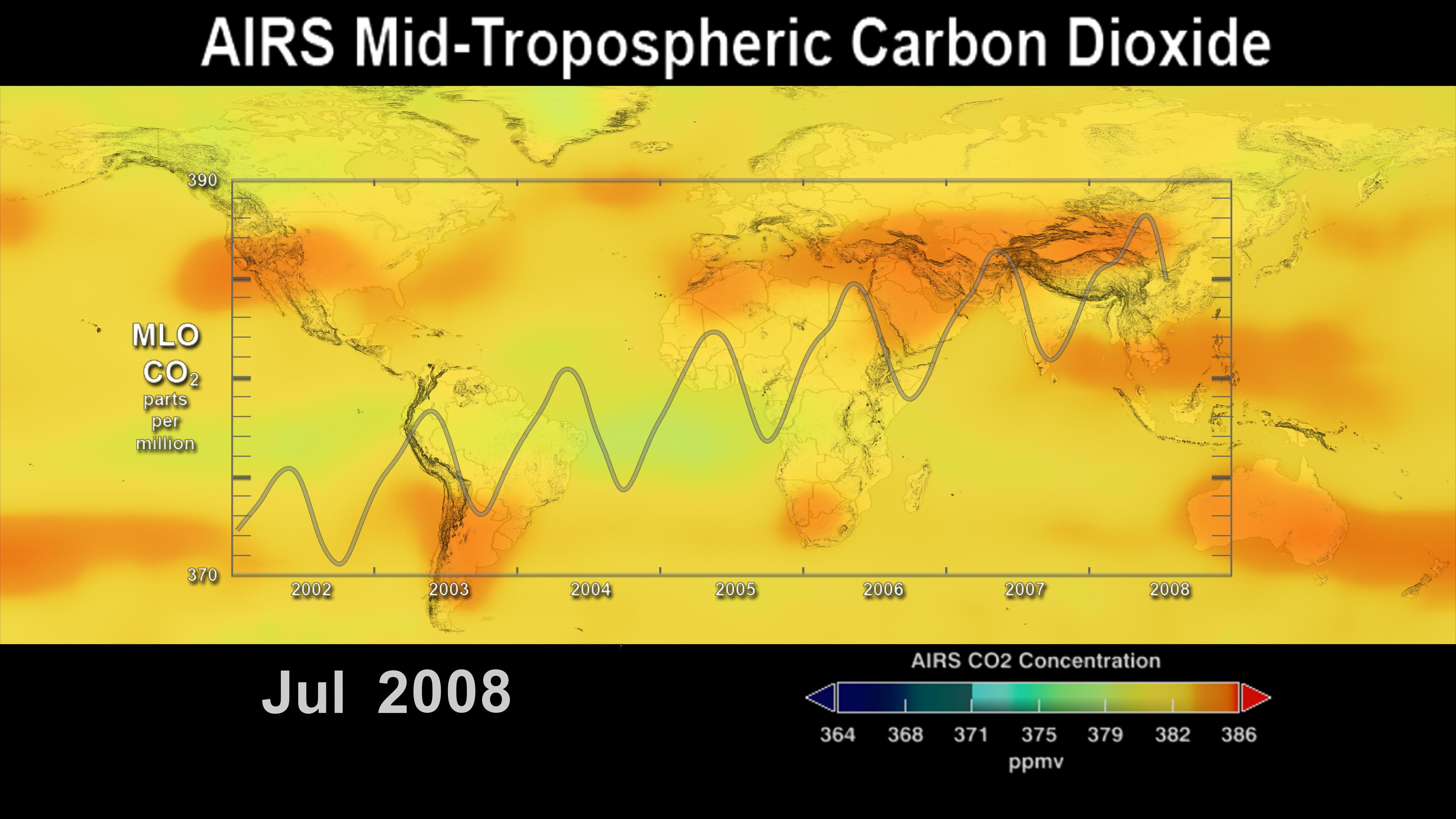
This image shows the distribution and amount of carbon dioxide in Earth's
mid-troposphere in July 2008 as measured by NASA's Atmospheric Infrared
Sounder (AIRS) instrument. The overlying graph is the seasonal variation
and interannual increase of atmospheric carbon dioxide recorded at the
Mauna Loa Observatory in Hawaii.
The AIRS data reveal the average concentration (parts per million) over an
altitude range of 3-13 kilometers (1.8 to 8 miles), whereas the Mauna Loa
data show the concentration of carbon dioxide at an altitude of 3.4
kilometers (2.1 miles) and its annual increase at a rate of approximately
2 parts per million (ppmv) per year.
This image is the final frame of a visualization showing the time-series
of AIRS's measurements of mid-tropospheric carbon dioxide from 2002 to
2008. The 30-second visualization is available at http://airs.jpl.nasa.gov/story_archive/CO2_Increase_Sep2002-Jul2008/ and
http://svs.gsfc.nasa.gov/vis/a000000/a003500/a003562/index.html.
The Atmospheric Infrared Sounder (AIRS) in conjunction with the Advanced
Microwave Sounding Unit (AMSU) sense emitted infrared and microwave
radiation from the Earth to provide a three-dimensional look at Earth's
weather and climate. Working in tandem, the two instruments can make
simultaneous observations all the way down to the Earth's surface, even
in the presence of heavy clouds. With more than 2,000 channels sensing
different regions of the atmosphere, the system creates a global, 3-D map
of atmospheric temperature and humidity, cloud amounts and heights,
greenhouse gas concentrations, and many other atmospheric phenomena.
The AIRS and AMSU fly onboard NASA's Aqua spacecraft and are managed
by the Jet Propulsion Laboratory, Pasadena, California, under contract to NASA.
JPL is a division of the California Institute of Technology in Pasadena.
The AIRS Public Web site can be found at http://airs.jpl.nasa.gov.


