|
National Land Cover Dataset 2001(NLCD)
Contents:
|
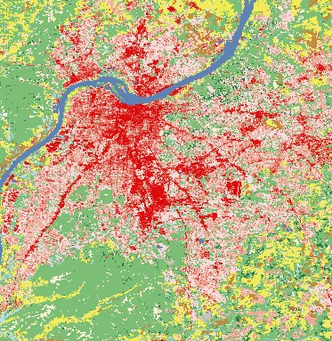
 NLCD 2001 subset image
(Louisville,KY) |
Description
The USGS National Land Cover Characterization 2001 project is compiled of land
cover data (NLCD 2001) across all 50 states and Puerto Rico using
Landsat 5 and 7 data. NLCD 2001 is a cooperative effort involving several
Federal agencies: USGS, EPA, USFS, and NOAA. The key component of this
land-cover mapping effort is a database approach, which provides flexibility
in developing and applying suites of independent data layers. These independent
standardized data layers or themes, will be useful not only within the
land-cover classification but as data components for other applications.
Three derivative layers including, imperviousness, canopy, and land cover were
classified from the database and are products offered. To view
availability on The National Map Seamless Server, got to the interactive map, open Layer Extent from the Display list.
Check one of the NLCD 2001 indexes.
Back To Top
Specifications
|
National Land Cover Data (NLCD) 2001
|
| Resolution
|
1 arc-second
(approx. 30m)
- Conterminous U.S. |
| Projection |
Albers Equal Area Conic |
| Horizontal Datum |
NAD83 |
Back To Top
Format Information
ArcGrid is an Arc/Info
proprietary format. Some other software packages can read the ArcGrid format.
Customers who specify ArcGrid will be delivered a workspace. The workspace is
not tarred or gzipped.
BIL is a non-proprietary
format made by running the GRIDIMAGE command in Arc. The data is a simple binary
raster format (signed integer data). There is an accompanying ASCII header file
that provides file size information (number of rows and columns). The data are
stored in row major order (all the data for row 1, followed by all the data for
row 2, etc.).
TIFF with world file for NLCD is a non-proprietary format.
It is essentially a floating-point binary data file with accompanying ASCII descriptor
files including a world file containing geographic extents for the file.
Back To Top
Download Information
National Landcover Characterization
Dataset (NLCD) 2001 |
| Delivery
Options |
Cost |
Format |
Availability |
|
Free Download in 250 MB increments |
No
Charge |
ArcGrid
, Bil*,
TIFF
with world file |
Conterminous
US
|
* Bil is a binary integer point format
Back To Top
|