|
|
|
Metadata
|
|
ID
|
L-4-75-BS
|
|
Also Known As
|
BERS-75-XA
|
|
Abstract
|
Chief Scientists: Alan Cooper, Mike Marlow. Geophysical
data (uniboom, sonobuoy, gravity, magnetics, 3dot5khz,
gradiometer, integratednavigation, minisparker, 24channel,
airgun, airgunarcer, Burgairgun, Burgsparker, sparker) of
field activity L-4-75-BS in Bering Sea, Aleutian Basin,
Alaska from 09/07/1975 to 09/18/1975
|
|
Chief Scientist
|
Alan Cooper
Mike Marlow
|
|
Activity Type
|
Geophysical
|
|
Platform
|
Samuel Phillips Lee
|
|
Area of Operation
|
Bering Sea, Aleutian Basin, Alaska
|
|
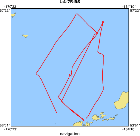
Location map
|

|
|
Bounding Coordinates
|
57.21860
-169.05780 -165.50410
54.02090
|
|
Ports
|
leave Dutch Harbor, AK
arrive Dutch Harbor, AK
leave Dutch Harbor, AK
arrive Dutch Harbor, AK
leave Dutch Harbor, AK
arrive Dutch Harbor, AK
|
|
Dates
|
09/07/1975 (JD 250) to 09/18/1975 (JD 261)
|
|
Analog Materials
|
list
|
|
Index map
|
|
|
Crew
|
|
Alan Cooper
|
Chief Scientist
|
|
Andy Montez
|
Electronics Technician
|
|
Andy Stevenson
|
Geophysicist
|
|
Ann McKinney
|
Dafe Curator
|
|
Byron Ruppel
|
Geophysicist
|
|
Dave Scholl
|
Geophysicist
|
|
Don Tompkins
|
Geophysicist
|
|
Gary Boucher
|
Geophysicist
|
|
Graig McHendrie
|
Geophysicist
|
|
Jack Lee
|
Electronics Technician
|
|
Jim Nicholson
|
Electronics Technician
|
|
Joe Edwards
|
Mechanical Technician
|
|
John Howell
|
Geophysicist
|
|
Jon Erickson
|
Mechanical Technician
|
|
Mike Marlow
|
Chief Scientist
|
|
Pamela Smith
|
Dafe Curator
|
|
Ronnie Montgomery
|
Electronics Technician
|
|
Terry Kelley
|
Electronics Technician
|
|
|
Equipment Used
|
|
uniboom
|
|
sonobuoy
|
|
gravity
|
|
magnetics
|
|
3dot5khz
|
|
gradiometer
|
|
integratednavigation
|
|
minisparker
|
|
24channel
|
|
airgun
|
|
airgunarcer
|
|
Burgairgun
|
|
Burgsparker
|
|
sparker
|
|
|
NGDC Overview
|
|
! Converted to time format with year at start.
|
|
!
|
|
DATA COLLECTION OVERVIEW (use NGDC GEODAS CD to retrieve data)
|
|
|
|
MCG Data Collection ID --- L475BS
|
|
Institution Data Collection ID --- L475BS
|
|
NGDC ID --- 06050002
|
|
Funding --- (unspecified)
|
|
Project, Cruise & Leg --- BERS75XA SOUTH EAST BERING SEA
|
|
Study region --- +58.00000,+54.00000,-170.00000,-165.00000
|
|
Chief Scientist(s) --- MIKE MARLOW, ALAN COOPER
|
|
Name of vessel --- Lee (surface ship)
|
|
Date field data collection started --- 09/06/75 DUTCH HARBOR, ALASKA
|
|
Date field data collection ended --- 09/24/75 DUTCH HARBOR, ALASKA
|
|
Parameters surveyed ---
|
|
Bathymetry: surveyed, contained in data file
|
|
Magnetics: surveyed, contained in data file
|
|
Gravity: surveyed, contained in data file
|
|
High-resolution seismics: (unspecified)
|
|
Deep penetration seismics: surveyed, contained in data file
|
|
Format --- (I1,A8,F5.2,4I2,F5.3,F8.5,F9.5,I1,F6.4,F6.1,I2,i1,3F6.1,I1,F5.1,F6.0,F7.1,F6.1,F5.1,A8,4I1)
|
|
Date of data input to NGDC --- 03/03/87
|
|
Contributing institution --- USGS Branch of Pacific Marine Geology
|
|
Country --- United States
|
|
|
|
Navigation instrumentation --- (unspecified)
|
|
Position determination method --- (unspecified)
|
|
|
|
Bathymetry instrumentation --- (unspecified)
|
|
Additional forms of bathymetric data --- (unspecified)
|
|
General rate of bathymetry in file --- 1.9 minutes
|
|
General collection rate of bathymetry --- (unspecified)
|
|
Assumed sound velocity --- (unspecified)
|
|
Bathymetric datum code --- No correction applied (sea level)
|
|
Bathmetry interpolation scheme --- (unspecified)
|
|
|
|
Magnetics instrumentation --- (unspecified)
|
|
Additional forms of magnetics data --- (unspecified)
|
|
General rate of magnetics in file --- 1.7 minutes
|
|
General collection rate of magnetics --- (unspecified)
|
|
Magnetic sensor tow distance --- (unspecified)
|
|
Magnetic sensor depth --- (unspecified)
|
|
Two sensor horizontal separation --- (unspecified)
|
|
Residual magnetics reference field --- (unspecified)
|
|
Method of applying residual field --- (unspecified)
|
|
|
|
Gravity instrumentation --- (unspecified)
|
|
Additional forms of gravity data --- (unspecified)
|
|
General rate of gravity in file --- 1.9 minutes
|
|
General collection rate of gravity --- (unspecified)
|
|
Theoretical gravity formula --- (unspecified)
|
|
Reference system --- (unspecified)
|
|
Corrections applied --- (unspecified)
|
|
Starting land tie --- (unspecified)
|
|
Ending land tie --- (unspecified)
|
|
|
|
Seismic instrumentation --- (unspecified)
|
|
Formats of seismic data --- SEE ADD. DOC.
|
|
|
|
Notes ---
|
|
CDP SECTIONS,24 FOLD SUMMATION SEPIA OR BLACKLINE 3 IN/SEC AND 20 TR/IN
|
|
SHOT POINTS ON MAG TAPE
|
|
|
Publications
|
|
Marlow, M.S., Cooper, A.K., Scholl, David W., and Alpha, Tau Rho, 1976, Twenty-four channel
|
|
seismic reflection data acquired on the R/V S. P. Lee in the Bering Sea, September 1975, and
|
|
structure contours of acoustic basement beneath the southern Bering Sea Shelf: U.S. Geological
|
Survey Open-File Report 76-0652, 3 p.
|
|
|
Got Help?
|
For L-4-75-BS, we would appreciate any information on -- contract, days at sea, dive count, funding, information specialist, information to be derived, kms of navigation, national plan, notes, organization, owner, project, project number, purpose, scanned materials, seismic description, station count, station description, submersible, summary, tabulated info.
|
|