

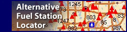

Alternative Fueling Station Route Mapper

The Route Mapper displays public and private fueling stations that have been independently verified by the Alternative Fuels and Advanced Vehicles Data Center (AFDC). Some stations in the database have addresses that couldn't be located by the mapping application; this may result in a station appearing in the wrong location. We recommend that you call any station you plan to visit to verify its location, hours of operation, and type of access.
The Route Mapper allows users to map a route between a specific start and end point. It creates a map showing alternative fueling stations along the route and provides driving directions with four options for displaying and printing the information. Users can add certain refueling stations as stops along the route.
The Route Mapper is dynamically generated. If you are using a specialized screen reader and having difficulty understanding the page content, contact the AFDC Webmaster who can assist you with a verbal or written description.
![]()