|
|||||
| Ground-water conditions in southern Florida |
|
|||||
| Ground-water conditions in southern Florida |
This report has been reformatted for presentation on the World Wide Web. The official text of WRIR 01-4275 (6.3 MB download) is available in PDF format. The Adobe PDF Reader program is available, at no cost, from Adobe.
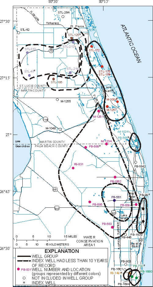
Figure 25. Network coverage defined by R2 analysis using index wells in the surficial aquifer system. Wells STL-125, STL-41, and PB-689 have less than 10 years of data and normally would not be considered as potential index wells. However, few ground-water monitoring wells in these areas have additional data.
Return to Table of Contents
Return to Discussion of Surficial Aquifer Well Coverage
Figure 24.-- Map showing network coverage defined by R2 analysis using index wells in the mid-Hawthorn aquifer (81K)
Figure 26.-- Graph showing comparison between water-level data from well STL-175 and estimation of water levels using data from well M-1004 (30K)
Funding for the USGS to design and maintain this site has been provided through a cooperative agreement with the South Florida Water Management District (SFWMD). Water-level conditions are monitored by the USGS with support from Federal, State, and local cooperators.
| Real-time conditions (de-trended data) |
End-of-month conditions (de-trended data) |
FISC-WRS, home page |
| Accessibility FOIA Privacy Policies and Notices | |
Page Last Modified: Thursday, 27-May-2004 16:03:21 EDT |
|