
USGS/Cascades Volcano Observatory, Vancouver, Washington
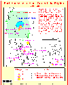
Crater Lake, Oregon
Maps and Graphics, etc.
-
 [Interactive Imagemap]
Cascade Range Volcanoes
-- Graphic by: Lyn Topinka, 1996
-
 [Map,20K,InlineGIF]
Major West Coast Volcanoes - Washington, Oregon, and California
-
 [Map,27K,InlineGIF]
Potentially Active Volcanoes of the Western United States
-- Modified from: Brantley, 1994, Volcanoes of the United States:
USGS General Interest Publication
-
 [Graphic,70K,InlineGIF]
Cascades Eruptions During the Past 4000 Years
-
 [Map,21K,InlineGIF]
Central Oregon High Cascades
-- Modified from: Scott and Gardner, 1990
-
 [Map,23K,InlineGIF]
Southern Oregon Cascades
-- Modified from: Hoblitt, et.al., 1987, USGS Open-File Report 87-297
-
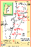
 [Map,14K,InlineGIF]
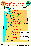
Location Map: Crater Lake National Park
-- Modified from: U.S. National Park Service
-
 [Map,380K,GIF]
Topo Map - Crater Lake National Park
-- Map modified from: U.S. National Park Service Map, original scan obtained from:
University of Texas at Austin,
Perry-Castaneda Library Map Collection
-- to DOWNLOAD BIGGER IMAGE:
[Map,925K,JPG]
-
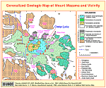 [Map,38K,InlineGIF]
Generalized Geologic Map of Mount Mazama and Vicinity
-- Modified from: Bacon, et.al., 1997,
USGS Open-File Report 97-487
-
 [Map,25K,InlineGIF]
Geologic Map of Crater Lake Caldera Floor
-- Modified from: Bacon, et.al., 1997,
USGS Open-File Report 97-487
-
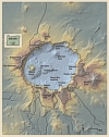 [Map,112K,InlinedJPG]
Annotated Relief Map, Crater Lake
-- From: Kilimasauskas, et.al., 2002,
USGS Fact Sheet 092-02
-
 [Map,29K,InlineGIF]
Earthquake Epicenters and Magnitudes in the Crater Lake Region,
1920-1995
-- Modified from: Bacon, et.al., 1997,
USGS Open-File Report 97-487
-
 [Map,40K,InlineGIF]
University of Washington's Pacific Northwest Seismic Network
-- Modified from: University of Washington Geophysics Program, 1998,
includes seismic station location map and link to PNSN
-
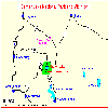
 [Map,30K,InlineGIF]
Oregon and Southern Washington -
University of Washington's Pacific Northwest Seismograph Network
-- Modified from: University of Washington Geophysics Program, 1999,
includes seismic station location map and link to PNSN
-
 [Graphic,25K,InlineGIF]
Crater Lake Seismicity, 1997-2007
-- Modified from: University of Washington Geophysics Program
-
[Graphic,70K,InlineGIF]
Cascades Eruptions During the Past 4000 Years
-
 [Graphic,18K,InlineGIF]
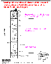
Plot of thickness vs. distance from vent for several tephras from
Cascade Range volcanoes.
-- Modified from:
Hoblitt, et.al., 1987, USGS Open-File Report 87-297
-
 [Graphic,12K,GIF]
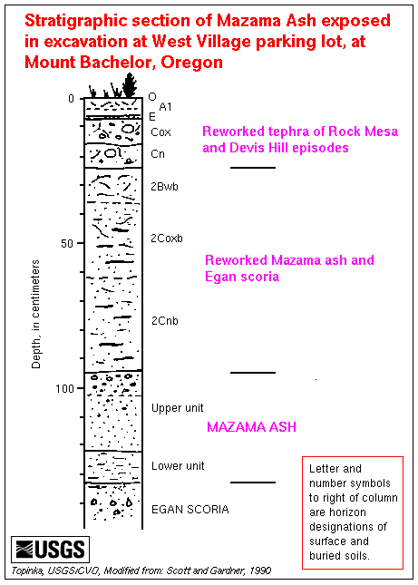
Stratigraphic section of Mazama ash
exposed in excavation at West Village parking lot,
at Mount Bachelor.
Letter and number symbols to right of column are horizon
designations of surface and buried soils.
-- Modified from: Scott and Gardner, 1990
Return to:
[Crater Lake Menu] ...
[Crater Lake Eruptive History Menu] ...
[MORE Cascade Range Maps and Graphics]
[MORE Oregon Maps and Graphics]

Use of CVO Material and Copyright Information
URL for CVO HomePage is:
<http://vulcan.wr.usgs.gov/home.html>
URL for this page is:
<http://vulcan.wr.usgs.gov/Volcanoes/CraterLake/Graphics/framework.html>
If you have questions or comments please contact:
<GS-CVO-WEB@usgs.gov>
09/02/08, Lyn Topinka
 [Graphic,12K,GIF]