|
||||||
|
|
|||||||
|
||||||||
|
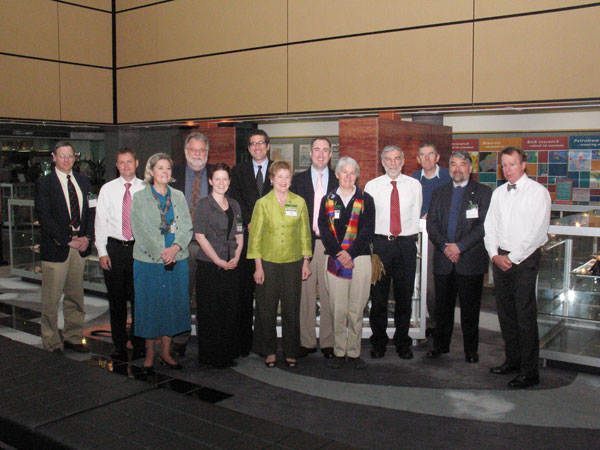
USGS is Part of Law of the Sea Delegation Visiting Australia
U.S. Geological Survey (USGS) scientists Jon Childs and Debbie Hutchinson were part of a U.S. delegation that visited Geoscience Australia—the country's national agency for geoscience research and geospatial information—in Canberra on April 28-30, 2008. The purpose of their visit was to talk with the principal members of the Australian Extended Continental Shelf Group about the lessons they learned as they defined their extended-continental-shelf boundaries, how they organized the 10-year effort to define their boundaries, and whether they had any recommendations for the United States in using Article 76 of the United Nations Convention on the Law of the Sea (the Convention) to define our extended continental shelf. Although most geologists think of the continental shelf as those shallow-water parts of the continental margin covered by less than about 200 m of water, the legal continental shelf can extend across the entire morphologic continental margin. In the Convention, every coastal nation has a right to a legal continental shelf that goes either to 200 nautical miles from the shore or to a shared maritime boundary with another nation. The Convention also allows for an extended continental shelf beyond 200 nautical miles if a nation can show that it meets the conditions set forth in Article 76. Within the extended continental shelf, a nation has exclusive sovereign rights over natural resources, as well as exclusive control of marine research, on the sea floor and sub-sea floor. The United States is just at the beginning stages of defining its extended continental shelf beyond 200 nautical miles. In contrast, Australia in late April received recommendations from the Commission on the Limits of the Continental Shelf on the positions of its final boundaries and is therefore nearly done with its delimitation process. The visit by the Law of the Sea delegation was not planned to coincide with the final recommendations; however, this coincidence allowed the U.S. delegation to talk with the Australians about strategies that proved to be successful. One of the most important outcomes was that geology and seismic-reflection data played a prominent role in every step of the delimitation process. Other members of the delegation included Margaret Hayes, Brian Van Pay, Mark Simonoff, Larry Mayer, and Barbara Moore from the U.S. Department of State and Christopher Fox and Heather Allen from the National Oceanic and Atmospheric Administration.
|
in this issue:
Palos Verdes Shelf Experiment: Whatever Can Go Wrong Submarine Landslides and Large Earthquakes
USGS Part of Law of the Sea Delegation Carolinas Coastal Change Processes Project
|
||||||||||||||||||||||||