|
|
 |
Hurricane Jeanne
Before and After Photo Sets
 |
| Index map showing locations of pre- and post-storm photo sets. |
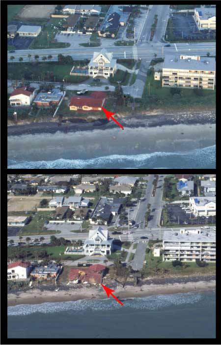 |
Undermined House, Satellite Beach, FL:
Satellite Beach, FL (upper photo: post-Hurricane Frances, 9/8/04; bottom: post-Hurricane Jeanne, 9/29/04): The dune line eroded landward and undermined the house with the red roof. (U.S. Geological Survey photos.) [larger version] |
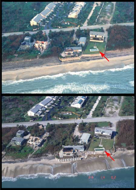 |
Dune erosion and seawall failure, Melbourne Shores, FL:
Melbourne Shores, FL (upper photo: post-Frances, 9/8/04; bottom: post-Jeanne, 9/29/04): The seawall on the right survived Hurricane Frances, but failed during Jeanne. Note the extreme dune erosion where the front face of the dune retreated landward to the pool. (U.S. Geological Survey photos.) [larger version] |
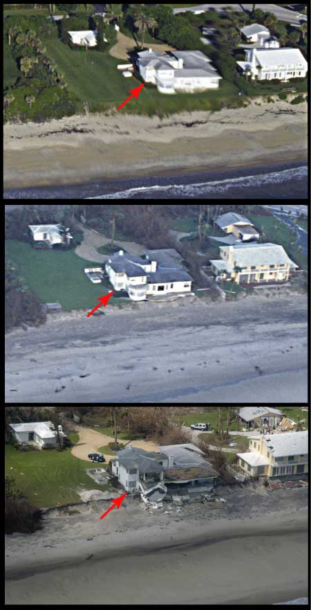 |
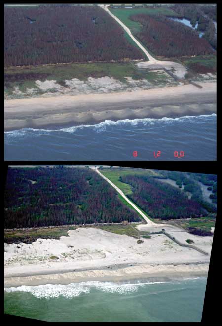
Dune eroded and house undermined, Vero Beach, FL:
Vero Beach, FL (upper photo: 8/12/97; middle: post-Frances, 9/8/04; bottom: post-Jeanne, 9/29/04): At the time of the first photo, the seaward face of the dune was vegetated. After Hurricane Frances, the dune had retreated to the edge of the house. During Jeanne, the dune eroded farther and undermined the house. (U.S. Geological Survey photos.). [larger version] |
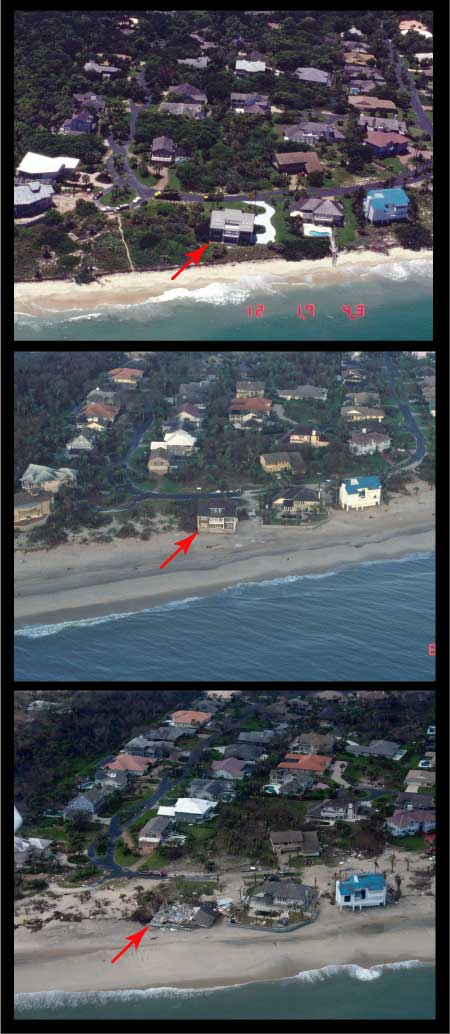 |
Dune retreat and house undermined, Floralton Beach, FL:
Floralton Beach, FL (upper photo: 8/12/97; middle: post-Frances, 9/8/04; bottom: post-Jeanne, 9/29/04): Note the persistent retreat of the dune line landward, ultimately undermining the house in the middle of the images. (U.S. Geological Survey photos.) [larger version] |
 |
Overwash, North Hutchinson Island, FL:
North Hutchinson Island, FL (upper photo: post-Frances, 9/8/04; bottom: post-Jeanne, 9/29/04): Classic overwash deposit where the waves overtopped the dune and sand was driven landward of the beach. (U.S. Geological Survey photos.) [larger version] |
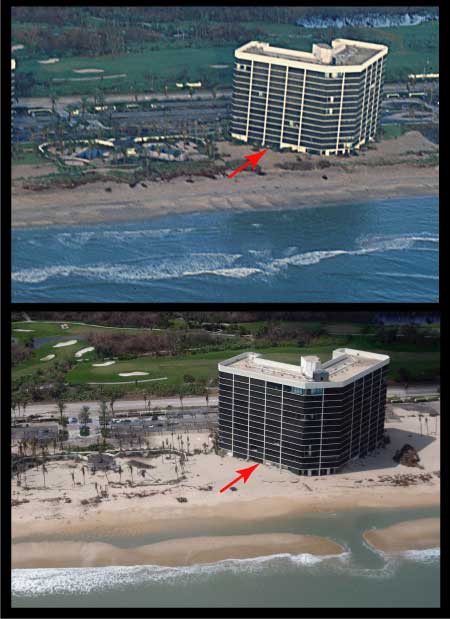 |
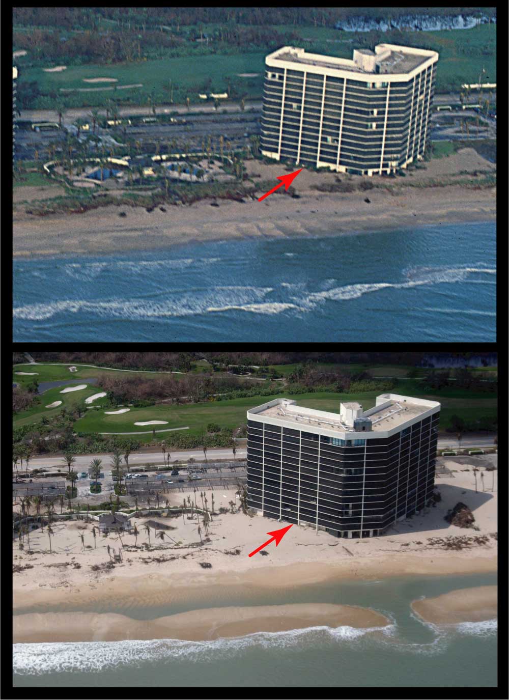
Overwash, Hutchinson Island, FL:
Hutchinson Island, FL (upper photo: post-Frances, 9/8/04; bottom: post-Jeanne, 9/29/04): This area had some overwash during Hurricane Frances, but far more during Jeanne. Note the two swimming pools that are filled with sand after Jeanne. Also note the sand level burying part of the first floor of the condominium tower. (U.S. Geological Survey photos.) [larger version] |
|