|
 |
American Samoa · Guam · Puerto Rico/Virgin Islands |
 |
 |
|
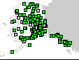
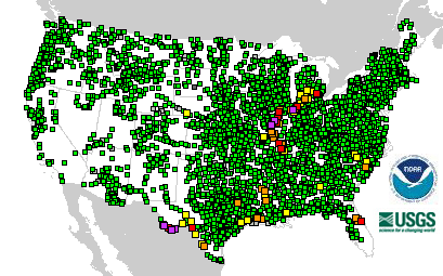
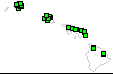
4056 Total Gauges
|
 9 Gauges: Major Flooding 9 Gauges: Major Flooding
|
|
112 Locations in Flood |
 36 Gauges: Moderate Flooding 36 Gauges: Moderate Flooding
|
|
|
 67 Gauges: Minor Flooding 67 Gauges: Minor Flooding
|
 254 Gauges: Observations older than 24 hours 254 Gauges: Observations older than 24 hours
|
 52 Gauges: Near Flood Stage 52 Gauges: Near Flood Stage
|
 12 Gauges: Out of Service 12 Gauges: Out of Service
|
 3626 Gauges: No Flooding 3626 Gauges: No Flooding
|
Last map update: Wed, Sep, 17, 2008 at 10:52:54 am EDT.
|
|

