![[USGS Banner]](https://webarchive.library.unt.edu/eot2008/20081107061837im_/http://astrogeology.usgs.gov/Teams/Geomatics/assets/banners/gif/banner_1.gif)
|
|
|
|
|
|
|
|
|
|
|
|
|||||||||
| |||||||||
|
|
|
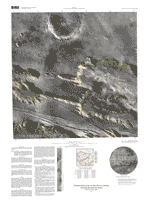
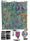
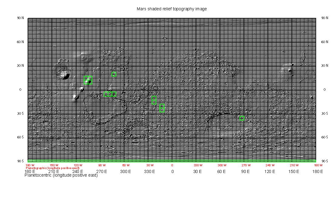
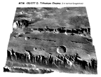
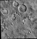
MTM -05/277E
Tithonium Chasma |
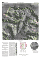
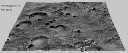
MTM -05/282E
west Candor Chasma |
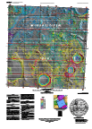
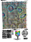
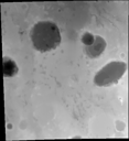
MTM -05/287E
Ophir and central Candor Chasmata |
|
|
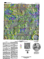
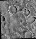
MTM -10/337 E
Margaritifer Chaos |
MTM -15/337 E
northwest Loire Valles |
MTM -20/347 E
southeast Loire Valles |
MTM -25/347 E
Parana Valles |
|
MTM 10/252 E
southwest Ascraeus Mons |
MTM 10/257 E
southeast Ascraeus Mons |
MTM 15/252 E
northwest Ascraeus Mons |
MTM 15/257 E
northeast Ascraeus Mons |
|
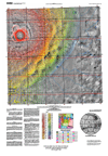
MTM -90/000 E
Mars south pole |
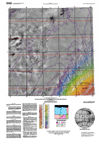
MTM -35/087 E
Dao and Niger Valles |
MTM 20/287 E
Lunae Planum |
This material is based upon work supported by the National Aeronautics and Space Administration under Contract No. W 10,185 issued through the Office of Space Science.
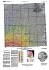
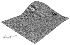
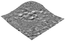
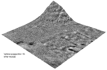
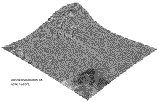
Shaded relief topography image based on MOLA data
Generated with IMap v1: Mon Aug 04 17:10:58 2003
This material is based upon work supported by the National Aeronautics and Space Administration under Contract No. W 10,185 issued through the Office of Space Science.
| Status | Description |
| Draft | Inital data with minimum edits and no review of data. |
| Review | Data has been edited based on comments received from review. |
| Final | Final review and edits made to data. Note: Final map sheets are available on the Western Region Geopubs web site. When available a link will be provided to the site with Final map sheets. Digital elevation models and digital images are stored on a FTP server maintained by Astrogeology Team, Flagstaff AZ. |
NOTE: This web page and thumbnail images are served from the Astrogeology web server. Digital data and maps that are in Draft or Review Status are available through ftp on the Webgis server. Final map psheets are available on the Western Geopubs server. Links are provided from this page to the appropriate server for the digital data or map product.
Files can be downloaded from ftp://ftpflag.wr.usgs.gov/dist/pigpen/mars/usgs/topo/MTM/mtm-05277e.
See the README file (Microsoft Word Document , Adobe Acrobat PDF File , or Text File) for a description of the files.
|
Map
Review |
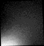
Digital Elevation Model
Final |
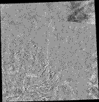
Ortho Image

Final |
3-D Perspective Scene
Final |
Files can be downloaded from ftp://ftpflag.wr.usgs.gov/dist/pigpen/mars/usgs/topo/MTM/mtm-05282e.
See the README file (Microsoft Word Document , Adobe Acrobat PDF File , or Text File) for a description of the files.
|
Map
Review |
Digital Elevation Model
Final |
Ortho Image
Final |
3-D Perspective Scene

Final |
Files can be downloaded from ftp://ftpflag.wr.usgs.gov/dist/pigpen/mars/usgs/topo/MTM/mtm-05287e.
See the README file (Microsoft Word Document , Adobe Acrobat PDF File , or Text File) for a description of the files.
|
Map
Review |
Digital Elevation Model
Final |
Ortho Image
Final |
3-D Perspective Scene

Final |
Files can be downloaded from ftp://ftpflag.wr.usgs.gov/dist/pigpen/mars/usgs/topo/MTM/mtm-10337e.
See the README file (Microsoft Word Document , Adobe Acrobat PDF File , or Text File) for a description of the files. These files have not been updated to planetocentric projection, they are being edited and will be updated in the near future.
|
Map
Review |
Digital Elevation Model
Final |
Ortho Image
Final |
3-D Perspective Scene

Final |
Files can be downloaded from ftp://ftpflag.wr.usgs.gov/dist/pigpen/mars/usgs/topo/MTM/mtm-15337e.
See the README file (Microsoft Word Document , Adobe Acrobat PDF File , or Text File) for a description of the files.
|
Map
Final |
Digital Elevation Model
Final |
Ortho Image
Final |
3-D Perspective Scene

Final |
Files can be downloaded from ftp://ftpflag.wr.usgs.gov/dist/pigpen/mars/usgs/topo/MTM/mtm-20347e.
See the README file (Microsoft Word Document , Adobe Acrobat PDF File , or Text File) for a description of the files.
|
Map
Final |
Digital Elevation Model

Final |
Ortho Image
Final |
3-D Perspective Scene
Final |
Files can be downloaded from ftp://ftpflag.wr.usgs.gov/dist/pigpen/mars/usgs/topo/MTM/mtm-25347e.
See the README file (Microsoft Word Document , Adobe Acrobat PDF File , or Text File) for a description of the files.
|
Map
Final |
Digital Elevation Model
Final |
Ortho Image
Final |
3-D Perspective Scene

Final |
Files can be downloaded from ftp://ftpflag.wr.usgs.gov/dist/pigpen/mars/usgs/topo/MTM/mtm10252e.
See the README file (Microsoft Word Document, Adobe Acrobat PDF File , or Text File) for a description of the files.
|
Map
Review |
Digital Elevation Model

Final |
Ortho Image

Final |
3-D Perspective Scene
Final |
Files can be downloaded from ftp://ftpflag.wr.usgs.gov/dist/pigpen/mars/usgs/topo/MTM/mtm10257e.
See the README file (Microsoft Word Document , Adobe Acrobat PDF File , or Text File) for a description of the files.
|
Map
Review |
Digital Elevation Model
Final |
Ortho Image

Final |
3-D Perspective Scene
Final |
Files can be downloaded from ftp://ftpflag.wr.usgs.gov/dist/pigpen/mars/usgs/topo/MTM/mtm15252e.
See the README file (Microsoft Word Document , Adobe Acrobat PDF File , or Text File) for a description of the files.
|
Map
Review |
Digital Elevation Model

Final |
Ortho Image

Final |
3-D Perspective Scene
Final |
Files can be downloaded from ftp://ftpflag.wr.usgs.gov/dist/pigpen/mars/usgs/topo/MTM/mtm15257e.
See the README file (Microsoft Word Document , Adobe Acrobat PDF File , or Text File) for a description of the files.
|
Map
Review |
Digital Elevation Model
Final |
Ortho Image
Final |
3-D Perspective Scene
Final |