|
|
|
Metadata
|
|
ID
|
Z-2-07-MB
|
|
Abstract
|
Monterey Bay Aquarium Research Institute,Stanford
University,United States Geological Survey, Menlo Park,
California,Chevron Research. Chief Scientist: Dave Caress,
MBARI. Chirp and Multibeam Sonar data of field activity
Z-2-07-MB in Little Lucia Canyon and lobe area from
05/09/2007 to 05/11/2007
|
|
Organization
|
Monterey Bay Aquarium Research Institute
Stanford University
United States Geological Survey, Menlo Park, California
Chevron Research
|
|
Project/Theme
|
Continental Margin and Submarine Canyon Processes
|
|
Chief Scientist
|
Dave Caress
|
|
Activity Type
|
Chirp and Multibeam Sonar
|
|
Platform
|
Zephyr
|
|
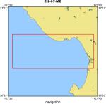
Area of Operation
|
Little Lucia Canyon and lobe area
|
|
Location map
|
|
|
Bounding Coordinates
|
37.00000
-122.50000 -121.75000
36.75000
|
|
Ports
|
LEAVE Moss Landing, CA
ARRIVE Moss Landing, CA
|
|
Dates
|
05/09/2007 (JD 129) to 05/11/2007 (JD 131)
|
|
Analog Materials
|
No analog holdings.
|
|
Index map

|
|
|
Information Specialist
|
|
|
Crew
|
|
David Caress
|
Chief Scientist, MBARI
|
|
Hans Thomas
|
AUV operations supervisor, MBARI
|
|
Doug Conlin
|
AUV technician, MBARI
|
|
Aaron Gregg
|
Zephyr crew (Master), MBARI
|
|
Matthew Noyes
|
Zephyr crew (Engineer), MBARI
|
|
Paul Ban
|
Zephyr crew (Mate), MBARI
|
|
Perry Shoemake
|
Zephyr crew (Mate), MBARI
|
|
|
Purpose
|
|
Three AUV dives were planned in the Little
|
|
Lucia channel system, located offshore between Point Sur, CA and the offshore
|
|
Santa Monica Basin. The primary target was the transition from highly
|
|
channelized to unconfined sedimentation features. The areas mapped are in
|
|
water depths of 975 to 1050 m. The primary objective of these dives was to
|
|
obtain multibeam bathymetry data and subbottom profiles. Processing and
|
|
analysis of this data will be used to study the sedimentary architecture of
|
|
the area. Approximately 1.5 m vibracores were taken using the MBARI ROV
|
|
Tiburon during cruise W-1-06-MB.
|
|
|
Information to be Derived
|
|
Very high-resolution bathymetry and subbottom
|
|
structure of the Little Lucia channel and lobe system. Bathymetric maps will
|
|
be produced at a one-meter contour interval.
|
|
|
Summary
|
|
1630/JD129 R/V Zephyr departs Moss Landing.
|
|
|
2257/JD129 Begin first successful AUV dive over Little Lucia
|
|
|
0824/JD130 Complete first successful AUV Dive over Little Lucia
|
|
|
~0600/JD131 R/V Zephyr arrives in Moss Landing
|
|
|
A total of 2 AUV dives were completed. The first dive aborted early and caused
|
|
the mission to be split in two dives. The navigation offset within this first
|
|
dive mission will be corrected after editing the bathymetry data. The data
|
|
collected will be used for interpretation of turbidite depositional processes
|
|
in a low-relief continental slope basin. A second dive covered the last third
|
|
of the survey area and successfully collected multibeam bathymetry and subbottom data.
|
|
|
The AUVs starting position is determined by GPS at the launch site. The
|
|
vehicle then dives in a USBL-nav-aided spiral to 50 meters above the
|
|
seafloor. The total survey trackline was ~70 km with 150 m line spacing.
|
|
The AUV can survey with the multibeam sounding system and chirp sonar less
|
|
than 9 hours; it then returns to the sea surface to be picked by the R/V
|
|
Zephyr.
|
|
This cruise completed the Little Lucia mission, which began with dives on March 13-14 (Z-1-07-MB).
|
|
|
Notes
|
|
MLuciaMAUV2v4 Acoustic modem did not initialize; mission restarted at 2257Z
|
|
(-121.805038, 35.728336)
|
|
|
A timeout abort caused the mission to be split in two missions. Significant navigation offset to be corrected after multibeam
|
|
editing. (-121.788876, 35.762259)1020 (max)
|
|
|
AUVLuciaMAUV3v5 130 14 28 Acoustic modem failed to initialize; mission restarted 2 min. later.
|
|
(-121.804907, 35.745675) 130 23 14 Successful recovery.
|
|
Great weather.
|
|
(-121.810435, 35.756731) 1020 (max)
|
|
|
Got Help?
|
For Z-2-07-MB, we would appreciate any information on -- analog materials, contract, days at sea, dive count, equipment used, funding, kms of navigation, national plan, NGDC Info, owner, project number, publications, scanned materials, seismic description, station count, station description, submersible, tabulated info.
|
|