|
|
|
Metadata
|
|
ID
|
T-OH-08-JP
|
|
Abstract
|
United States Geological Survey, Menlo Park,
California,National Science Foundation. Chief Scientist: Rob
Kayen. Data (GPS, receiver, LiDar) of field activity
T-OH-08-JP in Tohuku, southern Iwate, and Akita prefectures,
Northern Miyagi Prefecture from 06/25/2008 to 06/30/2008
|
|
Organization
|
United States Geological Survey, Menlo Park, California
National Science Foundation
|
|
Chief Scientist
|
Rob Kayen
|
|
Area of Operation
|
Tohuku, southern Iwate, and Akita prefectures, Northern Miyagi Prefecture
|
|
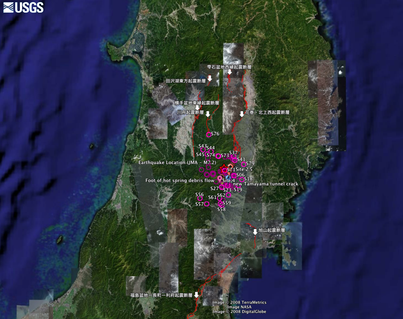
Location map
|

|
|
Bounding Coordinates
|
39.71170
140.51546 141.16723
38.72449
|
|
Dates
|
06/25/2008 (JD 177) to 06/30/2008 (JD 182)
|
|
Analog Materials
|
No analog holdings.
|
|
Index maps

|
|
|
Information Specialist
|
|
|
Crew
|
|
Rob Kayen
|
|
Brady Cox
|
|
Jorgen Johannson
|
|
Yu Zhao
|
|
Hajime Tanaka
|
|
|
Equipment Used
|
|
GPS
|
(Garmin hand-held GPS units)
|
|
receiver
|
(Topcon Hiper+ DGPS base station receiver and rover)
|
|
LiDar
|
(Riegl Z420i LiDAR laser scanner)
|
|
|
Notes
|
|
The Iwate-Miyagi Nairiku Earthquake, 2008 epicenter is at 39.028333,140.88.
|
|
This earthquake occurred in the south of the inland of Iwate Prefecture
|
|
at 8:43 JST on Saturday morning, June 14 (23:43 UTC on June 13).
|
|
The JMA magnitude was estimated at Mj 7.2, and
|
|
the moment magnitude by USGS was at Mw 6.9.
|
|
Data collection used WGS84, ellipsoid heights.
|
|
Data accuracy for LiDAR is 3 to 5 cm.
|
|
Data accuracy for DGPS is less than 1 cm.
|
|
Data accuracy for GPS is 2 to 8 m.
|
|
No post-processing done to data.
|
|
|
Got Help?
|
For T-OH-08-JP, we would appreciate any information on -- activity type, analog materials, contract, days at sea, dive count, funding, information to be derived, kms of navigation, national plan, NGDC Info, owner, platform, ports, project, project number, publications, purpose, scanned materials, seismic description, station count, station description, submersible, summary, tabulated info.
|
|


