|
|
|
Metadata
|
|
ID
|
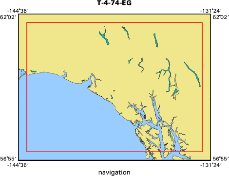
T-4-74-EG
|
|
Also Known As
|
EGAL-74-XA
|
|
Abstract
|
Chief Scientists: Bruce Molnia, Paul Carlson. Data
(navigation) of field activity T-4-74-EG in Northern Gulf of
Alaska from 10/25/1974 to 11/01/1974
|
|
Chief Scientist
|
Bruce Molnia
Paul Carlson
|
|
Platform
|
Thomas G. Thompson
|
|
Area of Operation
|
Northern Gulf of Alaska
|
|
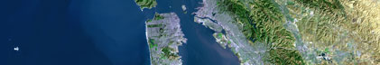
Location map
|

|
|
Bounding Coordinates
|
61.75000
-144.00000 -132.00000
57.25000
|
|
Dates
|
10/25/1974 (JD 298) to 11/01/1974 (JD 305)
|
|
Analog Materials
|
list
|
|
Index map
|
|
|
Crew
|
|
Bruce Molnia
|
Chief Scientist, USGS Western Region
|
|
Paul Carlson
|
Chief Scientist, USGS Western Region
|
|
|
Equipment Used
|
|
|
Publications
|
|
Carlson, Paul R., Bruns, Terry R., Molnia, Bruce F., and Schwab, William C., 1982,
|
|
Submarine valleys in the northeastern Gulf of Alaska; characteristics and probable origin:
|
Marine Geology, v. 47, no. 3-4, p. 217-242.
|
|
|
Carlson, Paul R., and Schwab, William C., 1982, Northern Gulf of Alaska environmental geology,
|
|
in Bruns, T. R., ed., Hydrocarbon resource report for proposed OCS lease sale 88; southeastern
|
|
Alaska, northern Gulf of Alaska, Cook Inlet, and Shelikof Strait, Alaska: U.S. Geological
|
Survey Open-File Report 82-0928, p. 73-86.
|
|
|
Got Help?
|
For T-4-74-EG, we would appreciate any information on -- activity type, contract, days at sea, dive count, funding, information specialist, information to be derived, kms of navigation, national plan, NGDC Info, notes, organization, owner, ports, project, project number, purpose, scanned materials, seismic description, station count, station description, submersible, summary, tabulated info.
|
|