|
|
|
Metadata
|
|
ID
|
S-1-76-SC
|
|
Also Known As
|
EBS1-76-SC
|
|
Abstract
|
Chief Scientist: Jack Vedder. Geological data (bathymetry,
dartcore) of field activity S-1-76-SC in Patton Ridge to
Blake Knolls, Southern California from 09/23/1976 to
10/03/1976
|
|
Project/Theme
|
Southern California Continental Borderland
|
|
Chief Scientist
|
Jack Vedder
|
|
Activity Type
|
Geological
|
|
Platform
|
Ellen B. Scripps
|
|
Area of Operation
|
Patton Ridge to Blake Knolls, Southern California
|
|
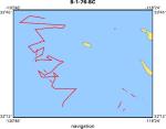
Location map
|
|
|
Bounding Coordinates
|
33.65583
-120.65248 -118.50224
32.29390
|
|
Dates
|
09/23/1976 (JD 267) to 10/03/1976 (JD 277)
|
|
Analog Materials
|
list
|
|
Index map

|
|
|
Crew
|
|
Jack Vedder
|
Chief Scientist, USGS Western Region
|
|
Jim Crouch
|
Geologist, USGS Western Region
|
|
|
Equipment Used
|
|
|
Publications
|
|
Arnal, R.E., and Vedder, J.G., 1976, Late Miocene paleobathymetry of California
|
|
continental borderland north of 32 degrees: American Association of Petroleum
|
|
Geologists Bulletin, v. 60, no. 12, American Association of Petroleum Geologists-
|
Society For Sedimentary Geology-SEG Pacific sections meeting, p. 2174.
|
|
|
Vedder, J.G., Crouch, J.K., Arnal, R.E., Bukry, D., Barron, J.A., and Lee-Wong, F., 1977,
|
|
Description of pre-Quaternary samples, R/V Ellen B. Scripps, September 1976, Patton Ridge
|
|
to Blake Knolls, southern California continental borderland: U.S. Geological Survey Open-File
|
Report 77-0474, 19 p.
|
|
|
Got Help?
|
For S-1-76-SC, we would appreciate any information on -- contract, days at sea, dive count, funding, information specialist, information to be derived, kms of navigation, national plan, NGDC Info, notes, organization, owner, ports, project number, purpose, scanned materials, seismic description, station count, station description, submersible, summary, tabulated info.
|
|