|
|
|
Metadata
|
|
ID
|
S-1-07-KA
|
|
Abstract
|
United States Geological Survey, Pacific Science Center.
Chief Scientist: Mike Field. Data (ADCP, pressuresensor,
opticalbackscattersensor) of field activity S-1-07-KA in
Hanalei Bay, Kauai, Hawaii from 04/20/2007 to 04/24/2007
|
|
Organization
|
United States Geological Survey, Pacific Science Center
|
|
Project/Theme
|
Coral Reef Project
|
|
Chief Scientist
|
Mike Field
|
|
Area of Operation
|
Hanalei Bay, Kauai, Hawaii
|
|
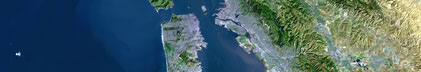
Location map
|

|
|
Bounding Coordinates
|
22.25000
-159.75000 -158.25000
21.75000
|
|
Ports
|
LEAVE Hanalei, HI
ARRIVE Hanalei, HI
|
|
Dates
|
04/20/2007 (JD 110) to 04/24/2007 (JD 114)
|
|
Analog Materials
|
No analog holdings.
|
|
Index map

|
|
|
Information Specialist
|
|
|
Crew
|
|
Curt Storlazzi
|
Oceanographer, Diver, United States Geological Survey, Santa Cruz, CA
|
|
Josh Logan
|
Information Specialist, Geographer, Diver, United States Geological Survey, Santa Cruz, CA
|
|
Ron Hoeke
|
Oceanographer, Diver, National Oceanic and Atmospheric Administration, Coral Reef Ecosystem Division, Honolulu, HI
|
|
|
Equipment Used
|
|
ADCP
|
|
pressuresensor
|
|
opticalbackscattersensor
|
|
|
Purpose
|
|
Determine nearshore oceanographic conditions in Hanalei Bay
|
|
|
Information to be Derived
|
|
Oceanographic conditions in Hanalei Bay.
|
|
Current speed and direction, wave size and direction, turbidity.
|
|
|
Notes
|
|
|
Got Help?
|
For S-1-07-KA, we would appreciate any information on -- activity type, analog materials, contract, days at sea, dive count, funding, kms of navigation, national plan, NGDC Info, owner, platform, project number, publications, scanned materials, seismic description, station count, station description, submersible, summary, tabulated info.
|
|