|
|
|
Metadata
|
|
ID
|
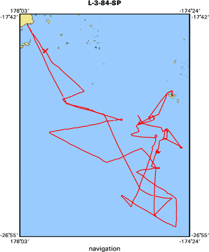
L-3-84-SP
|
|
Abstract
|
Chief Scientists: Dave Scholl, Rick Herzer. Geological and
Geophysical data (3dot5khz, 12khz, transitsatellite,
dopplersonar, integratednavigation, magnetics, gravity,
airgun, 24channel, gravitycore, chaindredge, Niskenbottle,
tempsalinometer, expendablebatthermograph, underwatercamera,
airgunmonitor, sonobuoy) of field activity L-3-84-SP in
Tonga, Southern Pacific from 04/02/1984 to 05/01/1984
|
|
Chief Scientist
|
Dave Scholl
Rick Herzer
|
|
Activity Type
|
Geological and Geophysical
|
|
Platform
|
Samuel Phillips Lee
|
|
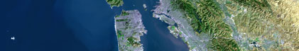
Area of Operation
|
Tonga, Southern Pacific
|
|
Location map
|
|
|
Bounding Coordinates
|
-18.13553
178.39099 -174.74606
-26.50575
|
|
Ports
|
leave Suva Fiji
arrive Tongatapu
leave Tongatapu
arrive Suva Fiji
|
|
Dates
|
04/02/1984 (JD 093) to 05/01/1984 (JD 122)
|
|
Analog Materials
|
list
|
|
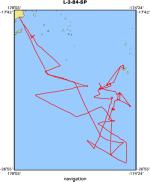
Index map
|
|
|
Crew
|
|
Andy Stevenson
|
Geologist
|
|
Chris Gutmacher
|
Navigator
|
|
Chris Poppe
|
Chief Mate
|
|
Dave Scholl
|
Chief Scientist
|
|
David Tappin
|
Geologist, Tonga
|
|
Dennis Mann
|
Geophysicist
|
|
George Chaproniere
|
Biologist, Aust
|
|
Jack Lee
|
Electronics Technician
|
|
Jan Morton
|
Geophysicist
|
|
Jill McCarthy
|
Geophysicist
|
|
John Dobranski
|
Chief Engineer
|
|
Jon Erickson
|
Mechanical Technician
|
|
Kaye Kinoshita
|
Navigator
|
|
Larry Kooker
|
Electronics Technician
|
|
Pat Moore
|
Ship Captain
|
|
Paul Wenberg
|
Mechanical Technician
|
|
Paula Quinterno
|
Biologist
|
|
Peter Ballance
|
Geologist, NZ
|
|
Peter Cawood
|
Geologist, Aust
|
|
Ray Sliter
|
Geophysicist
|
|
Rick Herzer
|
Chief Scientist, NZ
|
|
Rob O'Connor
|
Geologist
|
|
Robin Frisch
|
Navigator
|
|
Tevita Vuibau
|
Geologist, Fiji
|
|
Tracy Vallier
|
Geologist
|
|
|
Equipment Used
|
|
3dot5khz
|
|
12khz
|
|
transitsatellite
|
|
dopplersonar
|
|
integratednavigation
|
|
magnetics
|
|
gravity
|
|
airgun
|
|
24channel
|
|
gravitycore
|
|
chaindredge
|
|
Niskenbottle
|
|
tempsalinometer
|
|
expendablebatthermograph
|
|
underwatercamera
|
|
airgunmonitor
|
|
sonobuoy
|
|
|
NGDC Overview
|
|
! Converted to time format with year at start.
|
|
!
|
|
DATA COLLECTION OVERVIEW (use NGDC GEODAS CD to retrieve data)
|
|
|
|
MCG Data Collection ID --- L384SP
|
|
Institution Data Collection ID --- L384SP
|
|
NGDC ID --- 06050070
|
|
Funding --- (unspecified)
|
|
Project, Cruise & Leg --- SOUTH PACIFIC / TONGA
|
|
Study region --- -18.00000,-27.00000,+178.00000,-174.00000
|
|
Chief Scientist(s) --- DAVE SCHOLL, RICK HERZER
|
|
Name of vessel --- Lee (surface ship)
|
|
Date field data collection started --- 04/02/84 LEAVE SUVA FIJI
|
|
Date field data collection ended --- 05/01/84 ARRIVE SUVA
|
|
Parameters surveyed ---
|
|
Bathymetry: surveyed, contained in data file
|
|
Magnetics: surveyed, contained in data file
|
|
Gravity: surveyed, contained in data file
|
|
High-resolution seismics: (unspecified)
|
|
Deep penetration seismics: (unspecified)
|
|
Format --- (I1,A8,F5.2,4I2,F5.3,F8.5,F9.5,I1,F6.4,F6.1,I2,i1,3F6.1,I1,F5.1,F6.0,F7.1,F6.1,F5.1,A8,4I1)
|
|
Date of data input to NGDC --- 07/16/87
|
|
Contributing institution --- USGS Branch of Pacific Marine Geology
|
|
Country --- United States
|
|
|
|
Navigation instrumentation --- NAV SAT/DOPPLER SONAR/INTGR. NAV
|
|
Position determination method --- (unspecified)
|
|
|
|
Bathymetry instrumentation --- 12KHZ
|
|
Additional forms of bathymetric data --- ANALOG
|
|
General rate of bathymetry in file --- 1.6 minutes
|
|
General collection rate of bathymetry --- (unspecified)
|
|
Assumed sound velocity --- (unspecified)
|
|
Bathymetric datum code --- No correction applied (sea level)
|
|
Bathmetry interpolation scheme --- (unspecified)
|
|
|
|
Magnetics instrumentation --- PROTON PRECESSION MAG
|
|
Additional forms of magnetics data --- ANALOG RECORDS
|
|
General rate of magnetics in file --- 1.3 minutes
|
|
General collection rate of magnetics --- (unspecified)
|
|
Magnetic sensor tow distance --- (unspecified)
|
|
Magnetic sensor depth --- (unspecified)
|
|
Two sensor horizontal separation --- (unspecified)
|
|
Residual magnetics reference field --- (unspecified)
|
|
Method of applying residual field --- (unspecified)
|
|
|
|
Gravity instrumentation --- SHIPBOARD GRAVITY METER
|
|
Additional forms of gravity data --- ANALOG RECORDS
|
|
General rate of gravity in file --- 0.9 minutes
|
|
General collection rate of gravity --- (unspecified)
|
|
Theoretical gravity formula --- (unspecified)
|
|
Reference system --- (unspecified)
|
|
Corrections applied --- (unspecified)
|
|
Starting land tie --- (unspecified)
|
|
Ending land tie --- (unspecified)
|
|
|
|
Seismic instrumentation --- 3.5KHZ,SNGL CH.AIRGUN/24CHANNEL
|
|
Formats of seismic data --- ANALOG PAPER ROLL
|
|
|
|
Notes ---
|
|
SONOBOUY
|
|
|
Publications
|
|
Morton, Janet L., Scholl, David W., Vallier, Tracy L., Herzer, Richard H., Stevenson, A.J.,
|
|
and McCarthy, J., 1984, An active spreading center in the Lau back-arc basin defined, in
|
|
The Geological Society of America, 97th meeting: Geological Society of America Abstracts
|
with Programs, v. 16, no. 6, p. 601.
|
|
|
Cole, Jeffrey E., and Mann, Dennis M., 1985, Velocity analyses of near seafloor strata based
|
|
on multichannel seismic data from the Tonga Platform, in Scholl, David W., and Vallier,
|
|
Tracy L., eds., Geology and offshore resources of Pacific island arcs; Tonga region: Houston,
|
TX, Circum-Pacific Council Energy and Mineral Resources.
|
|
|
Steele, W.C., and Kinoshita, K.L., 1986, Navigation for CCOP/SOPAC Cruise, Leg 3, Solomon Islands,
|
|
in Vedder, John G., Pound, K.S., and Boundy, S.Q., eds., Geology and offshore resources of Pacific
|
|
island arcs; central and western Solomon Islands: Circum-Pacific Council for Energy and Mineral
|
Resources, Earth Science Series, v. 4, p. 19-20.
|
|
|
Hein, James R., Schulz, Marjorie S., and Kang, Jung-Keuk, 1988, Hydrothermal and hydrogenetic
|
|
ferromanganese oxide mineralization of active volcanic arcs, in Schindler, Katharine S.,
|
|
ed., USGS research on mineral resources, 1989; program and abstracts: U.S. Geological Survey
|
Circular 1035, p. 29-30.
|
|
|
Wong, Florence L., Richmond, B.A., Greene, H.G., Dingler, John R., Hein, James R.,
|
|
Kvenvolden, Keith A., Marlow, M.S., Morton, Janet L., Rubin, D.M., Scholl, D.W., and
|
|
Vedder, J.G., 1991, SOPAC; a decade of research on mineral and hydrocarbon resources in
|
|
the South Pacific, in Good, Elizabeth E., Slack, John F, and Kotra, Rama K., eds.,
|
|
USGS research on mineral resources, 1991; program and abstracts: U.S. Geological Survey
|
Circular 1062, p. 78-79.
|
|
|
Greene, H. Gary., Scholl, David W., Vedder, John G., and Wong, Florence L., 1988,
|
|
Oil and gas potential of island arcs in the Southwest Pacific; a new frontier,
|
|
in Wagner, Holly C., Wagner, Leslie C., Wang, Frank F.H., and Wong, Florence L.,
|
|
eds., Petroleum resources of China and related subject: Circum-Pacific Council
|
for Energy and Mineral Resources, Earth Science Series, v. 10, p. 671-691.
|
|
|
von Blanckenburg, F., O'Nions, R.K., Belshaw, N.S., Gibb, A., and Hein, J.R., 1996,
|
|
Global distribution of beryllium isotopes in deep ocean water as derived from Fe-Mn
|
crusts: Earth and Planetary Science Letters, v. 141, no. 1-4, p. 213-226.
|
|
|
Chan, L.H., Zhang, L., and Hein, J.R., 1994, Lithium isotope characteristics of marine
|
sediments: American Geophysical Union Eos, Transactions, v. 75, no. 44, Supplement, p. 314.
|
|
|
Hein, James R., Koschinsky, Andrea, Halbach, Peter E., Manheim, Frank T., Bau, Michael,
|
|
Kang, Jung-Keuk, and Lubick, Naomi, 1997, Iron and manganese oxide mineralization in the
|
|
Pacific, in Nicholson, Keith, Hein, James R., Buehn, Bernhard, and Dasgupta, Somnath, eds.,
|
|
Manganese mineralization; geochemistry and mineralogy of terrestrial and marine deposits:
|
Geological Society Special Publications, v. 119, p. 123-138.
|
|
|
Got Help?
|
For L-3-84-SP, we would appreciate any information on -- contract, days at sea, dive count, funding, information specialist, information to be derived, kms of navigation, national plan, notes, organization, owner, project, project number, purpose, scanned materials, seismic description, station count, station description, submersible, summary, tabulated info.
|
|