|
|
|
Metadata
|
|
ID
|
07041
|
|
Also Known As
|
K-1-07-MA
07041
|
|
Abstract
|
United States Geological Survey, Woods Hole, Massachusetts.
Chief Scientist: Mike Bothner. Data of field activity 07041
(K-1-07-MA) in Deep Pond, Falmouth, Massachusetts, United
States from 10/30/2007 to 10/30/2007
|
|
Organization
|
United States Geological Survey, Woods Hole, Massachusetts
|
|
Project/Theme
|
Coastal Geologic Processes and Long Term Environmental Change: Northeast U.S.
|
|
Chief Scientist
|
Mike Bothner
|
|
Platform
|
Kayak
|
|
Area of Operation
|
Deep Pond, Falmouth, Massachusetts, United States
|
|
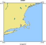
Location map
|
|
|
Bounding Coordinates
|
41.56667
-70.64167 -70.63000
41.56167
|
|
Ports
|
LEAVE WHSC
ARRIVE WHSC
|
|
Dates
|
10/30/2007 (JD 303) to 10/30/2007 (JD 303)
|
|
Analog Materials
|
No analog holdings.
|
|
Index map

|
|
|
Information Specialist
|
|
|
Crew
|
|
Mike Bothner
|
Chief Scientist
|
|
Mike Bothner
|
Dann Blackwood, Mike Casso
|
|
|
Purpose
|
|
Collect yellow perch and small mouth bass to assess the
|
|
level of mercury contamination.
|
|
|
Information to be Derived
|
|
Mercury concentrations in yellow perch and small mouth bass.
|
|
|
Summary
|
|
The following fish were collected with rod and reel: 1 small
|
|
mouth bass, 4 yellow perch, 2 catfish.
|
|
|
Notes
|
|
2921-BOF70 Coastal Geologic Processes and Long Term Environme
|
|
1 days at sea.
|
|
|
Funding
|
|
|
Got Help?
|
For 07041, we would appreciate any information on -- activity type, analog materials, contract, days at sea, dive count, equipment used, kms of navigation, national plan, NGDC Info, owner, project number, publications, scanned materials, seismic description, station count, station description, submersible, tabulated info.
|
|