|
|
|
Metadata
|
|
ID
|
04038
|
|
Also Known As
|
04038
B-2-04-CD
|
|
Abstract
|
United States Geological Survey, Woods Hole, Massachusetts.
Chief Scientist: John Crusius. Data (navigation) of field
activity 04038 (B-2-04-CD) in Salt Pond, Cape Cod National
Seashore, Barnstable, from 05/26/2004 to 05/28/2004
|
|
Organization
|
United States Geological Survey, Woods Hole, Massachusetts
|
|
Project/Theme
|
Atlantic Coastal Groundwater Systems
Coastal Change Hazards
|
|
Chief Scientist
|
John Crusius
|
|
Platform
|
CCNS UNMOTORIZED AND ON FOOT
|
|
Area of Operation
|
Salt Pond, Cape Cod National Seashore, Barnstable,
|
|
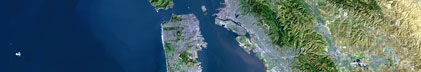
Location map
|

|
|
Bounding Coordinates
|
41.83576
-69.97021 -69.96868
41.83323
|
|
Ports
|
MAY 26, 2004 - Salt Pond, CCNS
MAY 28, 2004 - Salt Pond, CCNS
|
|
Dates
|
05/26/2004 (JD 147) to 05/28/2004 (JD 149)
|
|
Analog Materials
|
No analog holdings.
|
|
Index map

|
|
|
Information Specialist
|
|
|
Crew
|
|
John Crusius
|
Chief Scientist Woods Hole
|
|
John Bratton
|
Woods Hole
|
|
Dirk Koopmans
|
Woods Hole
|
|
|
Equipment Used
|
|
|
Purpose
|
|
geochem reconnaissance of Salt Pond one day sampling
|
|
|
Information to be Derived
|
|
Qualitative assessment of surface-water and groundwater Rn
|
|
|
Summary
|
|
Determined that surface-water and groundwater Rn and Ra activities
|
|
|
Notes
|
|
|
Got Help?
|
For 04038, we would appreciate any information on -- activity type, analog materials, contract, days at sea, dive count, funding, kms of navigation, national plan, NGDC Info, owner, project number, publications, scanned materials, seismic description, station count, station description, submersible, tabulated info.
|
|