|
|
|
|
Metadata
|
|
ID
|
99CCH04
|
|
Also Known As
|
A-4-99-EC
XSTORMS
h19990918f
|
|
Abstract
|
United States Geological Survey, St. Petersburg,
Florida,BayAir. Chief Scientists: Dennis Krohn, USGS, K.
Morgan, USGS, R. Peterson, USGS, P. Thompson, USGS, T.
Rismiller, BayAir. Oblique Aerial Photo and Video Survey data
of field activity 99CCH04 (A-4-99-EC) in Eastern coasts of
North and South Carolina from 01/01/1999 to 01/01/1999
|
|
Organization
|
United States Geological Survey, St. Petersburg, Florida
BayAir
|
|
Project/Theme
|
Extreme Storm Coastal Change Hazards
|
|
Chief Scientist
|
Dennis Krohn
K. Morgan
R. Peterson
P. Thompson
T. Rismiller
|
|
Activity Type
|
Oblique Aerial Photo and Video Survey
|
|
Platform
|
Airplane
|
|
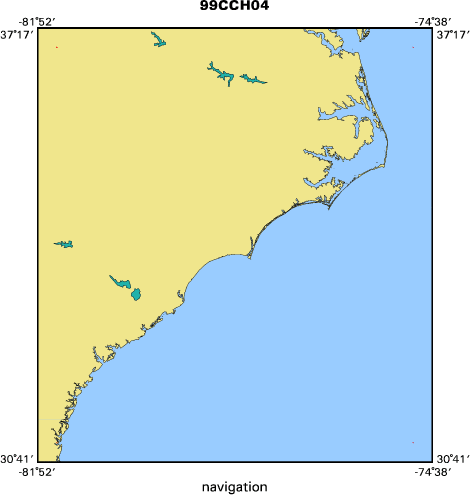
Area of Operation
|
Eastern coasts of North and South Carolina
|
|
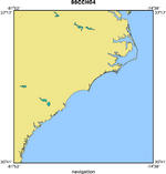
Location map
|
|
|
Bounding Coordinates
|
37.00000
-81.50000 -75.00000
31.00000
|
|
Ports
|
LEAVE Myrtle Beach, SC
ARRIVE Tar and Neuse Rivers, NC
|
|
Dates
|
01/01/1999 (JD 001) to 01/01/1999 (JD 001)
|
|
Analog Materials
|
No analog holdings.
|
|
Index map
|
|
|
Information Specialist
|
|
|
Purpose
|
|
Post hurricane Floyd survey to document the storm impact on the coast.
|
|
|
Information to be Derived
|
|
Analysis of coastal change due to extreme storms.
|
|
|
Summary
|
|
3 mini DV tapes burned onto 2 DVDs; 38 Rolls of film (approximately 1, 359
|
|
slides)
|
|
|
Notes
|
|
Digitized by M. Streubert and J. Subino.
|
|
Red Hen GPS signal was downloaded from original tapes. Video navigation fixes were interpolated for each second for which a known fix is not available using Excel. Analog and digital data are stored at the USGS St. Petersburg Office in the Extreme Storm Impact Event storage facility Room 128 and 254. Digital version of the data also exists online on the internal St. Petersburg Lidar server.
|
|
Platform used: N2KK Navajo Chieftain Airplane
|
|
|
Got Help?
|
For 99CCH04, we would appreciate any information on -- analog materials, contract, crew, days at sea, dive count, equipment used, funding, kms of navigation, national plan, NGDC Info, owner, project number, publications, scanned materials, seismic description, station count, station description, submersible, tabulated info.
|
|