|
|
|
Metadata
|
|
ID
|
01068
|
|
Also Known As
|
01068
A-2-01-MA
|
|
Abstract
|
Woods Hole Oceanographic Institution,United States
Geological Survey, Woods Hole, Massachusetts. Chief
Scientist: Marinna Martini. Mooring Redeployment data
(submersible, sidescansonar) of field activity 01068
(A-2-01-MA) in Scituate, Massachusetts from 08/16/2001 to
08/16/2001
|
|
Organization
|
Woods Hole Oceanographic Institution
United States Geological Survey, Woods Hole, Massachusetts
|
|
Project/Theme
|
Low Cost Telemetry Project
|
|
Chief Scientist
|
Marinna Martini
|
|
Activity Type
|
Mooring Redeployment
|
|
Platform
|
Christopher Andrew
|
|
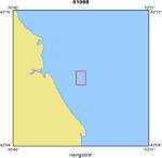
Area of Operation
|
Scituate, Massachusetts
|
|
Location map
|
|
|
Bounding Coordinates
|
42.16270
-70.63990 -70.63990
42.16210
|
|
Ports
|
leave Scituate, MA
arrive Scituate, MA
|
|
Dates
|
08/16/2001 (JD 228) to 08/16/2001 (JD 228)
|
|
Analog Materials
|
No analog holdings.
|
|
Index map

|
|
|
Information Specialist
|
|
|
Crew
|
|
Marinna Martini
|
Chief Scientist, USGS Woods Hole
|
|
Dann Blackwood
|
Deck Ops & Diving, USGS Woods Hole
|
|
M. Robideaux
|
Deck Ops, USGS Woods Hole
|
|
? Blackwood
|
Volunteer, USGS Woods Hole
|
|
Lary Ball
|
Diving, WHOI
|
|
G. Maceachern
|
Unspecified
|
|
Darren ?
|
Unspecified
|
|
Frank Mirarchi
|
Captain
|
|
|
Equipment Used
|
|
submersible
|
|
sidescansonar
|
|
|
Purpose
|
|
Search for and recover stranded tripod, move mooring.
|
|
|
Information to be Derived
|
|
|
Summary
|
|
|
Notes
|
|
|
Got Help?
|
For 01068, we would appreciate any information on -- analog materials, contract, days at sea, dive count, funding, kms of navigation, national plan, NGDC Info, owner, project number, publications, scanned materials, seismic description, station count, station description, submersible, tabulated info.
|
|


