|
|
|
Metadata
|
|
ID
|
88008
|
|
Also Known As
|
88008
ACAD88-1
A-1-88-LA
|
|
Abstract
|
United States Geological Survey, Woods Hole, Massachusetts.
Chief Scientists: Jeff Williams, Shea Penland. Data
(navigation) of field activity 88008 (A-1-88-LA) in Louisiana
Coastal from 07/19/1988 to 07/26/1988
|
|
Organization
|
United States Geological Survey, Woods Hole, Massachusetts
|
|
Project/Theme
|
Coastal Erosion
Coastal Change Hazards
|
|
Chief Scientist
|
Jeff Williams
Shea Penland
|
|
Platform
|
Acadiana
|
|
Area of Operation
|
Louisiana Coastal
|
|
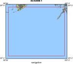
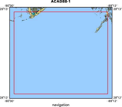
Location map
|
|
|
Bounding Coordinates
|
29.16000
-90.44000 -89.26000
28.25000
|
|
Dates
|
07/19/1988 (JD 201) to 07/26/1988 (JD 208)
|
|
Analog Materials
|
No analog holdings.
|
|
Index map
|
|
|
Crew
|
|
Jeff Williams
|
Chief Scientist, USGS Woods Hole
|
|
Shea Penland
|
Chief Scientist, LGS
|
|
Rick Vail
|
Technician, USGS Woods Hole
|
|
Dave Nichols
|
Technician, USGS Woods Hole
|
|
Randy McBride
|
Scientist, LGS
|
|
Wayne Simoneaux
|
Unspecified, Lumcon
|
|
Greg Taylor
|
Scientist, LGS
|
|
Greg Taylor
|
Technician, LGS
|
|
Dave Pope
|
Technician, LGS
|
|
|
Equipment Used
|
|
|
Purpose
|
|
|
Got Help?
|
For 88008, we would appreciate any information on -- activity type, analog materials, contract, days at sea, dive count, funding, information specialist, information to be derived, kms of navigation, national plan, NGDC Info, notes, owner, ports, project number, publications, scanned materials, seismic description, station count, station description, submersible, summary, tabulated info.
|
|